
Natural Resources
Conservation Service
Ecological site R051XE260CO
Chico Fan 8-12 PZ
Last updated: 12/11/2024
Accessed: 02/21/2026
General information
Provisional. A provisional ecological site description has undergone quality control and quality assurance review. It contains a working state and transition model and enough information to identify the ecological site.
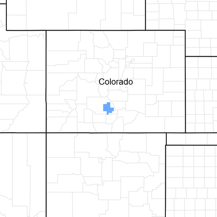
Figure 1. Mapped extent
Areas shown in blue indicate the maximum mapped extent of this ecological site. Other ecological sites likely occur within the highlighted areas. It is also possible for this ecological site to occur outside of highlighted areas if detailed soil survey has not been completed or recently updated.
MLRA notes
Major Land Resource Area (MLRA): 051X–High Intermountain Valleys
MLRA 51, better known as the San Luis Valley, is an isolated intermontane basin often described as a high mountain valley. The basin encompasses approximately 4,030 square miles in the Southern Rocky Mountains in south-central Colorado and north-central New Mexico; 89% in Colorado and 11% in New Mexico. The basin is approximately 122 miles (196 km) long and 74 miles (119 km) wide.
MLRA 51 is part of the Rio Grande Rift, bound by the Sangre de Cristo Mountains on the east and the San Juan Mountains to the north and west. The headwaters of the Rio Grande originate in the San Juan Mountains; flowing south and east, the river drains the southern Colorado portion of the basin. The northern portion of the valley is considered a closed basin; no surface water contributes to the Rio Grande.
The MLRA is divided into five different physiographic subdivisions: Alamosa Basin; Costilla Plains, Culebra Reentrant; San Luis Hills and; Taos Plateau (Upson 1939).
LRU 51-5 lies above the Alamosa Basin.
Elevation ranges from 6,900 feet to 8,860 feet.
Ecological site concept
Chico Fan was developed from the 1993 Draft Chico Bench range site (R051XY260CO).
This is an upland site on alluvial fans and fan remnants found in association with Limy Bench, Basalt Hills, and Mountain Outwash sites. The Chico Fan site occurs on soils which support calcium carbonates deeper in the soil profile than its Limy Bench counterpart and is expressed as a black greasewood shrub community on moderately alkaline loams.
Associated sites
| R051XY276CO |
Limy Bench Carbonates are deeper on the Chico Fan site |
|---|
Similar sites
| R051XY276CO |
Limy Bench Carbonates are deeper on the Chico Fan site |
|---|
Table 1. Dominant plant species
| Tree |
Not specified |
|---|---|
| Shrub |
(1) Sarcobatus vermiculatus |
| Herbaceous |
(1) Bouteloua gracilis |
Physiographic features
LRU 51-5 is situated along the northern and western edges of the valley where the foothills and alluvial fans of the San Juan and Sangre de Cristo Mountains transition into the Alamosa Basin.
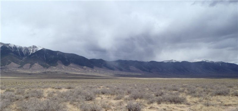
Figure 2. Panorama
Table 2. Representative physiographic features
| Landforms |
(1)
Alluvial fan
(2) Fan remnant |
|---|---|
| Flooding frequency | None |
| Ponding duration | Very brief (4 to 48 hours) |
| Ponding frequency | None to rare |
| Elevation | 7,700 – 8,100 ft |
| Slope | 1 – 11% |
| Aspect | Aspect is not a significant factor |
Climatic features
The climate that typifies the High Intermountain Valley ranges from arid to semi-arid and is characterized by cold winters, moderate summers, and much sunshine. Average annual precipitation ranges from 7 to 10 inches throughout most of the resource area. Average annual precipitation in upper elevations and southern reaches ranges from 11 to 13 inches. Precipitation extremes vary from 3 to 20 inches per year depending on location. The San Juan Mountains to the west and the Sangre de Cristo Mountains to the east intercept much of the precipitation causing a two-way rain shadow effect. Approximately 60 to 65 percent of the annual precipitation falls between May 1 and October 1, mostly from short duration high intensity thundershowers in July and August. Snowfall averages 34 inches annually; snow cover is light or patchy throughout much of the winter. Wind speeds average 7 miles per hour annually. High wind velocities are common in late winter through the spring.
Cold air from the encompassing mountain ranges drains into the valley and settles. This phenomena results in long cold winters and moderate summer temperatures. July is the hottest month and January is the coldest. Summer temperatures range from highs in the upper 70s and low 80s and occasionally reach to the mid-90s. Summer nights are cool, with lows averaging in the mid-40s. Temperatures of -20 degrees F are common during most winters and -40 degrees F can occur during some years. Higher elevations can receive a dusting of snow as early as September 1. There is a 50% probability that the first freeze in the fall will occur near September 22, and the last freeze in the spring on about May 26. The average length of the growing season is 135 days and varies from 127 to 141 days. Summer humidity is low. Evaporation rates average lower than those of dry regions because of the cool climate.
Most major plant species initiate growth between mid-May and late July, but growth may extend into September. Some cool season plants begin growth earlier and complete growth by mid-June.
Table 3. Representative climatic features
| Frost-free period (average) | 113 days |
|---|---|
| Freeze-free period (average) | 141 days |
| Precipitation total (average) | 10 in |
Figure 3. Monthly precipitation range
Figure 4. Monthly average minimum and maximum temperature
Influencing water features
There are no water features influencing this site.
Soil features
The soils of this site are dominantly very deep. Typically, the soils are well drained with slow to moderate permeability. They are formed in alluvium derived from volcanic rocks on alluvial fans and fan remnants. This site occurs mostly in the north to northwest part of the San Luis Valley and is associated with the San Juan Mountains. The surface layer ranges from loamy sand to sandy loam. The subsoil ranges from sandy loam to clay loam. The pH is moderately alkaline to strongly alkaline in the surface and subsoil. These soils are non-saline, however, there is some sodium associated with this site which supports the native black greasewood. The soil moisture regime is ustic aridic and the soil temperature is frigid. The calcium carbonate has mostly been leached out of the upper part of the soil which distinguishes it from the limy bench counterpart.
Major soil series that could be correlated to this ecological site include: Hapney
Table 4. Representative soil features
| Parent material |
(1)
Alluvium
–
andesite
(2) Outwash – basalt |
|---|---|
| Surface texture |
(1) Loamy sand (2) Sandy loam |
| Family particle size |
(1) Loamy |
| Drainage class | Well drained |
| Permeability class | Slow to moderate |
| Soil depth | 80 in |
| Surface fragment cover <=3" | 35% |
| Surface fragment cover >3" | 15% |
| Available water capacity (0-40in) |
3 – 9 in |
| Calcium carbonate equivalent (0-40in) |
5 – 15% |
| Electrical conductivity (0-40in) |
2 – 4 mmhos/cm |
| Sodium adsorption ratio (0-40in) |
5 – 10 |
| Soil reaction (1:1 water) (0-40in) |
7.9 – 9 |
| Subsurface fragment volume <=3" (Depth not specified) |
70% |
| Subsurface fragment volume >3" (Depth not specified) |
25% |
Ecological dynamics
This ecological site supports a semi-desert greasewood shrubland which developed under cold, dry, high intermountain valley climatic conditions with natural influence of herbivores and occasional fire. Climatic conditions, along with complex relations between physical, chemical, and topographic gradients and management actions drive changes in these greasewood plant communities. The soils are moderately alkaline with some sodium associated with the site which supports the native black greasewood. This site is treeless however one site was found in the lower reaches of a pinyon pine/Rocky Mountain juniper stand west of the town of Saguache.
The Reference Plant Community (RPC) was determined by observation and examination of rangeland areas protected from excessive disturbance. Trends in plant community dynamics ranged from heavily grazed to lightly grazed areas, seasonal use areas, and sites with non-use over several decades.
The RPC is a predominately warm season bunchgrass/warm season shrub community with a subdominant cool season bunchgrass/rhizomatous grass component. The site supports blue grama, alkali sacaton and alkali wildrye, with the major woody shrubs represented by black greasewood (chico) and Greenes rabbitbrush. Other shrubs found on site were rubber rabbitbrush, Parrys rabbitbrush, fourwing saltbush, pricklypear cactus, mountain ball cactus, and yucca. Subshrubs fringed sage and broom snakeweed were commonly observed. Scarlet globemallow, wild tarragon, beggars tick, herb sophia, and biscuitroot are the noted forbs. Minor grasses include western wheatgrass, sand dropseed, hairy grama, threeawn, ring muhly and bottlebrush squirreltail.
Black greasewood is a phreatophyte with very deep root systems; consequently greasewood stands can develop in seemingly dry areas, mining readily available subsurface water. Greasewood height, canopy coverage, and total leaf surface area are inversely related to depth to water. During drought this plant responds with reduced canopy size or increased mortality. Greasewood has succulent leaves which pull salts from water. As a greasewood stand and litter builds, it begins to suppress germination of understory plants by tying up nutrient availability with the salts.
In a drought, as water tables drop, shrubs show diminished vigor and increased mortality. Remnant cool season bunchgrasses may be found. Warm season bunchgrasses are in decline but persist.
Plant diversity will increase on sandier sites and on sites where calcium carbonates are deeper in the soil profile. Soil water availability is greater on these less alkaline sites than the loamy sites, even in good moisture years. During times of drought and non-use, greasewood continues to grow, forbs and cool season rhizomatous grasses diminish and/or disappear, while cool and warm season bunchgrasses decline but persist.
A greasewood and rubber rabbitbrush co-dominant site can easily be mismanaged. Mismanaged grazing such as recurring same season grazing, calving, overgrazing on this site will negatively impact desirable grasses allowing greasewood to outcompete other plants on the site, creating a greasewood dominated site with rubber rabbitbrush as a part of the overstory. Mistimed brush management targeting greasewood on this site will favor rubber rabbitbrush by greatly reducing greasewood leading to a rabbitbrush dominated site. Followed by long term non-use due to diminished forage quality and extended drought, the site becomes a rabbitbrush dominated site with a lichen layer.
Recurrent early season grazing, sheep camps, continuous grazing during the growing season will cause greasewood and undesirable shrubs such as Greenes rabbitbrush and pricklypear cactus to increase and will remove cool season grasses. Blue grama maintains its production longer than other dominant grasses but will eventually weaken and diminish or disappear if disturbance becomes significant or continuous grazing persists. Ring muhly increases with the decline in productivity. Erosion can be significant where plant cover is destroyed or severely weakened, and will be accelerated with continued physical disturbance.
The following State and Transition Model is a diagram that illustrates the Reference Plant Community and the common plant communities (natural variability) that can occur on the site. Transitional and restoration pathways are delineated with arrows between communities. Bold lines represent ecological thresholds. The "T" arrows indicate transitions away from states across thresholds, while "R" arrows indicate restoration pathways back toward states across thresholds. The ecological processes will be discussed in more detail in the plant community descriptions following the diagram.
State and transition model
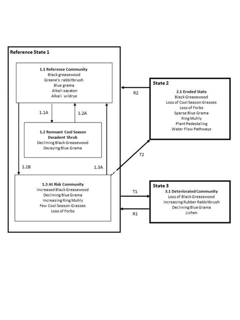
Figure 5. STMSept16
More interactive model formats are also available.
View Interactive Models
More interactive model formats are also available.
View Interactive Models
Click on state and transition labels to scroll to the respective text
Ecosystem states
State 2 submodel, plant communities
State 3 submodel, plant communities
State 1
Reference
The Reference state describes the ecological potential of the site and the historic range of variability from natural disturbances such as herbivory, fire, insects and disease, etc.
Community 1.1
Black Greasewood, Rabbitbrush, Blue Grama, and Alkali Sacaton

Figure 6. Chico Fan Reference Community
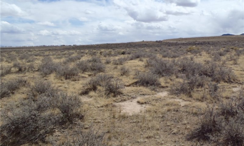
Figure 7. Reference Plant Community
This plant community evolved with grazing by herbivores and is well suited for grazing by wildlife and livestock. Litter is properly distributed with very little movement off-site and natural plant mortality is low. This is a resilient plant community in terms of soil stability, watershed function, and biological integrity. The aridic nature of the site makes it less resilient to disturbances that reduce ground cover and increase bare ground. This plant community is stable and productive. Principle grasses are blue grama and alkali sacaton. Subdominant grasses are alkali wildrye. Sand dropseed, western wheatgrass, bottlebrush squirreltail, Indian ricegrass and littleseed ricegrass are minor grasses that may occur. Key shrubs include black greasewood and Greenes rabbitbrush. Secondary shrubs and sub-shrubs include fourwing saltbush, rubber rabbitbrush, pricklypear, broom snakeweed and fringed sage. Forbs are sparse, but may include scarlet globemallow, biscuitroot, mesa pepperweed, tansyaster, and mealy goosefoot. The potential vegetation is about 70% grasses and grass-likes, 5% forbs, and 25% shrubs. Pinyon pine and Rocky Mountain juniper may be adjacent; however trees are not expected on the site. Associated successional stages within the interpretive plant community include a cool season/warm season shift in species composition. This is driven by repeated extended drought and/or early season grazing disturbance. For example, repeated herbivory in the cool season without adequate recovery and moisture would cause a shift to a warm season successional stage. Conversely, repeated warm season disturbances without adequate recovery, will cause a shift to a cool season successional stage. Total annual production ranges from 600 to 1,150 pounds of air-dry vegetation per acre and will average 900 pounds during a typical year.
Figure 8. Annual production by plant type (representative values) or group (midpoint values)
Table 5. Annual production by plant type
| Plant type | Low (lb/acre) |
Representative value (lb/acre) |
High (lb/acre) |
|---|---|---|---|
| Grass/Grasslike | 480 | 665 | 850 |
| Shrub/Vine | 150 | 205 | 265 |
| Forb | 20 | 30 | 35 |
| Total | 650 | 900 | 1150 |
Figure 9. Plant community growth curve (percent production by month). CO5102, Warm season dominant, cool season sub-dominant; MLRA-51; coarse textured soils.
| Jan | Feb | Mar | Apr | May | Jun | Jul | Aug | Sep | Oct | Nov | Dec |
|---|---|---|---|---|---|---|---|---|---|---|---|
| J | F | M | A | M | J | J | A | S | O | N | D |
| 0 | 0 | 0 | 2 | 15 | 25 | 30 | 20 | 8 | 0 | 0 | 0 |
Community 1.2
Remnant Cool Season Grasses and Decadent Shrub
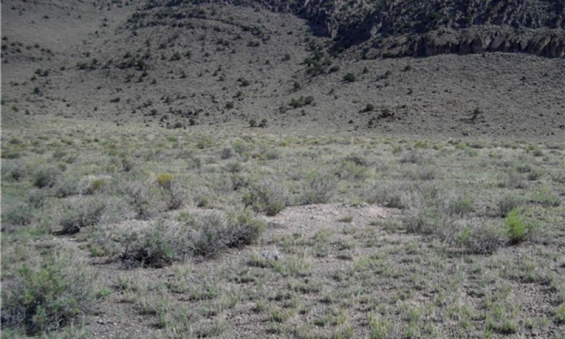
Figure 10. Remnant Cool Season/Decadent Shrub
Figure 11. Remnant Cool Season/Decadent Shrub Community
In a drought, as run-off is minimized and water tables drop, shrubs respond through leaf drop, diminished vigor, and increased mortality. Remnant cool season bunchgrasses may be found but are in rapid decline. Warm season bunchgrasses are in decline but persist. This community is within the natural variability of the Reference State.
Community 1.3
Increased Blue Grama and Decreased Alkali Wildrye
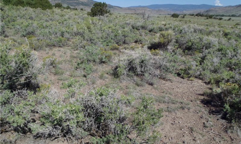
Figure 12. At Risk Community: Increased Blue Grama, Decreased
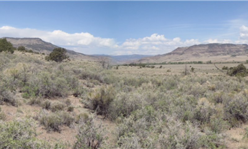
Figure 13. At Risk Community: Increased Blue Grama, Decreased
This community is an associated successional phase within the natural variability of the Reference State. It is represented by a cool season to warm season shift in species composition. This is driven by extended drought, long term non-use, and/or seasonal grazing disturbance. For example, repeated herbivory and/or drought in the cool season without adequate recovery opportunity would cause a shift to a warm season successional stage; conversely, repeated warm season disturbances (herbivory and drought) without adequate recovery and moisture, will cause a shift to a cool season successional stage. This community is at risk of crossing an ecological threshold. The biotic integrity has been impaired due the loss of rhizomatous cool season grasses and a further decline in warm season grasses and in particular, the amount of blue grama. As a result of the shift in species composition water infiltration has been negatively affected along with some impairment of energy flow. Total annual production ranges from 600-1,000 pounds of air-dry vegetation per acre and will average 800 pounds.
Pathway 1.1A
Community 1.1 to 1.2


A community pathway leading to the remnant cool season, decadent shrub, and declining black greasewood and blue grama community occurs with lack of disturbance. Lack of herbivory and/or the absence of fire reduces plant vigor. Through drought, runoff from adjaent uplands is reduced, infiltration decreased, water tables drop, and plants respond with diminished productivity and increased mortality. Species production, vigor and density will decrease as lack of disturbance and or drought persists.
Pathway 1.1B
Community 1.1 to 1.3


A community pathway leading to the at risk community of increased greasewood, declining blue grama, increased ring muhly, cool season/warm season shift in grasses, and loss of forbs. Long-term nonuse and extended or severe drought are the drivers of this change.
Pathway 1.2A
Community 1.2 to 1.1


More frequent fire and/or herbivory with adequate recovery periods leads toward the reference plant community. Above average or normal precipitation following extended drought can also cause a shift back toward the reference community.
Pathway 1.3A
Community 1.3 to 1.1


An increase in precipitation, herbivory, and/or fire will return the at risk community toward the reference community.
State 2
Eroded
This state has crossed an ecological threshold. Desertification is obvious. Biological integrity has been lost. With plant structure, diversity, and cover severely diminished, very little to no capture and infiltration of precipitation, which is lost to overland flow, increasing hydrologic dysfunctional and severe destruction of soil stability. Soils eroded to subsurface horizons in places.
Community 2.1
Greasewood, Pricklypear, Sparse Blue Grama and Ring Muhly, with Plant Pedestals and Water Flow Paths
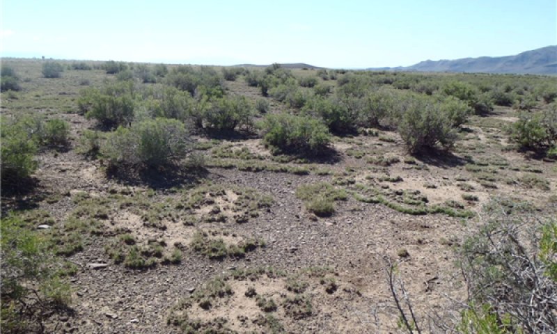
Figure 14. Eroded State
This plant community develops under recurrent early season grazing such as sheep camps and/or continuous grazing during the growing season. Long-term non-use and lack of disturbance may also lead to this state. The decline of the plant community becomes more pronounced under extended drought conditions. Black greasewood remains on the site and pricklypear has increased. Blue grama and ring muhly may persist in small stands. Litter levels are extremely low due to decreased herbaceous biomass and litter movement off the site. Water erosion is evident. Flow paths are continuous and bare areas wide-spread. Greasewood also has a drying effect by extracting soil moisture from greater depths, and depleting subsurface moisture for herbaceous plants. The nutrient cycle, water cycle and overall energy flow are greatly impaired. Organic matter/carbon reserves are greatly reduced or almost non-existent. This community is unstable. Desertification is obvious.
State 3
Deteriorated
Ecological condition is deteriorated through mismanagement coupled with extended drought.
Community 3.1
Deteriorated
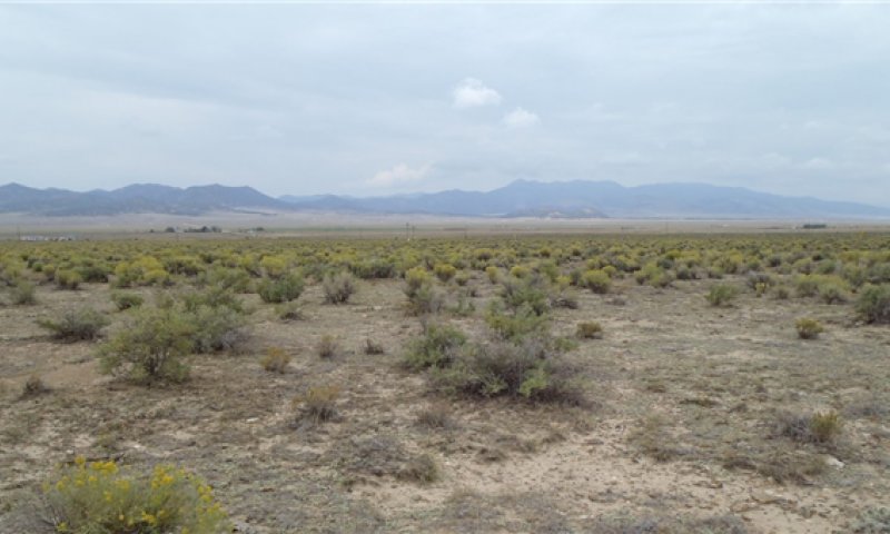
Figure 15. Deteriorated State
Ecological condition is deteriorated through mismanagement coupled with extended drought.
Transition T1A
State 1 to 2
Recurring same season grazing (i.e. sheep camp, or continuous grazing) without adequate recovery opportunity between grazing events, will move this site across an ecological threshold to the Eroded State. Lack of disturbance/long term non-use and/or extended drought may also cause this transition to occur.
Transition T1B
State 1 to 3
Improper timing of brush management, (mechanical or chemical) to manipulate or reduce the shrub community, can cause a shift across an ecological threshold toward the Deteriorated State. Recurring same season grazing (i.e. sheep camp, or continuous grazing) without adequate recovery opportunity between grazing events, will also move this site to the Deteriorated State. Lack of disturbance/long term non-use and/or extended drought may also cause this transition to occur.
Restoration pathway R2A
State 2 to 1
One or more treatments such as properly timed brush control, range seeding, and long-term prescribed grazing will restore this state/plant community to the reference state and/or associated communities. Restoration is a very slow process (many years) due to the aridic nature and soil properties of this site. If an adequate seedbank is adjacent to the site, the native plant community will return with favorable moisture without mechanical inputs.
Restoration pathway R3A
State 3 to 1
Favorable moisture, properly timed brush management with range seeding, and long-term prescribed grazing after successful seeding establishment, will restore this state/plant community to the reference state and/or associated communities. Restoration is a very slow process (many years) due to the aridic nature and soil properties of this site.
Additional community tables
Table 6. Community 1.1 plant community composition
| Group | Common name | Symbol | Scientific name | Annual production (lb/acre) | Foliar cover (%) | |
|---|---|---|---|---|---|---|
|
Grass/Grasslike
|
||||||
| 1 | 400–900 | |||||
| alkali sacaton | SPAI | Sporobolus airoides | 180–315 | – | ||
| blue grama | BOGR2 | Bouteloua gracilis | 135–180 | – | ||
| alkali wildrye | LESI5 | Leymus simplex | 45–135 | – | ||
| ring muhly | MUTO2 | Muhlenbergia torreyi | 9–45 | – | ||
| western wheatgrass | PASM | Pascopyrum smithii | 9–45 | – | ||
| squirreltail | ELELE | Elymus elymoides ssp. elymoides | 9–45 | – | ||
| sand dropseed | SPCR | Sporobolus cryptandrus | 9–45 | – | ||
| Grass, perennial | 2GP | Grass, perennial | 0–27 | – | ||
| Indian ricegrass | ACHY | Achnatherum hymenoides | 0–27 | – | ||
| purple threeawn | ARPU9 | Aristida purpurea | 0–9 | – | ||
| littleseed ricegrass | PIMI | Piptatheropsis micrantha | 0–9 | – | ||
|
Forb
|
||||||
| 2 | 10–35 | |||||
| Forb, perennial | 2FP | Forb, perennial | 9–27 | – | ||
| scarlet globemallow | SPCO | Sphaeralcea coccinea | 9–18 | – | ||
| tarragon | ARDR4 | Artemisia dracunculus | 0–9 | – | ||
| Northern Idaho biscuitroot | LOOR | Lomatium orientale | 0–9 | – | ||
|
Shrub/Vine
|
||||||
| 3 | Shrubs | 145–300 | ||||
| greasewood | SAVE4 | Sarcobatus vermiculatus | 135–250 | – | ||
| fourwing saltbush | ATCA2 | Atriplex canescens | 9–72 | – | ||
| prairie sagewort | ARFR4 | Artemisia frigida | 0–36 | – | ||
| Greene's rabbitbrush | CHGR6 | Chrysothamnus greenei | 9–27 | – | ||
| rubber rabbitbrush | ERNAC2 | Ericameria nauseosa ssp. consimilis | 0–27 | – | ||
| plains pricklypear | OPPO | Opuntia polyacantha | 0–18 | – | ||
| mountain ball cactus | PESI | Pediocactus simpsonii | 0–9 | – | ||
| soapweed yucca | YUGL | Yucca glauca | 0–9 | – | ||
| Parry's rabbitbrush | ERPAP10 | Ericameria parryi var. parryi | 0–9 | – | ||
| broom snakeweed | GUSA2 | Gutierrezia sarothrae | 0–9 | – | ||
| Shrub (>.5m) | 2SHRUB | Shrub (>.5m) | 0–9 | – | ||
Interpretations
Animal community
Reference Plant Community:
These sites have a variety of grasses and forbs. The RPC has a scattered overstory of greasewood and rabbitbrush with an herbaceous understory of warm season (blue grama) and a mix of cool-season bunch and rhizomatous grasses (Indian ricegrass, alkali wildrye), with some forbs. Antelope, deer and elk frequent this area. This site supports antelope and deer summer and winter ranges, elk migration and winter concentration areas. *
Sagebrush passerine birds use greasewood and fourwing saltbush sites. The shrubs provide nesting cover while the birds will find insects and seeds within the complex of shrubs and grasses. Sage thrasher, Brewer’s sparrow, sage sparrow would nest in this area. Northern Harrier, Swainson’s hawk and ferruginous hawk will hunt in this area for small mammals. Cliffs may provide nesting for swallows and hawks, when present above the site.
Small mammals use these areas especially those that burrow. Small populations of endemic species occur within the Valley. Small mammals that use these sites include: Black-tailed jack rabbit, desert cottontail, least chipmunk, Wyoming ground squirrel, Ord’s kangaroo rat and silky pocket mouse. Thirteen-lined squirrel and Northern pocket gopher could also inhabit this area. **
Where a riparian area or sub-irrigated/irrigated meadows are adjacent, reptiles and amphibians may have some habitat depending on moisture. Most of the reptiles and amphibians would be here during the non-breeding time period. Some reptiles would include: short-horned lizard and gopher snake, plains spadefoot, New Mexico spadefoot, variable skink, and milksnake. This site should have some amphibians that would be non-breeders including Great Plains toad and woodhouse toad.
* Wildlife Resource Inventory System Maps
**1972 Distribution of Mammals in Colorado
Decadent Plant Community:
In this community, the herbaceous understory has been greatly diminished, while the shrub component is dominant. Antelope and deer may frequent the area. Small mammals use these areas especially those that burrow. Small populations of endemic species occur within the Valley. Small mammals that use these sites include: Black-tailed jack rabbit, desert cottontail, least chipmunk, Wyoming ground squirrel, Ord’s kangaroo rat and silky pocket mouse. Thirteen-lined squirrel and Northern pocket gopher could also inhabit this area. **
Reptiles may include short-horned lizard and gopher snake. Amphibians are absent due to lack of available water.
* Wildlife Resource Inventory System Maps
**1972 Distribution of Mammals in Colorado
Recreational uses
This site may be used for hunting small game.
Wood products
None
Supporting information
Other references
Armstrong, D.M. 1972. Distribution of Mammals in Colorado. Monograph of the Museum of Natural History, The University of Kansas. 415pp.
Emery, P.A. 1982. Hydrogeology of the San Luis Valley, Colorado: An Overview - and a Look at the Future.
Hammerson, G.A. Langlois, D., 1981. Colorado Reptile and Amphibian Distribution LatiLong Study, 2nd ed. Colorado Division of Wildlife. 24pp.
Jackson, Donald. 1966 The journals of Zebulon Montgomery Pike with letters & related documents. Univ. of Oklahoma Press, First Edition.
Kingery, H.E., Dillon, M.B, 1987. Colorado Bird Distribution LatiLong Study. Colorado Division of Wildlife. 81pp.
Meaney, C.A. 1990. Colorado Mammal Distribution LatiLong Study. Colorado Division of Wildlife and The Denver Museum of Natural History. 31pp.
Natural Diversity Information Source. 2012. Download Data. Colorado State University. Accessed 9-11-13. Available online at http://ndis.nrel.colostate.edu/ftp/index.html
USDA, Forest Service. 2002. Data and Information Systems. http://www.fs.fed.us/database/. Accessed 9-13-13
USDA, NRCS. National Range and Pasture Handbook, September 1997
USDA, NRCS. National Soil Information System, Information Technology Center, 2150 Centre Avenue, Building A, Fort Collins, CO 80526. (http://nasis.nrcs.usda.gov)
USDA, NRCS. 2013. The PLANTS Database (http://plants.usda.gov, 6 September 2013). National Plant Data Team, Greensboro, NC 27401-4901 USA.
USDA, Soil Conservation Service. Soil Survey of Saguache County Area, Colorado. In cooperation with Colorado Agricultural Experiment Station. Issued November 1984
Western Regional Climate Center, 2215 Raggio Parkway, Reno, Nevada 89512 (http://www.wrcc.dri.edu/index.html)
Other sources used as references include: USDA NRCS Water and Climate Center and USDA NRCS Soil Surveys from neighboring counties.
Contributors
Alan J. Stuebe
Alan Stuebe
Kimberly A. Diller, Cynthia A. Villa, Richard T. Sparks
R. Murph
Approval
Kirt Walstad, 12/11/2024
Rangeland health reference sheet
Interpreting Indicators of Rangeland Health is a qualitative assessment protocol used to determine ecosystem condition based on benchmark characteristics described in the Reference Sheet. A suite of 17 (or more) indicators are typically considered in an assessment. The ecological site(s) representative of an assessment location must be known prior to applying the protocol and must be verified based on soils and climate. Current plant community cannot be used to identify the ecological site.
| Author(s)/participant(s) | K. A. Diller, C. A. Villa |
|---|---|
| Contact for lead author |
Kimberly Diller, Ecological Site Specialist NRCS Pueblo MLRA Soil Survey 200 S. Santa Fe Ave. Pueblo, CO 81003 (719) 543-8386, Ext 125 kimberly.diller@co.usda.gov |
| Date | 09/10/2013 |
| Approved by | Kirt Walstad |
| Approval date | |
| Composition (Indicators 10 and 12) based on | Annual Production |
Indicators
-
Number and extent of rills:
None -
Presence of water flow patterns:
Flow paths 1-3 feet in length, disconnected, and varying from 4-10 inches in width. -
Number and height of erosional pedestals or terracettes:
Pedestals 0.5-0.75 inches in height, common and located primarily along edges of flow path. Occasional vegetative barriers or debris dams located at ends of flow paths. -
Bare ground from Ecological Site Description or other studies (rock, litter, lichen, moss, plant canopy are not bare ground):
5% or less bare ground, with bare patches generally ranging from 1-3 inches in diameter. Extended drought can cause bare ground to increase upwards to 10% with bare patches ranging from 4-6 inches in diameter. Most sites have high rock fragment component that acts as cover, within the range of 50%. -
Number of gullies and erosion associated with gullies:
None -
Extent of wind scoured, blowouts and/or depositional areas:
None -
Amount of litter movement (describe size and distance expected to travel):
Typically 6-12 inches in length. Litter may move 2-3 feet during intense wind and rainfall events. -
Soil surface (top few mm) resistance to erosion (stability values are averages - most sites will show a range of values):
Stability class rating anticipated to be 2-3 in interspaces at soil surface. -
Soil surface structure and SOM content (include type of structure and A-horizon color and thickness):
Surface soils range from loam to cobbly loam. The A-horizon is light brownish gray that can extend to 9 inches thick. The structure is typically weak ranging from fine granular to fine sub-angular blocky. -
Effect of community phase composition (relative proportion of different functional groups) and spatial distribution on infiltration and runoff:
Rhizomatous grass, bunchgrass, and shrub distribution act to capture and slow overland flow, providing increased time for infiltration to occur. Extended drought reduces shrub and grass production causing decreased infiltration and increased runoff following intense storms. -
Presence and thickness of compaction layer (usually none; describe soil profile features which may be mistaken for compaction on this site):
None -
Functional/Structural Groups (list in order of descending dominance by above-ground annual-production or live foliar cover using symbols: >>, >, = to indicate much greater than, greater than, and equal to):
Dominant:
Warm season bunchgrass > ShrubsSub-dominant:
Cool season rhizomatous grass > Cool Season bunchgrass >Other:
ForbsAdditional:
-
Amount of plant mortality and decadence (include which functional groups are expected to show mortality or decadence):
Expect some natural mortality and decadence on bunchgrasses and shrubs. Extended drought will increase mortality. Lack of disturbance will increase decadence, particularly on bunchgrasses. -
Average percent litter cover (%) and depth ( in):
10-20% litter cover at <= 0.25 inch depth. Litter cover during and following extended drought ranges from 5-10%. -
Expected annual annual-production (this is TOTAL above-ground annual-production, not just forage annual-production):
650 lbs/ac low precipitation years; 900 lbs/ac average precipitation years; 1,150 lbs/ac high precipitation years. After extended drought, production will be significantly reduced 200-400 lbs/ac or more. -
Potential invasive (including noxious) species (native and non-native). List species which BOTH characterize degraded states and have the potential to become a dominant or co-dominant species on the ecological site if their future establishment and growth is not actively controlled by management interventions. Species that become dominant for only one to several years (e.g., short-term response to drought or wildfire) are not invasive plants. Note that unlike other indicators, we are describing what is NOT expected in the reference state for the ecological site:
Rabbitbrush, pricklypear cactus, tarragon -
Perennial plant reproductive capability:
The only limitations are weather related, natural disease, wildlife and insects that may temporarily reduce reproductive capability.
Print Options
Sections
Font
Other
The Ecosystem Dynamics Interpretive Tool is an information system framework developed by the USDA-ARS Jornada Experimental Range, USDA Natural Resources Conservation Service, and New Mexico State University.
Click on box and path labels to scroll to the respective text.