Major Land Resource Area 077E
Southern High Plains, Breaks
Accessed: 04/06/2026
Next steps
-
1
Select an ecological site
Select an ecological site using the list, keys, photos, briefcase, or quick search option located on this page. -
2
Explore the ecological site description
Next, learn more about the selected ecological site and its characteristic dynamics by browsing the ecological site description and exploring alternative state and transition model formats.
Ecological site list
-
i
Key Characteristics
- Site does not receive significant additional moisture.
- Soil depth moderately deep to very deep (>20” (50cm)) without root restricting layer that inhibits the productivity potential
- Soils are NOT skeletal (<35% coarse fragments by volume in top 20” (50cm”))
- Soils NOT highly calcareous (<15% CCE)
- Fine-loamy soils with well-developed subsoils (argillic horizon) and clay loam surface textures. Site is very deep, well drained, moderately permeable soils on formed from mixed alluvial and eolian processes on broad erosion remnants and interfluves
-
i
Key Characteristics
- Sites that receive additional moisture from runoff of adjacent slopes, overbank flooding from intermittent/perennial streams, or have a water table.
- Soils with greater than 18% clay in the subsoil. Site is very deep with well drained, moderately permeable soils on draws adjacent to uplands, on smaller drainageways without a defined flood plain
-
i
Key Characteristics
- Site does not receive significant additional moisture.
- Soil depth moderately deep to very deep (>20” (50cm)) without root restricting layer that inhibits the productivity potential
- Soils are skeletal (>35% coarse fragments by volume)
- Loamy-skeletal soils with >35% gravels in the subsoil and > 50 percent quartzite gravels on the soil surface formed in sandy and gravelly alluvium. Site is well drained, moderately permeable, and occurs on hillslopes
-
i
Key Characteristics
- Site does not receive significant additional moisture.
- Soil depth moderately deep to very deep (>20” (50cm)) without root restricting layer that inhibits the productivity potential
- Soils are NOT skeletal (<35% coarse fragments by volume in top 20” (50cm”))
- Soils NOT highly calcareous (<15% CCE)
- Fine-loamy soils with no clay accumulation (no argillic) in the subsoil, formed in loamy eolian deposits emplaced on hillslopes. Site is very deep, well drained, and moderately permeable and occurs on hillslopes
-
i
Key Characteristics
- Site does not receive significant additional moisture.
- Soil depth moderately deep to very deep (>20” (50cm)) without root restricting layer that inhibits the productivity potential
- Soils are NOT skeletal (<35% coarse fragments by volume in top 20” (50cm”))
- Soils NOT highly calcareous (<15% CCE)
- Fine-loamy soils with well-developed subsoils (argillic horizon) and loam, silt loam, or clay loam surface textures. Site is very deep, well drained, moderately permeable soils formed from ancient alluvial deposition on stream terraces
-
i
Key Characteristics
- Site does not receive significant additional moisture.
- Soil depth moderately deep to very deep (>20” (50cm)) without root restricting layer that inhibits the productivity potential
- Soils are NOT skeletal (<35% coarse fragments by volume in top 20” (50cm”))
- Soils highly calcareous (>15% CCE)
- Coarse-loamy soils developed in calcareous arenaceous limestone (caliche) colluvium that grade to highly calcareous subsoils (calcic horizons) within 100 cm (40 in) of the soil surface and fractured and degraded caliche. Site is moderately deep to very deep, well drained, and moderately permeable soils that occur on hillslopes
-
i
Key Characteristics
- Sites that receive additional moisture from runoff of adjacent slopes, overbank flooding from intermittent/perennial streams, or have a water table.
- Soils with greater than 18% clay in the subsoil. Site is very deep with well drained, moderately permeable soils on well-developed flood plains of larger streams and rivers
-
i
Key Characteristics
- Site does not receive significant additional moisture.
- Soil depth moderately deep to very deep (>20” (50cm)) without root restricting layer that inhibits the productivity potential
- Soils are NOT skeletal (<35% coarse fragments by volume in top 20” (50cm”))
- Soils highly calcareous (>15% CCE)
- Coarse-loamy and sandy soils developed in mixed ancient sandy and gravelly alluvium with stratified heterogeneous subsoils. Some soils, but not all, have moderate accumulations of calcium carbonate in the subsoil (calcic horizon). Site is moderately deep to very deep, well drained to excessively drained, moderately rapidly permeable to rapidly permeable soils that occur on hillslopes and alluvial fans
-
i
Key Characteristics
- Site does not receive significant additional moisture.
- Soil depth very shallow (<10” (25cm)), shallow (10-20” (25-50cm)) skeletal (>35% coarse fragments by volume in top 20” (50cm”))
- Loamy soils with depth to restrictive layer of very shallow (<25 cm (<10 in)) over calcareous arenaceous limestone (caliche) colluvium or petrocalcic developed in cobbly caliche colluvium, slopes are greater than 8% up to 80%. Site is somewhat excessively drained, moderately rapidly permeable, and occurs on steep hillslopes and breaks
-
i
Key Characteristics
- Site does not receive significant additional moisture.
- Soil depth moderately deep to very deep (>20” (50cm)) without root restricting layer that inhibits the productivity potential
- Soils are NOT skeletal (<35% coarse fragments by volume in top 20” (50cm”))
- Sites on upland positions formed by deposition of eolian sands (<18% clay).
- Soils have little or no subsoil accumulation of clay (no argillic horizon). Site is very deep with excessively drained, rapidly permeable soils on dunes
-
i
Key Characteristics
- Site does not receive significant additional moisture.
- Soil depth moderately deep to very deep (>20” (50cm)) without root restricting layer that inhibits the productivity potential
- Soils are NOT skeletal (<35% coarse fragments by volume in top 20” (50cm”))
- Sites on upland positions formed by deposition of eolian sands (<18% clay).
- Soils with a surface texture of loamy sand, loamy fine sand, or sand and a lesser developed (argillic horizon) of loamy sand or loamy fine sand. Site is very deep with excessively drained, rapidly permeable soils on low dunes
-
i
Key Characteristics
- Sites that receive additional moisture from runoff of adjacent slopes, overbank flooding from intermittent/perennial streams, or have a water table.
- Soils with less than 18% clay and greater than 60% sand in the subsoil. Fluctuating seasonal high water table from 50 to >200 cm (20 to >80 in). Site is very deep with somewhat poorly drained to well drained, rapidly permeable soils on flood plains of larger streams and rivers
-
i
Key Characteristics
- Site does not receive significant additional moisture.
- Soil depth moderately deep to very deep (>20” (50cm)) without root restricting layer that inhibits the productivity potential
- Soils are NOT skeletal (<35% coarse fragments by volume in top 20” (50cm”))
- Sites on upland positions formed by deposition of eolian sands (<18% clay).
- Soils with a surface texture of sandy loam or fine sandy loam and a well-developed subsoil (argillic horizon) of sandy loam, sandy clay loam, loam, or clay loam. Site is very deep with well drained, moderately permeable soils on sand sheets
-
i
Key Characteristics
- Site does not receive significant additional moisture.
- Soil depth very shallow (<10” (25cm)), shallow (10-20” (25-50cm)) skeletal (>35% coarse fragments by volume in top 20” (50cm”))
- Loamy soils with depth to restrictive layer of very shallow (<25 cm (<10 in)) or shallow (25 to 50 cm (10 to 20 in)) over calcareous arenaceous limestone (caliche) residuum, with slopes are less than 8%. Site is well drained, and occurs on hillslopes and structural benches
-
i
Key Characteristics
- Sites that receive additional moisture from runoff of adjacent slopes, overbank flooding from intermittent/perennial streams, or have a water table.
- Fine-textured soils with high shrink swell and wetness features (redoximorphic features) in the upper part of the soil. Site occurs in dips and swales on terraces or interfluves that accumulate additional moisture into closed depressions with potential or apparent ponding. Site is very deep, with poorly drained, very slowly permeable soils on playas
-
i
Key Characteristics
- Sites that receive additional moisture from runoff of adjacent slopes, overbank flooding from intermittent/perennial streams, or have a water table.
- Subirrigated soils with continuous water table from 15 to 122 cm (6 to 48 in). Site is very deep with poorly drained to somewhat poorly drained, moderately slow to moderately rapid permeability soils on flood plains of larger streams and rivers

Ecological site map
Basemap
Find me
Find point
Full screen
Zoom in to display soil survey map units for an area of interest, and zoom out to display MLRAs. Select a map unit polygon to view ecological sites correlated to that map unit. View a brief description of an ecological site by clicking on its name in the map popup. Soil survey correlations may not be accurate, and ecological site classification of a location should always be verified in the field. Each selection may require the transfer of several hundred KB of data.
Ecological site keys
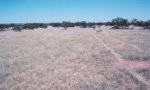
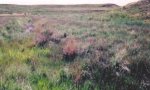
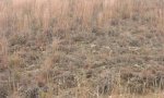
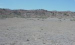
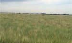
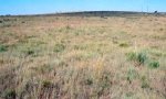
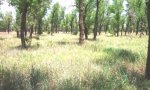
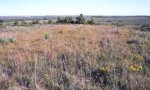
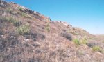
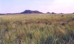
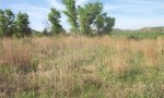
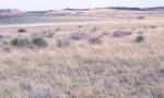
Ecological site photos
Print Options
Sections
Font
Other
Briefcase
Add ecological sites and Major Land Resource Areas to your briefcase by clicking on the briefcase (![]() ) icon wherever it occurs. Drag and drop items to reorder. Cookies are used to store briefcase items between browsing sessions. Because of this, the number of items that can be added to your briefcase is limited, and briefcase items added on one device and browser cannot be accessed from another device or browser. Users who do not wish to place cookies on their devices should not use the briefcase tool. Briefcase cookies serve no other purpose than described here and are deleted whenever browsing history is cleared.
) icon wherever it occurs. Drag and drop items to reorder. Cookies are used to store briefcase items between browsing sessions. Because of this, the number of items that can be added to your briefcase is limited, and briefcase items added on one device and browser cannot be accessed from another device or browser. Users who do not wish to place cookies on their devices should not use the briefcase tool. Briefcase cookies serve no other purpose than described here and are deleted whenever browsing history is cleared.
Ecological sites
Major Land Resource Areas
The Ecosystem Dynamics Interpretive Tool is an information system framework developed by the USDA-ARS Jornada Experimental Range, USDA Natural Resources Conservation Service, and New Mexico State University.