
Natural Resources
Conservation Service
Ecological site F097XA007MI
Wet Acidic Sandy Flatwoods
Last updated: 1/16/2024
Accessed: 02/09/2026
General information
Approved. An approved ecological site description has undergone quality control and quality assurance review. It contains a working state and transition model, enough information to identify the ecological site, and full documentation for all ecosystem states contained in the state and transition model.
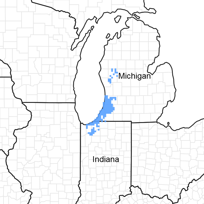
Figure 1. Mapped extent
Areas shown in blue indicate the maximum mapped extent of this ecological site. Other ecological sites likely occur within the highlighted areas. It is also possible for this ecological site to occur outside of highlighted areas if detailed soil survey has not been completed or recently updated.
MLRA notes
Major Land Resource Area (MLRA): 097X–Southwestern Michigan Fruit and Vegetable Crop Belt
Major land resource area 97 wraps around the southern end of Lake Michigan covering portions of Michigan, Illinois, and Indiana corresponding to a major lake-moderated fruit-growing region. The subunit of the MLRA corresponding to the extent of this ecological site description, however, is Forest Service subsections 222Ja and 222Jb. As such, it excludes most of the Illinois portion of the MLRA because the lake plain is less sandy and less lake-moderated there. Instead, the subunit includes a significant portion of MLRA 98, following sandy lake plains and fruit-growing moraines northward into Muskegon County, Michigan. The western boundary is Lake Michigan and the eastern boundary is roughly the extent of lake-ameliorated climate. The northern boundary is defined by a major floristic boundary where vegetation switches from one of predominantly central hardwoods species to one of mainly northern woodland species. The southern boundary is defined by a predominantly prairie flora. The triple juxtaposition of central hardwood, prairie, and northern woodland species in the southern portion of the region make this among the more plant species rich areas of the country.
Soil map units where Wet Acidic Sandy Flatwoods is a major component cover about 14,834 acres (6003 ha) or about 0.7 percent of this area, but mostly in subsection 222Ja.
Classification relationships
This ecological site concept has community phases equivalent to:
1 or more NatureServe systems
4 or more National Vegetation Classification (NVC) associations
4 Michigan Natural Features Inventory (MNFI) communities
3 Indiana Division of Nature Preserves communities
This ecological site concept has equivalent classifications in the following alternative ecological land type classifications
1 United State Forest Service ecological land type phase (ELTP)
0 Kotar habitat types
These are elaborated under “Other References”.
Ecological site concept
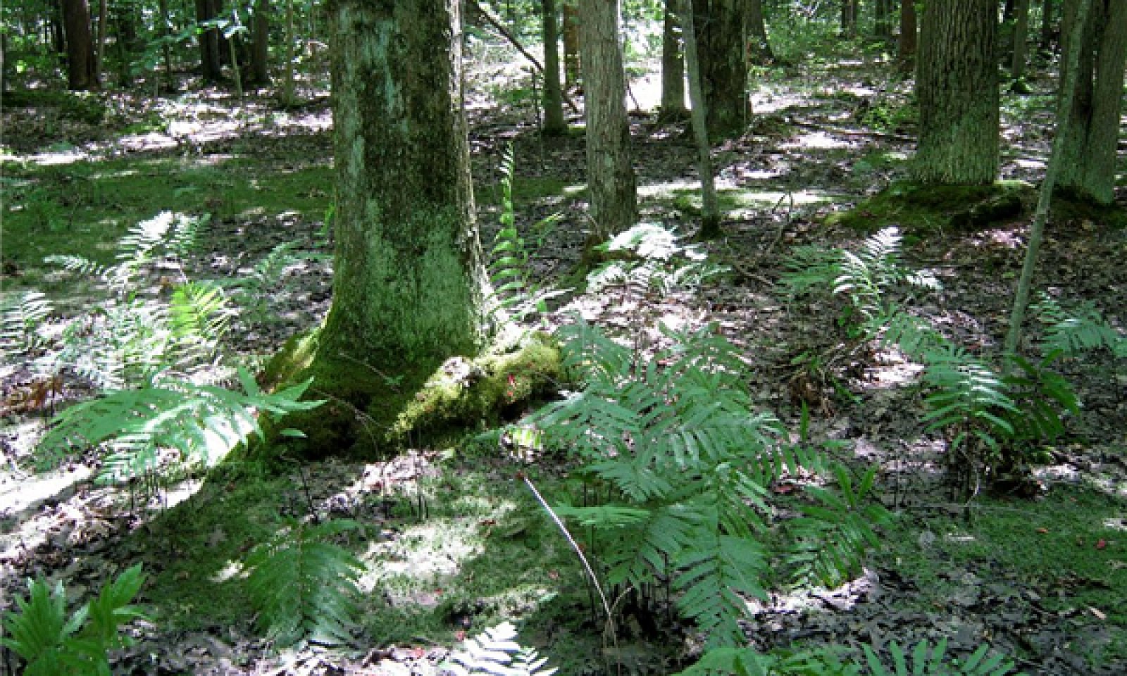
The central concept of the Wet Acidic Sandy Flatwoods is deep sands (>70 percent sands >100 cm deep) with low base saturation (pHs <5.5 or Spodosols) and seasonal ponding (poorly drained and very poorly drained). Such sites support vegetation composed of mostly wetland species of which tolerate low nutrient conditions. Late successional forest dominates the area, but small areas of open marsh and prairie do occur. Characteristic species include red maple, pin oak, and black gum in forested sites with ferns, heaths, and peat moss in the understory. Open sites tend to have various grasses, sedges, and rushes and buttonbush.
Sites with loamier surface textures, shallower depths to clay, higher base saturation, or that are dryer belong to other ecological sites. Some ponded and water map units which have such long hydro periods that surface water is absent only for periods during drought years are a different site concept.
Associated sites
| F097XA006MI |
Moist Acidic Sandy Flatwoods Occurs on adjacent (dryer) somewhat poorly drained sites. |
|---|
Table 1. Dominant plant species
| Tree |
(1) Acer rubrum |
|---|---|
| Shrub |
(1) Vaccinium corymbosum |
| Herbaceous |
(1) Osmundastrum cinnamomeum |
Physiographic features
The surface of this area is covered mainly with glacial till and lacustrine deposits. The lake plain consists of sands deposited by high-energy shoreline processes, which reworked glacial outwash deltas of post-glacial Lake Chicago. Some areas have relict shoreline features of alternating dune and swale topography wherein this ecological site is found in the margin of wet swales. Some higher areas (>200 m elevation; 656 feet) are underlain with a dense glacial till aquatard, usually deeper than 2 meters (80 inches), which is responsible for perched water tables. The wetlands in these sites tend to be acidic Newton soils. The site becomes more minerotrophic due to the influence of the calcareous till where the depths to till is within 50-100 cm (20-40 inches) converging with Rimer and Selfridge soils.
This site also occurs on the margins of broad flat plains with a high regional water table due to low elevations relative to lake level (which is at 176 m; 577 feet) and undrained by rivers or creeks. In these lower areas, groundwater has a larger catchment area and is consequently more minerotrophic, resulting in richer adjacent wetland ecological sites in Granby or Kingsville soils.
Bedrock has no influence on local topography or soils in this area. Bedrock is buried beneath 10-200 m (33-656 feet) of surface deposits and consists primarily of limestone and dolomite in Indiana, and sandstone and shale in Michigan.
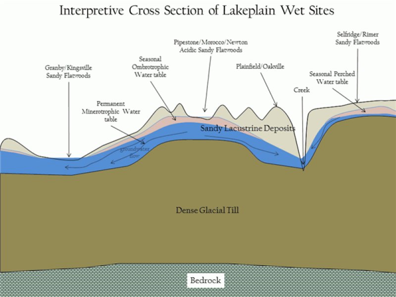
Figure 2. Cross Section
Table 2. Representative physiographic features
| Landforms |
(1)
Lake plain
(2) Interdune |
|---|---|
| Runoff class | Negligible to very low |
| Flooding frequency | None |
| Ponding duration | Brief (2 to 7 days) to long (7 to 30 days) |
| Ponding frequency | Occasional to frequent |
| Elevation | 591 – 755 ft |
| Slope | 3% |
| Ponding depth | 20 in |
| Water table depth | 10 in |
| Aspect | Aspect is not a significant factor |
Climatic features
The southeastern Lake Michigan lake plain and adjacent lake influenced moraines have a humid warm continental climate with cold winters and warm summers.
Just over half of the precipitation is distributed during the warmer half of the year with a significant portion of the precipitation occurring as heavy downpours during thunderstorms. Thunderstorm activity is enhanced inland by lake breeze fronts, while it is diminished near the lakeshore by the stabilizing effect of the cooler lake waters. Occasionally, thunderstorm microbursts cause localized high winds which open single tree gaps in forest canopies, or more rarely, tornados and derechos (severe straight-line winds) open larger gaps. Fall storms bring more frequent strong winds, but with impacts moderated by the lack of leaves (wind resistance) in the canopy. During July, average precipitation lags potential evapotranspiration, resulting in droughty conditions in the upper soil horizons of upland sites. During dry years, this droughty period is extended into August and September, resulting in dry fuels and potential for wildfire over oak and pine dominated areas.
Winter precipitation is enhanced by lake effect snows, with 1.6 to 2.4 m (40-95 inches) falling annually within the snow belt. Peak snowfall occurs at intermediate distances from the lake where topography enhances uplift. The combination of heavier winter snowfall, lake-delayed spring warm up, and frequent wetlands all contribute to relatively lower fire frequencies relative to inland locations with similarly droughty soils.
The area falls within USDA Hardiness zones 6a and 6b and has delayed spring warm up until after the last killing frosts, allowing for a wide range of fruit crops to be grown.
Table 3. Representative climatic features
| Frost-free period (characteristic range) | 123-149 days |
|---|---|
| Freeze-free period (characteristic range) | 149-196 days |
| Precipitation total (characteristic range) | 36-40 in |
| Frost-free period (actual range) | 117-160 days |
| Freeze-free period (actual range) | 143-202 days |
| Precipitation total (actual range) | 33-41 in |
| Frost-free period (average) | 137 days |
| Freeze-free period (average) | 173 days |
| Precipitation total (average) | 37 in |
Figure 3. Monthly precipitation range
Figure 4. Monthly minimum temperature range
Figure 5. Monthly maximum temperature range
Figure 6. Monthly average minimum and maximum temperature
Figure 7. Annual precipitation pattern
Figure 8. Annual average temperature pattern
Climate stations used
-
(1) INDIANA DUNES NATL LKS [USC00124244], Chesterton, IN
-
(2) BLOOMINGDALE [USC00200864], Bloomingdale, MI
-
(3) SOUTH HAVEN [USC00207690], South Haven, MI
-
(4) MUSKEGON CO AP [USW00014840], Muskegon, MI
-
(5) VALPARAISO WTR WKS [USC00128999], Valparaiso, IN
-
(6) ALLEGAN 5NE [USC00200128], Allegan, MI
-
(7) BENTON HARBOR AP [USW00094871], Benton Harbor, MI
-
(8) EAU CLAIRE 4 NE [USC00202445], Dowagiac, MI
-
(9) GRAND HAVEN FIRE DEPT [USC00203290], Grand Haven, MI
-
(10) HOLLAND WTP [USC00203858], Holland, MI
-
(11) HOLLAND TULIP CITY AP [USW00004839], Holland, MI
Influencing water features
In the hydrogeomorphic classification, this site is a mineral flats (flat lake plain), or an upland depression (interdunal). Layers restricting the drainage of local rainwater such as clay loam (till) textures are usually below a depth of 2 m (180 inches), but can occasionally be found within as close as 1 m (40 inches) where the lacustrine sands are the thinnest. Sites are located above sources of more minerotrophic groundwater, and are thus only influenced by local precipitation, which maintains very low pHs.
Soil features
Soils generally classify as poorly drained and very poorly drained Typic Psammaquents (Dair series) and Typic Humaquepts (Newton series). Soils are generally 80 to 100 percent sand to a depth greater than 200 cm (80 inch). Fluctuating water table from local precipitation and a lack of clay in the sandy parent material maintains low pH and low base saturation. An O horizon is often present and is 10 to 17 cm (4 to 7 inches) thick. The A horizon is generally black and 18 to 30 cm (7 to 12 inches) thick and is usually mucky sand. Where thick enough, the A horizon is part of an umbric epipedon (in Humaquepts). Where substantial hard, root-restricting ortstein is developed in the B horizon (Bhsm) and the soils classify as Typic Duraquods (Jebavy series). Other Spodosols (Endoaquods) can occur but are too infrequent to form a series.
The seasonally high water table limits stand composition to wetland species. As a site becomes more forested, the water table may drop somewhat from increased water utilization by trees and tip-up mounds may form from wind thrown trees, factors both of which may increase the number of non-wetland species that can occur.
The low base saturation of the soil limits the site to species adapted to acidic, low nutrient conditions. Sites with calcareous clay-loam till within depths of 100 to 200 cm (40 to 80 inches) may also behave in ways similar to this site in as much as the rooting zone lacks nutrients to support high base obligates. The low pH occur in the upper horizons and can extend throughout the profile, but sometimes the lowest wettest sites have more moderate pHs with depth associated with a more long term widely flowing ground water. The productivity is likely higher at the upper end of the pH scale (greater than 5), and thus the wettest sites may have higher grass cover and may converge with the higher base concepts such as Wet Sandy Flatwoods.
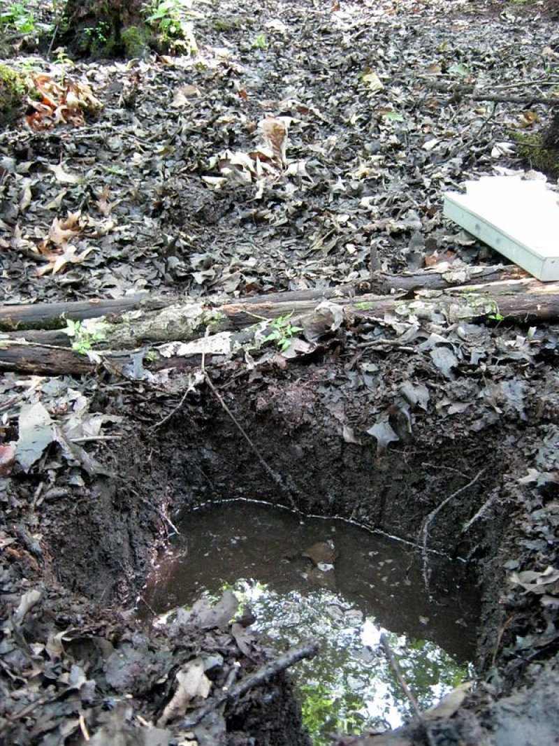
Figure 9. Example of the Newton soil series
Table 4. Representative soil features
| Parent material |
(1)
Lacustrine deposits
|
|---|---|
| Surface texture |
(1) Sand (2) Fine sand (3) Mucky sand |
| Family particle size |
(1) Sandy |
| Drainage class | Poorly drained to very poorly drained |
| Permeability class | Moderately rapid to rapid |
| Soil depth | 80 in |
| Surface fragment cover <=3" | 1% |
| Surface fragment cover >3" | Not specified |
| Available water capacity (0-39.4in) |
1.57 – 3.94 in |
| Calcium carbonate equivalent (0-39.4in) |
Not specified |
| Soil reaction (1:1 water) (0-19.7in) |
3.5 – 5.5 |
| Subsurface fragment volume <=3" (0-59.1in) |
10% |
| Subsurface fragment volume >3" (0-59.1in) |
5% |
Ecological dynamics
The reference state is characterized by a relatively low fire frequency (fire return interval >100 years) and a trend towards shade tolerant and hydrophytic vegetation. Prior to European-American settlement of the area, about 88 percent of this ecological site was forested, of which more than half was conifer (hemlock) swamp. Only 2 percent was in a wet sand prairie phase, and about 10 percent was in a buttonbush swamp or coastal plain marsh phase.
Variation in fire return intervals, which combined with hydrology ultimately account for the frequency of open community phases, are themselves affected by fire return intervals of adjacent uplands. Fire return intervals of adjacent uplands ranged from greater than 1,000 years for a northern hardwoods-hemlock dominated system to crown fires about every 290 years with understory fires every 70 years for a pine-oak dominated system (U.S. Department of the Interior, Geological Survey, 2008). Even in its wettest expressions of hydrology, fire is thought to be an important factor in preventing (or reversing) the buildup of peat and long-term conversion to bog (Kost and Penskar, 2000).
Presently, 17 percent of the ecological site is forested, more or less consistent with a phase within the reference condition (U.S. Department of the Interior, Geological Survey, 2011). About 49 percent is of the ecological site is intensively managed as agriculture, urban development, or other managed vegetation more or less addressed in state 2. Another 35 percent is in open condition, which may either be a post agricultural phase of state 2 or something resembling natural vegetation in the more open phases within the reference state.
The highest (deepest water table) portions of the Wet Acidic Sandy Flatwoods ecological site typically have pit and mound topography, which results in a complex mosaic of seasonally ponded and unponded ground surfaces within 1 to 10 meters distance. Many of the hummock or mound sites are not submerged for long enough to be considered poorly drained and can support non-hydrophytic vegetation. At the scale of a typical vegetation plot (100 to 400 m²), the difference between the Wet Acidic Sandy Flatwoods site concept and the adjacent Acidic Sandy site concept is which portion of the microtopography constitutes the majority of the area. Where microtopography does not exist, there is more hydrophytic vegetation.
State and transition model
More interactive model formats are also available.
View Interactive Models
Click on state and transition labels to scroll to the respective text
Ecosystem states
State 2 submodel, plant communities
State 1
Reference State
Prior to European-American settlement of the area, about 49 percent of the vegetation was dominated by very shade tolerant species such as hemlock (Tsuga canadensis) (phase 1.2) and about 28 percent was dominated by red maple (Acer rubrum) and other swamp hardwoods (phase 1.1) (Albert, et al., 1995). Hemlock does not occur naturally in northern Indiana (Kartesz, 2013; Swink & Wilhelm, 1994), so there phase 1.2 would have included only yellow birch (Betula alleghaniensis). Because forests are still recovering from past logging, most forests today are intermediate in succession as phase 1.1. Canopy dominants range from red maple to pin oak with varying amounts of black gum (Nyssa sylvatica) and swamp white oak (Quercus bicolor). Although usually not abundant in this region, black gum is a reliable indicator of acidic sites like these. Pin oak (Quercus palustris) is found throughout the range of this site concept, but is less prevalent to absent in stands north of Ottawa County. Acid tolerant ferns (e.g. cinnamon fern, Osmundastrum cinnamomeum; Virginia chain fern, Woodwardia virginica) are found in the understory. Most of the frequent understory shrubs (e.g. blueberries, swamp dewberry – Rubus hispidus) and forbs (e.g. partridge berry, Mitchella repens; Canada mayflower, Maianthemum canadense) are found almost exclusively on hummocks, whereas the low wet ponded portions are nearly bare of vegetation depending on shade levels. Peat moss (Sphagnum spp.) is common in zones that remain saturated for long periods, but which are only shallowly ponded. Otherwise, buttonbush (Cephalanthus occidentalis) and lizard’s tail (Saururus cernuus) are frequent constituents where ponding has precluded other species. Sites that are ponded for longer durations may lack canopy altogether and give way to wet-mesic prairie or coastal plain marsh. Because wet acidic sands are relative outliers in a region otherwise dominated by calcareous tills, many species occur here that are disjuncts from their main ranges in unglaciated areas to the south (e.g. Rhynchospora macrostachya). Several species are disjuncts from the Gulf and Atlantic Coastal Plains where they are found in similarly acidic sandy sites (Reznicek, 1994; Sorrie & Weakley, 2001).
Community 1.1
Red maple-Pin Oak/Highbush Blueberry/Cinnamon Fern

Figure 10. Pin oak with chain fern and peat moss.
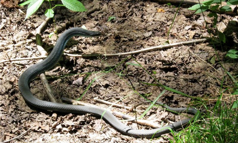
Figure 11. Blue racer (Coluber constrictor foxii)
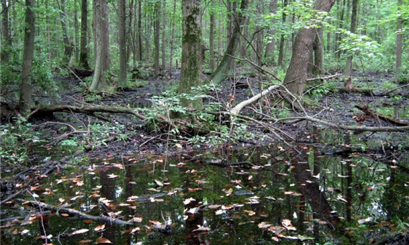
Figure 12. Ponding
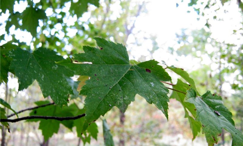
Figure 13. Red maple

Figure 14. Black gum
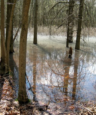
Figure 15. Ponding in spring with pollen on the surface. Pin oak on the outer portion of the pond with buttonbush in the center.
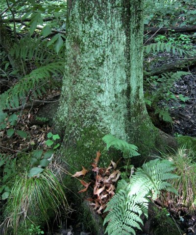
Figure 16. Pin oak
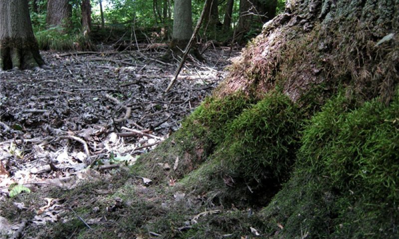
Figure 17. Pin oak trunk with moss zonation
This phase consists of a mix of lowland hardwoods typical of wet conditions that are of lesser shade tolerance: pin oak (intolerant), swamp white oak (intermediate), red maple (tolerant). The persistence of pin oak and swamp white oak depends on their greater tolerance to flooding relative to the more shade-tolerant red maple and black gum.
Forest overstory. Red maple and pin oak are the most dominant trees, with frequent black gum and occasional swamp white oak.
Forest understory. Highbush blueberry and cinnamon fern are among the more frequent components of the moderately sparse understory. Blueberries and most of the other species are usually found on hummocks. Peat moss may occur at the base of hummocks near the high water line. Virginia chain fern usually occurs in the seasonally ponded areas.
Table 5. Soil surface cover
| Tree basal cover | 0.5-1.0% |
|---|---|
| Shrub/vine/liana basal cover | 0.5-2.0% |
| Grass/grasslike basal cover | 0-3% |
| Forb basal cover | 1-2% |
| Non-vascular plants | 0.1-1.0% |
| Biological crusts | 0% |
| Litter | 75-90% |
| Surface fragments >0.25" and <=3" | 0% |
| Surface fragments >3" | 0% |
| Bedrock | 0% |
| Water | 0% |
| Bare ground | 0% |
Table 6. Woody ground cover
| Downed wood, fine-small (<0.40" diameter; 1-hour fuels) | 3-5% N* |
|---|---|
| Downed wood, fine-medium (0.40-0.99" diameter; 10-hour fuels) | 3-5% N* |
| Downed wood, fine-large (1.00-2.99" diameter; 100-hour fuels) | 0-1% N* |
| Downed wood, coarse-small (3.00-8.99" diameter; 1,000-hour fuels) | 0-5% N* |
| Downed wood, coarse-large (>9.00" diameter; 10,000-hour fuels) | 0-5% |
| Tree snags** (hard***) | – |
| Tree snags** (soft***) | – |
| Tree snag count** (hard***) | 0-65 per acre |
| Tree snag count** (hard***) | 0-28 per acre |
* Decomposition Classes: N - no or little integration with the soil surface; I - partial to nearly full integration with the soil surface.
** >10.16cm diameter at 1.3716m above ground and >1.8288m height--if less diameter OR height use applicable down wood type; for pinyon and juniper, use 0.3048m above ground.
*** Hard - tree is dead with most or all of bark intact; Soft - most of bark has sloughed off.
Table 7. Canopy structure (% cover)
| Height Above Ground (ft) | Tree | Shrub/Vine | Grass/ Grasslike |
Forb |
|---|---|---|---|---|
| <0.5 | 0-1% | 0-1% | 0-2% | 2-3% |
| >0.5 <= 1 | 0-1% | 0-1% | 0-1% | 1-10% |
| >1 <= 2 | 1-5% | 1-3% | 0-1% | 1-10% |
| >2 <= 4.5 | 1-5% | 1-2% | – | – |
| >4.5 <= 13 | 10-60% | 1-2% | – | – |
| >13 <= 40 | 40-70% | 0-1% | – | – |
| >40 <= 80 | 100-100% | 0-1% | – | – |
| >80 <= 120 | 10-45% | – | – | – |
| >120 | – | – | – | – |
Community 1.2
Eastern Hemlock-Yellow Birch/Cinnamon Fern

Figure 18. Hemlock with peat moss understory.
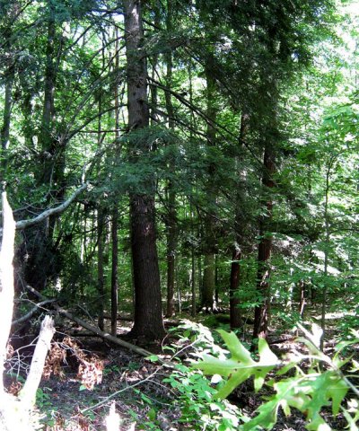
Figure 19. Hemlock
In general, conifers in these swampy sites consisted of eastern hemlock, which is very shade tolerant (Barnes and Wagner, 2004). Thus, the conifer domination of these sites is an indicator of a tendency for late successional phases. Yellow birch shares with hemlock the tendency to establish seedlings on nurse logs (Marx and Walters, 2008), which may give it an edge in late successional habitats despite intermediate shade tolerance.
Forest overstory. Eastern hemlock (Tsuga canadensis) and occasional yellow birch (Betula alleghaniensis) characterize the overstory.
Forest understory. Cinnamon fern (Osmundastrum cinnamomeum) and peat moss (Sphagnum spp.) are typical understory plants.
Community 1.3
Pin Oak –Swamp White Oak/Buttonbush/Virginia Chain Fern-Lizard’s tail
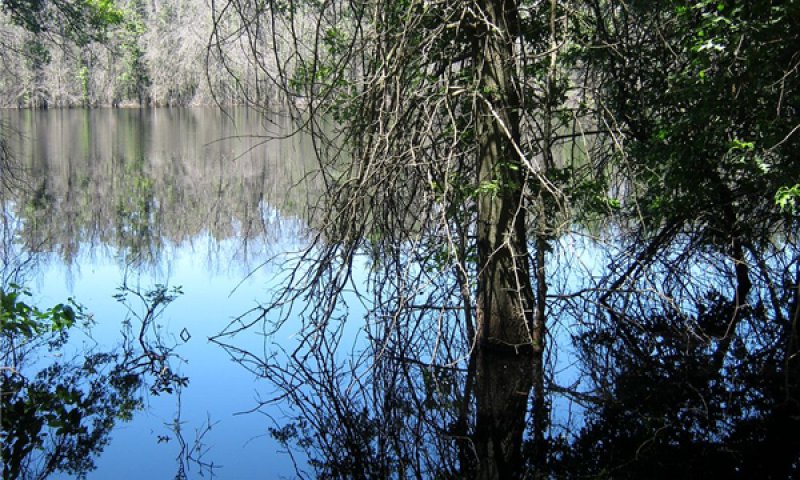
Figure 20. Pin oak at edge of longer duration ponding phase.
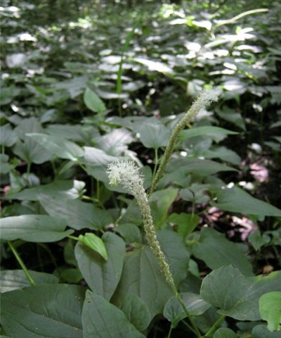
Figure 21. Lizards Tail (Saururus cernuus)
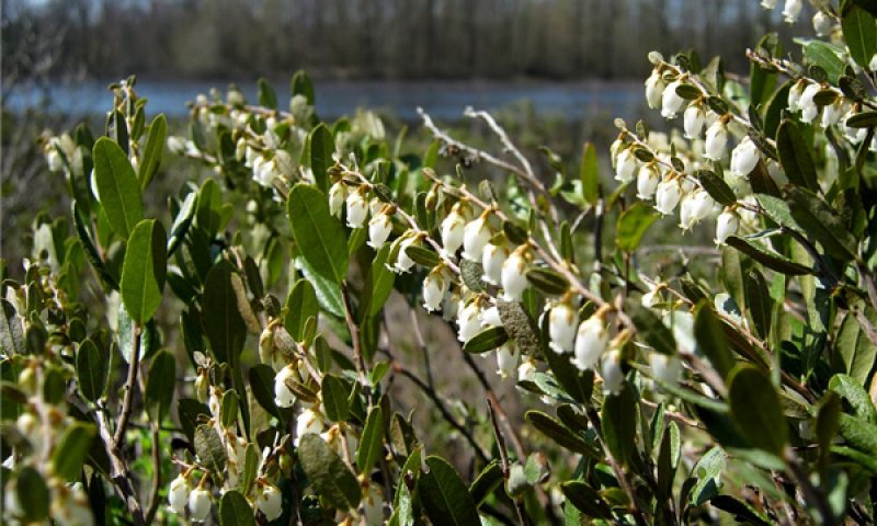
Figure 22. Leatherleaf (Chamaedaphne calyculata)
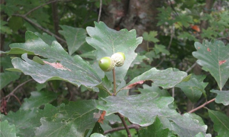
Figure 23. Swamp white oak
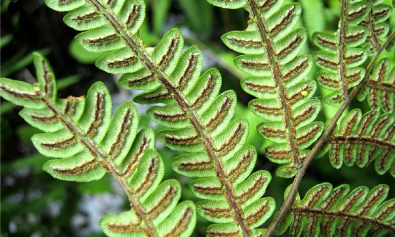
Figure 24. Virginia chain fern

Figure 25. Pin oak swamp with high water line on their trunks.
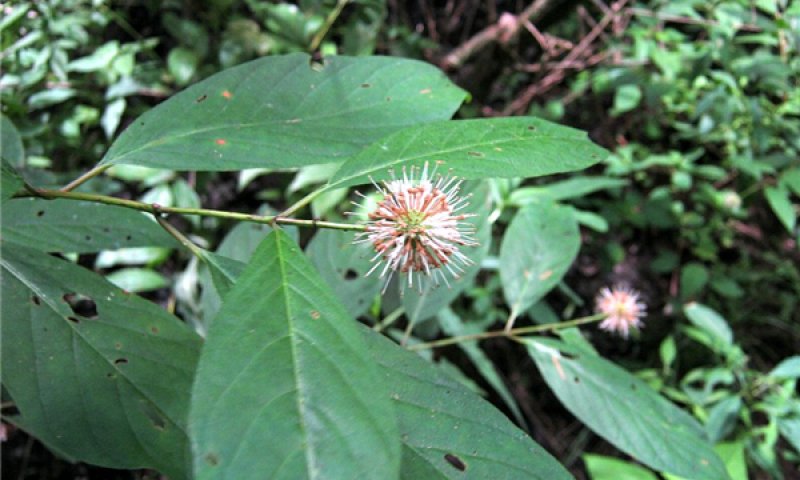
Figure 26. Buttonbush
This phase represents a wetter, less hummocky condition, often at the edge of an open pond. Trees such as pin oak and swamp white oak that are more tolerant of ponding prevail over red maple and black gum.
Forest overstory. Pin oak and swamp white oak are the most frequent and characteristic members of the canopy. Green ash (Fraxinus pensylvanica) may be present, presumably, where nutrient levels are higher.
Forest understory. Buttonbush and lizards tail may occur in the understory, particularly where the canopy is more open. Keeping with the hypothesis that some sites are burned out peat bogs, leatherleaf (Chamaedaphne calyculata) has been observed at the forest-pond boundary.
Community 1.4
Bluejoint
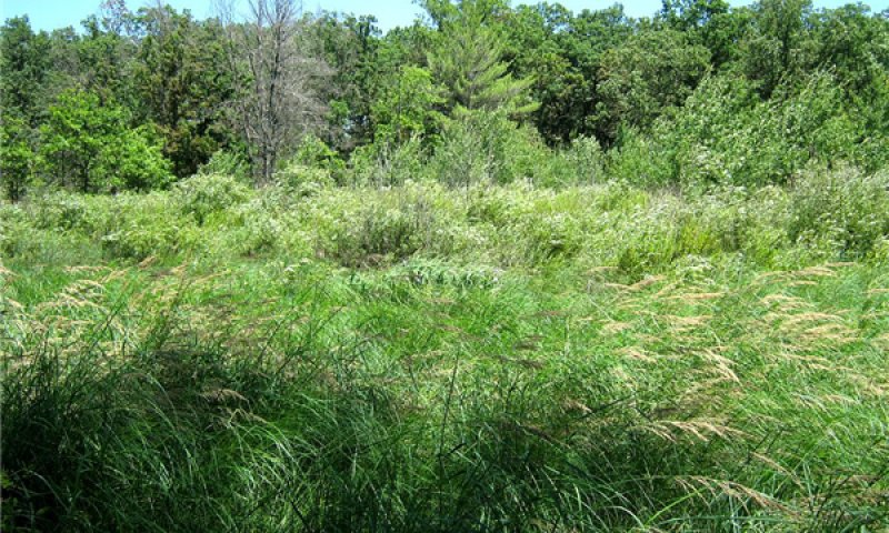
Figure 27. Bluejoint, wet-mesic sand prairie
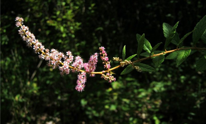
Figure 28. Steeplebush
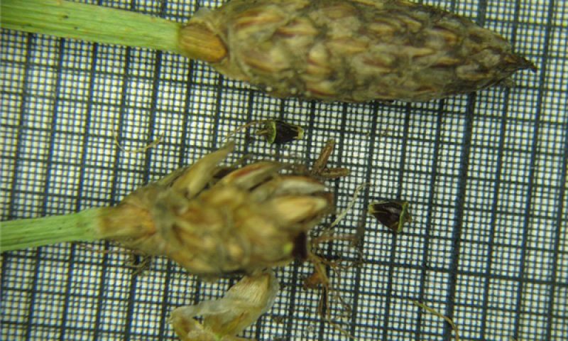
Figure 29. Eleocharis melanocarpa spikes with achenes (1 mm, 0.2 mm scale)
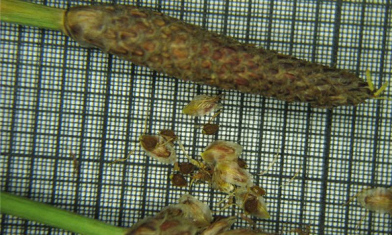
Figure 30. Eleocharis tricostata spikes with achenes (1 mm, 0.2 mm scale)
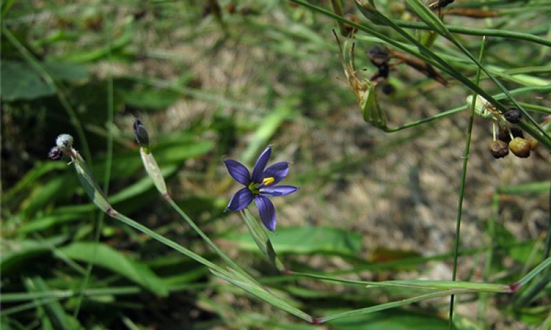
Figure 31. Sisyrinchium atlanticum
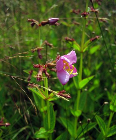
Figure 32. Virginia meadow-beauty (Rhexia virginica)
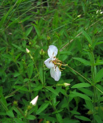
Figure 33. Maryland meadowbeauty (Rhexia mariana)
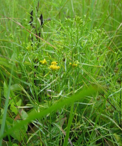
Figure 34. Slender goldentop (Euthamia caroliniana)
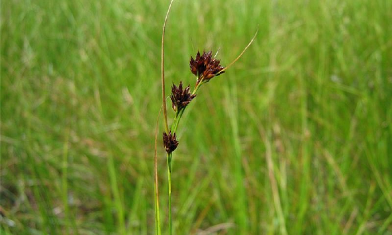
Figure 35. Rhynchospora capitellata
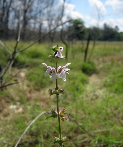
Figure 36. Hyssop hedge-nettle (Stachys hyssopifolia)
This phase represents an open canopy condition where grasses prevail. Unless maintained with fire or prolonged ponding, this phase will be colonized by swamp hardwoods.
Forest understory. Bluejoint (Calamagrostis canadensis) is a typical common grass species in this community phase; however, a diversity of other grasses, sedges, rushes, and forbs differentiate it from other wet prairie site concepts. A large proportion of the total flora are Atlantic-Gulf Coastal Plain disjuncts. Species list, in part, was taken from Kost and Penskar (2000). While there is overlap in taxa among community phases, zonation is visibly apparent.
Community 1.5
Tall Horned Beak Sedge
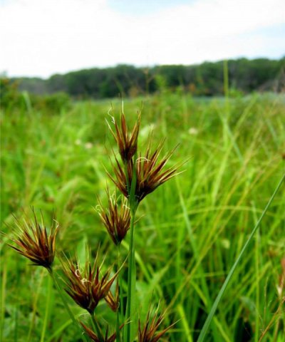
Figure 37. Tall Horned Beak Sedge (Rhynchospora macrostachya)
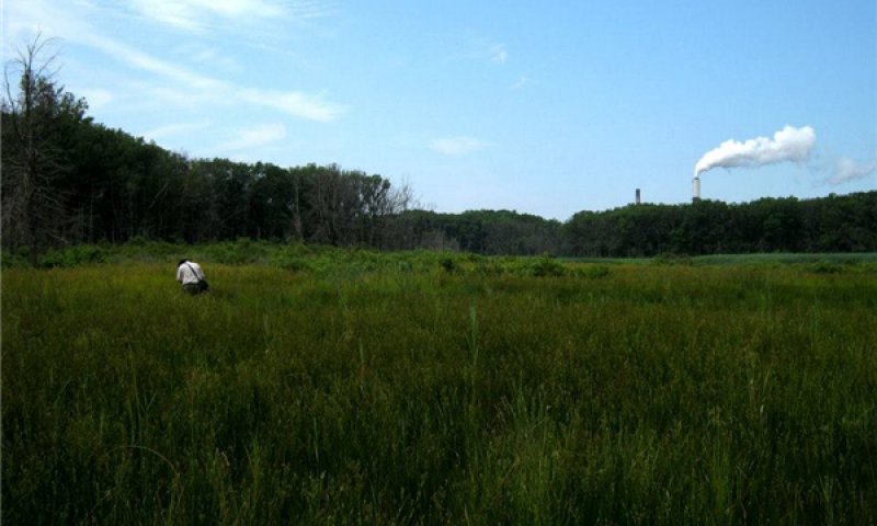
Figure 38. Cowles Bog at Indiana Dunes National Lakeshore
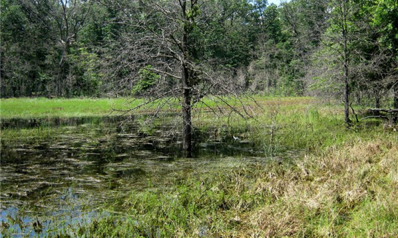
Figure 39. Dead pin oak
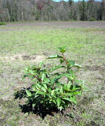
Figure 40. Buttonbush in long duration seasonally ponded zone (dry period)
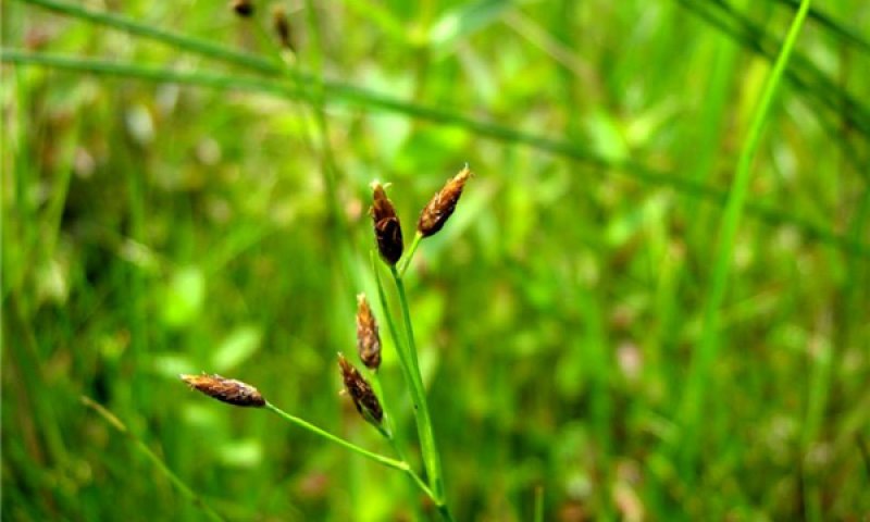
Figure 41. Rhynchospora scirpoides
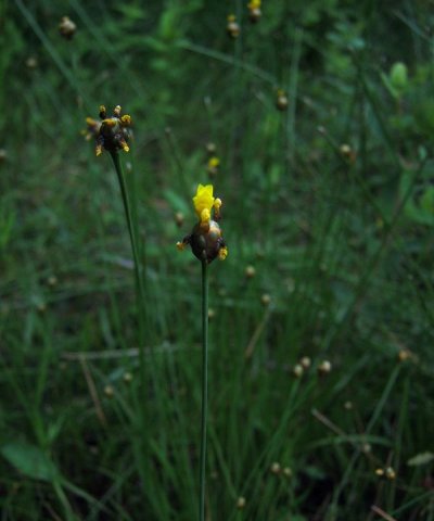
Figure 42. Yellow-eyed grass (Xyris torta)
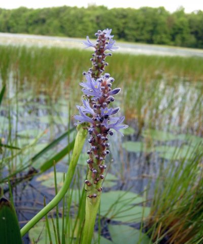
Figure 43. Pickerel-weed (Pontederia cordata)
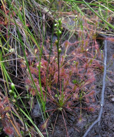
Figure 44. Sundew (Drosera intermedia)
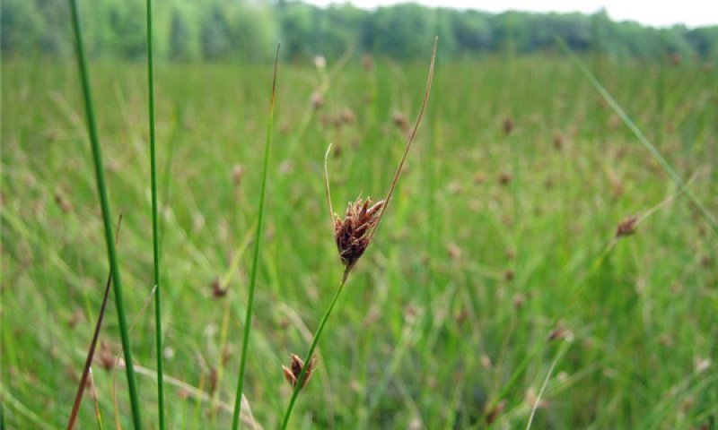
Figure 45. Rhynchospora fusca
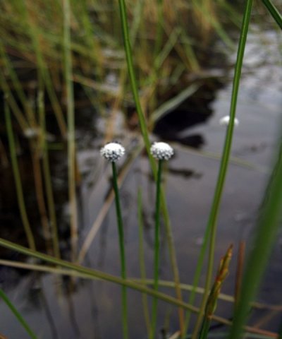
Figure 46. Pipewort (Eriocaulon aquaticum)
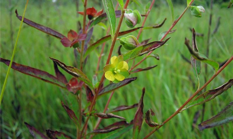
Figure 47. Seedbox (Ludwigia alternifolia)

Figure 48. Ludwigia sphaerocarpa
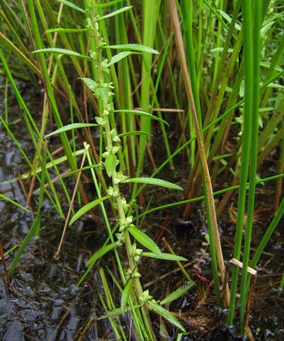
Figure 49. Mermaidweed (Proserpinaca palustris)
This community phase is ponded for most of the year, and sometimes only exposed during drought years.
Forest understory. There is a mix of aquatic and emergent herbaceous taxa, with a dominance of graminoids. A large portion of the flora is Gulf-Atlantic Coastal Plain disjuncts (e.g. Rhynchospora macrostachya, having a large gap in its distribution separating it from its main range in the Southeast). Some taxa are rare annuals, which only emerge when the pond bottom is exposed and may go unnoticed for decades before rediscovery (e.g. Rhynchospora nitens). While there is overlap in taxa among community phases, zonation is visibly apparent.
Pathway 1.1A
Community 1.1 to 1.2


Continued shade in the overstory inhibits the ability of oak to recruit. The accumulation of down woody debris provides elevated seedbeds (nurse logs) for light seeded, flood intolerant trees such as hemlock and yellow birch, further reducing the advantage of flood tolerance over shade tolerance. Intense shade of hemlock results in reduced red maple coverage.
Pathway 1.1B
Community 1.1 to 1.3


Increased ponding duration, erosion of mound microtopography, and reduced nurse log frequency, results in the mortality of less flood intolerant species such as red maple and black gum. This increases the light available for pin oak and swamp white oak. Larger windthrow gaps allow for buttonbush establishment.
Pathway 1.2A
Community 1.2 to 1.1


Large canopy gaps from windthrow or fire could allow more shade-intolerant species such as pin oak or red maple to establish.
Pathway 1.2B
Community 1.2 to 1.3


Increased ponding duration, erosion of mound microtopography, and reduced nurse log frequency results in the mortality of less flood intolerant species such as red maple and black gum. This increases the light available for pin oak and swamp white oak. Larger windthrow gaps allow for buttonbush establishment.
Pathway 1.3A
Community 1.3 to 1.1


Decreased ponding duration due to dryer climate or increased water use by forest vegetation, combined with the accumulation of pit and mound microtopography from wind throws of larger trees, results in the recruitment of less flood-tolerant and more shade-tolerant red maple and black gum.
Pathway 1.3B
Community 1.3 to 1.4


Tree mortality induced by increased ponding duration or crown fire results in increased light availability for a rich understory of forbs and graminoids.
Pathway 1.4A
Community 1.4 to 1.3


Reduced ponding duration due to dryer climate or reduced fire frequency permits colonization by flood-tolerant tree species. Increasing shade results in the reduction of the understory vegetation and replacement by more shade-tolerant taxa.
Pathway 1.4B
Community 1.4 to 1.5


Increased ponding duration from seasonally ponded to intermittently exposed allows for the establishment of aquatic plants and reduces the number emergent species. Some of the rarest annuals are maintained in the seed bank, only emerging during extreme dry years when the pond bottom is exposed.
Pathway 1.5A
Community 1.5 to 1.4


Decreased ponding duration due to drying climate allows a wider array of emergent herbaceous taxa to colonize, but reduces the abundance of aquatic taxa.
State 2
Agriculture
The Agriculture State accommodates the 49 percent of the sites that are actively managed, or are recovering from agriculture. This is a heterogeneous assemblage addressed here collectively. Included within the 49 percent is 31 percent of the area considered agriculture and 17 percent that is developed at low to high intensities (e.g. cities) (U.S. Department of the Interior, Geological Survey, 2011).
Community 2.1
Blueberry Farm
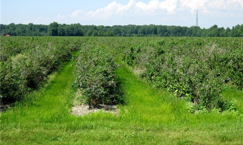
Figure 50. Blueberry Farm
Blueberries are among the most important crops in this ecological site. This and adjacent riparian sandy sites support some of the nation’s largest supply of blueberries. Although commonly in the form of cultivars, this is one of the few essentially native crops, being that all are derived from Vaccinium corymbosum. Large operations require chemical control for introduced insect pests (affecting fruit quality), but these pests do not otherwise threaten the viability of wild populations (Demchak and Rudisill, 2006). Despite the natural occurrence of native blueberries on these low nutrient sites, for optimal production, blueberry farmers increase the levels of available nitrogen and calcium in the form of salts, which maintain the optimal low pH, levels (4.5 to 5.1). Nitrogen is supplied as ammonium sulfate, and calcium is supplied with calcium sulfate (gypsum). When necessary, pH is adjusted upward with lime (calcium carbonate) and downward with sulfur (Hayden, 2001). Sites are often mulched to help maintain low pH. Recommended water tables for blueberry production are 36 to 56 cm (14 to24 inches), which requires drainage ditches for poorly drained sites (Hayden, 2001). Deeper seasonal water tables allows for larger rooting volumes, which helps maintain stronger plants for production. With or without drainage ditches, the natural variability in water table and low available water holding capacity of the sandy textures requires that the blueberry crop be irrigated. Other practices represented by this community phase are ornamental nurseries, hayfields, and pastures. Although not elaborated here, these agricultural practices involve the establishment of different species, alternative patterns of drainage and irrigation, and different nutrient management regimes. In general, they may require higher applications of lime to raise the soil pH as compared to blueberry cultivation.
Forest understory. Production blueberry fields typically have ample herbaceous ground covers. The composition of the ground vegetation differs in important ways from the reference condition due to frequent disturbance, the heavy inputs of nitrogen fertilizers, and most importantly the artificially lowered water tables. As a result, cosmopolitan weed species such as yellow nutsedge can proliferate. Other weeds such as the non-native sheep sorrel are characteristic of disturbed sites such as these that are acidic.
Transition T1A
State 1 to 2
Clearing/Drainage/Cultivation
Restoration pathway R2A
State 2 to 1
Restoration of poorly drained conditions by blocking drainage ditches is critical to restoring reference state hydrology. Control non-native invasive species, and reestablish native plant species characteristic of the forested reference state. If applicable, cease nutrient enrichment (to allow excess calcium and nitrogen to be slowly flushed from the system or incorporated into biomass). If the site had been limed heavily, application of sulfur should be considered depending on restoration objectives.
Conservation practices
| Brush Management | |
|---|---|
| Tree/Shrub Site Preparation | |
| Tree/Shrub Establishment | |
| Restoration and Management of Rare and Declining Habitats | |
| Wetland Restoration | |
| Wetland Enhancement | |
| Herbaceous Weed Control |
Additional community tables
Table 8. Community 1.1 forest overstory composition
| Common name | Symbol | Scientific name | Nativity | Height (ft) | Canopy cover (%) | Diameter (in) | Basal area (square ft/acre) |
|---|---|---|---|---|---|---|---|
|
Tree
|
|||||||
| red maple | ACRUR | Acer rubrum var. rubrum | Native | 32.8–78.7 | 0–100 | 5.3–25.7 | – |
| pin oak | QUPA2 | Quercus palustris | Native | 41–73.8 | 0–70 | 7.2–16.9 | – |
| swamp white oak | QUBI | Quercus bicolor | Native | 32.8–82 | 0–60 | 13–23.9 | – |
| swamp white oak | QUBI | Quercus bicolor | Native | 32.8–82 | 0–60 | – | – |
| American beech | FAGR | Fagus grandifolia | Native | 16.4–49.2 | 10–45 | – | – |
| green ash | FRPE | Fraxinus pennsylvanica | Native | – | 0–40 | – | – |
| American elm | ULAM | Ulmus americana | Native | 16.4–49.2 | 0–25 | – | – |
| northern red oak | QURU | Quercus rubra | Native | 32.8–82 | 0–25 | 6.8–18.6 | – |
| red maple | ACRUR | Acer rubrum var. rubrum | Native | 16.4–43.7 | 0–25 | – | – |
| blackgum | NYSY | Nyssa sylvatica | Native | 32.8–65.6 | 0–25 | 8.5–17.4 | – |
| American elm | ULAM | Ulmus americana | Native | 32.8–65.6 | 0–10 | – | – |
| sassafras | SAAL5 | Sassafras albidum | Native | 32.8–65.6 | 0–10 | 8.5–10.9 | – |
| yellow birch | BEAL2 | Betula alleghaniensis | Native | – | 0–5 | – | – |
| white oak | QUAL | Quercus alba | Native | – | 0–5 | – | – |
| black cherry | PRSE2 | Prunus serotina | Native | – | 0–5 | – | – |
| black oak | QUVE | Quercus velutina | Native | – | 0–5 | – | – |
| blackgum | NYSY | Nyssa sylvatica | – | 16.4–38.3 | 0–5 | – | – |
| pin oak | QUPA2 | Quercus palustris | Native | 16.4–49.2 | 0–5 | – | – |
| American hornbeam | CACA18 | Carpinus caroliniana | Native | 16.4–32.8 | 0–5 | – | – |
| tuliptree | LITU | Liriodendron tulipifera | Native | – | 0–5 | 32.9 | – |
| American witchhazel | HAVI4 | Hamamelis virginiana | Native | 16.4–32.8 | 0–2 | – | – |
| northern red oak | QURU | Quercus rubra | Native | 16.4–49.2 | 0–2 | – | – |
| sassafras | SAAL5 | Sassafras albidum | Native | 16.4–49.2 | 0–2 | – | – |
| paper birch | BEPA | Betula papyrifera | Native | – | 0–0.1 | – | – |
Table 9. Community 1.1 forest understory composition
| Common name | Symbol | Scientific name | Nativity | Height (ft) | Canopy cover (%) | |
|---|---|---|---|---|---|---|
|
Grass/grass-like (Graminoids)
|
||||||
| sedge | CAREX | Carex | Native | 0–0.3 | 0–15 | |
| mannagrass | GLYCE | Glyceria | Native | 0–0.3 | 0–0.5 | |
| weak stellate sedge | CASE6 | Carex seorsa | Native | 0–0.1 | 0–0.2 | |
| greater bladder sedge | CAIN12 | Carex intumescens | Native | 0.3–1.6 | 0–0.1 | |
| drooping sedge | CAPR12 | Carex prasina | Native | 0.3–1.6 | 0–0.1 | |
|
Forb/Herb
|
||||||
| lizard's tail | SACE | Saururus cernuus | Native | 0.3–1.6 | 0–45 | |
| smallspike false nettle | BOCY | Boehmeria cylindrica | Native | 0–1.6 | 0–5 | |
| waterhorehound | LYCOP4 | Lycopus | Native | – | 0–2 | |
| spotted water hemlock | CIMA2 | Cicuta maculata | Native | 0.3–1.6 | 0–2 | |
| Canada mayflower | MACA4 | Maianthemum canadense | Native | 0–0.3 | 0–2 | |
| jewelweed | IMCA | Impatiens capensis | Native | 0–1.6 | 0–2 | |
| blue skullcap | SCLA2 | Scutellaria lateriflora | Native | 0–1.6 | 0–1 | |
| Indian cucumber | MEVI | Medeola virginiana | Native | 0–1.6 | 0–1 | |
| partridgeberry | MIRE | Mitchella repens | Native | 0–0.3 | 0–0.5 | |
| threeleaf goldthread | COTR2 | Coptis trifolia | Native | 0–0.3 | 0–0.2 | |
| American water horehound | LYAM | Lycopus americanus | Native | 0–1.6 | 0–0.2 | |
| water plantain | ALISM | Alisma | Native | – | 0–0.1 | |
| hairy Solomon's seal | POPU4 | Polygonatum pubescens | Native | 0.3–1.6 | 0–0.1 | |
| starflower | TRBO2 | Trientalis borealis | Native | 0–0.3 | 0–0.1 | |
| Virginia iris | IRVI | Iris virginica | Native | 0.3– | 0–0.1 | |
| duckweed | LEMNA | Lemna | Native | – | 0–0.1 | |
| marsh skullcap | SCGA | Scutellaria galericulata | Native | – | 0–0.1 | |
| hemlock waterparsnip | SISU2 | Sium suave | Native | – | 0–0.1 | |
| beggarticks | BIDEN | Bidens | Native | 0.3–1.6 | 0–0.1 | |
|
Fern/fern ally
|
||||||
| Virginia chainfern | WOVI | Woodwardia virginica | Native | 0.3–1.6 | 0–2 | |
| spinulose woodfern | DRCA11 | Dryopteris carthusiana | Native | 0–1.6 | 0–1 | |
| western brackenfern | PTAQL | Pteridium aquilinum var. latiusculum | Native | 0.3–1.6 | 0–0.2 | |
| sensitive fern | ONSE | Onoclea sensibilis | Native | – | 0–0.1 | |
|
Shrub/Subshrub
|
||||||
| common buttonbush | CEOC2 | Cephalanthus occidentalis | Native | 1.6–3.3 | 0–45 | |
| highbush blueberry | VACO | Vaccinium corymbosum | Native | 1.6–3.3 | 0.1–25 | |
| common winterberry | ILVE | Ilex verticillata | Native | 1.6–6.6 | 0–5 | |
| southern arrowwood | VIRE7 | Viburnum recognitum | Native | – | 0–2 | |
| lowbush blueberry | VAAN | Vaccinium angustifolium | Native | 0.3–1.6 | 0–2 | |
| eastern teaberry | GAPR2 | Gaultheria procumbens | Native | 0–0.3 | 0–2 | |
| southern arrowwood | VIRE7 | Viburnum recognitum | Native | 1.6– | 0–2 | |
| northern spicebush | LIBE3 | Lindera benzoin | Native | 1.6–3.3 | 0–2 | |
| northern spicebush | LIBE3 | Lindera benzoin | Native | 0–1.6 | 0–1 | |
| bristly dewberry | RUHI | Rubus hispidus | Native | 0–0.3 | 0.1–1 | |
| common buttonbush | CEOC2 | Cephalanthus occidentalis | Native | 0.3–1.6 | 0–1 | |
| common winterberry | ILVE | Ilex verticillata | Native | 0–1.6 | 0–1 | |
| purple chokeberry | ARPR2 | Aronia ×prunifolia | Native | 1.6– | 0–0.5 | |
| glossy buckthorn | FRAL4 | Frangula alnus | Introduced | 6.6–16.4 | 0–0.5 | |
| highbush blueberry | VACO | Vaccinium corymbosum | Native | 0–1.6 | 0–0.1 | |
| swamp rose | ROPA | Rosa palustris | Native | 0.3–1.6 | 0–0.1 | |
| gray dogwood | CORA6 | Cornus racemosa | Native | 0.3–1.6 | 0–0.1 | |
| swamp loosestrife | DEVE | Decodon verticillatus | Native | 0.3–1.6 | 0–0.1 | |
|
Tree
|
||||||
| American beech | FAGR | Fagus grandifolia | Native | 1.6–16.4 | 15–60 | |
| American elm | ULAM | Ulmus americana | Native | 1.6–16.4 | 0–10 | |
| American hornbeam | CACA18 | Carpinus caroliniana | Native | 6.6–16.4 | 0–10 | |
| red maple | ACRUR | Acer rubrum var. rubrum | Native | 6.6–16.4 | 0–5 | |
| yellow birch | BEAL2 | Betula alleghaniensis | Native | 6.6–16.4 | 0–5 | |
| blackgum | NYSY | Nyssa sylvatica | Native | 6.6–16.4 | 0–2 | |
| American beech | FAGR | Fagus grandifolia | Native | 0.3–1.6 | 0–2 | |
| sassafras | SAAL5 | Sassafras albidum | Native | 1.6– | 0–2 | |
| white oak | QUAL | Quercus alba | Native | 1.6– | 0–2 | |
| American witchhazel | HAVI4 | Hamamelis virginiana | Native | 1.6–16.4 | 0–2 | |
| green ash | FRPE | Fraxinus pennsylvanica | Native | 1.6– | 0–2 | |
| black oak | QUVE | Quercus velutina | Native | 1.6– | 0–1 | |
| black cherry | PRSE2 | Prunus serotina | Native | 0–1.6 | 0–1 | |
| northern red oak | QURU | Quercus rubra | Native | 0.3–1.6 | 0–0.5 | |
| green ash | FRPE | Fraxinus pennsylvanica | Native | 0.3–1.6 | 0–0.3 | |
| red maple | ACRUR | Acer rubrum var. rubrum | Native | 0–1.6 | 0–0.2 | |
| blackgum | NYSY | Nyssa sylvatica | Native | 0–1.6 | 0–0.2 | |
| common serviceberry | AMAR3 | Amelanchier arborea | Native | 0–1.6 | 0–0.2 | |
| sassafras | SAAL5 | Sassafras albidum | Native | 0.3–1.6 | 0–0.2 | |
| white oak | QUAL | Quercus alba | Native | 0.3–1.6 | 0–0.2 | |
| common serviceberry | AMAR3 | Amelanchier arborea | Native | 6.6–16.4 | 0–0.1 | |
| tuliptree | LITU | Liriodendron tulipifera | Native | – | 0–0.1 | |
| yellow birch | BEAL2 | Betula alleghaniensis | Native | – | 0–0.1 | |
| swamp white oak | QUBI | Quercus bicolor | Native | – | 0–0.1 | |
| pin oak | QUPA2 | Quercus palustris | Native | 0–0.3 | 0–0.1 | |
| eastern white pine | PIST | Pinus strobus | Native | 0–0.3 | 0–0.1 | |
| eastern hemlock | TSCA | Tsuga canadensis | Native | 0–0.3 | 0–0.1 | |
|
Vine/Liana
|
||||||
| roundleaf greenbrier | SMRO | Smilax rotundifolia | Native | 0.3–1.6 | 0–10 | |
| roundleaf greenbrier | SMRO | Smilax rotundifolia | Native | 6.6–16.4 | 0–5 | |
| Virginia creeper | PAQU2 | Parthenocissus quinquefolia | Native | 1.6–16.4 | 0–0.1 | |
| Virginia creeper | PAQU2 | Parthenocissus quinquefolia | Native | 0–0.3 | 0–0.1 | |
|
Nonvascular
|
||||||
| sphagnum | SPHAG2 | Sphagnum | Native | 0–0.3 | 0–15 | |
| Moss | 2MOSS | Moss | Native | 0–0.3 | 0–0.5 | |
| RIFL4 | Riccia fluitans | Native | – | 0–0.1 | ||
| climacium moss | CLIMA2 | Climacium | Native | 0–0.3 | 0–0.1 | |
Table 10. Community 1.2 forest overstory composition
| Common name | Symbol | Scientific name | Nativity | Height (ft) | Canopy cover (%) | Diameter (in) | Basal area (square ft/acre) |
|---|---|---|---|---|---|---|---|
|
Tree
|
|||||||
| yellow birch | BEAL2 | Betula alleghaniensis | Native | – | – | – | – |
| eastern hemlock | TSCA | Tsuga canadensis | Native | – | – | – | – |
Table 11. Community 1.2 forest understory composition
| Common name | Symbol | Scientific name | Nativity | Height (ft) | Canopy cover (%) | |
|---|---|---|---|---|---|---|
|
Nonvascular
|
||||||
| sphagnum | SPHAG2 | Sphagnum | Native | – | – | |
Table 12. Community 1.3 forest overstory composition
| Common name | Symbol | Scientific name | Nativity | Height (ft) | Canopy cover (%) | Diameter (in) | Basal area (square ft/acre) |
|---|---|---|---|---|---|---|---|
|
Tree
|
|||||||
| swamp white oak | QUBI | Quercus bicolor | Native | – | – | – | – |
| pin oak | QUPA2 | Quercus palustris | Native | – | – | – | – |
Table 13. Community 1.3 forest understory composition
| Common name | Symbol | Scientific name | Nativity | Height (ft) | Canopy cover (%) | |
|---|---|---|---|---|---|---|
|
Forb/Herb
|
||||||
| lizard's tail | SACE | Saururus cernuus | Native | – | – | |
|
Fern/fern ally
|
||||||
| Virginia chainfern | WOVI | Woodwardia virginica | Native | – | – | |
|
Shrub/Subshrub
|
||||||
| common buttonbush | CEOC2 | Cephalanthus occidentalis | Native | – | – | |
Table 14. Community 1.4 forest understory composition
| Common name | Symbol | Scientific name | Nativity | Height (ft) | Canopy cover (%) | |
|---|---|---|---|---|---|---|
|
Grass/grass-like (Graminoids)
|
||||||
| switchgrass | PAVI2 | Panicum virgatum | Native | – | – | |
| Hall's bulrush | SCHA10 | Schoenoplectiella hallii | Native | – | – | |
| bluejoint | CACA4 | Calamagrostis canadensis | Native | – | – | |
| fewflower nutrush | SCPA5 | Scleria pauciflora | Native | – | – | |
| whiteroot rush | JUBR | Juncus brachycarpus | Native | – | – | |
| Vasey's rush | JUVA | Juncus vaseyi | Native | – | – | |
| needlepod rush | JUSC | Juncus scirpoides | Native | – | – | |
| smallflower halfchaff sedge | LIMI12 | Lipocarpha micrantha | Native | – | – | |
| rough panicgrass | DILE4 | Dichanthelium leucothrix | Native | – | – | |
| weakstalk bulrush | SCPU14 | Schoenoplectiella purshiana | Native | – | – | |
| three-angle spikerush | ELTR5 | Eleocharis tricostata | Native | – | – | |
| smallfruit spikerush | ELMI2 | Eleocharis microcarpa | Native | – | – | |
| slender flatsedge | CYBI6 | Cyperus bipartitus | Native | – | – | |
| prairie dropseed | SPHE | Sporobolus heterolepis | Native | – | – | |
| purple sandgrass | TRPU4 | Triplasis purpurea | Native | – | – | |
| warty panicgrass | PAVE2 | Panicum verrucosum | Native | – | – | |
| whip nutrush | SCTR | Scleria triglomerata | Native | – | – | |
| densetuft hairsedge | BUCA2 | Bulbostylis capillaris | Native | – | – | |
| brownfruit rush | JUPE | Juncus pelocarpus | Native | – | – | |
| blackfruit spikerush | ELME | Eleocharis melanocarpa | Native | – | – | |
| brownish beaksedge | RHCA12 | Rhynchospora capitellata | Native | – | – | |
| broom sedge | CASC11 | Carex scoparia | Native | – | – | |
| smooth sawgrass | CLMA | Cladium mariscoides | Native | – | – | |
|
Forb/Herb
|
||||||
| rabbit-tobacco | PSOBO | Pseudognaphalium obtusifolium ssp. obtusifolium | Native | – | – | |
| slender goldentop | EUCA26 | Euthamia caroliniana | Native | – | – | |
| drumheads | POCR | Polygala cruciata | Native | – | – | |
| bog white violet | VILA4 | Viola lanceolata | Native | – | – | |
| American water horehound | LYAM | Lycopus americanus | Native | – | – | |
| twining screwstem | BAPA2 | Bartonia paniculata | Native | – | – | |
| whorled mountainmint | PYVE | Pycnanthemum verticillatum | Native | – | – | |
| Maryland meadowbeauty | RHMA | Rhexia mariana | Native | – | – | |
| rice button aster | SYDUD2 | Symphyotrichum dumosum var. dumosum | Native | – | – | |
| handsome Harry | RHVI | Rhexia virginica | Native | – | – | |
| rosepink | SAAN | Sabatia angularis | Native | – | – | |
| eastern blue-eyed grass | SIAT | Sisyrinchium atlanticum | Native | – | – | |
| yellow fringed orchid | PLCI2 | Platanthera ciliaris | Native | – | – | |
| roundfruit hedgehyssop | GRVI | Gratiola virginiana | Native | – | – | |
| Leggett's pinweed | LEPU4 | Lechea pulchella | Native | – | – | |
| orangegrass | HYGE | Hypericum gentianoides | Native | – | – | |
| slender yelloweyed grass | XYTO | Xyris torta | Native | – | – | |
| little lady's tresses | SPTU | Spiranthes tuberosa | Native | – | – | |
| hyssopleaf hedgenettle | STHY3 | Stachys hyssopifolia | Native | – | – | |
| lesser Canadian St. Johnswort | HYCA7 | Hypericum canadense | Native | – | – | |
| seedbox | LUAL2 | Ludwigia alternifolia | Native | – | – | |
|
Fern/fern ally
|
||||||
| inundated clubmoss | LYIN2 | Lycopodiella inundata | Native | – | – | |
| Marguerite's clubmoss | LYMA7 | Lycopodiella margueritiae | Native | – | – | |
| northern bog clubmoss | LYSU2 | Lycopodiella subappressa | Native | – | – | |
|
Shrub/Subshrub
|
||||||
| common buttonbush | CEOC2 | Cephalanthus occidentalis | Native | – | – | |
| leatherleaf | CHCA2 | Chamaedaphne calyculata | Native | – | – | |
| highbush blueberry | VACO | Vaccinium corymbosum | Native | – | – | |
| swamp loosestrife | DEVE | Decodon verticillatus | Native | – | – | |
| bristly dewberry | RUHI | Rubus hispidus | Native | – | – | |
| purple chokeberry | ARPR2 | Aronia ×prunifolia | Native | – | – | |
| white meadowsweet | SPAL2 | Spiraea alba | Native | – | – | |
| steeplebush | SPTO2 | Spiraea tomentosa | Native | – | – | |
|
Nonvascular
|
||||||
| sphagnum | SPSU9 | Sphagnum subsecundum | Native | – | – | |
Table 15. Community 1.5 forest understory composition
| Common name | Symbol | Scientific name | Nativity | Height (ft) | Canopy cover (%) | |
|---|---|---|---|---|---|---|
|
Grass/grass-like (Graminoids)
|
||||||
| Robbins' spikerush | ELRO | Eleocharis robbinsii | Native | – | – | |
| slender fimbry | FIAU2 | Fimbristylis autumnalis | Native | – | – | |
| dwarf umbrella-sedge | FUPU | Fuirena pumila | Native | – | – | |
| brown beaksedge | RHFU | Rhynchospora fusca | Native | – | – | |
| slender yelloweyed grass | XYTO | Xyris torta | Native | – | – | |
| netted nutrush | SCRE | Scleria reticularis | Native | – | – | |
| sevenangle pipewort | ERAQ2 | Eriocaulon aquaticum | Native | – | – | |
| shortbeak beaksedge | RHNI | Rhynchospora nitens | Native | – | – | |
| jointed spikesedge | ELEQ | Eleocharis equisetoides | Native | – | – | |
| tall horned beaksedge | RHMA6 | Rhynchospora macrostachya | Native | – | – | |
| longbeak beaksedge | RHSC5 | Rhynchospora scirpoides | Native | – | – | |
| swaying bulrush | SCSU10 | Schoenoplectus subterminalis | Native | – | – | |
|
Forb/Herb
|
||||||
| watershield | BRSC | Brasenia schreberi | Native | – | – | |
| pickerelweed | POCO14 | Pontederia cordata | Native | – | – | |
| globefruit primrose-willow | LUSP | Ludwigia sphaerocarpa | Native | – | – | |
| snailseed pondweed | POBI9 | Potamogeton bicupulatus | Native | – | – | |
| variableleaf pondweed | POGR8 | Potamogeton gramineus | Native | – | – | |
| Illinois pondweed | POIL | Potamogeton illinoensis | Native | – | – | |
| swollen bladderwort | UTIN | Utricularia inflata | Native | – | – | |
| zigzag bladderwort | UTSU | Utricularia subulata | Native | – | – | |
| combleaf mermaidweed | PRPE | Proserpinaca pectinata | Native | – | – | |
| European bur-reed | SPEM2 | Sparganium emersum | Native | – | – | |
| marsh seedbox | LUPA | Ludwigia palustris | Native | – | – | |
| lowland rotala | RORA | Rotala ramosior | Native | – | – | |
| American white waterlily | NYODO | Nymphaea odorata ssp. odorata | Native | – | – | |
| seedbox | LUAL2 | Ludwigia alternifolia | Native | – | – | |
| marsh mermaidweed | PRPA3 | Proserpinaca palustris | Native | – | – | |
| spoonleaf sundew | DRIN3 | Drosera intermedia | Native | – | – | |
Table 16. Community 2.1 forest understory composition
| Common name | Symbol | Scientific name | Nativity | Height (ft) | Canopy cover (%) | |
|---|---|---|---|---|---|---|
|
Grass/grass-like (Graminoids)
|
||||||
| bristlegrass | SETAR | Setaria | Introduced | – | – | |
| yellow nutsedge | CYES | Cyperus esculentus | Native | – | – | |
| crabgrass | DIGIT2 | Digitaria | Introduced | – | – | |
| fall panicgrass | PADI | Panicum dichotomiflorum | Native | – | – | |
|
Forb/Herb
|
||||||
| alfalfa | MESA | Medicago sativa | Introduced | – | – | |
| common sheep sorrel | RUAC3 | Rumex acetosella | Introduced | – | – | |
| white clover | TRRE3 | Trifolium repens | Introduced | – | – | |
|
Shrub/Subshrub
|
||||||
| highbush blueberry | VACO | Vaccinium corymbosum | Native | – | – | |
Interpretations
Animal community
The following wildlife species discussion emphasizes species of economic (game or fur trapping) or conservation concern, which have suitable habitat within one or more community, phases within the site concept or that are ecologically significant to the structure of community phases. The major references used to determine habitat suitability are NatureServe (2013), Michigan Natural Features Inventory (2013), Indianapolis Department of Transportation (2004), Harding (1997), Chartier, et al. (2011), Brewer, et al. (1991), Ehrlich, et al. (1988), and National Park Service (2013). Vertebrate nomenclature is consistent with NatureServe (2013).
Mammals
Large Herbivores
The largest herbivore in the region is white-tailed deer (Odocoileus virginianus), a browser that occupies a wide range of cover phases in all but the most inundated habitats. Agricultural conversion and forest fragmentation, both of which are favorable to deer forage, and the extirpation of most natural predators has resulted in excess populations of deer across the entire area. Excess deer browse limits the continued recruitment of hemlock into the overstory and severely reduces the diversity of forbs in the understory (Rooney, 2001).
Large Predators
Formerly, gray wolf (Canis lupus), American black bear (Ursus americanus), and cougar (Puma concolor), were among the top predators occupying all community phases. By the late 1800s, these species were extirpated from the area through excess hunting and habitat conversion. Bobcat (Lynx rufus) and fisher (Pekania pennanti) ranked among the medium-sized predators until they too were extirpated by the late 1800s. However, bear and bobcats may yet occur at the northern end of this ecological site concept, in Muskegon and Newaygo Counties, Michigan, adjacent to where they can still be hunted legally.
At present, the only native carnivore capable of preying on deer is the coyote (Canis latrans), which occupies all community phases. Medium-sized mammalian predators include gray fox (Urocyon cinereoargenteus) and red fox (Vulpes vulpes), both of which occupy a wide range of community phases, but on balance, gray fox prefers more forested phases than red fox.
Small Mammals
Small predators that occur across the span of community phases include striped skunk (Mephitis mephitis) and long-tailed weasel (Mustela frenata). Both forested and open phases of this ecological site provide suitable habitats for eastern cottontail (Sylvilagus floridanus) and various deermice and voles (Cricetidae) and shrews (Soricidae).
Among the various bat species which may pass through or occupy community phases of this ecological site, the Indiana myotis (Myotis sodalis) and tricolored bat (or eastern pipistrelle, Perimyotis subflavus) are of conservation concern. These species roost in summer in cavities and under bark, thus requiring community phases with at least mature trees. They also favor forest edges adjacent to savanna or water bodies. Indiana myotis hibernates off-site in Kentucky and Indiana caves, whereas tricolored bat may be only of local concern to this ecological site concept, since it is seldom more than 48 km (30 miles) from local hibernacula such as a cave in Berrien County, Michigan (the only cave in the area) (Michigan Natural Features Inventory, 2013).
Birds
American woodcock (Scolopax minor) has a potential to occur in this poorly drained site concept in mostly early successional community phases that include openings and dense shrubs, except perhaps the long duration ponded phase.
Passenger pigeon (Ectopistes migratorius) and blue jay (Cyanocitta cristata) are historically important components of the avifauna responsible for the long distance dispersal of nut trees (beech and oaks) that occur in forested phases of this ecological site concept (Webb, 1986; Johnson and Webb III, 1989). The passenger pigeon is now extinct.
Woodpeckers such as pileated woodpecker (Dryocopus pileatus) and red-bellied woodpecker (Melanerpes carolinus) are important creators of tree and snag cavities, in which they and many other animal taxa depend for nesting. As such, their frequency would be expected to increase with stand age and associated tree mortality. Typically encountered song bird species in the forested phases include: eastern wood-pewee (Contopus virens), acadian flycatcher (Empidonax virescens), yellow-throated vireo (Vireo flavifrons), red-eyed vireo (Vireo olivaceus), black-capped chickadee (Poecile atricapillus), tufted titmouse (Baeolophus bicolor), veery (Catharus fuscescens), wood thrush (Hylocichla mustelina), American robin (Turdus migratorius), ovenbird (Seiurus aurocapilla), black-and-white warbler (Mniotilta varia), hooded warbler (Setophaga citrina), American redstart (Setophaga ruticilla), cerulean warbler (Setophaga cerulea), yellow warbler (Setophaga petechia), scarlet tanager (Piranga olivacea), rose-breasted grosbeak (Pheucticus ludovicianus) (ebird, 2013).
Large tracts of late successional forested phases are favorable to northern goshawk (Accipiter gentilis), red-shouldered hawk (Buteo lineatus), cerulean warbler (Setophaga cerulea), prothonotary warbler (Protonotaria citrea), and hooded warbler (Setophaga citrina) forage and nesting sites. In particular, goshawk and red-shouldered hawk require snags or larger trees for nesting. Prothonotary warbler requires tree or snag cavities for nesting. Management for small forest interior songbirds species such as cerulean and hooded warblers, must consider their vulnerability to brown-headed cowbird (Molothrus ater), a brood parasite that becomes more common near forest edges. Tall emergent canopy white pine, particularly near water, is favorable to bald eagle (Haliaeetus leucocephalus) nesting.
In the open wet “coastal plain marsh” phases there is potential for Wilson's snipe (Gallinago delicata) and sora (Porzana carolina) to occur. The birds with the greatest conservation concern in these sites are: American bittern (Botaurus lentiginosus), black tern (Chlidonias niger), northern harrier (Circus cyaneus), marsh wren (Cistothorus palustris), trumpeter swan (Cygnus buccinator), common moorhen (Gallinula chloropus), least bittern (Ixobrychus exilis), black-crowned night-heron (Nycticorax nycticorax), Wilson's phalarope (Phalaropus tricolor), and king rail (Rallus elegans).
Reptiles
Common snakes such as ribbon and garter (Thamnophis spp.) prey upon soft invertebrates and amphibian among all cover types (community phases) on land and occasionally in the water. Blue racer (Coluber constrictor foxii) and midland ratsnake (Pantherophis spiloides, of the “black ratsnake” species complex) are the largest snakes, preying upon small mammals and birds. The snakes with the greatest conservation concern are the midland ratsnake and the eastern massasauga (Sistrurus catenatus catenatus). Ratsnakes are arboreal and terrestrial and would likely occupy forested areas in the dryer portions of the landscape, particularly where there is a suitable amount of down woody debris. Massaugas, the region’s only significantly venomous species, occupies a mixture of cover types, but frequently associate with open upland phases during cooler periods. Massaugas also require the high water tables that characterize this site concept for their subterranean hibernacula, in order to avoid freezing over the winter.
The turtles with the greatest conservation concern in the open wet “coastal plain marsh” phases are: spotted turtle (Clemmys guttata) and Blanding's turtle (Emydoidea blandingii). Among these, the Blandings’s turtle may venture into uplands whether open or forested. In addition to their preferred forage habitats, most turtles also prefer bare terrestrial microsites in sand (or other suitably friable soils) in order to bury a clutch of eggs.
Amphibians
The seasonally ponded areas associated with this ecological site provide potentially important fish-free pools for the development of amphibian larvae. Amphibians most frequently encountered in wooded community phases are wood frogs (Lithobates sylvaticus) and gray treefrogs (Hyla versicolor and H. chrysoscelis). This ecological site is a potentially significant larval recruitment site for marbled salamander (Ambystoma opacum). The adult marbled salamanders, normally stays hidden below ground in a range of forest types where they forage for invertebrates. However, unlike other related “mole” salamanders, these species reproduce in the fall rather the spring. They lay their eggs in forest depressions that become inundated by fall rains (Harding, 1997). The eggs or larvae overwinter in the pools, where they later have a size advantage to prey upon the larvae of spring-breeding amphibian larvae. However, their fall breeding habit leaves them vulnerable, as shallow pools tend to freeze solid over winter in ecological sites occurring northward or inland away from the moderating influence of Lake Michigan.
Wet, open “coastal plain marsh” phase of this ecological site may provide suitable habitat for the Blanchard's cricket frog (Acris blanchardi).
Invertebrates
There is much uncertainty regarding invertebrates of conservation interest, so only species that that show particular dependence on this or similar ecological sites are mentioned. Regal fern borer (Papaipema speciosissima) is a moth that specializes on royal and cinnamon ferns (Osmundaceae), which are frequent in forested phases of this ecological site. Pine katydid (Scudderia fasciata) specializes in hemlock and pine, which can be common in forested phases of this ecological site. In open wet “coastal plain marsh” and “wet sand prairie” phases there is potential for green desert grasshopper (Orphulella pelidna).
Non-native invasive species
Hemlock woolly adelgid (Adelges tsugae) is currently devastating hemlock in the Southern Appalachians (Hessl and Pederson, 2013). Should this serious pest spread northwestward, it would potentially alter the reference state by permanently eliminating hemlock as an important canopy component.
The scale insect, Cryptococcus fagisuga, is a vector of two different fungi responsible for beech bark disease, is a serious threat to the continued existence of beech, and has begun to spread into sites relatively close to this ecological site (O'Brien, et al., 2001).
Domesticated Livestock
This ecological site is not a significant host for domesticated livestock. Understory forage opportunities are likely sparse and low in nutrients without addition of fertilizers or non-native invasive nitrogen-fixers like clovers.
Hydrological functions
Generally speaking, predominantly broadleaf-forested states function to accelerate potential evapotranspiration and maintain a lower water table than under herbaceous vegetated or conifer dominated phases. Therefore, on the wettest sites, there may be a delay in reforestation if ponding duration increases beyond the physiological limits of the dominant tree species.
Recreational uses
Recreational opportunities are mainly hunting, hiking, botanizing, and bird watching. Ponding creates issues with camping. Abundant mosquitoes may compromise user experience during the warmer seasons.
Wood products
Red Maple (Acer rubrum)
Red maple is managed through a variety of silivicultural systems, including clearcutting, and regenerates by stump sprouting, but sometimes suppressed with herbicide and fire where oak is more desired.
Wood is used for furniture and cabinetry. It is a moderate-density firewood (dry specific gravity: 0.54).
Pin Oak (Quercus palustris)
Pin oak is managed by group selection and shelterwood harvest.
Wood is grouped with other related red oaks, and is used in flooring, furniture, cabinetry, but presence of persistent branches often result in knots that make this species undesirable for wood products. It is a high-density firewood (dry specific gravity: 0.63).
Swamp White Oak (Quercus bicolor)
Swamp white oak is managed by shelterwood harvest.
Wood is grouped with other related white oaks, is used in furniture, and is uniquely suitable (above all other woods) for its use in wine barrels. It is a high-density firewood (dry specific gravity: 0.72).
Black Gum (Nyssa sylvatica)
Although not frequently managed, black gum can be clearcut or selectively harvested. It can stump sprout, but is usually present in new stand as advance regeneration.
Wood is used in flooring, tool handles, pallets and crates, but rarely of merchantable size. It is a moderate-density firewood (dry specific gravity: 0.50).
Sources include Miles and Smith (2009) and Burns and Honkala (1990), and Andy Henriksen’s expert knowledge.
Other products
Wild blueberries may be sought in most forested cover phases.
Supporting information
Inventory data references
The type locations were 20 by 20 m plots, in which occular estimates of cover by species by stratum were conducted.
The low intensity plots consisted of occular estimates within roughtly 10 m viewshed and for only three standard strata of delimited by 0.5 and 5 meters.
The site index plot consisted of a 3-4 trees measured per plot. No ECS-5 plots were used.
Type locality
| Location 1: Allegan County, MI | |
|---|---|
| Latitude | 42° 31′ 44″ |
| Longitude | 86° 2′ 59″ |
| Location 2: Newaygo County, MI | |
| Latitude | 43° 18′ 16″ |
| Longitude | 85° 55′ 44″ |
| Location 3: LaPorte County, IN | |
| Latitude | 41° 43′ 40″ |
| Longitude | 86° 48′ 39″ |
Other references
In the Natureserve Systems classification (NatureServe, 2011), this site concept would be grouped either with the hardwood dominated “North-Central Interior Wet Flatwoods” system or the mixed conifer-hardwood “North-Central Appalachian Acidic Swamp.” Although “Laurentian-Acadian Alkaline Conifer-Hardwood Swamp” is more regionally appropriate for Michigan, the term “alkaline” and the presence of black gum make “North-Central Appalachian Acidic Swamp” a better fit. The open bluejoint phase is analogous (in the sense of being called “prairie”) to the “Great Lakes Wet-Mesic Lakeplain Prairie” system but fits conceptually within the range of variation of the “Northern Atlantic Coastal Plain Pond” system. The wetter tall horned beak sedge phase is consistent with the “Northern Atlantic Coastal Plain Pond” system.
The NatureServe/National Vegetation Classification System (NatureServe, 2011) classifies the wetter hardwood dominated phases as “Quercus palustris - Quercus bicolor - Acer rubrum Flatwoods Forest.” A related concept, “Quercus palustris - Quercus bicolor - Nyssa sylvatica - Acer rubrum Sand Flatwoods Forest” association (as applied just to the south in Kankakee Sands) may also be applicable. The late successional phase is floristically most consistent with “Tsuga canadensis - Betula alleghaniensis / Ilex verticillata / Sphagnum spp. Forest” (as described to the east in the northern Appalachian states), although the concept “Tsuga canadensis - Betula alleghaniensis Saturated Forest” (as described for less diverse stands in northern Michigan and Wisconsin) may also fit. The open bluejoint phase is analogous to the “Andropogon gerardii - Calamagrostis canadensis Sand Herbaceous Vegetation” association in the sense of it being “wet sand prairie,” however; it lacks big bluestem and prairie cordgrass. Perhaps more appropriate to its relative zonation to a coastal plain marsh/pondshore is the “Calamagrostis canadensis - Dichanthelium meridionale - (Mixed Shrub) Herbaceous Vegetation” association, otherwise known as “Bluejoint Pondshore Margin” (albeit this association had not been attributed to Michigan or Indiana in NatureServe database). The wetter tall horned beak sedge phase is consistent with the “Rhynchospora capitellata - Rhexia virginica - Rhynchospora scirpoides - Schoenoplectus hallii Herbaceous Vegetation” association, but also overlaps “Rhexia virginica - Panicum verrucosum Herbaceous Vegetation.”
According to the Indiana natural community types (Namestnik and Board, 2010; Jacquart, et al., 2002), the site concept is equivalent to "Boreal Flatwoods" (which emphasizes a minor amount of paper birch responsible for the "boreal" modifier in the name; other taxa are not distinctly northern, except relative to their ranges in Indiana). The site concept is also related to the "Sand Flatwoods" further south in the Kankakee region. The open bluejoint phase overlaps the Indiana concept of “Wet Sand Prairie.” The wettest tall horned beak sedge phase overlaps the Indiana concept of “Muck and Sand Flats.”
The Michigan Natural Features Inventory (MNFI, 2011) groups hardwood dominated wetlands with a broadly defined “Southern Hardwood Swamp” whereas anything that includes some hemlock classifies as “Hardwood-Conifer Swamp.” The “Wet-Mesic Sand Prairie” concept overlaps with the bluejoint phase. (Michigan does not have “wet sand prairie,” but some element occurrences occur on poorly drained sites, suggesting that they do not adhere to the Indiana the definition always equating wet-mesic with a somewhat poorly drained drainage class). The sand prairie concepts of Michigan and Indiana do not make a distinction between high and low pH status. The “Coastal Plain Marsh” overlaps the tall horned beak sedge phase.
This site concept is roughly equivalent to Huron-Manistee National Forest ELTP 72 (Cleland, et al., 1994).
Acknowledgments
The following individuals made substantive comments regarding the development of this ESD: David Clausnitzer, NRCS; Andy Henriksen, NRCS; Roger Hedge, Indiana Natural Heritage Program; Daniel Zay, NRCS.
Literature Cited
Albert, D. A. et al., 1995. Vegetation circa 1800 of Michigan. Michigan's native landscape as interpreted from the General Land Office Surveys 1816-1856 (digital map), Lansing: Michigan Natural Features Inventory.
Barnes, B. V. and Wagner, W. H., 2004. Michigan trees: a guide to the trees of the Great Lakes region. Ann Arbor, Michigan: University of Michigan Press.
Brewer, R., McPeek, G. A. and Adams Jr., R. J., 1991. The atlas of breeding birds of Michigan. East Lansing, Michigan: Michigan State University Press.
Burns, R. M. and Honkala , B. H., 1990. Silvics of North America: 1. Conifers; 2. Hardwoods. Agriculture Handbook 654. U.S. Department of Agriculture, Forest Service, Washington, DC. vol.2, 877 pp.
Chartier, A. T., Baldy, J. J. & Brenneman, J. M., 2011. The Second Michigan Breeding Bird Atlas. Accessed December 2013. http://www.mibirdatlas.org/MichiganBreedingBirdAtlasII.aspx.
Cleland, D. T. et al., 1994. Field guide: Ecological classification and inventory system of the Huron-Manistee National Forests, s.l.: USDA Forest Service, North Central Forest Experiment Station.
Demchak, K. and Rudisill, A., 2006. Chapter 7: Blueberries. In: The mid-Atlantic berry guide for commercial growers. University Park (Pennsylvania): Penn State College of Agricultural Sciences, Agricultural Research and Cooperative Extension, pp. 115-169.
eBird, 2013. An online database of bird distribution and abundance. Accessed December 2013. http://www.ebird.org.
Harding, J. H., 1997. Amphibians and reptiles of the Great Lakes region. Ann Arbor, Michigan: University of Michigan Press.
Hayden, R. A., 2001. Fertilizing blueberries, West Lafayette: Dept. of Horticulture, Purdue University, Cooperative Extension Service.
Hessl, A. and Pederson, N., 2013. Hemlock Legacy Project (HeLP) A paleoecological requiem for eastern hemlock. Progress in Physical Geography, 37(1), pp. 114--129.
Indiana Department of Transportation, 2004. Appendix G - Wetland, Habitat, & Trophic Response Guilds for Vertebrates in Indiana. In: Draft Environmental Impact Statement: US 31 Improvement Project Plymouth to South Bend. Indianapolis, Indiana..
Jacquart, E., Homoya, M. and Casebere, L., 2002. Natural Communities of Indiana (Working Draft), Indianapolis: Indiana Department of Natural Resources, Division of Nature Preserves.
Johnson, W. C. and Webb III, T., 1989. The role of blue jays (Cyanocitta cristata L.) in the postglacial dispersal of fagaceous trees in eastern North America. Journal of Biogeography, Volume 16, pp. 561--571.
Kartesz, J. T., 2013. The Biota of North America Program (BONAP): Taxonomic Data Center. http://www.bonap.net/tdc.
Kost, M. A. et al., 2010. Natural Communities of Michigan: Classification and Description, Lansing, MI: Michigan Natural Features Inventory.
Kost, M. A. and Penskar, M. R., 2000. Natural community abstract for coastal plain marsh. Lansing, MI: Michigan Natural Features Inventory.
Marx, L. and Walters, M. B., 2008. Survival of tree seedlings on different species of decaying wood maintains tree distribution in Michigan hemlock--hardwood forests. Journal of Ecology, Volume 96, pp. 505--513.
Miles, P. D. and Smith, W. B., 2009. Specific gravity and other properties of wood and bark for 156 tree species found in North America. Res. Note NRS-38. Newtown Square, PA: U.S. Department of Agriculture, Forest Service, Northern Research Station. 35 pp.
Michigan Natural Features Inventory, 2013. Michigan Natural Features Inventory Rare Species Explorer [Web Database]. Accessed December 2013. http://mnfi.anr.msu.edu/explorer/search.cfm.
Namestnik, S. and Board, K., 2010. The Vascular Flora of Sebert Property, Laporte County, Indiana. The Michigan Botanist, Volume 49, pp. 1-40.
National Park Service, 2013. NPSpecies - The National Park Service biodiversity database: Indiana Dunes National Lakeshore. Accessed December 2013. https://irma.nps.gov/NPSpecies/Reports/Shared/Species%20Full%20List%20with%20Details/INDU.
NatureServe, 2011. An online encyclopedia of life. NatureServe, www.natureserve.org/explorer .
O'Brien, J. G. et al., 2001. First report of beech bark disease in Michigan. Plant Disease, Volume 85, pp. 921--921.
Reznicek, A. A., 1994. The disjunct coastal plain flora in the Great Lakes region. Biological Conservation, 68(3), pp. 203-215.
Rooney, T. P., 2001. Deer impacts on forest ecosystems: a North American perspective. Forestry, Volume 74, pp. 201--208.
Sorrie, B. A. and Weakley, A. S., 2001. Coastal plain vascular plant endemics: phytogeographic patterns. Castanea, Volume 66, pp. 50-82.
Swink, F. and Wilhelm, G., 1994. Plants of the Chicago Region. Indianapolis(Indiana): Indiana Academy of Science.
U.S. Department of the Interior, Geological Survey, 2008. LANDFIRE: LANDFIRE 1.1.0 Vegetation Dynamics Models. Accessed August 28, 2012. http://landfire.cr.usgs.gov/viewer/.
U.S. Department of the Interior, Geological Survey, 2011. LANDFIRE: LANDFIRE 1.1.0 Existing Vegetation Type layer. http://landfire.cr.usgs.gov/viewer/.
Webb, S. L., 1986. Potential role of passenger pigeons and other vertebrates in the rapid Holocene migrations of nut trees. Quaternary Research, Volume 26, pp. 367--375.
Contributors
Gregory J. Schmidt
Approval
Nels Barrett, 1/16/2024
Rangeland health reference sheet
Interpreting Indicators of Rangeland Health is a qualitative assessment protocol used to determine ecosystem condition based on benchmark characteristics described in the Reference Sheet. A suite of 17 (or more) indicators are typically considered in an assessment. The ecological site(s) representative of an assessment location must be known prior to applying the protocol and must be verified based on soils and climate. Current plant community cannot be used to identify the ecological site.
| Author(s)/participant(s) | |
|---|---|
| Contact for lead author | |
| Date | 01/20/2024 |
| Approved by | Nels Barrett |
| Approval date | |
| Composition (Indicators 10 and 12) based on | Annual Production |
Indicators
-
Number and extent of rills:
-
Presence of water flow patterns:
-
Number and height of erosional pedestals or terracettes:
-
Bare ground from Ecological Site Description or other studies (rock, litter, lichen, moss, plant canopy are not bare ground):
-
Number of gullies and erosion associated with gullies:
-
Extent of wind scoured, blowouts and/or depositional areas:
-
Amount of litter movement (describe size and distance expected to travel):
-
Soil surface (top few mm) resistance to erosion (stability values are averages - most sites will show a range of values):
-
Soil surface structure and SOM content (include type of structure and A-horizon color and thickness):
-
Effect of community phase composition (relative proportion of different functional groups) and spatial distribution on infiltration and runoff:
-
Presence and thickness of compaction layer (usually none; describe soil profile features which may be mistaken for compaction on this site):
-
Functional/Structural Groups (list in order of descending dominance by above-ground annual-production or live foliar cover using symbols: >>, >, = to indicate much greater than, greater than, and equal to):
Dominant:
Sub-dominant:
Other:
Additional:
-
Amount of plant mortality and decadence (include which functional groups are expected to show mortality or decadence):
-
Average percent litter cover (%) and depth ( in):
-
Expected annual annual-production (this is TOTAL above-ground annual-production, not just forage annual-production):
-
Potential invasive (including noxious) species (native and non-native). List species which BOTH characterize degraded states and have the potential to become a dominant or co-dominant species on the ecological site if their future establishment and growth is not actively controlled by management interventions. Species that become dominant for only one to several years (e.g., short-term response to drought or wildfire) are not invasive plants. Note that unlike other indicators, we are describing what is NOT expected in the reference state for the ecological site:
-
Perennial plant reproductive capability:
Print Options
Sections
Font
Other
The Ecosystem Dynamics Interpretive Tool is an information system framework developed by the USDA-ARS Jornada Experimental Range, USDA Natural Resources Conservation Service, and New Mexico State University.
Click on box and path labels to scroll to the respective text.