Natural Resources
Conservation Service
Ecological site F125XY005WV
Low Stream Terrace Alluvium
Last updated: 9/27/2024
Accessed: 12/05/2025
General information
Provisional. A provisional ecological site description has undergone quality control and quality assurance review. It contains a working state and transition model and enough information to identify the ecological site.
MLRA notes
Major Land Resource Area (MLRA): 125X–Cumberland Plateau and Mountains
This area is in Kentucky (43 percent), Tennessee (25 percent), West Virginia (20 percent), Virginia (9 percent), and Alabama (3 percent). It makes up about 20,330 square miles (52,685 square kilometers). The towns of Logan, Madison, Welch, and Williamson, West Virginia, and Norton and Wise, Virginia, are in the northeastern part of this area. The towns of Middlesboro, Williamsburg, Corbin, London, Hazard, and Pikeville, Kentucky, and La Follette and Crossville, Tennessee, are in the area. Chattanooga, Tennessee, and Huntsville, Alabama, are just outside the southeast and southwest corners, respectively.
Interstates 24, 64/77, 75, and 40/75 cross this area. The Cumberland Gap National Historic Park is in the part of this area along the Virginia and Kentucky border. The Daniel Boone and Jefferson National Forests occur in this area. Numerous State forests and parks are throughout the area (USDA-NRCS, 2006).
Classification relationships
Soils within this Provisional Ecological Site (PES) are associated with several Landtypes developed by the USDA-Forest Service for the Cumberland Mountains and the Northern Cumberland Plateau, including:
1. Mountain footslopes, fans, terraces, and streambottoms with good drainage
2. Mountain terraces and streambottoms with poor drainage
3. Footslopes, terraces, and flood plains with good drainage
4. Terraces and flood plains with poor drainage
(Smalley 1984 and 1988, respectively).
Ecological site concept
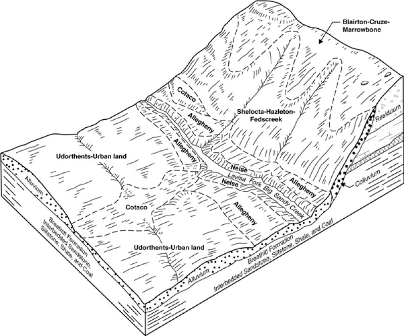
This site occurs on fans and low stream terraces as alluvium sourced from sandstone, siltstone and shale. This PES is largely used for crops, principally corn, burley tobacco, small grains, fruit, sorghum, and hay or pasture.
Reference conditions in this description are inferred due to the highly settled/disturbed nature of this PES. Examples of the reference state have not been discovered in literature searches and existing data resources. Further fieldwork will be required going forward to determine true reference conditions, if they exist on the landscape. From the information available, a naturalized forest is considered to be the reference state in lieu of data supporting true reference conditions. Where this exists, moisture tolerant mixed hardwoods dominate, with eastern hemlock and some pines occurring in small areas. Oaks are common in the overstory.
Associated sites
| F125XY001WV |
Sandstone Residuum |
|---|---|
| F125XY002WV |
Interbedded Sedimentary Colluvium |
| F125XY003WV |
Interbedded Sedimentary Uplands |
| F125XY004WV |
Floodplain Alluvium |
Similar sites
| F125XY004WV |
Floodplain Alluvium |
|---|
Table 1. Dominant plant species
| Tree |
(1) Quercus |
|---|---|
| Shrub |
Not specified |
| Herbaceous |
Not specified |
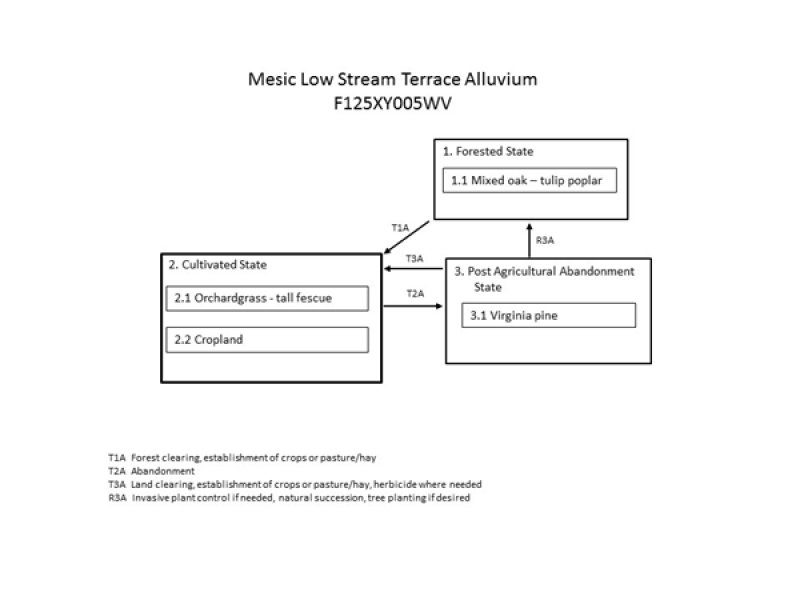
Click on box and path labels to scroll to the respective text.

