Major Land Resource Area 232X
Yukon Flats Lowlands
Accessed: 04/12/2026
Description
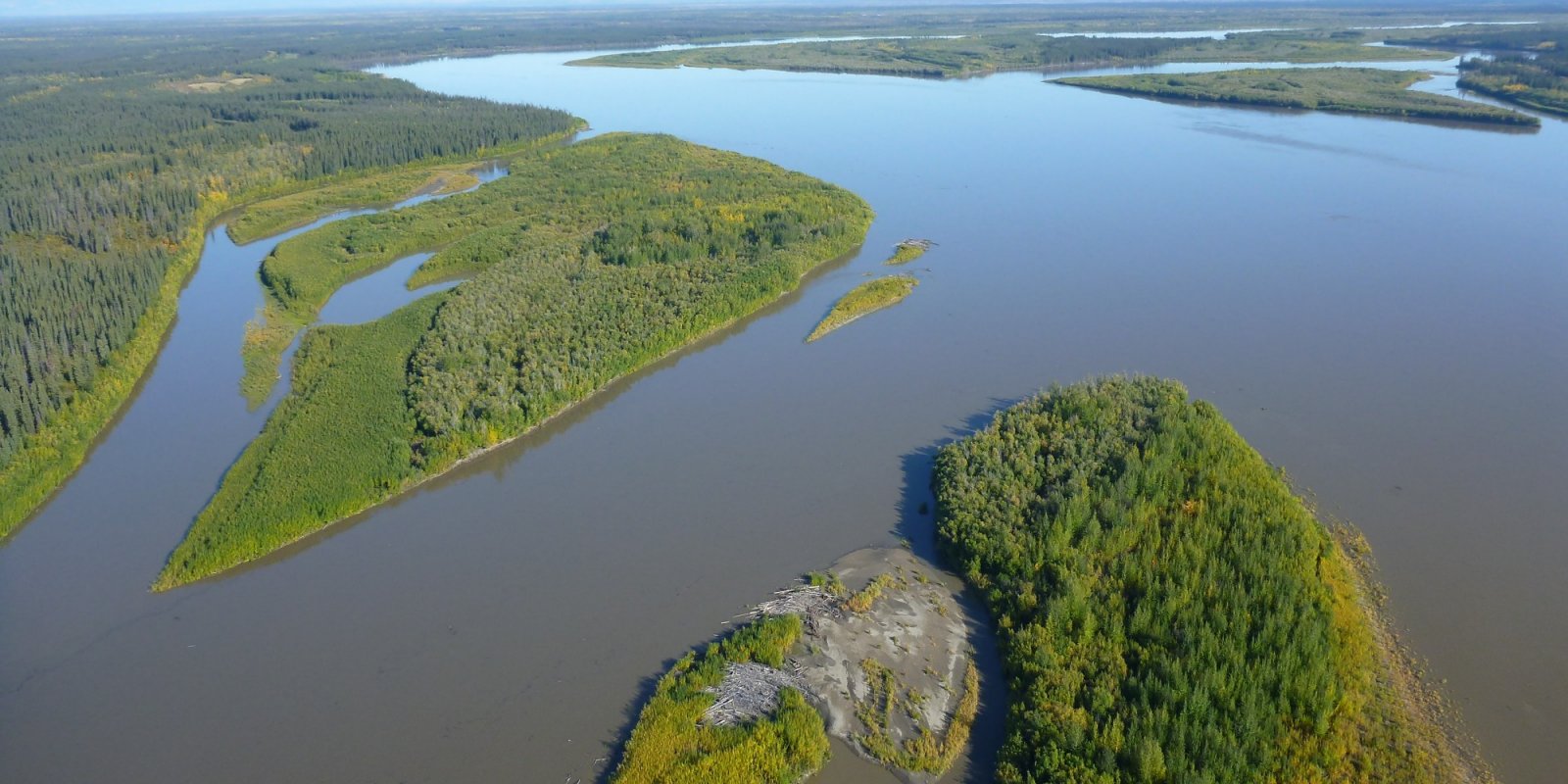
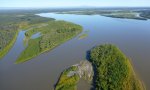
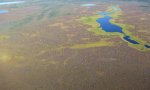
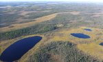
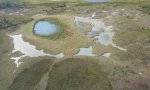
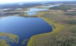
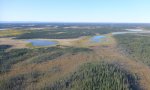
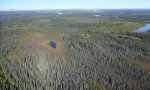
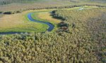
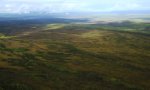
The Yukon Flats Lowlands MLRA is an expansive basin characterized by numerous levels of flood plains and terraces that are separated by minimal breaks in elevation. This MLRA is in Interior Alaska and is adjacent to the middle reaches of the Yukon River. Numerous tributaries of the Yukon River are within the Yukon Flats Lowlands MLRA. The largest are Beaver Creek, Birch Creek, Black River, Chandalar River, Christian River, Dall River, Hadweenzic River, Hodzana River, Porcupine River, and Sheenjek River. The MLRA has two distinct regions—lowlands and marginal uplands. The lowlands have minimal local relief and are approximately 9,000 square miles in size (Williams 1962). Landforms associated with the lowlands are flood plains and stream terraces. The marginal uplands consist of rolling and dissected plains that are a transitional area between the lowlands and adjacent mountain systems. The marginal uplands are approximately 4,700 square miles in size (Williams 1962). This MLRA is bounded by the Yukon-Tanana Plateau to the south, Hodzana Highlands to the west, Porcupine Plateau to the east, and southern foothills of the Brooks Range to the north (Williams 1962). These surrounding hills and mountains partially isolate the Yukon Flats Lowlands MLRA from weather systems affecting other MLRAs of Interior Alaska. As a result, temperatures are generally warmer in summer and colder in winter than is characteristic in other areas at comparable latitude. There is a moisture and temperature gradient in which the lowlands region tends to be drier and colder and the surrounding marginal uplands region tends to be moister and warmer (PRISM Climate Group 2006). The Yukon Flats Lowlands MLRA is mostly undeveloped lands that are sparsely populated and not accessible by a road system. A number of villages, including Beaver, Birch Creek, Chalkyitsik, Circle, Fort Yukon, Stevens Village, and Venetie, are adjacent to the Yukon River or one of its major tributaries. The largest village is Fort Yukon, which according to the 2010 U.S. Census has 583 residents that are dominantly Gwich’in Alaska Natives.
Key publications
Geographic subunits
Land Resource Unit 1. While Alaska has no officially recognized land resource units (USDA Agriculture Handbook 296), there appears to be two distinct regions in the Yukon Flats Lowlands MLRA. These distinct regions are thought to have differing climatic regimes, landforms, and soil types (STATSGO and Jorgensen and Meidinger 2015) and will be termed the lowlands LRU and the marginal uplands LRU. LRU 01 refers to the lowlands region.
Land Resource Unit 2. While Alaska has no officially recognized land resource units (USDA Agriculture Handbook 296), there appears to be two distinct regions in the Yukon Flats Lowlands MLRA. These distinct regions are thought to have differing climatic regimes, landforms, and soil types (STATSGO and Jorgensen and Meidinger 2015) and will be termed the lowlands LRU and the marginal uplands LRU. LRU 02 refers to the marginal uplands region.
Next steps
-
1
Select an ecological site
Select an ecological site using the list, keys, photos, briefcase, or quick search option located on this page. -
2
Explore the ecological site description
Next, learn more about the selected ecological site and its characteristic dynamics by browsing the ecological site description and exploring alternative state and transition model formats.
Ecological site list
-
i
Key Characteristics
- The soils have less than 40 cm of organic material.
- The site occurs on a flood plain.
- All other positions.
- Not as above (e.g. Yukon and Porcupine Rivers).
- The site experiences frequent flooding (floods greater then 50 times in 100 years). Low flood plain positions.
-
i
Key Characteristics
- The soils have 40+ cm of organic material.
- The organic material is highly acidic (i.e. ultra to strongly acidic, < 5.6 pH).
- The soils have 40+ cm of acidic organic matter.
-
i
Key Characteristics
- The soils have less than 40 cm of organic material.
- The site occurs on a flood plain.
- All other positions.
- Not as above (e.g. Yukon and Porcupine Rivers).
- Not as above. Occasional flooding (5-50 times in 100 years).
- Occasional flooding with long flood duration. Middle flood plain positions.
-
i
Key Characteristics
- The soils have less than 40 cm of organic material.
- The site occurs on a flood plain.
- All other positions.
- Not as above (e.g. Yukon and Porcupine Rivers).
- Not as above. Occasional flooding (5-50 times in 100 years).
- Occasional flooding, with brief flood duration. High flood plain positions.
-
i
Key Characteristics
- The soils have less than 40 cm of organic material.
- The site occurs on a flood plain.
- The site occurs in a closed flood plain depression.
- Frequent ponding with long ponding duration. Soils are considered poorly drained. Ponding generally occurs in early growing season.
-
i
Key Characteristics
- The soils have less than 40 cm of organic material.
- The site occurs on a flood plain.
- The site occurs in a closed flood plain depression.
- Depression edge. Less frequent and shorter ponding duration then above.
-
i
Key Characteristics
- The soils have 40+ cm of organic material.
- Not as above.
-
i
Key Characteristics
- The soils have less than 40 cm of organic material.
- The site occurs on a stream terrace.
- Not as above.
- Not as above.
- Not as above.
- wetter soils then above; soils prone to ponding; very shallow to shallow water table for much of the growing season.
- Not as above.
- Very poorly drained soils. Ponding frequent, with very long durations.
-
i
Key Characteristics
- The soils have less than 40 cm of organic material.
- The site occurs on a stream terrace.
- The site occurs in a depression.
- The site occurs in a swale or drainageway.
- The site occurs in a drainageway.
-
i
Key Characteristics
- The soils have less than 40 cm of organic material.
- The site occurs on a stream terrace.
- Not as above.
- Not as above.
- Not as above.
- wetter soils then above; soils prone to ponding; very shallow to shallow water table for much of the growing season.
- Not as above.
- Somewhat poorly to poorly drained soils. Less frequent ponding then above.
-
i
Key Characteristics
- The soils have less than 40 cm of organic material.
- The site occurs on a stream terrace.
- Not as above.
- Not as above.
- Not as above.
- well to somewhat poorly drained soils; no ponding; water table either not present or at moderate to deep depths for majority of growing season.
- somewhat poorly to moderately well drained soils. Seasonal water table generally occurs during the early growing season but drops out of the soil or occurs at moderate to deep depths for the majority of the growing season.
-
i
Key Characteristics
- The soils have less than 40 cm of organic material.
- The site occurs on a stream terrace.
- Not as above.
- Not as above.
- Not as above.
- well to somewhat poorly drained soils; no ponding; water table either not present or at moderate to deep depths for majority of growing season.
- Well-drained soils; no seasonal water table.
-
i
Key Characteristics
- The soils have less than 40 cm of organic material.
- The site occurs on a stream terrace.
- The site occurs in a depression.
- The site occurs in a closed depression.
- The site typically occurs in the depression center. The soils pond frequently for brief durations of time and often have sodic soil properties.
-
i
Key Characteristics
- The soils have less than 40 cm of organic material.
- The site occurs on a stream terrace.
- The site occurs in a depression.
- The site occurs in a closed depression.
- The site typically occurs on the edge of depressions. Ponding occurs occasionally for brief durations.
-
i
Key Characteristics
- The soils have less than 40 cm of organic material.
- The site occurs on a stream terrace.
- Not as above.
- The site occurs on a dune.
-
i
Key Characteristics
- The soils have less than 40 cm of organic material.
- The site occurs on a stream terrace.
- The site occurs in a depression.
- The site occurs in a swale or drainageway.
- The site occurs in a swale.
-
i
Key Characteristics
- The soils have less than 40 cm of organic material.
- The site occurs on a stream terrace.
- Not as above.
- Not as above.
- Sand and gravel occurs at very shallow depth (0-25 cm) in the soil profile and soils are considered somewhat excessively drained.
-
i
Key Characteristics
- The soils have less than 40 cm of organic material.
- The site occurs on a stream terrace.
- Not as above.
- Not as above.
- Not as above.
- wetter soils then above; soils prone to ponding; very shallow to shallow water table for much of the growing season.
- The soils have sandy-gravelly material at very shallow to shallow depths (0-50 cm)?
-
i
Key Characteristics
- The soils have less than 40 cm of organic material.
- The site occurs on a flood plain.
- All other positions.
- Low gradient and low volume, small order streams. Deep loamy soils (e.g. The Forks).
-
i
Key Characteristics
- Not as above.
- The site occurs in a drainageway.
- Not as above.
-
i
Key Characteristics
- Not as above.
- Not as above.
- Not as above.
- The site occurs on warm slope positions (e.g. south and west facing slopes) and has dry soils. Soils are typically considered moderately well to well drained.
- Not as above.
-
i
Key Characteristics
- Not as above.
- Not as above.
- The site occurs on very steep and highly erosive slopes (e.g. escarpment).
-
i
Key Characteristics
- Not as above.
- Not as above.
- Not as above.
- The site has colder and wetter soils than above.
- Site occurs on slope positions where water accumulates (e.g. toeslopes, footslopes, and swales). Soils are prone to ponding and have a water table in the soil profile for long durations of the growing season. Soils are typically considered very poorly to poorly drained.
- Not as above.
-
i
Key Characteristics
- Not as above.
- Not as above.
- Not as above.
- The site has colder and wetter soils than above.
- The site occurs on slopes less prone to ponding than above (e.g. hill backslopes) and has a water table in the soil profile for shorter durations of the growing season than above. Soils are typically considered poorly to somewhat poorly drained.
- Not as above.


Ecological site map
Basemap
Find me
Find point
Full screen
Zoom in to display soil survey map units for an area of interest, and zoom out to display MLRAs. Select a map unit polygon to view ecological sites correlated to that map unit. View a brief description of an ecological site by clicking on its name in the map popup. Soil survey correlations may not be accurate, and ecological site classification of a location should always be verified in the field. Each selection may require the transfer of several hundred KB of data.
Ecological site keys
Ecological site photos
Print Options
Sections
Font
Other
Briefcase
Add ecological sites and Major Land Resource Areas to your briefcase by clicking on the briefcase (![]() ) icon wherever it occurs. Drag and drop items to reorder. Cookies are used to store briefcase items between browsing sessions. Because of this, the number of items that can be added to your briefcase is limited, and briefcase items added on one device and browser cannot be accessed from another device or browser. Users who do not wish to place cookies on their devices should not use the briefcase tool. Briefcase cookies serve no other purpose than described here and are deleted whenever browsing history is cleared.
) icon wherever it occurs. Drag and drop items to reorder. Cookies are used to store briefcase items between browsing sessions. Because of this, the number of items that can be added to your briefcase is limited, and briefcase items added on one device and browser cannot be accessed from another device or browser. Users who do not wish to place cookies on their devices should not use the briefcase tool. Briefcase cookies serve no other purpose than described here and are deleted whenever browsing history is cleared.
Ecological sites
Major Land Resource Areas
The Ecosystem Dynamics Interpretive Tool is an information system framework developed by the USDA-ARS Jornada Experimental Range, USDA Natural Resources Conservation Service, and New Mexico State University.