Ecological site group R014XG910CA
Dry Clayey Terrace
Last updated: 09/07/2023
Accessed: 02/21/2026
Ecological site group description
Key Characteristics
None specified
Provisional. A provisional ecological site description has undergone quality control and quality assurance review. It contains a working state and transition model and enough information to identify the ecological site.
Physiography
This ESG is very similar to Dry Clayey Basins and is associated with nearly level flood basins in intermountain valleys and large valleys, basins, flat terraces, and flood plains where water and smectitic clay sediments are deposited with slopes ranging from 0 to 2 percent at elevations from 10 to 1800 feet.
Climate
The climate is dry subhumid mesothermal with hot dry summers and cool moist winters. Mean annual precipitation ranges from 10 to 16 inches.
Soil features
The soils of this ESG include both very deep, poorly to very poorly drained sodic soils formed in alluvium from mixed rock sources and very deep, moderately well and well drained soils that formed in alluvium from mixed rock sources.
Representative soils include:
Cropley silty clay loams
Willows drained clays
Vegetation dynamics
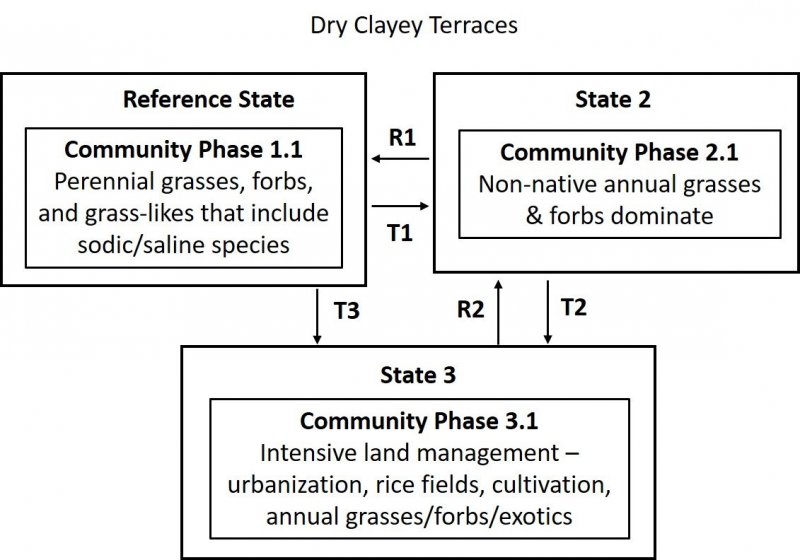
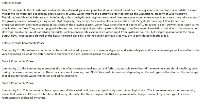
This ESG covers the areas of the valleys in MLRA 14 that were at one time part of a vast complex of marshes, tidal flats, estuaries, wetlands and wet meadows. The urbanized landscape in the valleys within this MLRA that exists today makes it difficult to imagine the natural landscape prior to human development.
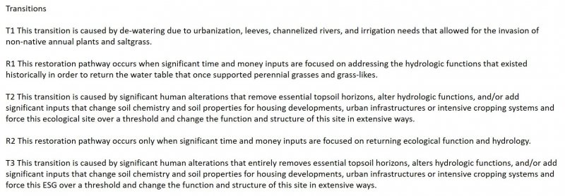
These clayey terracess were likely interrelated to the fine-textured depressional and deposition areas and isolated oxbows that were created from the network of freshwater and salt marshes, rivers and streams that ran through these valleys as their seasonal and tidally influenced flood waters stretched across the floodplains and terraces in spring and deposited sediment as they receded during summer. Once the area began to be settled, many of these water dominated ecosystems were drained, leveed, cleared for crops and other agriculture, and urbanized.
As this landscape was de-watered and houses and agriculture took over, the water table for many of these habitats moved deeper and deeper, creating soils that would no longer offer the available soil moisture for many of the plants that had evolved with the hydrologic function of the natural system that no longer existed. These clayey basins may have remained wetter than many of the surrounding soils, due to their high water-holding capacity and their valley bottom and terrace locations on the landscape. The clays of this ESG are high shrink-swell clays that dry out in the summer when the water table recedes and develop cracks and low soil pores spaces making them less hospitable for many of the native perennial grasses that existed within the drier surrounding grasslands.
Historically, this site may have looked similar to the CWHR wet meadow classification, however with the introduction of non-native annual grasses and the impacts from fragmentation, continued de-watering, and human alterations such as homes and roads, this site now reflects a lower producing, dry, annual grassland.
Major Land Resource Area
MLRA 014X
Central California Coastal Valleys
Stage
Provisional
Click on box and path labels to scroll to the respective text.


