
Natural Resources
Conservation Service
Ecological site R024XY067NV
SHALLOW SILTY 5-8 P.Z.
Last updated: 3/06/2025
Accessed: 03/15/2025
General information
Provisional. A provisional ecological site description has undergone quality control and quality assurance review. It contains a working state and transition model and enough information to identify the ecological site.
MLRA notes
Major Land Resource Area (MLRA): 024X–Humboldt Basin and Range Area
Major land resource area (MLRA) 24, the Humboldt Area, covers an area of approximately 8,115,200 acres (12,680 sq. mi.). It is found in the Great Basin Section of the Basin and Range Province of the Intermontane Plateaus. Elevations range from 3,950 to 5,900 feet (1,205 to 1,800 meters) in most of the area, some mountain peaks are more than 8,850 feet (2,700 meters).
A series of widely spaced north-south trending mountain ranges are separated by broad valleys filled with alluvium washed in from adjacent mountain ranges. Most valleys are drained by tributaries to the Humboldt River. However, playas occur in lower elevation valleys with closed drainage systems. Isolated ranges are dissected, uplifted fault-block mountains. Geology is comprised of Mesozoic and Paleozoic volcanic rock and marine and continental sediments. Occasional young andesite and basalt flows (6 to 17 million years old) occur at the margins of the mountains. Dominant soil orders include Aridisols, Entisols, Inceptisols and Mollisols. Soils of the area are generally characterized by a mesic soil temperature regime, an aridic soil moisture regime and mixed geology. They are generally well drained, loamy and very deep.
Approximately 75 percent of MLRA 24 is federally owned, the remainder is primarily used for farming, ranching and mining. Irrigated land makes up about 3 percent of the area; the majority of irrigation water is from surface water sources, such as the Humboldt River and Rye Patch Reservoir. Annual precipitation ranges from 6 to 12 inches (15 to 30 cm) for most of the area, but can be as much as 40 inches (101 cm) in the mountain ranges. The majority of annual precipitation occurs as snow in the winter. Rainfall occurs as high-intensity, convective thunderstorms in the spring and fall.
Nevada lies on the eastern, lee side of the Sierra Nevada Range, a massive mountain barrier that markedly influences the climate of the State. The prevailing winds are from the west, and as the warm moist air from the Pacific Ocean ascends the western slopes of the Sierra Range, the air cools, condensation takes place and most of the moisture falls as precipitation. As the air descends the eastern slope, it is warmed by compression, and very little precipitation occurs. The effects of this mountain barrier are felt not only in the west but throughout the State, with the result that the lowlands of Nevada are largely desert or steppes.
Ecological site concept
This site is on lake plains. Soils are very deep, well drained and formed in alluvium. The soil profile is characterized by an ochric epipedon, continuous weak cementation with in 20 inches (51cm), and coarse silty particle size control section.
This site will be field checked for possible correlation to 024XY003NV.
Associated sites
| R024XY008NV |
SODIC FLAT 8-10 P.Z. This site presents crusting & baking of the surface layer upon drying, inhibiting water infiltration and seedling emergence. High salt concentrations reduce seed viability, germination and the available water capacity of these soils. Black greasewood (SAVE4) dominant shrub; Shadscale (ATCO) minor shrub; Basin wildrye (LECI4) dominant grass. |
|---|---|
| R024XY011NV |
SODIC FLAT 6-8 P.Z. The soil profile is characterized by an ochric epipedon, a pH greater than 8.0 throughout, sodicity (SAR) greater than 30 and a water table between 35 to 59 inches (90 to 150cm) at some point during the spring. Dominant plant species are Black greasewood (SAVE4), Basin wildrye (LECI4), and saltgrass (DISP). |
| R024XY003NV |
SODIC TERRACE 6-8 P.Z. This ecological site is on lake plains and basin floor remnants. Soil are very deep, well drained and formed in a thin layer of loess and alluvium derived from mixed parent material influenced by volcanic ash over lacustrine sediments. Soils are characterized by a very low infiltration. The reference state is characterized by the mixing of shadscale (ATCO) and black greasewood (SAVE4) and approximate canopy cover is less than 15 percent. |
Similar sites
| R024XY025NV |
LOAMY SLOPE 5-8 P.Z. Indian ricegrass (ACHY) is a minor component; Bud sagebrush (ARSP5) is a major shrub. |
|---|---|
| R024XY060NV |
SHALLOW SILTY 8-10 P.Z. Wyoming sagebrush (ARTRW8) codominant shrub; more productive site. |
Table 1. Dominant plant species
| Tree |
Not specified |
|---|---|
| Shrub |
(1) Atriplex confertifolia |
| Herbaceous |
(1) Elymus elymoides |
Physiographic features
This site is on alluvial flats, lake terraces, basin-floor remnants, fan skirts and lake plains. The site is commonly associated with playas and is dissected by shallow intermittent drainageways. Slope gradients of 0 to 2 percent are typical. Elevations are 4000 to 4600 feet (1219 to 1402 m).
Table 2. Representative physiographic features
| Landforms |
(1)
Lake terrace
(2) Basin-floor remnant (3) Lake plain |
|---|---|
| Runoff class | Low to medium |
| Flooding frequency | None |
| Ponding frequency | None |
| Elevation | 1,219 – 1,402 m |
| Slope | 0 – 2% |
| Water table depth | 183 cm |
| Aspect | Aspect is not a significant factor |
Climatic features
The climate associated with this site is semiarid and characterized by cool, moist winters and warm, dry summers. Average annual precipitation is 4 to 8 inches (10 to 15cm). Mean annual air temperature is 52 to 56 degrees F. The average growing season is about 100 to 130 days.
Table 3. Representative climatic features
| Frost-free period (average) | 130 days |
|---|---|
| Freeze-free period (average) | |
| Precipitation total (average) | 203 mm |
Figure 1. Monthly average minimum and maximum temperature
Influencing water features
There are no influencing water features associated with this site.
Soil features
The soils associated with this site are very deep, well drained and formed in alluvium from mixed parent material and lacustrine deposits. The soil profile is characterized by an ochric epipedon, continuous weak cementation with in 20 inches (51cm), and coarse silty particle size control section.
The silty surface texture results in plating or surface crusting that decreases infiltration of water and restricts seed germination and establishment. Available water capacity is moderate. The potential for sheet and rill erosion is slight. The soil series associated with this site include: Cresal and Mazuma.
Table 4. Representative soil features
| Parent material |
(1)
Alluvium
(2) Lacustrine deposits |
|---|---|
| Surface texture |
(1) Silt loam |
| Family particle size |
(1) Loamy |
| Drainage class | Well drained |
| Permeability class | Moderately slow |
| Soil depth | 183 – 213 cm |
| Surface fragment cover <=3" | 0 – 2% |
| Surface fragment cover >3" | 0% |
| Available water capacity (0-101.6cm) |
12.95 – 18.8 cm |
| Calcium carbonate equivalent (0-101.6cm) |
1 – 20% |
| Electrical conductivity (0-101.6cm) |
0 – 32 mmhos/cm |
| Sodium adsorption ratio (0-101.6cm) |
1 – 99 |
| Soil reaction (1:1 water) (0-101.6cm) |
7.9 – 9.6 |
| Subsurface fragment volume <=3" (Depth not specified) |
2 – 7% |
| Subsurface fragment volume >3" (Depth not specified) |
0% |
Ecological dynamics
An ecological site is the product of all the environmental factors responsible for its development and it has a set of key characteristics that influence a site’s resilience to disturbance and resistance to invasives. Key characteristics include 1) climate (precipitation, temperature), 2) topography (aspect, slope, elevation, and landform), 3) hydrology (infiltration, runoff), 4) soils (depth, texture, structure, organic matter), 5) plant communities (functional groups, productivity), and 6) natural disturbance regime (fire, herbivory, etc.) (Caudle 2013). Biotic factors that influence resilience include site productivity, species composition and structure, and population regulation and regeneration (Chambers et al. 2013).
Shadscale is a densely clumped, rounded, compact native shrub. It generally attains heights of 8 to 32 inches and widths of 12 to 68 inches (Blaisdell and Holmgren 1984). Shadscale is considered an evergreen to partially deciduous shrub, since a small percentage of leaves are dropped in the winter (Smith and Nobel 1986). Shadscale possesses wider ecological amplitude than most Atriplex species (Crofts and Van Epps 1975), and shows ploidy levels from diploid (2x) to decaploid (10x). The extensive polyploidy of shadscale is an important consideration when implementing revegetation projects because ploidy levels are usually associated with distinct habitats (Sanderson et al. 1990). Diploid individuals are unlikely to perform as well in areas where tetraploids are more common. Diploid individuals generally occur above Pleistocene lake levels, whereas lake floors are usually occupied by autotetraploids. Overall, tetraploids are the most widespread throughout its range (Carlson 1984). Thus, the shadscale most associated with this site is a tetraploid. Bud sagebrush, a common shrub to this ecological site, is a native, summer-deciduous shrub. It is low growing, spinescent, aromatic shrub with a height of 4 to 10 inches and a spread of 8 to 12 inches (Chambers and Norton 1993). Indian ricegrass, the dominant grass within this site, is a hardy, cool-season, densely tufted, native perennial bunchgrass that grows from 4 to 24 inches in height (Blaisdell and Holmgren 1984). Squirreltail, another native, cool-season perennial bunchgrass, is often a co-dominant with Indian ricegrass.
Shadscale has experienced widespread mortality during periods of above average precipitation (Nelson et al. 1990a). The roots of desert shrubs are sensitive to the level of soil oxygen, waterlogging reduces soil oxygen. Waterlogging causes physiological changes in plants increasing susceptibly to parasite and disease where prolonged period of high soil moisture occur (Nelson et al. 1990a). Periods of elevated precipitation result in increased soil moisture and salinity, which predisposes the roots of the shrubs to pathogenic root rot organisms (Weber et al. 1990). Shadscale occurs in widespread genetically uniform populations on the edaphically consistent soil of the Pleistocene lake bottoms, setting the stage for extensive areas of plant death (Nelson et al. 1990a). Valley bottoms and upland depressions typically exhibit the greatest concentration of die back, due to ponding and run-in moisture. Shadscale is also susceptible to insect attack. Scale insects and mealy bugs have been found in the crown and upper root zone of shadscale plants during periods of dieoff (Nelson et al. 1990b).
Historically, shadscale dominant salt-desert shrub communities were free of exotic invaders; however, excessive grazing pressure during settlement and into the 20th century has increased the overall presence of cheatgrass, halogeton, Russian thistle and weedy mustard species (Peters and Bunting 1994). The lack of continuous fuels to carry fires made fire rare to non-existent in shadscale communities (Young and Tipton 1990), thus it is not surprising that shadscale and bud sagebrush are both fire intolerant (Banner 1992, West 1994). Shadscale does not readily recover from fire, except for establishment through seed (West 1994). The slow reestablishment allows for easy invasion by cheatgrass and other non-native weedy species (Sanderson et al. 1990). The increased presence of exotic annual grasses has greatly altered fire regimes in areas of the Intermountain West where shadscale is a major vegetational component. Exotic annuals increase fire frequency under wet to near-normal summer moisture conditions and repeated, frequent fire has converted large expanses of shadscale rangeland to annual non-native plant communities (Knapp 1998). Grazing exclusion for 2 or more years is beneficial for revegetation of postfire shadscale communities as first year shadscale seedlings lack spines and are highly susceptible to browsing. Spines develop in the second year (Zielinski 1994).
Fire Ecology:
Shadscale does not readily recover from fire, except for establishment through seed (West 1994). The slow reestablishment allows for easy invasion by cheatgrass and other non-native weedy species (Sanderson et al. 1990). The increased presence of exotic annual grasses has greatly altered fire regimes in areas of the Intermountain West where shadscale is a major vegetation component. Exotic annuals increase fire frequency under wet to near-normal summer moisture conditions and repeated, frequent fire has converted large expanses of shadscale rangeland to annual non-native plant communities (Knapp 1998).
The effect of fire on bunchgrasses relates to culm density, culm-leaf morphology, and the size of the plant. The initial condition of bunchgrasses within the site along with seasonality and intensity of the fire all factor into the individual species response. For most forbs and grasses the growing points are located at or below the soil surface providing relative protection from disturbances which decrease above ground biomass, such as grazing or fire. Thus, fire mortality is more correlated to duration and intensity of heat which is related to culm density, culm-leaf morphology, size of plant and abundance of old growth (Wright 1971, Young 1983). However, season and severity of the fire and post-fire soil moisture availability will influence plant response.
Indian ricegrass is a deep-rooted, cool season perennial bunchgrass that is adapted primarily to sandy soils. A prominent grass on this site, it is fairly fire tolerant (Wright 1985), which is likely due to its low culm density and below ground plant crowns. Vallentine (1989) cites several studies in the sagebrush zone that classified Indian ricegrass as being slightly damaged from late summer burning. Indian ricegrass has also been found to reestablish on burned sites through seed dispersed from adjacent unburned areas (Young 1983, West 1994). Thus the presence of surviving, seed producing plants facilitates the reestablishment of Indian ricegrass. Grazing management following fire to promote seed production and establishment of seedlings is important.
Bottlebrush squirreltail is considered more fire tolerant than Indian ricegrass due to its small size, coarse stems, and sparse leafy material (Britton et al. 1990). Postfire regeneration occurs from surviving root crowns and from on- and off-site seed sources. Bottlebrush squirreltail has the ability to produce large numbers of highly germinable seeds, with relatively rapid germination (Young and Evans 1977) when exposed to the correct environmental cues. Early spring growth and ability to grow at low temperatures contribute to the persistence of bottlebrush squirreltail among cheatgrass dominated ranges (Hironaka and Tisdale 1972).
Rehabilitation following fire will have limited success. Observations from one hundred and seven separate plantings within the shadscale zone in Utah and Nevada indicate a very low success rate (Bleak et al. 1965). Seed from 148 native and non-native grasses, forbs and shrubs were planted from 1937 to 1962 across ten locations. Good seedling stands were obtained with introduced wheatgrasses, but most perished during the first summer. A few plantings of crested wheatgrass (Agropyron cristatum), fairway and Siberian wheatgrass (Agropyron fragile) along with Russian wildrye (Psathyrostachys juncea) maintained stands for 10 or more years but eventually declined to very few plants (Bleak et al. 1965). The primary cause of seeding failures appeared to be the arid climate.
State and transition model
More interactive model formats are also available.
View Interactive Models
More interactive model formats are also available.
View Interactive Models
Click on state and transition labels to scroll to the respective text
State 1 submodel, plant communities
State 2 submodel, plant communities
State 3 submodel, plant communities
State 4 submodel, plant communities
State 5 submodel, plant communities
State 6 submodel, plant communities
State 1
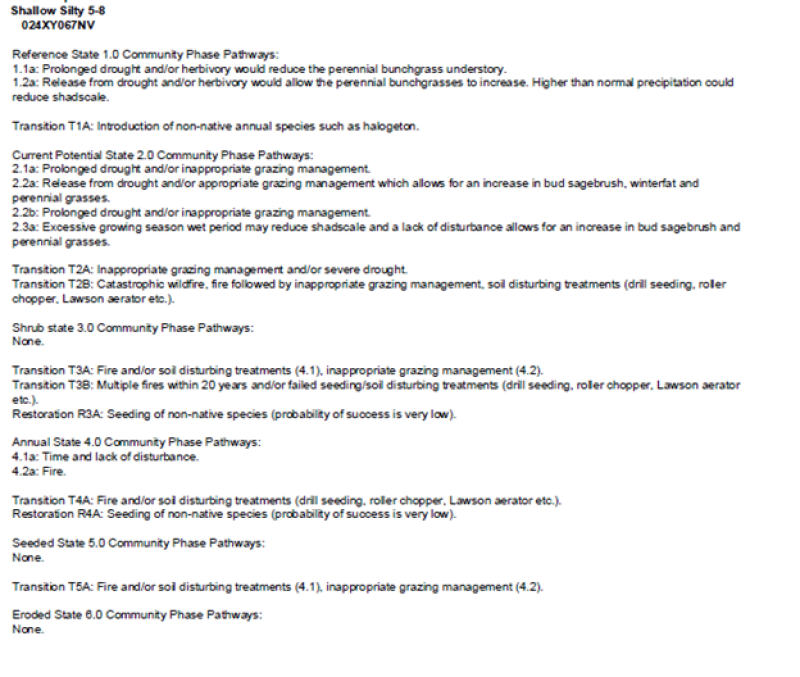
Reference State
The Reference State 1.0 is a representative of the natural range of variability under pristine conditions. The Reference State has two general community phases: a shrub-grass dominant phase and a shrub dominant phase. State dynamics are maintained by interactions between climatic patterns and disturbance regimes. Negative feedbacks enhance ecosystem resilience and contribute to the stability of the state. These include the presence of all structural and functional groups, low fine fuel loads, and retention of organic matter and nutrients. This site is very stable, with little variation in plant community composition. Plant community changes would be reflected in production response to long term drought or herbivory. Wet years will increase grass production, while drought years will reduce production. Shrub production will also increase during wet years; however, extreme growing season wet periods has been shown to cause shadscale death.
Community 1.1
Reference Plant Community 1.1
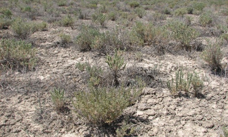
This community is dominated by shadscale, bud sagebrush, and Indian ricegrass. Bottlebrush squirreltail, spiny hopsage, and winterfat are important, but minor components within this community. Community phase changes are primarily a function of chronic drought. Drought will favor shrubs over perennial bunchgrasses. However, long-term drought will result in an overall decline in plant community production, regardless of functional group. Extreme growing season wet periods may also reduce the shadscale component. Fire is very infrequent to non-existent.
Figure 2. Annual production by plant type (representative values) or group (midpoint values)
Table 5. Annual production by plant type
| Plant type | Low (kg/hectare) |
Representative value (kg/hectare) |
High (kg/hectare) |
|---|---|---|---|
| Shrub/Vine | 71 | 191 | 286 |
| Grass/Grasslike | 9 | 22 | 34 |
| Forb | 4 | 11 | 17 |
| Total | 84 | 224 | 337 |
Community 1.2
Community Phase 1.2
Shadscale dominates overstory. Bud sagebrush may be co-dominate. Perennial bunchgrasses decrease with drought and are a minor component. If present, Sandberg bluegrass dominates understory.
Pathway 1.1a
Community 1.1 to 1.2
Long-term drought, extreme wet periods and/or herbivory. Drought will favor shrubs over perennial bunchgrasses. Extreme wet periods will reduce the shadscale component.
Pathway 1.2a
Community 1.2 to 1.1
Release from drought and/or herbivory would allow the vegetation to increase and bare ground would eventually decrease. Extreme growing season wet period may reduce shadscale.
State 2
Current Potential State
This state is similar to the Reference State 1.0 with the addition of a shadscale and sprouting shrub dominated community phase. Ecological function has not changed, however the resiliency of the state has been reduced by the presence of invasive weeds. Non-natives may increase in abundance but will not become dominant within this State. These non-natives can be highly flammable and can promote fire where historically fire had been infrequent. Negative feedbacks enhance ecosystem resilience and contribute to the stability of the state. These feedbacks include the presence of all structural and functional groups, low fine fuel loads, and retention of organic matter and nutrients. Positive feedbacks decrease ecosystem resilience and stability of the state. These include the non-natives’ high seed output, persistent seed bank, rapid growth rate, ability to cross pollinate, and adaptations for seed dispersal.
Community 2.1
Community Phase 2.1
This community is compositionally similar to the reference plant community with a trace of annual non-natives, primarily cheatgrass, halogeton and tansy mustard. Non-native species may also include seeded perennials and parasitic plants like dodder. Ecological resilience is reduced by the presence of non-native species. Community phase changes are primarily a function of chronic drought or extreme wet periods. Fire is infrequent and patchy due to low fuel loads.
Community 2.2
Community Phase 2.2
Shadscale dominates overstory while rabbitbrush may become sub-dominate. Bud sagebrush may become minor component if spring grazed. Sandberg bluegrass may dominate the understory whereas Indian ricegrass becomes a minor component. Bare ground interspaces increase in size and connectivity. Annual non-native weeds such as bur buttercup and halogeton increase. Prolonged drought may lead to an overall decline in the plant community. Wet periods may decrease the shadscale component, if present.
Community 2.3
Community Phase 2.3 (At Risk)
Shadscale and rabbitbrush dominates the overstory and perennial bunchgrasses and bud sagebrush are reduced, either from competition with shrubs, inappropriate grazing, chronic drought or a combination. Annual non-native species may be stable or increasing due to a lack of competition with perennial bunchgrasses. Bare ground may be significant. This community is at risk of crossing a threshold to either State 3.0 (shrub) or State 4.0 (annual).
Pathway 2.1a
Community 2.1 to 2.2
Inappropriate growing season grazing favors unpalatable shrubs over bunchgrasses, winterfat and bud sagebrush. Long term drought will also decrease the perennial bunchgrasses in the understory.
Pathway 2.2a
Community 2.2 to 2.1
Release from drought and/or grazing management that facilitates an increase in perennial grasses and bud sagebrush. Extreme growing season wet period may reduce shadscale.
Pathway 2.2b
Community 2.2 to 2.3
Long term drought and/or inappropriate grazing management will significantly reduce perennial grasses and bud sagebrush in favor of shadscale and rabbitbrush.
Pathway 2.3a
Community 2.3 to 2.2
Release from drought and/or inappropriate grazing allows for bud sagebrush and perennial grasses to increase. Extreme growing season wet period may reduce shadscale.
State 3
Shrub State
This state has one community phase that is characterized by shadscale, bud sagebrush or a sprouting shrub overstory with very little to no understory. The site has crossed a biotic threshold and site processes are being controlled by shrubs. Shrub cover exceeds the site concept and may be decadent, reflecting stand maturity and lack of seedling establishment due to competition with mature plants. The shrub overstory dominates site resources such that soil water, nutrient capture, nutrient cycling and soil organic matter are temporally and spatially redistributed. Bare ground has increased.
Community 3.1
Community Phase 3.1
Decadent shadscale and bud sagebrush dominate the overstory. Rabbitbrush and/or other sprouting shrubs may be a significant component or dominant shrub. Deep-rooted perennial bunchgrasses may be present in trace amounts or absent from the community. Annual non-native species increase. Bare ground is significant.
State 4
Annual State
This state consists of two community phases; an annual species dominant state and a shadscale/rabbitbrush dominant state with an annual understory. In this state, a biotic threshold has been crossed and state dynamics are driven by the dominance and persistence of the annual plant community which is perpetuated by a shortened fire return interval. The herbaceous understory is dominated by annual non-native species such as cheatgrass and halogeton. Bare ground may be abundant. Resiliency has declined and further degradation from fire facilitates a cheatgrass and sprouting shrub plant community. The fire return interval has shortened due to the dominance of cheatgrass in the understory and is a driver in site dynamics.
Community 4.1
Community Phase 4.1
This plant community phase is dominated by non-native annual species. Desert pavement and salt affected areas are present on some soils. This plant community is at-risk of increased erosion and soil loss or redistribution and reoccurring fire driven by fine fuels. Prescribed grazing may be used to reduce fuel loading and the cheatgrass seedbank. However, caution should be exercised; inappropriate grazing management resulting in the complete defoliation of the site will lead to a more degraded state, resulting in and Eroded state 5.0.
Community 4.2
Community Phase 4.2
This community is dominated by shadscale and/or rabbitbrush with annual non-native species dominating the understory. Forage kochia and other seeded species may be present in the community. This site is at risk of increased erosion and soil loss and an increase risk of fire due to the fine fuel loads.
Pathway 4.1a
Community 4.1 to 4.2
Seeding of shrub species may result in an increase in shadscale, forage kochia and other species on this site (probability of success is very low).
Pathway 4.2a
Community 4.2 to 4.1
Fire
State 5
Seeded State
This state has one community phase which is characterized by a dominance of seeded species most commonly forage kochia. Other seeded species such as crested wheatgrass and Russian wildrye may be present on the site. Annual non-native species are present to increasing.
Community 5.1
Community Phase 5.1
This phase is dominated by seeded species such as forage kochia. Other seeded species may be present. Native species such as shadscale and squirreltail may be present. Annual non-native species are present and may be increasing.
State 6
Eroded State
This state consists of one community phase. This state is characterized by the loss of vegetative cover, redistribution and loss of the soil surface, as well as, increasing cover of desert pavement. Feedbacks contributing to the stability of this state include soil loss, nutrient loss, soil surface degradation and increased area, distribution and connectivity between patches of bare soil. This state has only one community phase, described below.
Community 6.1
Community Phase 6.1
This community is the result of extreme soil loss and redistribution. The vegetative cover is minimal, but is dominated by introduced non-native grasses and/or forbs. Desert pavement is extensive. Site function is controlled by soil erosion, wind and soil temperature. Rehabilitation of this community is unknown.
Transition T1A
State 1 to 2
Trigger: This transition is caused by the introduction of non-native annual plants, such as halogeton, mustards and cheatgrass. Slow variables: Over time the annual non-native species will increase within the community. Threshold: Any amount of introduced non-native species causes an immediate decrease in the resilience of the site. Annual non-native species cannot be easily removed from the system and have the potential to significantly alter disturbance regimes from their historic range of variation.
Transition T2A
State 2 to 3
Trigger: Inappropriate grazing management and/or prolonged drought will decrease or eliminate deep rooted perennial bunchgrasses and favor shrub growth and establishment. Slow variables: Long term decrease in grass density and reduced native species (shrub and grass) recruitment rates. Increased reproduction of non-native invasive species. Threshold: Loss of deep-rooted perennial bunchgrasses changes nutrient cycling, nutrient redistribution, and reduces soil organic matter.
Transition T2B
State 2 to 4
Trigger: Fire and/or soil disturbing treatments such as drill seeding and plowing. An unusually wet spring may facilitate the increased germination and production of cheatgrass leading to its dominance within the community. Slow variables: Increased production and cover of non-native annual species. Threshold: Loss of deep-rooted perennial bunchgrasses and shrubs truncates, spatially and temporally, nutrient capture and cycling within the community. Increased, continuous fine fuels from annual non-native plants modify the fire regime by changing intensity, size and spatial variability of fires.
Transition T3A
State 3 to 4
Trigger: Fire and/or soil disturbing treatments such as drill seeding and plowing. Slow variables: Increased production and cover of non-native annual species. Threshold: Increased, continuous fine fuels modify the fire regime by changing intensity, size and spatial variability of fires. Changes in plant community composition and spatial variability of vegetation due to the loss of perennial bunchgrasses and sagebrush truncate energy capture spatially and temporally thus impacting nutrient cycling and distribution.
Restoration pathway R3A
State 3 to 5
Shrub management and seeding of desired species with minimal soil disturbance. This pathway has a low probability of success due to the arid climate of these sites (see Ecological Dynamics and Disturbance Response, Fire Ecology).
Transition T3B
State 3 to 6
Trigger: Multiple fires and/or failed seeding and other soil disturbing treatments such as drill seeding, roller chopper, Lawson aerator etc. Slow variables: Increased, continuous fine fuels modify the fire regime by changing intensity, size and spatial variability of fires. Threshold: Increased wind erosion resulting in soil loss preventing the establishment of native perennials. Increased, continuous fine fuels modify the fire regime by changing intensity, size and spatial variability of fires. Changes in plant community composition and spatial variability of vegetation due to the loss of perennial bunchgrasses and sagebrush truncate energy capture spatially and temporally thus impacting nutrient cycling and distribution.
Restoration pathway R4A
State 4 to 5
Seeding of perennial species. This pathway has a low probability of success due to the arid climate of these sites (see Ecological Dynamics and Disturbance Response, Fire Ecology).
Transition T4A
State 4 to 6
Trigger: Severe drought, multiple fires (typically occurring within 15 years) or inadequate rest and recovery from defoliation, coupled with soil loss and redistribution caused by an intense rain or wind event. Slow variables: Long term decrease in grass density and reduced native species (shrub and grass) recruitment rates. Long term soil movement and soil loss. Threshold: Increased overland flow and reduced soil moisture due to extensive bare ground.
Transition T5A
State 5 to 4
Trigger: Catastrophic fire Slow variable: Increased production and cover of non-native annual species. Threshold: Cheatgrass or other non-native annuals dominate the understory.
Transition T5B
State 5 to 6
Missing in narrative
Additional community tables
Table 6. Community 1.1 plant community composition
| Group | Common name | Symbol | Scientific name | Annual production (kg/hectare) | Foliar cover (%) | |
|---|---|---|---|---|---|---|
|
Grass/Grasslike
|
||||||
| 1 | Primary Perennial Grasses | 4–22 | ||||
| squirreltail | ELEL5 | Elymus elymoides | 4–22 | – | ||
| 2 | Secondary Perennial Grasses | 4–11 | ||||
| Indian ricegrass | ACHY | Achnatherum hymenoides | 1–7 | – | ||
| saltgrass | DISP | Distichlis spicata | 1–7 | – | ||
| basin wildrye | LECI4 | Leymus cinereus | 1–7 | – | ||
| Sandberg bluegrass | POSE | Poa secunda | 1–7 | – | ||
|
Forb
|
||||||
| 3 | Perennial Forbs | 4–18 | ||||
|
Shrub/Vine
|
||||||
| 4 | Primary Shrubs | 168–191 | ||||
| shadscale saltbush | ATCO | Atriplex confertifolia | 168–191 | – | ||
| 5 | Secondary Shrubs | 4–22 | ||||
| spiny hopsage | GRSP | Grayia spinosa | 2–4 | – | ||
| greasewood | SAVE4 | Sarcobatus vermiculatus | 2–4 | – | ||
| seepweed | SUAED | Suaeda | 2–4 | – | ||
| horsebrush | TETRA3 | Tetradymia | 2–4 | – | ||
Interpretations
Animal community
Livestock Interpretations:
This site has limited value for livestock grazing, due to the low forage production. Grazing management should be keyed to dominant grasses and palatable shrubs production. Shadscale is a valuable browse species, providing a source of palatable, nutritious forage for a wide variety of livestock. Shadscale provides good browse for domestic sheep. Shadscale leaves and seeds are an important component of domestic sheep and cattle winter diets. Bottlebrush squirreltail is very palatable winter forage for domestic sheep of Intermountain ranges. Domestic sheep relish the green foliage. Overall, bottlebrush squirreltail is considered moderately palatable to livestock.
Stocking rates vary over time depending upon season of use, climate variations, site, and previous and current management goals. A safe starting stocking rate is an estimated stocking rate that is fine tuned by the client by adaptive management through the year and from year to year.
Wildlife Interpretations:
Shadscale is a valuable browse species, providing a source of palatable, nutritious forage for a wide variety of wildlife particularly during spring and summer before the hardening of spiny twigs. It supplies browse, seed, and cover for birds, small mammals, rabbits, deer, and pronghorn antelope. Bottlebrush squirreltail is a dietary component of several wildlife species. Bottlebrush squirreltail may provide forage for mule deer and pronghorn.
Hydrological functions
Runoff is low to medium. Permeability is moderately slow to moderate. Hydrologic soil group is B. Rills are none. Water flow patterns are rare to common depending on site location relative to major inflow areas. Pedestals are none. There are typically no gullies. Shrubs and deep-rooted perennial herbaceous bunchgrasses aid in infiltration. Sparse shrub canopy and associated litter help break raindrop impact.
Recreational uses
Aesthetic value is derived from the diverse floral and faunal composition and the colorful flowering of wild flowers and shrubs during the spring and early summer. This site offers rewarding opportunities to photographers and for nature study. This site has potential for upland and big game hunting.
Other products
Seeds of shadscale were used by Native Americans for bread and mush.
Other information
Bottlebrush squirreltail is tolerant of disturbance and is a suitable species for revegetation.
Supporting information
Inventory data references
NASIS soil component data.
Type locality
| Location 1: Humboldt County, NV | |
|---|---|
| Township/Range/Section | T35N R34E S6 |
| UTM zone | N |
| UTM northing | 4532338 |
| UTM easting | 398683 |
| Latitude | 40° 56′ 9″ |
| Longitude | 118° 12′ 12″ |
| General legal description | NW¼ About 6 miles southwest of Imlay, Humboldt Canyon area, Humboldt County, Nevada. This site also occurs in Pershing County, Nevada. |
Other references
Fire Effects Information System (Online; http://www.fs.fed.us/database/feis/plants/).
USDA-NRCS Plants Database (Online; http://www.plants.usda.gov).
Banner, R.E. 1992. Vegetation types of Utah. Journal of Range Management 14(2):109-114.
Bich, B.S., J.L. Butler, and C.A. Schmidt. 1995. Effects of differential livestock use of key plant species and rodent populations within selected Oryzopsis hymenoides/Hilaria jamesii communities in Glen Canyon National Recreation Area. The Southwestern Naturalist 40(3):281-287.
Blaisdell, J.P. and R.C. Holmgren. 1984. Managing Intermountain rangelands – Salt-desert shrub ranges. USDA-FS General Technical Report INT-163. 52 p.
Booth, D. T., C. G. Howard, and C. E. Mowry. 2006. 'Nezpar' Indian ricegrass: description, justification for release, and recommendations for use. Rangelands Archives 2:53-54.
Britton, C.M., G.R. McPherson, and F.A. Sneva. 1990. Effects of burning and clipping on five bunchgrasses in eastern Oregon. The Great Basin Naturalist 50(2):115-120.
Carlson, J. 1984. Atriplex cultivar development. In: Proceedings--symposium on the biology of Atriplex and related chenopods; 1983 May 2-6; Provo, UT. Gen. Tech. Rep. INT-172. Ogden, UT: U.S. Department of Agriculture, Forest Service, Intermountain Forest and Range Experiment Station: Pgs 176-182.
Caudle, D., J. DiBenedetto, M. Karl, H. Sanchez, and C. Talbot. 2013. Interagency ecological site handbook for rangelands. Available at: http://jornada.nmsu.edu/sites/jornada.nmsu.edu/files /InteragencyEcolSiteHandbook.pdf. Accessed 4 October 2013.
Chambers, J.C. and B.E. Norton. 1993. Effects of grazing and drought on population dynamics of salt desert species on the Desert Experimental Range, Utah. Journal of Arid Environments 24:261-275.
Cibils, A.F., D.M. Swift and D.E. McArthur. 1998. Plant-herbivore interactions in Atriplex: current state of knowledge. Gen. Tech. Rep. RMRS-GTR-14. Ogden, UT: U.S. Department of Agriculture, Forest Service, Rocky Mountain Research Station. 31 p.
Cook, C.W. and R.D. Child. 1971. Recovery of desert plants in various states of vigor. Journal of Range Management 24(5):339-343.
Crofts, K. and G. Van Epps. 1975. Use of shadscale in revegetation of arid disturbed sites. In: Stutz, H.C. (ed.). Wildland shrubs: symposium and workshop proceedings; 1975 November 5-7; Provo, UT. Provo, UT: Brigham Young University: Pgs 151-152.
Eckert, R.E., Jr., F.F. Peterson, and F.L. Emmerich. 1987. A study of factors influencing secondary succession in the sagebrush [Artemisia spp. L.] type. In: Frasier, G.W. and R.A. Evans, (eds.). Proceedings of the symposium: "Seed and seedbed ecology of rangeland plants"; 1987 April 21-23; Tucson, AZ. Washington, DC: U.S. Department of Agriculture, Agricultural Research Service: Pgs 149-168.
Hironaka, M. and E.W. Tisdale. 1972. Growth and development of Sitanion hystrix and Poa sandbergii. Research Memorandum RM 72-24. U.S. International Biological Program, Desert Biome. 15 p.
Hutchings, S.S. and G. Stewart. 1953. Increasing forage yields and sheep production on Intermountain winter ranges. Circular No. 925. Washington, DC: U.S. Department of Agriculture. 63 p.
Johnson, K.L. 1978. Wyoming shrublands: Proceedings, 7th Wyoming shrub ecology workshop; 1978 May 31-June 1; Rock Springs, WY. Laramie, WY: University of Wyoming, Agricultural Extension Service. 58 p.
Knapp, P.A. 1998. Spatio-temporal patterns of large grassland fires in the Intermountain West, U.S.A. Global Ecology and Biogeography Letters 7(4):259-273.
Nelson, C.R., B.A. Haws and D.L. Nelson. 1990b. Mealybugs and related homoptera of shadscale: possible agents in the dieoff problem in the intermountain west. Pages 152–165 in Symposium on cheatgrass invasion, shrub die-off and other aspects of shrub biology and management. USDA Forest Service GTR-INT-276.
Nelson, D. L., D. J. Weber, and S. C. Garvin. 1990a. The possible role of plant disease in the recent wildland shrub dieoff in Utah. Pages 84–90 in Symposium on cheatgrass invasion, shrub die-off and other aspects of shrub biology and management. USDA Forest Service GTR-INT-276.
Pearson, L.C. 1964. Effect of harvest date on recovery of range grasses and shrubs. Agronomy Journal 56:80-82.
Pearson, L.C. 1965. Primary production in grazed and ungrazed desert communities of eastern Idaho. Ecology 46(3):278-285.
Peters, E. F. and S. C. Bunting. 1994. Fire conditions pre- and post-occurrence of annual grasses on the Snake River Plain. In: Monsen, S.B. and S.G. Kitchen (compilers). Proceedings--ecology and management of annual rangelands; 1992 May 18-22; Boise, ID. Gen. Tech. Rep. INT-GTR-313. Ogden, UT: U.S. Department of Agriculture, Forest Service, Intermountain Research Station: 31-36.
Quinones, F.A. 1981. Indian ricegrass evaluation and breeding. Bulletin 681. Las Cruces, NM: New Mexico State University, Agricultural Experiment Station. 19 p.
Sanderson, S. C., H.C. Stutz, and E.D. McArthur. 1990. Geographic differentiation in Atriplex confertifolia. American Journal of Botany 77(4):490-498.
Sharp, L.A., K. Sanders and N. Rimbey. 1990. Forty years of change in a shadscale stand in Idaho. Rangelands 12(6): 313-328.
Smith, S.D. and P.S. Nobel. 1986. Deserts. In: Baker, N.R. and S.P. Long (eds.). Photosynthesis in contrasting environments. Amsterdam, The Netherlands: Elsevier Science Publishers: Pgs 13-62.
Stubbendieck, J., S.L. Hatch, and C.H. Butterfield. 1992. North American range plants. 4th ed. Lincoln, NE: University of Nebraska Press. 493 p.
USDA-SCS. 1993. Determining success of forage production seedings. TN- Plant Materials No. 32. Reno NV.
Vallentine, John F. 1989. Range Development and Improvements. Third Ed. Academic Press, Inc. San Diego, CA. p. 524.
Weber, D.J., D.L. Nelson, W.H. Hess and R.B. Bhat. 1990. Salinity and moisture stress in relation to dieoff of wildland shrubs. Pages 91-102 in Symposium on cheatgrass invasion, shrub die-off and other aspects of shrub biology and management. USDA Forest Service GTR-INT-276.
West, N.E. 1994. Effects of fire on salt-desert shrub rangelands. In: Monsen, S.B. and S.G. Kitchen (compilers). Proceedings--ecology and management of annual rangelands; 1992 May 18-22; Boise, ID. Gen. Tech. Rep. INT-GTR-313. Ogden, UT: U.S. Department of Agriculture, Forest Service, Intermountain Research Station: Pgs 71-74.
Williams, M.C. 1960. Effect of sodium and potassium salts on growth and oxalate content of halogeton. Plant Physiology 35:500-505.
Wood, B.W. and J.D. Brotherson. 1986. Ecological adaptation and grazing response of budsage (Artemisia spinescens). In: McArthur, E.D. and B.L. Welch (compilers). Proceedings--symposium on the biology of Artemisia and Chrysothamnus; 1984 July 9-13; Provo, UT. Gen. Tech. Rep. INT-200. Ogden, UT: U.S. Department of Agriculture, Forest Service, Intermountain Research Station: 75-92.
Wright, H. A. 1971. Why Squirreltail Is More Tolerant to Burning than Needle-and-Thread. Journal of Range Management 24:277-284.
Young, R.P. 1983. Fire as a vegetation management tool in rangelands of the Intermountain Region. In: Monsen, S.B. and N. Shaw (compilers). Managing Intermountain rangelands--improvement of range and wildlife habitats: Proceedings; 1981 September 15-17; Twin Falls, ID; 1982 June 22-24; Elko, NV. Gen. Tech. Rep. INT-157. Ogden, UT: U.S. Department of Agriculture, Forest Service, Intermountain Forest and Range Experiment Station: Pgs 18-31.
Young, J.A. and R.A. Evans 1977. Squirreltail seed germination. Journal of Range Management 30(1):33-36.
Young, J.A. and F. Tipton. 1990. Invasion of cheatgrass into arid environments of the Lahontan Basin. In: McArthur, E.D., E.M. Romney, S.D. Smith, and P.T. Tueller (compilers). Proceedings--symposium on cheatgrass invasion, shrub die-off, and other aspects of shrub biology and management; 1989 April 5-7; Las Vegas, NV. Gen. Tech. Rep. INT-276. Ogden, UT: U.S. Department of Agriculture, Forest Service, Intermountain Research Station: Pgs 37-40.
Zielinski, M.J. 1994. Controlling erosion on lands administered by the Bureau of Land Management, Winnemucca District, Nevada. In: Monsen, S.B. and S.G. Kitchen (compilers). Proceedings--ecology and management of annual rangelands; 1992 May 18-22; Boise, ID. Gen. Tech. Rep. INT-GTR-313. Ogden, UT: U.S. Department of Agriculture, Forest Service, Intermountain Research Station: Pgs 143-146.
Contributors
DK
TK Stringham
Approval
Kendra Moseley, 3/06/2025
Rangeland health reference sheet
Interpreting Indicators of Rangeland Health is a qualitative assessment protocol used to determine ecosystem condition based on benchmark characteristics described in the Reference Sheet. A suite of 17 (or more) indicators are typically considered in an assessment. The ecological site(s) representative of an assessment location must be known prior to applying the protocol and must be verified based on soils and climate. Current plant community cannot be used to identify the ecological site.
| Author(s)/participant(s) | Patti Novak-Echenique |
|---|---|
| Contact for lead author | State Rangeland Management Specialist |
| Date | 03/19/2010 |
| Approved by | Kendra Moseley |
| Approval date | |
| Composition (Indicators 10 and 12) based on | Annual Production |
Indicators
-
Number and extent of rills:
Rills are none. -
Presence of water flow patterns:
Water flow patterns are rare to common depending on site location relative to major inflow areas. -
Number and height of erosional pedestals or terracettes:
Pedestals are none. -
Bare ground from Ecological Site Description or other studies (rock, litter, lichen, moss, plant canopy are not bare ground):
Bare Ground ± 80%. -
Number of gullies and erosion associated with gullies:
There are typically no gullies. -
Extent of wind scoured, blowouts and/or depositional areas:
None -
Amount of litter movement (describe size and distance expected to travel):
Fine litter (foliage of grasses and annual & perennial forbs) expected to move distance of slope length during periods of intense summer convection storms or run in of early spring snow melt flows. Persistent litter (large woody material) will remain in place except during unusual flooding (ponding) events. -
Soil surface (top few mm) resistance to erosion (stability values are averages - most sites will show a range of values):
Soil stability values will range from 1 to 4. (To be field tested.) -
Soil surface structure and SOM content (include type of structure and A-horizon color and thickness):
Structure of soil surface is thin to thick platy. Soil surface colors are light and soils are typified by an ochric epipedon. Organic matter of the surface 2 to 3 inches is typically less than 0.7 percent. -
Effect of community phase composition (relative proportion of different functional groups) and spatial distribution on infiltration and runoff:
Shrubs and deep-rooted perennial herbaceous bunchgrasses aid in infiltration. Sparse shrub canopy and associated litter help break raindrop impact. -
Presence and thickness of compaction layer (usually none; describe soil profile features which may be mistaken for compaction on this site):
Compacted layers are not typical. Platy, subangular blocky, or massive subsurface layers are normal for this site and are not to be interpreted as compaction. -
Functional/Structural Groups (list in order of descending dominance by above-ground annual-production or live foliar cover using symbols: >>, >, = to indicate much greater than, greater than, and equal to):
Dominant:
Reference Plant Community: Low-stature shrubs or half-shrubs (shadscale)Sub-dominant:
Deep-rooted, cool season, perennial bunchgrasses > shallow-rooted cool season, perennial bunchgrasses > associated shrubs > deep-rooted, cool season, perennial forbs = fibrous, shallow-rooted, cool season, perennial and annual forbsOther:
Additional:
-
Amount of plant mortality and decadence (include which functional groups are expected to show mortality or decadence):
Dead branches within individual shrubs common and standing dead shrub canopy material may be as much as 30% of total woody canopy. -
Average percent litter cover (%) and depth ( in):
Between plant interspaces (± 10%) and depth (± ¼ in.) -
Expected annual annual-production (this is TOTAL above-ground annual-production, not just forage annual-production):
For normal or average growing season (March thru May) ± 200 lbs/ac. -
Potential invasive (including noxious) species (native and non-native). List species which BOTH characterize degraded states and have the potential to become a dominant or co-dominant species on the ecological site if their future establishment and growth is not actively controlled by management interventions. Species that become dominant for only one to several years (e.g., short-term response to drought or wildfire) are not invasive plants. Note that unlike other indicators, we are describing what is NOT expected in the reference state for the ecological site:
Increasers include horsebrush, seepweed, and black greasewood. Invaders include annual mustards, annual kochia, Russian thistle, halogeton, knapweeds, and cheatgrass. -
Perennial plant reproductive capability:
All functional groups should reproduce in average (or normal) and above average growing season years.
Print Options
Sections
Font
Other
The Ecosystem Dynamics Interpretive Tool is an information system framework developed by the USDA-ARS Jornada Experimental Range, USDA Natural Resources Conservation Service, and New Mexico State University.
Click on box and path labels to scroll to the respective text.