Natural Resources
Conservation Service
Ecological site R024XY003NV
SODIC TERRACE 6-8 P.Z.
Last updated: 3/07/2025
Accessed: 04/10/2026
General information
Provisional. A provisional ecological site description has undergone quality control and quality assurance review. It contains a working state and transition model and enough information to identify the ecological site.
MLRA notes
Major Land Resource Area (MLRA): 024X–Humboldt Basin and Range Area
Major Land Resource Area (MLRA): 024X–Humboldt Basin and Range Area
Major land resource area (MLRA) 24, the Humboldt Area, covers an area of approximately 8,115,200 acres (12,680 sq. mi.). MLRA 24 is in the Great Basin Section of the Basin and Range Province of the Intermontane Plateaus. Elevations predominantly range from 3,950 to 5,900 feet (1,205 to 1,800 meters). The elevations of some mountain peaks are more than 8,850 feet (2,700 meters).
A series of widely spaced north-south trending mountain ranges are separated by broad valleys filled with alluvium washed in from adjacent mountain ranges. Most valleys are drained by tributaries to the Humboldt River. Playas, however, are in lower elevation valleys with closed drainage systems. Isolated ranges are dissected, uplifted fault-block mountains.
Geology is comprised of Mesozoic and Paleozoic volcanic rock and marine and continental sediments. Young andesite and basalt flows (6 to 17 million years old) are at the margins of the mountains.
Dominant soil orders include Aridisols, Entisols, Inceptisols and Mollisols. Soils of the area are generally characterized by a mesic soil temperature regime, an aridic soil moisture regime and mixed geology. They are generally well drained, loamy and very deep.
75 percent of MLRA 24 is federally owned. The remainder is primarily used for farming, ranching and mining. Irrigated land comprises 3 percent of the area; most of the irrigation water is from surface water sources, such as the Humboldt River and Rye Patch Reservoir.
Annual precipitation typically ranges from 6 to 12 inches (15 to 30 cm) for most of the area. In the mountains however the precipitation may be up to 40 inches (101 cm). Most of the annual precipitation is from snow in the winter. In the spring and fall, rainfall occurs as high- intensity, convective thunderstorms.
Nevada is on the eastern, lee side of the Sierra Nevada Range; a massive mountain barrier that markedly influences the climate of the State. The prevailing winds are from the west. The warm moist air from the Pacific Ocean ascends the western slopes of the Sierra Range, the air cools, condenses and the moisture falls as precipitation. As the air descends the eastern slope, it is warmed by compression, and very little precipitation occurs. The effects of this mountain barrier are felt not only in the west but throughout the State. The result is the lowlands of Nevada are largely desert or steppes.
Ecological site concept
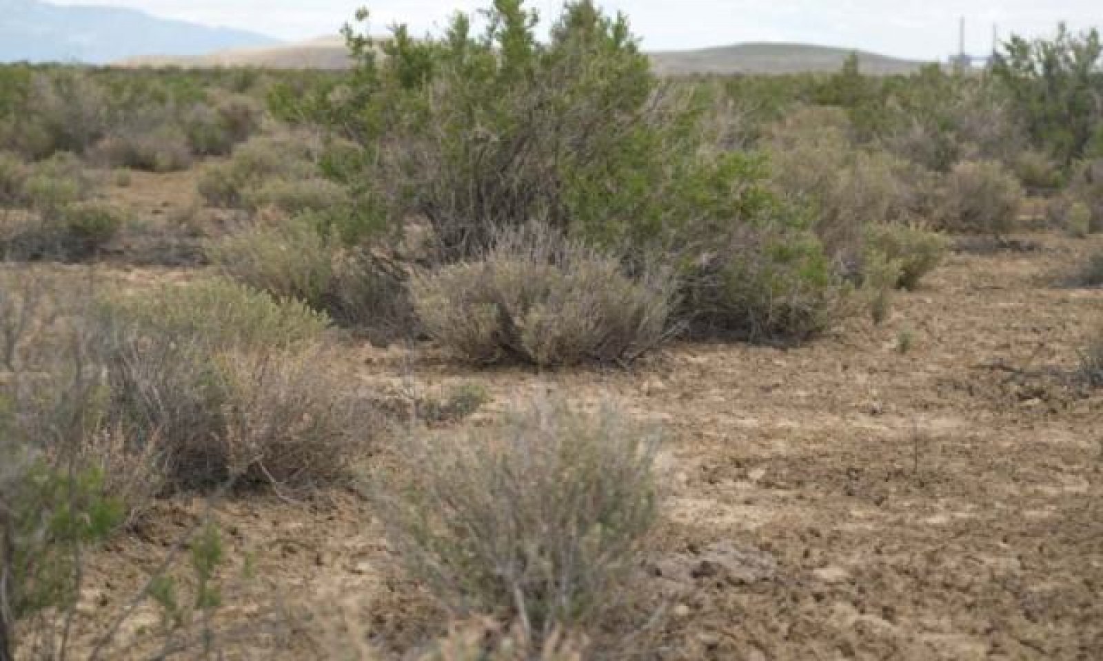
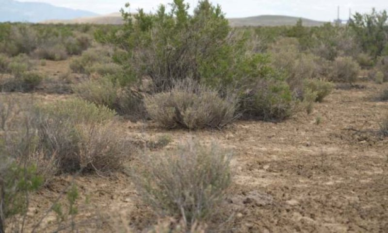
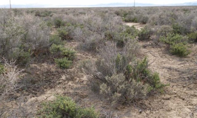
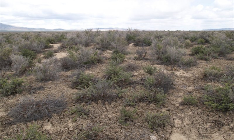
This ecological site is on lake plains and basin floor remnants. Soils are very deep, well drained and formed in a thin layer of loess and alluvium derived from mixed parent material influenced by volcanic ash over lacustrine sediments. Soils are characterized by a very low infiltration, an ochric epipedon, moderate to very strong alkalinity, and SAR greater than 45 in the upper profile. The soil temperature regime is mesic, and the soil moisture regime is typic aridic.
The reference state is characterized by the mixing of shadscale saltbrush (ATCO) and black greasewood (SAVE4) and approximate canopy cover is less than 15 percent. This site has similar species composition and does not compete based on soil characteristic or abiotic factors with Sodic Terrace 8-10"PZ R024XY022NV, Sodic Terrace 6-10"PZ R024XY014OR, or Sodic Fan 6- 10"PZ R024XY113OR.
Associated sites
| R024XY007NV |
SALINE BOTTOM The soil profile is characterized by an ochric epipedon, strong to moderate salinity throughout and a high-water table between 27 to 39 inches (70 to100 cm) at some time during the year. Sodicity (SAR) is 13-99 in the upper 20 inches (50cm) and decreases with depth. Dominant plant species are Black greasewood (SAVE4) and Basin wildrye (LECI4) |
|---|---|
| R024XY011NV |
SODIC FLAT 6-8 P.Z. The soil profile is characterized by an ochric epipdeon, a pH greater than 8.0 throughout, sodicity (SAR) greater than 30 and a water table between 35 to 59 inches (90 to 150 cm) at some point during the spring. Dominant plant species are Black greasewood (SAVE4), Basin wildrye (LECI4), and saltgrass (DISP). |
Similar sites
| R024XY060NV |
SHALLOW SILTY 8-10 P.Z. Soils are dominated by fine loams and find sands and have a strong vesicular horizon and very platy structure in the surface horizon. Shadscale (ATCO) dominant plant: bud sagebrush (ARSP5) and black greasewood (SAVE4) rare. |
|---|---|
| R024XY008NV |
SODIC FLAT 8-10 P.Z. This site presents crusting & baking of the surface layer upon drying, inhibiting water infiltration and seedling emergence. High salt concentrations reduce seed viability, germination and the available water capacity of these soils. Black greasewood (SAVE4) dominant shrub; Shadscale (ATCO) minor shrub; Basin wildrye (LECI4) dominant grass. |
| R024XY011NV |
SODIC FLAT 6-8 P.Z. The upper portion of these soils is strongly salt and sodium affected due to capillary movement of dissolved salts upward from the ground water. Effective rooting depths are limited by a fluctuating water table. Black greasewood (SAVE4) dominant shrub; Shadscale (ATCO) minor shrub. |
| R024XY067NV |
SHALLOW SILTY 5-8 P.Z. This site occurs on lake plains. Soils are very deep, well drained and formed in alluvium. The soil profile is characterized by an ochric epipedon, continuous weak cementation with in 20 inches (51 cm), and coarse silty particle size control section. Shadscale (ATCO) dominant shrub; less productive site. |
| R024XY022NV |
SODIC TERRACE 8-10 P.Z. The plant community is characterized by the mixing of shadscale (ATCO), black greasewood (SAVE4), and big sagebrush (ARTR2). More productive site. |
Table 1. Dominant plant species
| Tree |
Not specified |
|---|---|
| Shrub |
(1) Atriplex confertifolia |
| Herbaceous |
(1) Elymus elymoides |
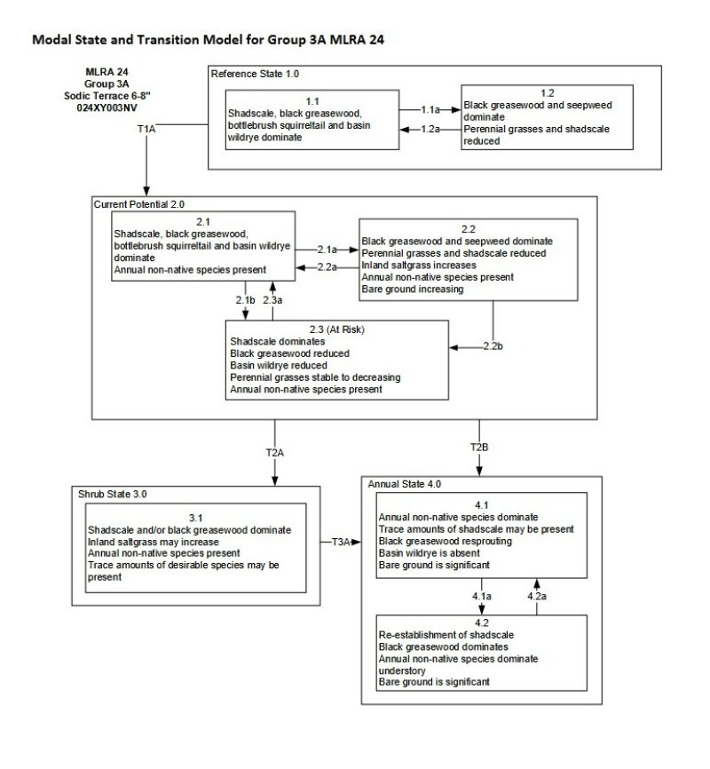


Click on box and path labels to scroll to the respective text.
| T1A | - | Trigger: This transition is caused by the introduction of non-native annual plants, such as halogeton, mustards and cheatgrass. Slow variables: Over time the annual non-native species will increase within the community. Threshold: Any amount of introduced non-native species causes an immediate decrease in the resilience of the site. Annual non-native species cannot be easily removed from the system and have the potential to significantly alter disturbance regimes from their historic range of variation. |
|---|---|---|
| T2A | - | Trigger: Long-term inappropriate grazing and/or long-term drought will decrease or eliminate deep rooted perennial bunchgrasses and favor shrub growth and establishment. Slow variables: Long term decrease in deep-rooted perennial grass density. Threshold: Loss of deep-rooted perennial bunchgrasses changes nutrient cycling, nutrient redistribution, and reduces soil organic matter. |
| T2B | - | Trigger: Fire and/or soil disturbing treatments such as drill seeding and plowing. An unusually wet spring may facilitate the increased germination and production of cheatgrass leading to its dominance within the community. Slow variables: Increased production and cover of non-native annual species. Threshold: Loss of deep-rooted perennial bunchgrasses and shrubs truncates, spatially and temporally, nutrient capture and cycling within the community. Increased, continuous fine fuels from annual non-native plants modify the fire regime by changing intensity, size and spatial variability of fires. |
| T3A | - | Trigger: Fire or soil disturbing treatments such as drill seeding and plowing. An unusually wet spring may facilitate the increased germination and production of cheatgrass leading to its dominance within the community. Slow variables: Increased production and cover of non-native annual species. Threshold: Increased, continuous fine fuels modify the fire regime by changing intensity, size and spatial variability of fires. Changes in plant community composition and spatial variability of vegetation due to the loss of perennial bunchgrasses and shadscale truncate energy capture spatially and temporally thus impacting nutrient cycling and distribution. |
State 1 submodel, plant communities
| 1.1a | - | This pathway is a result of long-term drought, extreme wet periods or herbivory. Drought will favor shrubs over perennial bunchgrasses. Extreme wet periods will reduce the shadscale component. |
|---|---|---|
| 1.2a | - | This pathway is a result of release from drought or herbivory which facilitates the vegetation cover to increase and bare ground cover to decrease. Extreme growing season wet period may reduce shadscale |
State 2 submodel, plant communities
| 2.1a | - | This pathway is a result of inappropriate grazing during the growing season which favors unpalatable shrubs cover over bunchgrass cover. Long term drought will also decrease the perennial bunchgrasses cover in the understory. |
|---|---|---|
| 2.1b | - | This pathway is a result of chronic drought or lowering of the water table, decreasing percent cover of the black greasewood component of the overstory. |
| 2.2a | - | This pathway is a result of a release from drought or appropriate grazing management that facilitates an increase in cover of perennial grass and shadscale. Extreme growing season wet periods may reduce cover of shadscale and increase cover of black greasewood. |
| 2.2b | - | This pathway is a result of long-term drought or inappropriate grazing significantly reducing cover of perennial grasses in favor of shadscale and rabbitbrush. |
| 2.3a | - | This pathway is a result of a release from drought or inappropriate grazing significantly increasing cover of perennial grasses. Extreme growing season wet periods may reduce shadscale. |
State 3 submodel, plant communities
State 4 submodel, plant communities
| 4.1a | - | This pathway is a result of time and lack of disturbances facilitating reestablishment of shadscale. |
|---|---|---|
| 4.2a | - | This pathway is a result of fire. |