
Natural Resources
Conservation Service
Ecological site R042AC241TX
Clay Flat, Desert Grassland
Last updated: 8/10/2020
Accessed: 11/21/2024
General information
Provisional. A provisional ecological site description has undergone quality control and quality assurance review. It contains a working state and transition model and enough information to identify the ecological site.
Figure 1. Mapped extent
Areas shown in blue indicate the maximum mapped extent of this ecological site. Other ecological sites likely occur within the highlighted areas. It is also possible for this ecological site to occur outside of highlighted areas if detailed soil survey has not been completed or recently updated.
MLRA notes
Major Land Resource Area (MLRA): 042A–Trans-Pecos Mountains, Plateaus, and Basins
Ecological site concept
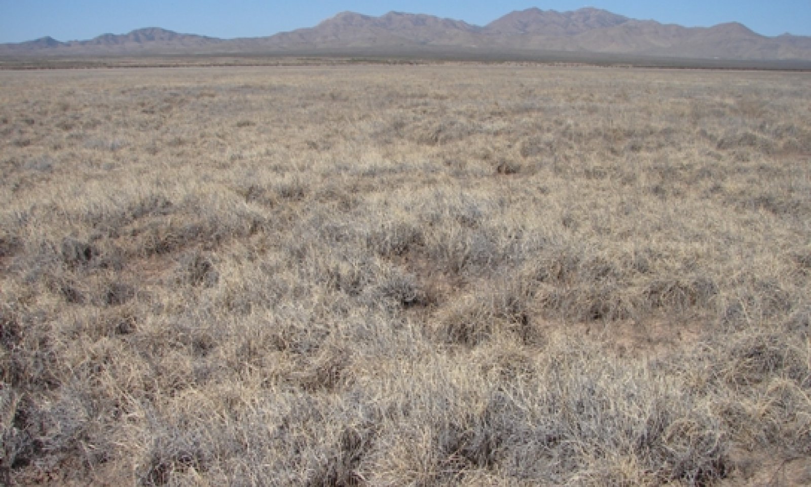
Tobosa dominated reference plant community occuring on basin floors, alluvial flats, and drainage ways within the Desert Grassland vegetation zone of MLRA 42. Soils are very deep and were formed in clayey alluvium weathered from igneous bedrock and/or sedimentary material.
Associated sites
| R042AC244TX |
Gravelly, Desert Grassland Can be adjacent to and in a higher position than the Clay Flat. |
|---|---|
| R042AC250TX |
Loamy, Desert Grassland Can be adjacent to and in a higher position than the Clay Flat. |
Similar sites
| R042AE272TX |
Clay Flat, Mixed Prairie The Clay Flat, Mixed Prairie is in a higher precipitation zone and varies in kinds and amounts of vegetation. It is correlated with the Phantom (moist) and Barlite soil components in Brewster and Presidio Counties. |
|---|
Table 1. Dominant plant species
| Tree |
Not specified |
|---|---|
| Shrub |
Not specified |
| Herbaceous |
(1) Pleuraphis mutica |
Physiographic features
The site occurs on nearly level basin floors, alluvial flats, and drainage ways. Slopes range from 0-2 percent. Rare to occasional and very brief flooding can occur April-October. Runoff potential is very low.
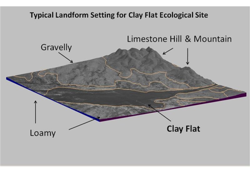
Figure 2. Typical landform setting for Clay Fat ecological s
Table 2. Representative physiographic features
| Landforms |
(1)
Basin floor
(2) Alluvial flat (3) Drainageway |
|---|---|
| Flooding duration | Very brief (4 to 48 hours) |
| Flooding frequency | Rare to occasional |
| Ponding frequency | None |
| Elevation | 1,067 – 1,402 m |
| Slope | 0 – 2% |
| Aspect | Aspect is not a significant factor |
Climatic features
The average annual precipitation is 12 to 14 inches. Approximately 75 percent of the precipitation occurs as widely scattered thunderstorms of high intensity and short duration during the summer. Occasional precipitation occurs as light rainfall during the cool season. Negligible amounts of precipitation fall in the form of sleet or snow.
The optimum growing season ranges from July through September, but is governed by the timing and amount of rainfall. Although frost-free days begin in April, sufficient moisture for growing plants to reach maturity is usually not available until late summer or early fall. Mean annual air temperature is 64° F. Daytime temperatures near 100º F are common from May through August. The prevailing wind is from the southwest. Average wind speed is highest, around 11 miles per hour, in March and April.
The combination of low rainfall and relative humidity, warm temperatures, and high solar radiation creates a significant moisture deficit. The annual Class-pan evaporation is approximately 85 inches.
Table 3. Representative climatic features
| Frost-free period (average) | 241 days |
|---|---|
| Freeze-free period (average) | 218 days |
| Precipitation total (average) | 330 mm |
Figure 3. Monthly precipitation range
Figure 4. Monthly average minimum and maximum temperature
Figure 5. Annual precipitation pattern
Figure 6. Annual average temperature pattern
Influencing water features
Soil features
The site consists of very deep, moderately well drained, slowly permeable soils formed in clayey
alluvium weathered from igneous bedrock and/or sedimentary materials. Depth to bedrock is
greater than 72 inches. The fine textured soils allows for increased water holding capacity.
However, increased clay also makes small precipitation events ineffective as water does not
penetrate deeply, but is retained near the surface where it is subject to evaporation. The site includes two Vertisols (Verhalen and Dalby soils) and one Mollisol (Phantom) with vertic
properties. These clay rich soils shrink and swell with changes in soil moisture resulting in
gilgai micro-relief in some areas. These are often seen as cracks or holes on the surface which
extend to depths of 20 inches or greater. These cracks allow water to infiltrate deep into the soil profile. These soils have been mapped in Culberson, Hudspeth, Presidio, Jeff Davis, Brewster, Pecos, and Reeves Counties.
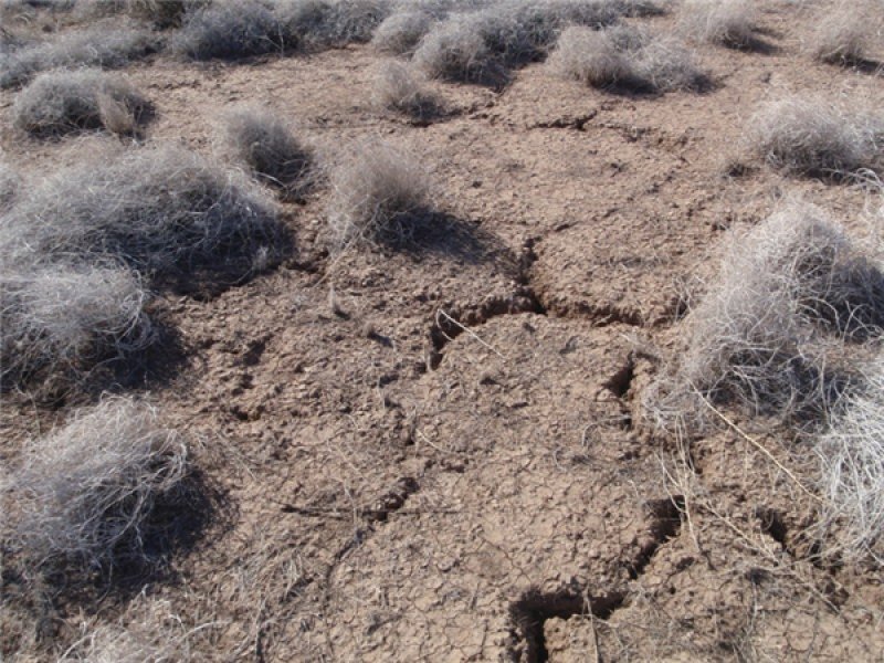
Figure 7. Natural cracks in the soil result from the high sh
Table 4. Representative soil features
| Parent material |
(1)
Alluvium
–
rhyolite
|
|---|---|
| Surface texture |
(1) Clay (2) Silty clay (3) Clay loam |
| Family particle size |
(1) Clayey |
| Drainage class | Well drained to moderately well drained |
| Permeability class | Very slow |
| Soil depth | 183 cm |
| Surface fragment cover <=3" | 0 – 1% |
| Surface fragment cover >3" | 0% |
| Available water capacity (0-101.6cm) |
12.7 – 22.86 cm |
| Calcium carbonate equivalent (0-101.6cm) |
0 – 35% |
| Electrical conductivity (0-101.6cm) |
0 – 8 mmhos/cm |
| Sodium adsorption ratio (0-101.6cm) |
0 – 10 |
| Soil reaction (1:1 water) (0-101.6cm) |
7.9 – 8.4 |
| Subsurface fragment volume <=3" (Depth not specified) |
0 – 5% |
| Subsurface fragment volume >3" (Depth not specified) |
0% |
Ecological dynamics
The reference plant community for the Clay Flat, Desert Grassland, ecological site is a tobosa dominated grassland with a variety of perennial forbs and infrequent, isolated shrubs. Minor grasses include blue grama, vine mesquite, ear muhly, and burrograss. Common woody plants include western honey mesquite, lotebush, and pricklypear.
Inherent features of the site such as the size of the area contributing run-in water, varying landforms (basin floor vs. drainageway), fire frequency, and the timing and amount of annual precipitation are the most influential factors affecting productivity and species composition. According to Canfield (1939), one inch of rainfall concentrated in a week period is needed to initiate growth of tobosa. The velocity and amount of surface run-off following rain events is slower and less, respectively, on sites occurring on broad basin floors versus narrow drainageways. Narrow drainageways will be more susceptible to soil erosion especially in areas within a large watershed.
Natural disturbances contributing to the development and maintenance of the site in reference condition include lightening induced fire and wildlife grazing and browsing. The mean fire interval is about 10 years long in desert grassland communities of the southwest, with high variation due to drought, which reduces fire frequency and moist periods that increase fire frequency (LANDFIRE Rapid Assessment 2007). Bison bones were discovered on one Clay Flat site in the Trans-Pecos which indicates that bison did utilize the site to some degree historically. According to Brown et al. (2010) only light numbers of bison periodically grazed the Trans-Pecos region historically.
Ranching activity by settlers began in the Trans-Pecos region in the late 1800s. The majority of the domestic livestock grazing during this time were cattle, sheep, and goats. Some historical accounts document ranches with stocking rates as high as one animal unit per four acres, which is far from sustainable in this environment. Continuous grazing with high stocking rates deteriorated the condition of rangelands in many parts of the Trans-Pecos region. Multiyear droughts exacerbate the effect of overutilization.
Within this site, prolonged high grazing intensity by cattle will decrease the more palatable grasses such as blue grama and vine mesquite and slowly allow tobosa to increase. Continued very high intensity grazing over long periods of time will eventually transition the tobosa grassland to an annual forb and bare ground community, or if mesquite is introduced, a mesquite shrubland. Continued overutilization will eventually accelerate the site into an eroded state. Hydrologic alterations such as dams, diversions, canals, levees, and roads will impact the vegetation dynamics.
Prescribed fire is commonly used in tobosa grasslands with one or more of the following objectives: 1) removing accumulated litter; 2) increasing tobosa and other grass production; 3) increasing accessibility and palatability of tobosa and other grasses for livestock and wildlife; 4) reducing shrub, succulent, and tree (especially mesquite) cover; and 5) reducing cool-season herbaceous annuals such as annual broomweed (Xanthocephalum dracunculoides) (Wright 1973, Wright 1974, Innes 2012). Post-fire productivity of tobosa and other grasses is highly dependent on amount of rainfall received during the year of the burn. Fire will help drive community change within states. Additionally, the Clay Flat site can be converted into irrigated cropland or pastureland.
The following diagram suggests general pathways that the vegetation on this site might follow. There are other plant communities and states not shown on the diagram. This information is intended to show what might happen in a given set of circumstances; it does not mean that this would happen the same way in every instance. Local professional guidance should always be sought before pursuing a treatment scenario.
State and transition model
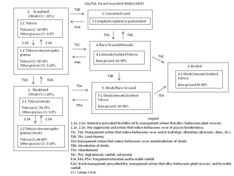
Figure 8. State and Transition Model
More interactive model formats are also available.
View Interactive Models
More interactive model formats are also available.
View Interactive Models
Click on state and transition labels to scroll to the respective text
Ecosystem states
States 2 and 5 (additional transitions)
State 1 submodel, plant communities
State 2 submodel, plant communities
State 3 submodel, plant communities
State 4 submodel, plant communities
State 5 submodel, plant communities
State 6 submodel, plant communities
State 1
Grassland
Grasslands comprise a small part of the Chihuahuan Desert but are vital to the biological diversity of the eco-region (Desmond and Montoya 2006). The Grassland State consists of two tobosa dominated communities: Tobosa 1.1 and the Tobosa-vine mesquite-gramas 1.2. Shrub canopy cover is less than 10 percent within both communities. The primary natural disturbance that influences species composition is fire. This state is very resistant to disturbances. Sites occurring on broad basin floors inherently support fewer shrubs than sites occurring in narrow drainageways.
Community 1.1
Tobosa

Figure 9. Tobosa grassland
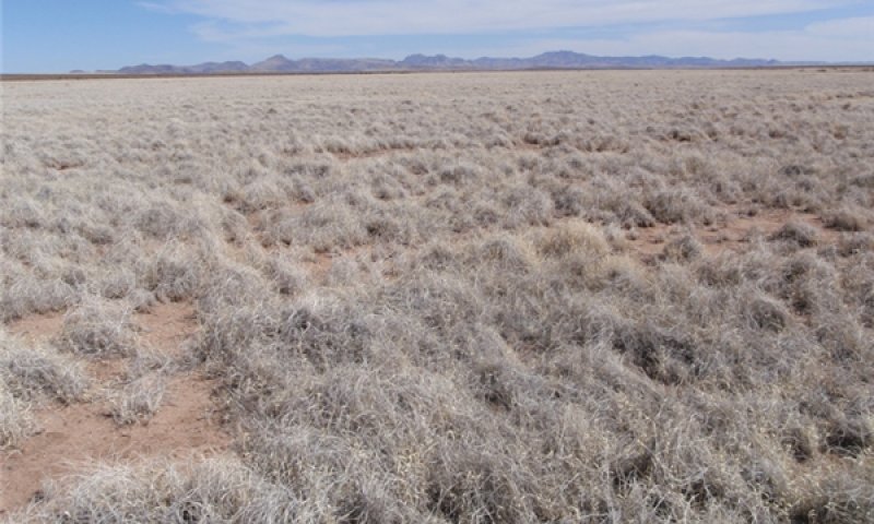
Figure 10. Tobosa grassland
The tobosa community phase is the reference plant community for the site. Grasses account for approximately 95 percent of plant community by air dry weight, while forbs and shrubs account for 4 and 1 percent, respectively. The site is characterized by high perennial grass cover, minimal soil movement, and small, unconnected bare patches. Depending on landscape position and its affect on hydrology, bare ground ranges from 8-20 percent. Tobosa is the dominant climax species in this community. Tobosa canopy cover ranges from 60-85 percent. Other late succession species that occur in association include blue grama, alkali sacaton, and sand muhly. Early succession species or pioneer species that initially grow in disturbed areas include burrograss and ear muhly. Tobosa is a highly productive species until it accumulates large amounts of litter and productivity subsequently drops and it becomes low quality forage (Neuenschwander et al. 1975). It is palatable to livestock only when it is green and succulent during the summer months. Prescribed fire is an effective management practice that can remove litter and dry stems and stimulate production when soil moisture is adequate. Prescribed fire has been shown to expedite the recovery of more palatable grasses such as blue grama and increase forage quality for tobosa grass. Tobosa is very resistant to grazing and up to 60 percent of its biomass can be utilized without injury (Canfield 1939). According to Paulsen and Ares (1962), intermediate grazing intensity increased basal area of tobosa grass when compared to an ungrazed pasture over a period of 15 years. Under continuous heavy grazing and trampling (typically in high use areas such as near water troughs and/or pens) palatable grasses decrease and stands of tobosa grass begin to deteriorate.
Figure 11. Annual production by plant type (representative values) or group (midpoint values)
Table 5. Annual production by plant type
| Plant type | Low (kg/hectare) |
Representative value (kg/hectare) |
High (kg/hectare) |
|---|---|---|---|
| Grass/Grasslike | 639 | 1401 | 2130 |
| Forb | 27 | 45 | 90 |
| Shrub/Vine | 7 | 11 | 22 |
| Tree | – | – | – |
| Total | 673 | 1457 | 2242 |
Table 6. Ground cover
| Tree foliar cover | 0% |
|---|---|
| Shrub/vine/liana foliar cover | 0.5-1.0% |
| Grass/grasslike foliar cover | 75-90% |
| Forb foliar cover | 1-5% |
| Non-vascular plants | 0% |
| Biological crusts | 0% |
| Litter | 50-60% |
| Surface fragments >0.25" and <=3" | 0-1% |
| Surface fragments >3" | 0% |
| Bedrock | 0% |
| Water | 0% |
| Bare ground | 8-20% |
Table 7. Soil surface cover
| Tree basal cover | 0% |
|---|---|
| Shrub/vine/liana basal cover | 0.5-1.0% |
| Grass/grasslike basal cover | 25-35% |
| Forb basal cover | 1-2% |
| Non-vascular plants | 0% |
| Biological crusts | 0% |
| Litter | 50-60% |
| Surface fragments >0.25" and <=3" | 0-1% |
| Surface fragments >3" | 0% |
| Bedrock | 0% |
| Water | 0% |
| Bare ground | 8-20% |
Table 8. Canopy structure (% cover)
| Height Above Ground (m) | Tree | Shrub/Vine | Grass/ Grasslike |
Forb |
|---|---|---|---|---|
| <0.15 | – | – | 1-3% | 1-2% |
| >0.15 <= 0.3 | – | 0-1% | 75-85% | 1-2% |
| >0.3 <= 0.6 | – | – | 3-5% | 0-1% |
| >0.6 <= 1.4 | – | 0-1% | – | – |
| >1.4 <= 4 | – | – | – | – |
| >4 <= 12 | – | – | – | – |
| >12 <= 24 | – | – | – | – |
| >24 <= 37 | – | – | – | – |
| >37 | – | – | – | – |
Figure 12. Plant community growth curve (percent production by month). TX0024, Midgrasses Dominant Community - Desert Grassland. Midgrass dominant with species such as tobosa and alkali sacaton. Very few shrubs..
| Jan | Feb | Mar | Apr | May | Jun | Jul | Aug | Sep | Oct | Nov | Dec |
|---|---|---|---|---|---|---|---|---|---|---|---|
| J | F | M | A | M | J | J | A | S | O | N | D |
| 1 | 1 | 2 | 5 | 5 | 10 | 20 | 25 | 15 | 10 | 5 | 1 |
Community 1.2
Tobosa-vine mesquite-gramas
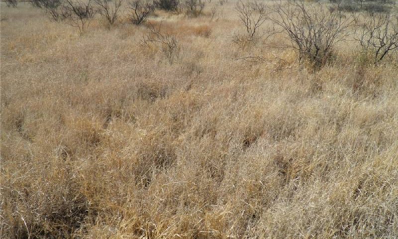
Figure 13. Post-fire plant community
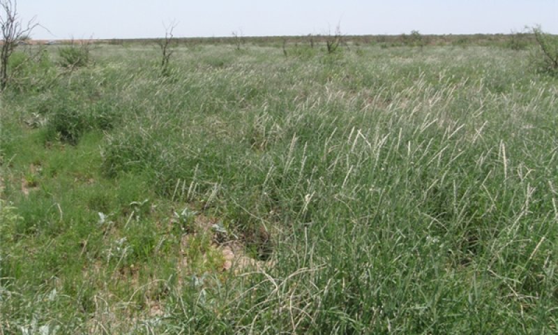
Figure 14. Post-fire plant community
This community phase is a post-fire plant community. Tobosa is very resistant to fire mortality (Innes 2012). Tobosa may increase, decrease, or remain unaffected by fire depending upon soil moisture and plant condition at the time of the fire, precipitation in the months following the fire, and site characteristics that influence soil moisture availability (Heirman and Wright 1969, Wright 1969, Dwyer 1972, Neuenshwander et al. 1975). During a wet year, spring burning of tobosa nearly doubled its production compared to unburned plots (Wright 1969). In southern New Mexico were annual precipitation is only 9 in/yr, little to no increase can be expected after burning (Dwyer 1972). Burning tobosa will also increase its palatability and nutritive quality by reducing litter and stimulating green and succulent new growth (Britton and Steuter 1983). However, this benefit is usually short-lived lasting one growing season. In the Trans-Pecos some prescribed burns have known to allow the regeneration of other grass species such as vine mesquite, sideoats grama and blue grama. This increase in grama species and other grasses following burns may not occur on all Clay Flat sites. Tobosa, in any case, still dominates the community. Western honey mesquite and many other shrubs typically re-sprout after burns. However, the intensity of the burn and age of the shrub will affect their ability to re-sprout. According to Sharrow and Wright (1977), burning tobosa and intervals of less than 5 years will potentially damage the future productivity of tobosa because of the time required to reestablish pre-fire soil nitrogen levels. In the Trans-Pecos, clay flats are typically burned in the spring or just before the summer monsoon/growing season.
Pathway 1.1A
Community 1.1 to 1.2


Prescribed fire is commonly used in tobosa grasslands with one or more of the following objectives: 1) removing accumulated litter; 2) increasing tobosa and other grass production; 3) increasing accessibility and palatability of tobosa and other grasses for livestock and wildlife; 4) reducing shrub, succulent, and tree (especially mesquite) cover; and 5) reducing cool-season herbaceous annuals such as annual broomweed (Wright 1973, Wright 1974, Innes 2012). Post-fire productivity of tobosa and other grasses is highly dependent on amount of rainfall received during the year of the burn.
Pathway 1.2A
Community 1.2 to 1.1


Selective grazing of blue grama, sideoats, grama, and vine mesquite and fire suppression over time will allow tobosa to increase and drive the community back to the Tobosa community phase 1.1.
State 2
Shrubland
A canopy cover of 10 percent or greater characterizes this state. Past land use has allowed shrubs, primarily western honey mesquite, to encroach. However, current management has allowed the recovery of tobosa. Tobosa cover ranges from 40-75 percent in this state. With adequate fine fuels, fire can be a useful management tool within this state.
Community 2.1
Tobosa/shrubs
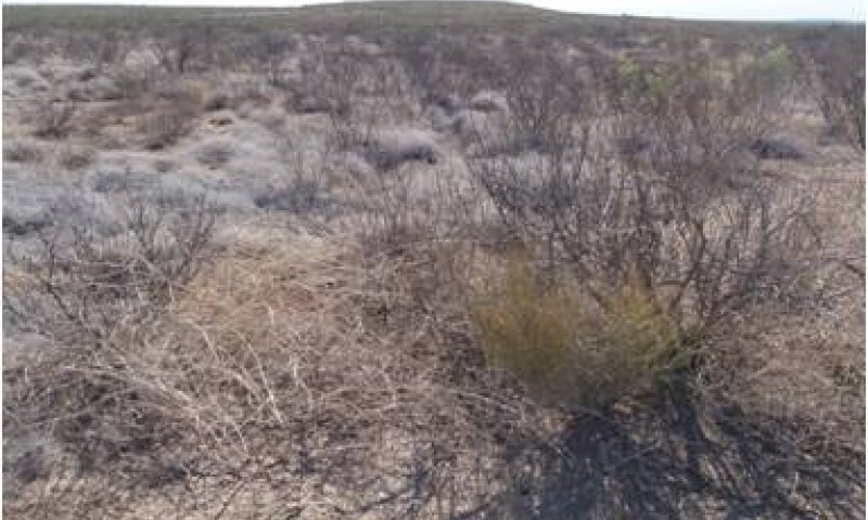
Figure 15. Tobosa/shrubs
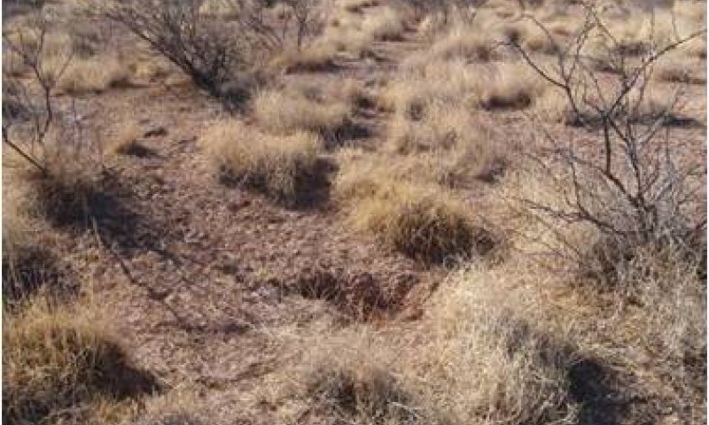
Figure 16. Tobosa/shrubs
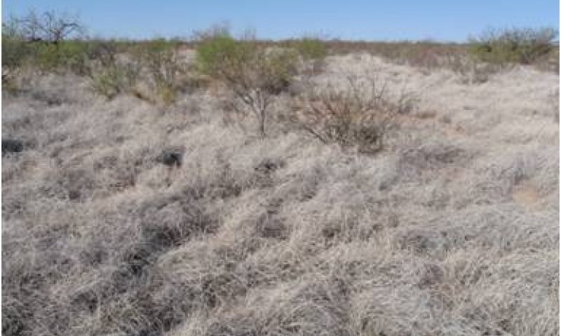
Figure 17. Tobosa/shrubs
This plant community is characterized by at least 10 percent canopy cover of shrubs. Past last use, primarily overgrazing facilitated the encroachment of shrubs such as western honey mesquite. Current land use, however, has allowed the recovery of mostly tobosa and other subdominant grasses. Tobosa cover ranges from about 50-75 percent. Other grasses such as burrograss, alkali sacaton, sideoats grama are typically less than 5 percent cover. Clay Flats occurring within narrow drainageways are more susceptible to have shrub encroachment than sites occurring on wide basin floors. Other shrubs occurring in this phase include lotebush, agarito, ephedra, catclaw acacia, and pricklypear. With adequate fine fuels, prescribed fire can be used as a management tool in this phase. The encroachment of shrubs into desert grasslands may act as a corridor for a diversity of bird species historically not associated with desert grasslands to occupy or move through an area, increasing vulnerability to nest predation (Mason, et al 2005).
Figure 18. Annual production by plant type (representative values) or group (midpoint values)
Table 9. Annual production by plant type
| Plant type | Low (kg/hectare) |
Representative value (kg/hectare) |
High (kg/hectare) |
|---|---|---|---|
| Shrub/Vine | 224 | 560 | 1009 |
| Grass/Grasslike | 129 | 504 | 958 |
| Forb | 28 | 56 | 90 |
| Total | 381 | 1120 | 2057 |
Table 10. Canopy structure (% cover)
| Height Above Ground (m) | Tree | Shrub/Vine | Grass/ Grasslike |
Forb |
|---|---|---|---|---|
| <0.15 | – | – | 1-5% | 1-5% |
| >0.15 <= 0.3 | – | 0-1% | 10-45% | 1-5% |
| >0.3 <= 0.6 | – | 5-15% | 3-5% | – |
| >0.6 <= 1.4 | – | 5-30% | – | – |
| >1.4 <= 4 | – | 0-5% | – | – |
| >4 <= 12 | – | – | – | – |
| >12 <= 24 | – | – | – | – |
| >24 <= 37 | – | – | – | – |
| >37 | – | – | – | – |
Figure 19. Plant community growth curve (percent production by month). TX0002, Desert Grassland Rangeland. Tobosa and mesquite rangeland.
| Jan | Feb | Mar | Apr | May | Jun | Jul | Aug | Sep | Oct | Nov | Dec |
|---|---|---|---|---|---|---|---|---|---|---|---|
| J | F | M | A | M | J | J | A | S | O | N | D |
| 1 | 1 | 2 | 5 | 5 | 10 | 20 | 25 | 15 | 10 | 5 | 1 |
Community 2.2
Tobosa-vine mesquite-gramas/shrubs
This community phase is a post-fire plant community. Many of the shrubs such as mesquite have resprouted and canopy cover remains above 10 percent. Continued burning of this community will eventually transition this community to the Grassland State. Tobosa is very resistant to fire mortality (Innes 2012). Tobosa may increase, decrease, or remain unaffected by fire depending upon soil moisture and plant condition at the time of the fire, precipitation in the months following the fire, and site characteristics that influence soil moisture availability (Heirman and Wright 1969, Wright 1969, Dwyer 1972, Neuenshwander et al. 1975). During a wet year, spring burning of tobosa nearly doubled its production compared to unburned plots (Wright 1969). In southern New Mexico were annual precipitation is only 9 in/yr, little to no increase can be expected after burning (Dwyer 1972). Burning tobosa will also increase its palatability and nutritive quality by reducing litter and stimulating green and succulent new growth (Britton and Steuter 1983). However, this benefit is usually short-lived lasting one growing season. In the Trans-Pecos prescribed burns have known to allow the regeneration of other grass species such as vine mesquite, sideoats grama and blue grama. This increase in grama species following burns may not occur on all Clay Flat sites. Tobosa, in any case, still dominates the community. Western honey mesquite and many other shrubs typically re-sprout after burns. However, the intensity of the burn and age of the shrub will affect their ability to re-sprout. According to Sharrow and Wright 1977, burning tobosa and intervals of less than 5 years will potentially damage the future productivity of tobosa because of the time required to reestablish pre-fire soil nitrogen levels. In the Trans-Pecos, clay flats are typically burned in the spring or just before the summer monsoon/growing season.
Pathway 2.1A
Community 2.1 to 2.2
Community Pathway 1.1A: Prescribed fire is commonly used in tobosa grasslands with one or more of the following objectives: 1) removing accumulated litter; 2) increasing tobosa and other grass production; 3) increasing accessibility and palatability of tobosa and other grasses for livestock and wildlife; 4) reducing shrub, succulent, and tree (especially mesquite) cover; and 5) reducing cool-season herbaceous annuals such as annual broomweed (Wright 1973, Wright 1974, Innes 2012). Post-fire productivity of tobosa and other grasses is highly dependent on amount of rainfall received during the year of the burn.
Pathway 2.2A
Community 2.2 to 2.1
Selective grazing of blue grama, sideoats grama, and vine mesquite and fire suppression over time will allow tobosa to increase and drive the community back to the Tobosa community phase 2.1.
State 3
Converted Land
This state is characterized by active farming of crops or forages.
Community 3.1
Irrigated cropland or pastureland
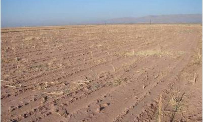
Figure 20. Irrigated cropland
This community is created by land clearing and plowing. Cultivated cropland and pastureland is a common land use practice only if irrigation is available. Abandoned crop or pastureland will eventually transition to the Bare Ground/Annuals State (4).
State 4
Bare Ground/Annuals
A high percentage of bare ground (20-90 percent) and isolated tobosa plants characterize this state. This state is typically restricted to high use areas where trampling and overutilization of tobosa has occurred, near areas where hydrologic alterations that restrict the natural flow of water have been installed, or on abandoned farmland.
Community 4.1
Annuals/isolated tobosa
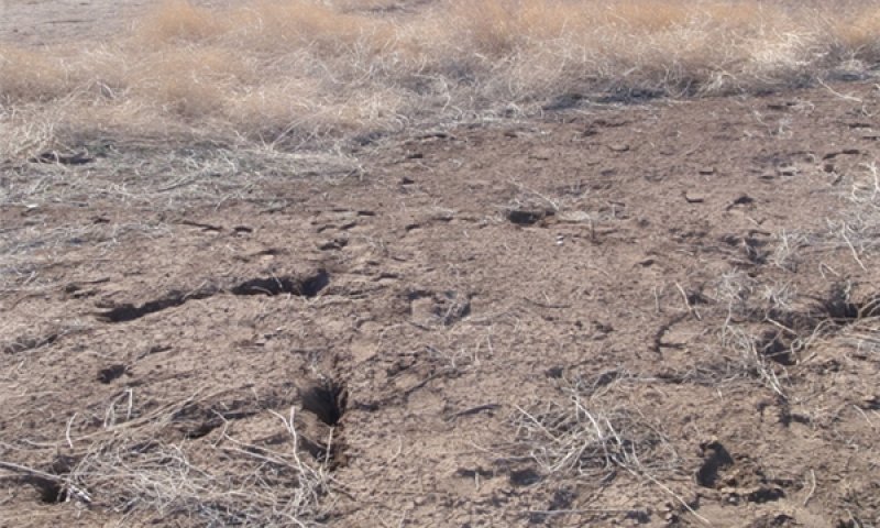
Figure 21. Bare ground/annuals
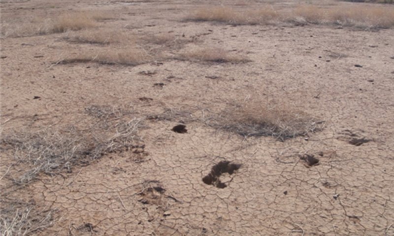
Figure 22. Bare ground/annuals
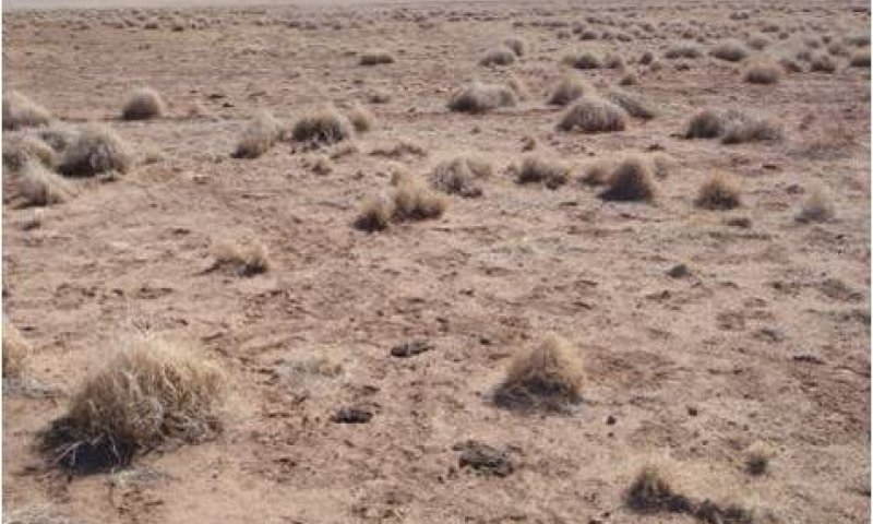
Figure 23. Bare ground/isolated tobosa
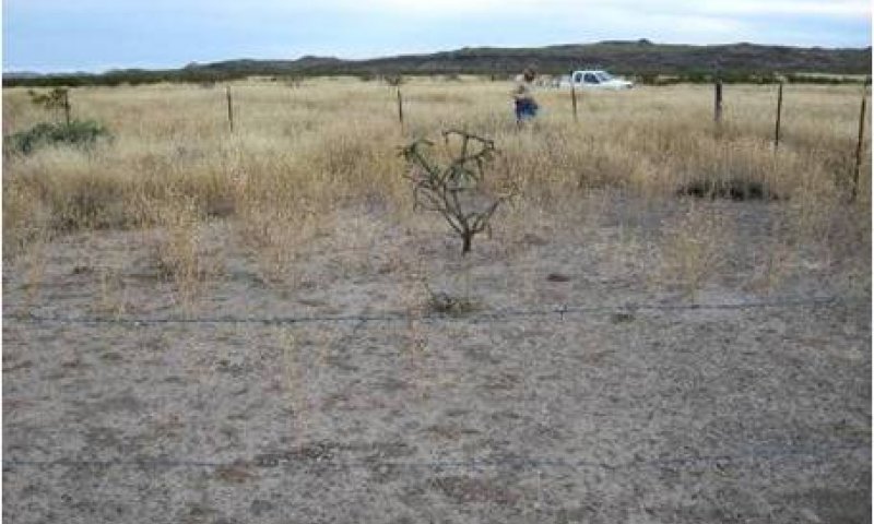
Figure 24. Bare ground/annuals
This plant community is the result of prolonged and extensive overutilization of plant resources by livestock. Often, hydrologic alterations (diversions, dams, stock tanks, roads) also play a role in developing this community phase. Annual forbs and grasses dominate with isolated shrubs and grasses. The community typically occurs near high use or staging areas such as near stock pens, feeding areas, sources of drinking water, near water dams and diversions, or on abandoned cropland. The site can be susceptible to toxic plants such as inkweed and western bitterweed. In some areas, annual broomweed is also known to dominate this community following rains. The seeds of annual broomweed, a native forb, are a highly desirable food source for quail but of no valuable to livestock. A combination of deferred livestock grazing, rangeland restoration treatments, and favorable rainfall over several decades can potentially facilitate grass recolonization. The presence of nearby surface water diversions or stock ponds can potentially affect recovery efforts by reducing the amount of run in water.
Figure 25. Annual production by plant type (representative values) or group (midpoint values)
Table 11. Annual production by plant type
| Plant type | Low (kg/hectare) |
Representative value (kg/hectare) |
High (kg/hectare) |
|---|---|---|---|
| Grass/Grasslike | 6 | 62 | 129 |
| Forb | 27 | 78 | 129 |
| Shrub/Vine | 7 | 11 | 22 |
| Total | 40 | 151 | 280 |
Table 12. Ground cover
| Tree foliar cover | 0% |
|---|---|
| Shrub/vine/liana foliar cover | 1-9% |
| Grass/grasslike foliar cover | 1-10% |
| Forb foliar cover | 1-25% |
| Non-vascular plants | 0% |
| Biological crusts | 0% |
| Litter | 0% |
| Surface fragments >0.25" and <=3" | 0% |
| Surface fragments >3" | 0% |
| Bedrock | 0% |
| Water | 0% |
| Bare ground | 20-90% |
State 5
Shrub/Bare Ground
A shrub canopy cover greater than 10 percent characterized this state. The most common shrub is western honey mesquite. The community is characterized by large patches of bare ground with few scattered grasses. This state is typically restricted to high use areas where trampling and overutilization of tobosa has occurred and mesquite and/or other shrubs have been introduced and established.
Community 5.1
Shrubs/annuals/isolated tobosa
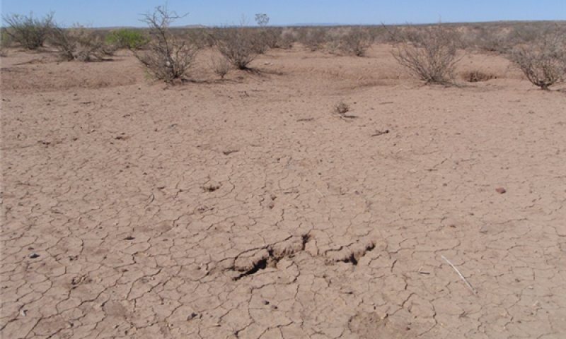
Figure 26. Bare ground/shrubs
This plant community is the result of prolonged and extensive overutilization of plant resources by livestock. Western honey mesquite and or other shrubs have encroached on the site, most likely facilitated by cattle. Bare ground ranges from 50-90 percent. Few isolated tobosa plants are present. Annual grasses and forbs dominated following rain events. This plant community is uncommon on broad basin floors. When it does occur on basin floors it is usually near high use or staging areas such as near stock pens, feeding areas, or sources of drinking water. This community phase can be more common when the site occurs on more narrow drainageways. The site can be susceptible to toxic plants such as inkweed and western bitterweed. In some areas, annual broomweed is also known to dominate this community following rains. The seeds of annual broomweed, a native forb, are a highly desirable food source for quail but of no valuable to livestock.
Table 13. Ground cover
| Tree foliar cover | 0% |
|---|---|
| Shrub/vine/liana foliar cover | 10-50% |
| Grass/grasslike foliar cover | 1-10% |
| Forb foliar cover | 1-25% |
| Non-vascular plants | 0% |
| Biological crusts | 0% |
| Litter | 1-15% |
| Surface fragments >0.25" and <=3" | 0% |
| Surface fragments >3" | 0% |
| Bedrock | 0% |
| Water | 0% |
| Bare ground | 50-90% |
State 6
Eroded
This is the most degraded state of the Clay Flat Site. It is characterized by extensive and active rill and gully erosion and is most commonly found adjacent to primary drainage channels and where the natural hydrology has been altered by dams, diversions, roads, canals, fences, or other man-made structures. These hydrologic alterations combined with prolonged overgrazing have caused this irreversible eroded state.
Community 6.1
Annuals/shrubs/isolated tobosa
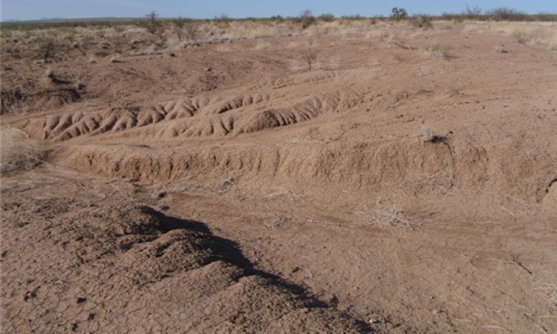
Figure 27. Eroded
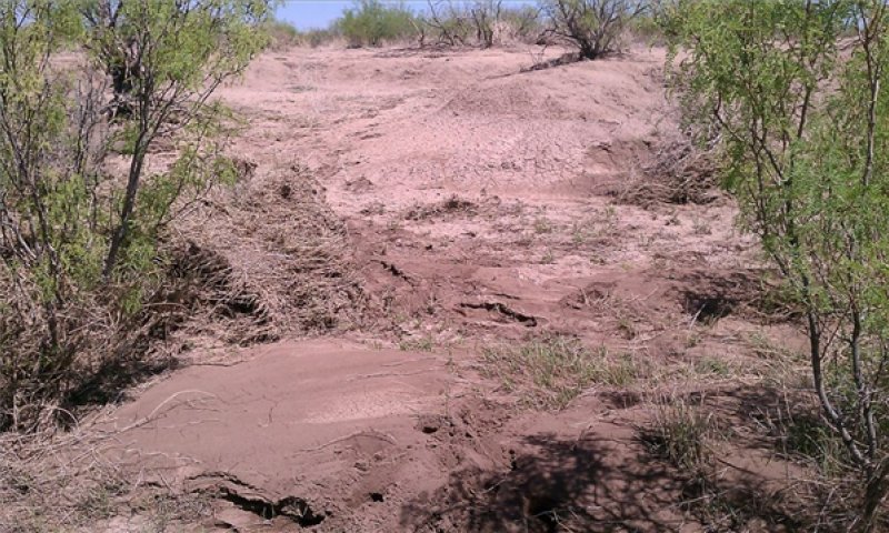
Figure 28. Eroded
The plant community is dominated by shrubs, specifically western honey mesquite and creosotebush with few isolated grasses and annuals. In many cases, the upper soil horizons have been eroded leaving behind the less fertile subsurface horizons. Plants that are able to survive in these eroded soils become establish such as creosotebush, Russian thistle (Salsola spp.) and mesquite. The site is susceptible to encroachment of noxious and invasive plants such as bitterweed, African rue (Peganum harmala), senecio (Senecio spp.), and inkweed. Restoration of the Eroded State to something similar to reference conditions in this climate is highly improbable and cost prohibited. This state is considered to have crossed an irreversible threshold especially in areas that have lost considerable topsoil. However, efforts can be done to slow erosion and hopefully reverse the trend. Any actions should first focus on restoring the ecological function of the site such as the hydrology. Man-made structures that alter the hydrology should be removed. Restoration efforts in eroded areas should utilize large bunchgrasses such as alkali sacaton and big sacaton (Sporobolus wrightii) that are adaptable and have the ability dissipate the energy of moving water. New fences and roads should be carefully located and constructed in a manner that maintains proper drainage and hydrologic function. Practices that concentrate water in unstable areas should be avoided. Grazing management should be adjusted to exclude livestock from actively eroding areas. Livestock tend to concentrate at the bottom of eroded channels and their trampling will exacerbate erosion.
Transition T1A
State 1 to 2
Overutilization of grasses by cattle, horses, or sheep over a prolonged period and the encroachment of shrubs, primarily western honey mesquite will transition the Grassland State 1 to the Shrubland State 2.
Transition T1B
State 1 to 3
Land clearing will transition the Grassland State 1 to the Converted Land State 3.
Transition T1C
State 1 to 4
Overutilization of grasses by cattle, horses, or sheep over a prolonged period and hydrological alterations such as dams and diversions, either alone or in combination, will transition the Grassland State 1 to the Bare Ground/Annuals State 4.
Restoration pathway R2A
State 2 to 1
Prescribed fire would be the most economical method to restore the Shrubland State to the Grassland State. Mechanical (grubbing) or chemical brush management is another option. Prescribed grazing or no grazing will also be needed to help facilitate the restoration process. Restoration of grasses cannot occur without favorable rainfall.
Transition T2A
State 2 to 5
Heavy continuous grazing by cattle, sheep, and/or horses over a prolonged period and hydrological alterations such as dams, diversions, dirt tanks, either alone or in combination, will transition the Shrub/Bare Ground State 5. to the Bare Ground/Shrub State (5).
Restoration pathway R3A
State 3 to 1
Rangeland restoration treatments and favorable rainfall will be needed to potentially restore the Grassland State. Restoration efforts may first need to address ecological processes, such as hydrology, first prior to restoring structure (individual plants) (Whisenant 1999). Under favorable conditions, abandoned areas can potentially be replanted to perennial grasses. Some limitations to reseeding include seed availability, drought, loss of topsoil, and improper seedbed preparation.
Transition T3A
State 3 to 4
Abandonment of cultivation will drive the Converted Land State to the Bare Ground/Annuals State (4).
Restoration pathway R4A
State 4 to 1
A combination of prescribed grazing or no grazing, intensive restoration treatments, and favorable rainfall will help restore the Grassland State. Restoration efforts should focus first on addressing ecological process (i.e. hydrology, nutrient cycling, energy capture) prior to addressing structure (individual plants) (Whisenant, 1999).
Transition T4A
State 4 to 3
Land clearing will transition the Bare/Annuals State to the Converted Land State.
Transition T4B
State 4 to 5
Introduction of mesquite seed by domestic livestock and favorable weather will transition the Bare/Annuals State to the Bare Ground/Shrub State.
Transition T4C
State 4 to 6
High intensity rainfall will cause varying degrees of erosion because of the lack of continuous herbaceous plant cover and eventually transition the community to the Eroded State.
Restoration pathway R5A
State 5 to 2
A combination of prescribed grazing or no grazing, intensive restoration treatments, and favorable rainfall will help restore the Grassland State. Restoration efforts should focus first on addressing ecological process (i.e. hydrology, nutrient cycling, energy capture) prior to addressing structure (individual plants) (Whisenant 1999).
Transition T5A
State 5 to 6
High intensity rainfall will cause varying degrees of erosion because of the lack of continuous herbaceous plant cover and eventually transition the community to the Eroded State (6).
Additional community tables
Table 14. Community 1.1 plant community composition
| Group | Common name | Symbol | Scientific name | Annual production (kg/hectare) | Foliar cover (%) | |
|---|---|---|---|---|---|---|
|
Grass/Grasslike
|
||||||
| 1 | Dominant rhizomatous | 572–1905 | ||||
| tobosagrass | PLMU3 | Pleuraphis mutica | 572–1905 | – | ||
| 2 | Bunchgrasses | 40–179 | ||||
| blue grama | BOGR2 | Bouteloua gracilis | 17–84 | – | ||
| alkali sacaton | SPAI | Sporobolus airoides | 17–84 | – | ||
| sand muhly | MUAR2 | Muhlenbergia arenicola | 2–6 | – | ||
| Hall's panicgrass | PAHA | Panicum hallii | 2–6 | – | ||
| 3 | Stoloniferous | 11–39 | ||||
| vine mesquite | PAOB | Panicum obtusum | 6–22 | – | ||
| burrograss | SCBR2 | Scleropogon brevifolius | 6–17 | – | ||
| 4 | Minor rhizomatous | 2–6 | ||||
| ear muhly | MUAR | Muhlenbergia arenacea | 2–6 | – | ||
| 5 | Annuals | 0–6 | ||||
| feather fingergrass | CHVI4 | Chloris virgata | 0–6 | – | ||
| Madagascar dropseed | SPPY2 | Sporobolus pyramidatus | 0–6 | – | ||
| Arizona signalgrass | URAR | Urochloa arizonica | 0–6 | – | ||
|
Shrub/Vine
|
||||||
| 6 | Shrubs | 1–6 | ||||
| escobilla butterflybush | BUSC | Buddleja scordioides | 0–3 | – | ||
| western honey mesquite | PRGLT | Prosopis glandulosa var. torreyana | 1–3 | – | ||
| lotebush | ZIOB | Ziziphus obtusifolia | 0–3 | – | ||
| longleaf jointfir | EPTR | Ephedra trifurca | 0–2 | – | ||
| 7 | Succulent | 6–17 | ||||
| tree cholla | CYIM2 | Cylindropuntia imbricata | 2–11 | – | ||
| pricklypear | OPUNT | Opuntia | 3–11 | – | ||
|
Forb
|
||||||
| 8 | Perennial | 27–84 | ||||
| Forb, perennial | 2FP | Forb, perennial | 11–50 | – | ||
| croton | CROTO | Croton | 6–17 | – | ||
| silverleaf nightshade | SOEL | Solanum elaeagnifolium | 6–17 | – | ||
| broom snakeweed | GUSA2 | Gutierrezia sarothrae | 6–11 | – | ||
| Indian rushpea | HOGL2 | Hoffmannseggia glauca | 2–7 | – | ||
| Davis Mountain mock vervain | GLBIC | Glandularia bipinnatifida var. ciliata | 0–7 | – | ||
| whitemargin sandmat | CHAL11 | Chamaesyce albomarginata | 2–7 | – | ||
| 9 | Annual | 0–6 | ||||
| prairie broomweed | AMDR | Amphiachyris dracunculoides | 0–6 | – | ||
| bladderpod | LESQU | Lesquerella | 0–1 | – | ||
Table 15. Community 2.1 plant community composition
| Group | Common name | Symbol | Scientific name | Annual production (kg/hectare) | Foliar cover (%) | |
|---|---|---|---|---|---|---|
|
Grass/Grasslike
|
||||||
| 1 | Dominant rhizomatous | 112–897 | ||||
| tobosagrass | PLMU3 | Pleuraphis mutica | 112–897 | – | ||
| 2 | Stoloniferous | 6–17 | ||||
| burrograss | SCBR2 | Scleropogon brevifolius | 6–17 | – | ||
| 3 | Bunchgrass | 11–45 | ||||
| alkali sacaton | SPAI | Sporobolus airoides | 11–45 | – | ||
| 4 | Annual | 0–6 | ||||
| feather fingergrass | CHVI4 | Chloris virgata | 0–6 | – | ||
| Arizona signalgrass | URAR | Urochloa arizonica | 0–6 | – | ||
|
Shrub/Vine
|
||||||
| 5 | Succulent | 7–28 | ||||
| tree cholla | CYIM2 | Cylindropuntia imbricata | 3–28 | – | ||
| pricklypear | OPUNT | Opuntia | 3–28 | – | ||
| 6 | Shrub | 224–1009 | ||||
| western honey mesquite | PRGLT | Prosopis glandulosa var. torreyana | 168–897 | – | ||
| catclaw acacia | ACGR | Acacia greggii | 28–112 | – | ||
| lotebush | ZIOB | Ziziphus obtusifolia | 28–84 | – | ||
| longleaf jointfir | EPTR | Ephedra trifurca | 11–56 | – | ||
|
Forb
|
||||||
| 7 | Perennial | 28–84 | ||||
| broom snakeweed | GUSA2 | Gutierrezia sarothrae | 11–50 | – | ||
| Forb, perennial | 2FP | Forb, perennial | 6–22 | – | ||
| croton | CROTO | Croton | 11–22 | – | ||
| silverleaf nightshade | SOEL | Solanum elaeagnifolium | 6–17 | – | ||
| whitemargin sandmat | CHAL11 | Chamaesyce albomarginata | 2–7 | – | ||
| 8 | Annuals | 0–22 | ||||
| Forb, annual | 2FA | Forb, annual | 0–17 | – | ||
| bladderpod | LESQU | Lesquerella | 0–6 | – | ||
| 9 | Invaders | 0–28 | ||||
| prickly Russian thistle | SATR12 | Salsola tragus | 0–28 | – | ||
| bitter rubberweed | HYOD | Hymenoxys odorata | 0–11 | – | ||
| thickleaf drymary | DRPA3 | Drymaria pachyphylla | 0–1 | – | ||
Table 16. Community 4.1 plant community composition
| Group | Common name | Symbol | Scientific name | Annual production (kg/hectare) | Foliar cover (%) | |
|---|---|---|---|---|---|---|
|
Grass/Grasslike
|
||||||
| 1 | Dominant rhizomatous | 0–112 | ||||
| tobosagrass | PLMU3 | Pleuraphis mutica | 0–112 | – | ||
| 2 | Stoloniferous | 6–17 | ||||
| burrograss | SCBR2 | Scleropogon brevifolius | 6–17 | – | ||
| 3 | Annuals | 0–6 | ||||
| feather fingergrass | CHVI4 | Chloris virgata | 0–6 | – | ||
| Arizona signalgrass | URAR | Urochloa arizonica | 0–6 | – | ||
|
Shrub/Vine
|
||||||
| 4 | Succulent | 6–17 | ||||
| tree cholla | CYIM2 | Cylindropuntia imbricata | 2–11 | – | ||
| pricklypear | OPUNT | Opuntia | 3–11 | – | ||
|
Forb
|
||||||
| 5 | Perennial | 28–67 | ||||
| broom snakeweed | GUSA2 | Gutierrezia sarothrae | 11–45 | – | ||
| Forb, perennial | 2FP | Forb, perennial | 11–28 | – | ||
| 6 | Annual | 0–73 | ||||
| prickly Russian thistle | SATR12 | Salsola tragus | 0–50 | – | ||
| prairie broomweed | AMDR | Amphiachyris dracunculoides | 0–28 | – | ||
| Forb, annual | 2FA | Forb, annual | 0–11 | – | ||
| 7 | Invaders | 0–22 | ||||
| thickleaf drymary | DRPA3 | Drymaria pachyphylla | 0–11 | – | ||
| bitter rubberweed | HYOD | Hymenoxys odorata | 0–11 | – | ||
Interpretations
Animal community
Livestock Interpretations:
The reference plant community is suited for grazing livestock such as cattle, horses, burros, and sheep. However, the site provides marginal amounts of browse for livestock, especially domestic goats. Livestock should be stocked in proportion to the amount of grass, forbs, and browse. Mature tobosa grass is coarse and not palatable as the associated native grasses; generally this grass needs to be grazed when it is green and actively growing to achieve optimum livestock performance. If all native species are to be managed on this site a rotational grazing system may need to be implemented for grazing during the growing season. Prescribed fire can be used to improve forage quality on this site, especially if the tobosa grass has become highly lignified and large amounts of litter have accumulated.
Improper grazing management causes a gradual decline in range health, reducing livestock nutrition and habitat quality for wildlife. Western bitterweed (Hymenoxys odorata), a native annual, can occur in disturbed areas within the Clay Flat site and can be toxic to sheep when consuming 1.3 percent of an animal’s weight (Hart et al. 2003). Inkweed (Drymaria pachyphylla) is also known to occur in disturbed areas within the site and can be poisonous to cattle, sheep, and goats. Inkweed and western bitterweed poisoning usually occurs when other forage is limiting.
Wildlife Interpretations:
Wildlife that use this site for at least a portion of their overall habitat needs include, pronghorn antelope, mule deer, javelinas, bobcats, coyotes, black-tailed jackrabbits, cottontails, raccoons, ringtails, gray foxes, mice, cotton rats, and ground squirrels. According to Tucker and Garner (1983), tobosa was the 2nd most frequent plant providing cover around pronghorn fawn bed sites in the Trans-Pecos. Cholla fruit is an important staple in a pronghorn’s winter diet as well as the numerous forbs that occur on this site. The Clay Flat site provides limited browse for mule deer.
Many grassland birds, particularly ground-nesting birds, use tobosa communities as cover. Birds that use this site for at least a portion of their lifecycle include scaled quail, mourning doves, western meadowlarks, lesser nighthawks, raptors, and numerous song birds. The encroachment of shrubs into tobosa grasslands may act as a corridor for a diversity of bird species historically not associated with desert grasslands to occupy or move through an area, increasing vulnerability to nest predation (Mason et al 2005). Grassland nesting birds’ food items include insects and invertebrates such as grasshoppers, crickets, beetles, caterpillars, ants, spiders and seeds from grasses and forbs (USDA 1999). Annual broomweed is an important seed source for scaled quail. Harvester ants can be found in tobosa communities and are known to consume and disperse tobosa seeds (Whitford 1978).
Hydrological functions
The site is located low in the landscape and thereby receives run in water during the rainy season from the surrounding watershed. Runoff potential is very low because of the nearly level slopes. Watershed size largely controls the amount of surface run in water a site may receive. Even within watersheds, the amount of contributing surface water may vary among Clay Flat sites. This can result in variability among species composition and abundance across the range of sites. Additionally, sites occurring in narrow drainageways compared to sites occurring in wide basin floors will have higher concentrated surface flow which can make these areas more susceptible to erosion.
Plant communities with high canopy cover of perennial grasses, provide the optimum hydrologic function for the site by minimizing surface runoff and maximizing water infiltration as well as moderating soil temperatures. Soil cracks can be found in areas that allow extra water to penetrate the surface very quickly especially after large rain events. Because of the shrink-swell nature of the clayey soils, the topography of the soil surface may have natural depressions, mounds, cracks, and sinkholes, a kind of patterned ground referred to as gilgai micro-relief. Gilgai affects water movement and spatial distribution of plants within the site. In addition, Gilgai is usually associated with Vertisols (Verhalen and Dalby soils) and can pose hazards for horses galloping or running across the site.
A reduction in grass and ground cover will impair the hydrologic function of the site by increasing surface runoff and decreasing infiltration. Exposed soil surfaces can be subject to raindrop-impact-induced erosion as soil particles are detached from the surfaced from raindrop energy (Kinnell 2005). This can lead to soil surface crusting which can impede infiltration and the natural recovery of some plants. The establishment of water diversions, stock ponds, canals, levees, or roads in the surrounding area can affect the amount of run in water the site receives and potentially increase the number of undesirable plants better adapted to drier conditions that develop down-slope from the structures.
Recreational uses
The holes and cracks caused by the shrink-swell soil properties make the site very uneven and difficult to traverse, thereby limiting the recreational uses such as hiking, camping, or horseback riding.
Wood products
N/A
Supporting information
Inventory data references
Information presented here has been developed from NRCS clipping, composition, plant cover, soils data, and ecological interpretations gained by field observation.
Other references
Britton, C. M. and A. A. Steuter. 1983. Production and nutritional attributes of tobosagrass following burning. The Southwestern Naturalist. 28: 347-352.
Brown, K., C. Richardson, R. Cantu, L. Campbell, L, McMurry. 2010. Wildlife management activities and practices: comprehensive wildlife management planning guidelines for the Trans-Pecos ecological region. Texas Parks and Wildlife Department. 320 pp. Accessible online: www.tpwd.state.tx.us/publications/pwdpubs/media/pwd_bk_w7000_0794.pdf.
Canfield, R. H. 1939. The effect of intensity and frequency of clipping on density and yield of black grama and tobosa grass. U.S. Department of Agriculture Technical Bulletin No. 681.
Campbell, R. S. 1931. Plant succession and grazing capacity on clay soils in southern New Mexico. Journal of Agricultural Research. 43:1027-1051.
Dwyer, D. D. 1972. Burning and nitrogen fertilization of tobosa grass. New Mexico State University Agriculture Experiment Station Bulletin 595. 8 p.
Hart, C.R., T. Garland, A.C. Barr, B.B. Carpenter, and J.C. Reagor. 2003. Toxic plants of Texas. Texas Cooperative Extension publication, Texas A&M Press, College Station.
Heurnam A, L., and H.A. Wright. 1973. Fire in medium fuels. Journal of Range Management 26:331-335.
Innes, Robin J. 2012. Pleuraphis mutica. In: Fire Effects Information System. U.S. Department of Agriculture, Forest Service, Rocky Mountain Research Station, Fire Sciences Laboratory. Available at : http://www.fs.fed.us/database/feis/. Accessed 16 July 2012.
Kinnell, P.I.A. 2005. Raindrop-impact-induced erosion processes and prediction: a review. Hydrological Processes 19:2815-2844.
LANDFIRE Rapid Assessment. 2007. Rapid assessment reference condition models. In: LANDFIRE. U.S. Department of Agriculture, Forest Service, Rocky Mountain Research Station, Fire Sciences Lab; U.S. Geological Survey; The Nature Conservancy. Available at: http://www.landfire.gov/models_EW.php. Accessed 17 July 2012.
Mason, L.C., M.J. Desmond, and M.S. Agudelo. 2005. Influence of grassland type, nest type, and shrub encroachment on predation of artificial nests in Chihuahuan Desert grasslands. Western North American Naturalist 65:196-201.
Neuenschwander, L.F., S. H. Sharrow, and H.A. Wright. 1975. Review of tobosa grass (Hilaria mutica). The Southwestern Naturalist 20:255-263.
Paulsen, H.A. Jr., and F.N. Ares. 1962. Grazing values and management of black grama and tobosa grassland and associated shrub ranges of the southwest. U.S. Department of Agriculture Technical Bulletin No.1270.
Sharrow, S.H. and H.A. Wright. 1977. Proper burning intervals for tobosagrass in West Texas based on nitrogen dynamics. Journal of Range Management 30:343-346.
Tucker, R.D. and G.W. Garner. 1983. Habitat selection and vegetational characteristics of antelope fawn bedsites in west Texas. Journal of Range Management 36:110-113.
USDA-NRCS. 1999. Grassland Birds. Wildlife Habitat Management Institute, Fish and Wildlife Management Leaflet 8. 12 pp.
Whisenant, S. G. 1999. Repairing damaged wildlands: a process-oriented, landscape scale approach. Cambridge, UK: Cambridge University Press. 312 p.
Whitford, W.G. 1978. Foraging in seed-harvester ants Pogonomyrmes spp. Ecology 59:185-189.
Wright, H.A. 1969. Effect of spring burning on tobosa grass. Journal of Range Management 22:425-427.
Wright, H.A. 1972. Fire as a tool to manage tobosa grasslands. Proceedings, Annual Tall Timbers Fire Ecology Conference 12: 153-167.
Reviewers and Contributors:
Jim Clausen, Soil Scientist, NRCS, Marfa, TX
Joe Franklin, Rangeland Management Specialist, San Angelo, TX
Gary Fuentes, District Conservationist, NRCS, Van Horn, TX
Herman Garcia, Ecological Site Inventory Specialist-QA, Phoenix, AZ
Tyson Hart, Ecological Site Inventory Specialist, NRCS, Nacogdoches, TX
David Hinojosa, Ecological Site Inventory Specialist, NRCS, Robstown, TX
Preston Irwin, Rangeland Management Specialist, NRCS, Fort Stockton, TX
Will Juett, Soil Conservation Technician, NRCS, Marfa, TX
Lynn Loomis, Soil Scientist, NRCS, Marfa, TX
Ryan McClintock, Wildlife Biologist, NRCS, San Angelo, TX
Dr. Alyson McDonald, Assistant Professor & Extension Range Specialist, Texas AgriLife Extension Service, Fort Stockton, TX.
Laurie Meadows, District Conservationist, NRCS, Balmorhea, TX
Mark Moseley, Ecological Site Inventory Specialist-QA, NRCS, Boerne, TX
Misty Sumner, Biologist, Texas Parks & Wildlife Department, Kent, TX.
Contributors
Michael Margo, RMS
Michael Margo, RMS, NRCS, Marfa, Texas
Unknown
Approval
Scott Woodall, 8/10/2020
Rangeland health reference sheet
Interpreting Indicators of Rangeland Health is a qualitative assessment protocol used to determine ecosystem condition based on benchmark characteristics described in the Reference Sheet. A suite of 17 (or more) indicators are typically considered in an assessment. The ecological site(s) representative of an assessment location must be known prior to applying the protocol and must be verified based on soils and climate. Current plant community cannot be used to identify the ecological site.
| Author(s)/participant(s) | Michael Margo and Jim Clausen, MLRA 42 Soil Survey, Marfa, TX. |
|---|---|
| Contact for lead author |
Zone RMS, San Angelo, Texas, 325-944-0147 |
| Date | 02/06/2012 |
| Approved by | Scott Woodall |
| Approval date | |
| Composition (Indicators 10 and 12) based on | Annual Production |
Indicators
-
Number and extent of rills:
None. -
Presence of water flow patterns:
None, except following high intesity storms, when short (less than 1 m) and discontinuous flow patterns may appear. Flow patterns in drainages are linear and continuous. -
Number and height of erosional pedestals or terracettes:
Uncommon for this site under reference conditions.
-
Bare ground from Ecological Site Description or other studies (rock, litter, lichen, moss, plant canopy are not bare ground):
Under reference conditions, bare ground usually ranges from 2-5%. -
Number of gullies and erosion associated with gullies:
None.
-
Extent of wind scoured, blowouts and/or depositional areas:
None.
-
Amount of litter movement (describe size and distance expected to travel):
On most of the site, minimal and short distance (<5ft) of litter movement associated with high intense rainfall.
-
Soil surface (top few mm) resistance to erosion (stability values are averages - most sites will show a range of values):
Soil stability values ranging from 5 to 6.
-
Soil surface structure and SOM content (include type of structure and A-horizon color and thickness):
Typically, surface horizon about 10 inches thick, very dark grayish brown with a weak, very fine granular structure. Soil organic matter about 2 percent.
-
Effect of community phase composition (relative proportion of different functional groups) and spatial distribution on infiltration and runoff:
A high canopy cover of midgrass bunch and stoliniferous grasses will help minimize runoff and maximize infiltration. Grasses should comprise at least 90% of total plant compostion by weight.
-
Presence and thickness of compaction layer (usually none; describe soil profile features which may be mistaken for compaction on this site):
None. -
Functional/Structural Groups (list in order of descending dominance by above-ground annual-production or live foliar cover using symbols: >>, >, = to indicate much greater than, greater than, and equal to):
Dominant:
Rhizomatous (tobosa)Sub-dominant:
Stoloniferous = bunchgrassesOther:
Forbs > annuals >> shrubsAdditional:
-
Amount of plant mortality and decadence (include which functional groups are expected to show mortality or decadence):
All grasses will show some mortality and decadence in addition to annual forbs. Mid/tall perennial shrubs will show some mortality or decadence only after prolonged and severe droughts. Subshrubs will be less resistant to severe droughts than mid/tall perennial shrubs.
-
Average percent litter cover (%) and depth ( in):
Majority of litter cover will occur under plants. -
Expected annual annual-production (this is TOTAL above-ground annual-production, not just forage annual-production):
600-2000 lbs/ac -
Potential invasive (including noxious) species (native and non-native). List species which BOTH characterize degraded states and have the potential to become a dominant or co-dominant species on the ecological site if their future establishment and growth is not actively controlled by management interventions. Species that become dominant for only one to several years (e.g., short-term response to drought or wildfire) are not invasive plants. Note that unlike other indicators, we are describing what is NOT expected in the reference state for the ecological site:
Invasive plants in this site include western honey mesquite, western bitterweed, and broomweed. -
Perennial plant reproductive capability:
All species should be capable of reproducing except during severe droughts.
Print Options
Sections
Font
Other
The Ecosystem Dynamics Interpretive Tool is an information system framework developed by the USDA-ARS Jornada Experimental Range, USDA Natural Resources Conservation Service, and New Mexico State University.
Click on box and path labels to scroll to the respective text.