Major Land Resource Area 043C
Blue and Seven Devils Mountains
Accessed: 04/04/2026
Description
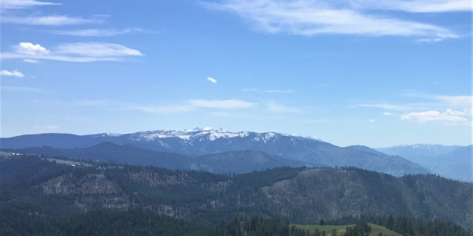
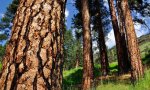
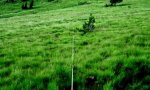
This MLRA is located in Oregon (84 percent), Idaho (11 percent), and Washington (5 percent). It makes up about 14,000 square miles (36,275 square kilometers). It has no large cities or towns. Several National forests are in the MLRA. These forests include the Umatilla, Wallowa-Whitman, Malheur, and Ochoco National Forests in Oregon and parts of the Payette and Nez Perce National Forests in Idaho. The forests have numerous national wilderness areas. The Hells Canyon National Recreation Area, along the Snake River, is in the eastern part of this area. Most of this area is in the Blue Mountain Section of the Columbia Plateaus Province of the Intermontane Plateaus. The western end in Oregon and the northern end in Washington and Idaho are in the Walla Walla Plateau Section of the same province and division. The southernmost part in Oregon extends into the Harney Section and the southern part in Idaho extends into the Payette Section of the same province and division. The middle part of the area in Idaho is in the Northern Rocky Mountains Province of the Rocky Mountain System. Thrust- and block-faulted mountains and deep canyons characterize this area. The central and eastern parts of the area have the steepest mountain slopes, whereas the western and northern parts have more gently rolling mountains. The highest peaks have been sculpted by alpine glaciation, leaving steep slopes and sharp crests. Most of the area is cut by narrow valleys with steep gradients. Some of the larger rivers draining the mountains have wide valley floors. Lakes are common, especially in glaciated areas. The extent of the major Hydrologic Unit Areas (identified by four-digit numbers) that make up this MLRA is as follows: Middle Columbia (1707), 40 percent; Lower Snake (1706), 34 percent; Middle Snake (1705), 18 percent; and Oregon Closed Basins (1712), 8 percent. The headwaters for the John Day, Grande Ronde, and Umatilla Rivers are in this area. The Salmon River crosses the part of this area in Idaho just upstream from its confluence with the Snake River. This MLRA consists of a complex collection of bedrock types that have been faulted and uplifted. These bedrock types include sedimentary, metasedimentary, and volcanic rocks. They range from Mesozoic limestones to Cenozoic volcanics. The rocks consist of limestone, serpentine, greenstone (metamorphic lava), schist, granite, andesite, and basalt. The Wallowa and Seven Devils Mountains are made up dominantly of greenstone (metamorphosed lavas) with some peaks and ridges of limestone. The Wallowa Mountains and the northern end of the Elkhorn Mountains have a core of granite. The Strawberry Mountains are dominantly andesite. The northern one-third of the Blue Mountains has Columbia River Basalt. The lower elevations include Columbia River Basalt and the Clarno and John Day Formations. Pleistocene glaciation has sculpted the higher peaks and filled many of the valleys with glacial till and outwash. The average annual precipitation in most of this area is 12 to 43 inches (305 to 1,090 millimeters), but it can be as much as 82 inches (2,085 millimeters) in the mountains. Summers are dry, except for occasional high-intensity, convective thunderstorms, especially at the higher elevations. Most of the precipitation, in the form of snow, occurs during the fall, winter, and spring. The average annual temperature generally is 34 to 45 degrees F (1 to 7 degrees C), decreasing with elevation. It can be as high as 52 degrees F (11 degrees C) in some of the deeper canyons. The freeze-free period averages 140 days and ranges from 55 to 225 days. The shortest freeze-free periods occur in the mountains, and the longest occur in some of the deeper canyons. Freezing temperatures can occur every month of the year in the mountains. The dominant soil orders in this MLRA include Mollisols and Andisols. The soils in the area have a mesic soil temperature regime at the lower elevations and a frigid or cryic soil temperature regime at the higher elevations. They have a xeric or udic soil moisture regime. Most of the soils have a component of volcanic ash from the Mount Mazama eruption. The soils are shallow to very deep, are very poorly drained to well drained, and have most of the soil texture classes. The soils at the lower elevations in the drier parts of the area are typically Argixerolls, Palexerolls, and Haploxerolls with smectitic mineralogy and are either fine textured or clayey-skeletal. The soils at the slightly higher elevations or in the more protected areas retain the influence of volcanic ash and are Vitrandic Haploxerolls or Vitrandic Argixerolls. The volcanic plateaus in the northeastern part of the area have Argialbolls. The soils in the meadows and on bottom lands are Fluvaquentic Haploxerolls and Cumulic Cryaquolls . Cryorthents, Cryepts, and areas of rock outcrop are on ridges and peaks above timberline. This area is used primarily for timber production, livestock grazing, wildlife habitat, recreation, and watershed. Only a very small area in the valleys is cropland, most of which s irrigated. A large percentage of the area is federally owned and administered by the U.S. Department of Agriculture, Forest Service.
Key publications
Next steps
-
1
Select an ecological site
Select an ecological site using the list, keys, photos, briefcase, or quick search option located on this page. -
2
Explore the ecological site description
Next, learn more about the selected ecological site and its characteristic dynamics by browsing the ecological site description and exploring alternative state and transition model formats.
Ecological site list
-
i
Key Characteristics
- Site is forested
- Sites reside north of the West Fork of the Walla Walla River and north of the South Fork of the Wenaha River and north of the Grand Ronde River, or east of the Snake River
- Site resides in mesic soil temperature regime and xeric soil moisture regime (meaning very warm, dry soil conditions)
-
 ProvisionalF043CY502WA/F043CY502WACool-Frigid, Dry-Xeric, Loamy Mountains (Douglas-fir Cool Dry Grass)i
Key Characteristics
- Site is forested
- Sites reside north of the West Fork of the Walla Walla River and north of the South Fork of the Wenaha River and north of the Grand Ronde River, or east of the Snake River
- Site resides in the frigid soil temperature regime and xeric soil moisture regime (meaning warm, dry soil conditions)
- Frigid or Cool-frigid
- Cool-frigid/dry-xeric
-
i
Key Characteristics
- Site receives subsurface moisture from an adjacent stream, spring or seep
- Water table remains at > 30cm during mid summer
- Valley gradient moderate, shrub/forested communities
-
ProvisionalF043CY503WA/F043CY503WAFrigid, Moist-Xeric Loamy, Canyons and Mountains (Grand fir/Moist Shrub)i
Key Characteristics
- Site is forested
- Sites reside north of the West Fork of the Walla Walla River and north of the South Fork of the Wenaha River and north of the Grand Ronde River, or east of the Snake River
- Site resides in the frigid soil temperature regime and xeric soil moisture regime (meaning warm, dry soil conditions)
- Frigid or Cool-frigid
- Frigid
- Moist-xeric
-
i
Key Characteristics
- Site is forested
- Sites reside north of the West Fork of the Walla Walla River and north of the South Fork of the Wenaha River and north of the Grand Ronde River, or east of the Snake River
- Site resides in the frigid soil temperature regime and xeric soil moisture regime (meaning warm, dry soil conditions)
- Warm-Frigid
- Xeric…EX43CESG02 (Douglas-fir/shrub).
- Not as above
- Basalt geology
-
ProvisionalF043CY505WA/F043CY505WAWarm-Frigid, Xeric, Loamy Eolian Hills and Plateaus (Douglas-fir/ warm dry shrub)i
Key Characteristics
- Site is forested
- Sites reside north of the West Fork of the Walla Walla River and north of the South Fork of the Wenaha River and north of the Grand Ronde River, or east of the Snake River
- Site resides in the frigid soil temperature regime and xeric soil moisture regime (meaning warm, dry soil conditions)
- Warm-Frigid
- Xeric…EX43CESG02 (Douglas-fir/shrub).
- Not as above
- Other geology
- Other geology (dominantly eolian deposits)
-
ProvisionalF043CY506WA/F043CY506WAWarm-Frigid, Xeric Loamy, Granitic, Mountains (Douglas-fir/ warm dry shrub)i
Key Characteristics
- Site is forested
- Sites reside north of the West Fork of the Walla Walla River and north of the South Fork of the Wenaha River and north of the Grand Ronde River, or east of the Snake River
- Site resides in the frigid soil temperature regime and xeric soil moisture regime (meaning warm, dry soil conditions)
- Warm-Frigid
- Xeric…EX43CESG02 (Douglas-fir/shrub).
- Not as above
- Other geology
- Granitic geology
-
ProvisionalF043CY507WA/F043CY507WAWarm-Frigid, Xeric Loamy, Hills and Plateaus, High WT (Douglas-fir/ warm dry shrub)i
Key Characteristics
- Site is forested
- Sites reside north of the West Fork of the Walla Walla River and north of the South Fork of the Wenaha River and north of the Grand Ronde River, or east of the Snake River
- Site resides in the frigid soil temperature regime and xeric soil moisture regime (meaning warm, dry soil conditions)
- Warm-Frigid
- Xeric…EX43CESG02 (Douglas-fir/shrub).
- High water table
-
ProvisionalF043CY508WA/F043CY508WAFrigid, Xeric, Loamy, Mountains and Plateaus, Mixed Ash Surface Grand fir/pinegrassi
Key Characteristics
- Site is forested
- Sites reside north of the West Fork of the Walla Walla River and north of the South Fork of the Wenaha River and north of the Grand Ronde River, or east of the Snake River
- Site resides in the frigid soil temperature regime and xeric soil moisture regime (meaning warm, dry soil conditions)
- Frigid or Cool-frigid
- Frigid
- Xeric…EX043CESG01 (grand fir/pinegrass)
- Mixed ash surface
-
ProvisionalF043CY509WA/F043CY509WAFrigid, Xeric, Loamy Mountains and Plateaus, Ashy Surface Grand fir/pinegrassi
Key Characteristics
- Site is forested
- Sites reside north of the West Fork of the Walla Walla River and north of the South Fork of the Wenaha River and north of the Grand Ronde River, or east of the Snake River
- Site resides in the frigid soil temperature regime and xeric soil moisture regime (meaning warm, dry soil conditions)
- Frigid or Cool-frigid
- Frigid
- Xeric…EX043CESG01 (grand fir/pinegrass)
- Ashy surface
-
i
Key Characteristics
- Site is forested
- Sites reside north of the West Fork of the Walla Walla River and north of the South Fork of the Wenaha River and north of the Grand Ronde River, or east of the Snake River
- Site resides in frigid soil temperature regime and udic soil moisture regime (meaning warm, moist soil conditions)
- Basalt geology
- Mixed ash surface
-
ProvisionalF043CY512WA/F043CY512WAFrigid, Dry-Udic, Loamy, Hills, and Canyons, Mixed Ash (grand fir/moist herb)i
Key Characteristics
- Site is forested
- Sites reside north of the West Fork of the Walla Walla River and north of the South Fork of the Wenaha River and north of the Grand Ronde River, or east of the Snake River
- Site resides in frigid soil temperature regime and udic soil moisture regime (meaning warm, moist soil conditions)
- Other geology
- Mixed ash surface
-
ProvisionalF043CY513WA/F043CY513WAFrigid, Dry-Udic, Loamy, Mountains, and Canyons, Ashy Surface (grand fir/moist herb)i
Key Characteristics
- Site is forested
- Sites reside north of the West Fork of the Walla Walla River and north of the South Fork of the Wenaha River and north of the Grand Ronde River, or east of the Snake River
- Site resides in frigid soil temperature regime and udic soil moisture regime (meaning warm, moist soil conditions)
- Other geology
- Ashy surface
-
ProvisionalF043CY514WA/F043CY514WACryic, Dry-Udic Mountains and Ridges (Subalpine Fir cold dry shrub)i
Key Characteristics
- Site is forested
- Sites reside north of the West Fork of the Walla Walla River and north of the South Fork of the Wenaha River and north of the Grand Ronde River, or east of the Snake River
- Site resides in the cryic soil temperature regime and the udic soil moisture regime (meaning cold, moist soil conditions)
- Warm-Cryic transition zone
- Dry-udic
-
i
Key Characteristics
- Site is forested
- Sites reside north of the West Fork of the Walla Walla River and north of the South Fork of the Wenaha River and north of the Grand Ronde River, or east of the Snake River
- Site resides in the cryic soil temperature regime and the udic soil moisture regime (meaning cold, moist soil conditions)
- Warm-Cryic transition zone
- Udic… EX43CESG04 (Subalpine Fir-Mountain Hemlock/ Cool Moist Shrub)
- Basalt geology
- Ashy surface
-
i
Key Characteristics
- Site is forested
- Sites reside north of the West Fork of the Walla Walla River and north of the South Fork of the Wenaha River and north of the Grand Ronde River, or east of the Snake River
- Site resides in the cryic soil temperature regime and the udic soil moisture regime (meaning cold, moist soil conditions)
- Warm-Cryic transition zone
- Udic… EX43CESG04 (Subalpine Fir-Mountain Hemlock/ Cool Moist Shrub)
- Basalt geology
- Mixed ash surface
-
ProvisionalF043CY518WA/F043CY518WAWarm-Cryic, Udic, Loamy, Mountains, Ashy surface (subalpine fir/cool moist shrub)i
Key Characteristics
- Site is forested
- Sites reside north of the West Fork of the Walla Walla River and north of the South Fork of the Wenaha River and north of the Grand Ronde River, or east of the Snake River
- Site resides in the cryic soil temperature regime and the udic soil moisture regime (meaning cold, moist soil conditions)
- Warm-Cryic transition zone
- Udic… EX43CESG04 (Subalpine Fir-Mountain Hemlock/ Cool Moist Shrub)
- Other geology
- Ashy surface
-
ProvisionalF043CY519WA/F043CY519WAWarm-Cryic, Udic, Loamy, Mountains, Mixed Ash (subalpine fir/cool moist shrub)i
Key Characteristics
- Site is forested
- Sites reside north of the West Fork of the Walla Walla River and north of the South Fork of the Wenaha River and north of the Grand Ronde River, or east of the Snake River
- Site resides in the cryic soil temperature regime and the udic soil moisture regime (meaning cold, moist soil conditions)
- Warm-Cryic transition zone
- Udic… EX43CESG04 (Subalpine Fir-Mountain Hemlock/ Cool Moist Shrub)
- Other geology
- Mixed ash surface
-
i
Key Characteristics
- Site is forested
- Sites reside south of the West Fork of the Walla Walla River and south of the South Fork of the Wenaha River and south of the Grand Ronde River and west of the Snake River
- Dry days: <45
- Temperature regime is cryic, moisture regime is udic. Commonly occurs on very high elevation forested backslopes
-
i
Key Characteristics
- Site is forested
- Sites reside south of the West Fork of the Walla Walla River and south of the South Fork of the Wenaha River and south of the Grand Ronde River and west of the Snake River
- Dry days: <45
- Temperature regime is frigid, moisture regime is udic. Commonly occurs on high elevation forested backslopes
-
i
Key Characteristics
- Site is forested
- Sites reside south of the West Fork of the Walla Walla River and south of the South Fork of the Wenaha River and south of the Grand Ronde River and west of the Snake River
- Dry days: 45-60
- Temperature regime is frigid, moisture regime is xeric
-
i
Key Characteristics
- Site is forested
- Sites reside south of the West Fork of the Walla Walla River and south of the South Fork of the Wenaha River and south of the Grand Ronde River and west of the Snake River
- Dry days: 60-90
- Soil temperature regime is frigid, moisture regime is xeric
- Soils typically have an AWC of greater than 1 inch in the upper ten inches
-
i
Key Characteristics
- Site is forested
- Sites reside south of the West Fork of the Walla Walla River and south of the South Fork of the Wenaha River and south of the Grand Ronde River and west of the Snake River
- Dry days: 60-90
- Soil temperature regime is frigid, moisture regime is xeric
- Not as above
-
i
Key Characteristics
- Site is forested
- Sites reside south of the West Fork of the Walla Walla River and south of the South Fork of the Wenaha River and south of the Grand Ronde River and west of the Snake River
- Dry days: 60-90
- Soil temperature regime is mesic, moisture regime is xeric
-
i
Key Characteristics
- Site receives subsurface moisture from an adjacent stream, spring or seep
- Water table remains at > 30cm during mid summer
- Valley gradient very low or low, meadow communities
-
i
Key Characteristics
- Site receives subsurface moisture from an adjacent stream, spring or seep
- Water table recedes to < 30cm by mid summer
- Temperature regime is frigid or cryic, moisture regime is xeric or udic
-
i
Key Characteristics
- Site is rangeland (or juniper woodland)
- Temperature regime is cryic
- Temperature regime is cryic, moisture regime is xeric or udic
-
i
Key Characteristics
- Site is rangeland (or juniper woodland)
- Temperature regime is frigid
- Not as above
- Not as above
- Not as above
- Soils have a maritime climate with damaging winter frosts
-
i
Key Characteristics
- Site is rangeland (or juniper woodland)
- Temperature regime is frigid
- Not as above
- Not as above
- Not as above
- Soils have a continental climate
-
i
Key Characteristics
- Site is rangeland (or juniper woodland)
- Temperature regime is frigid
- Not as above
- Not as above
- Soils are generally shallow or very shallow over fractured bedrock interspersed with areas of rock outcrop. Soils may also have lower Ca/Mg ratios
-
i
Key Characteristics
- Site is rangeland (or juniper woodland)
- Temperature regime is frigid
- Not as above
- Soils are very shallow over lithic bedrock
- Soils have a continental climate
-
i
Key Characteristics
- Site is rangeland (or juniper woodland)
- Temperature regime is frigid
- Not as above
- Soils are very shallow over lithic bedrock
- Soils have a maritime climate with damaging winter frosts
-
i
Key Characteristics
- Site is rangeland (or juniper woodland)
- Temperature regime is frigid
- Soil has an abrupt textural change within 10 inches of the surface (Well-developed claypan)
-
i
Key Characteristics
- Site is rangeland (or juniper woodland)
- Temperature regime is mesic or frigid near mesic
- Soils occur on foothills or mountains
-
i
Key Characteristics
- Site is rangeland (or juniper woodland)
- Temperature regime is mesic or frigid near mesic
- Soils occur in canyons on fans or alluvial benches
Ecological site map
Basemap
Find me
Find point
Full screen
Zoom in to display soil survey map units for an area of interest, and zoom out to display MLRAs. Select a map unit polygon to view ecological sites correlated to that map unit. View a brief description of an ecological site by clicking on its name in the map popup. Soil survey correlations may not be accurate, and ecological site classification of a location should always be verified in the field. Each selection may require the transfer of several hundred KB of data.
Ecological site keys
Ecological site photos
Print Options
Sections
Font
Other
Briefcase
Add ecological sites and Major Land Resource Areas to your briefcase by clicking on the briefcase (![]() ) icon wherever it occurs. Drag and drop items to reorder. Cookies are used to store briefcase items between browsing sessions. Because of this, the number of items that can be added to your briefcase is limited, and briefcase items added on one device and browser cannot be accessed from another device or browser. Users who do not wish to place cookies on their devices should not use the briefcase tool. Briefcase cookies serve no other purpose than described here and are deleted whenever browsing history is cleared.
) icon wherever it occurs. Drag and drop items to reorder. Cookies are used to store briefcase items between browsing sessions. Because of this, the number of items that can be added to your briefcase is limited, and briefcase items added on one device and browser cannot be accessed from another device or browser. Users who do not wish to place cookies on their devices should not use the briefcase tool. Briefcase cookies serve no other purpose than described here and are deleted whenever browsing history is cleared.
Ecological sites
Major Land Resource Areas
The Ecosystem Dynamics Interpretive Tool is an information system framework developed by the USDA-ARS Jornada Experimental Range, USDA Natural Resources Conservation Service, and New Mexico State University.