Natural Resources
Conservation Service
Ecological site R047XA305UT
Upland Stony Loam (Utah juniper)
Last updated: 2/05/2025
Accessed: 04/03/2026
General information
Provisional. A provisional ecological site description has undergone quality control and quality assurance review. It contains a working state and transition model and enough information to identify the ecological site.
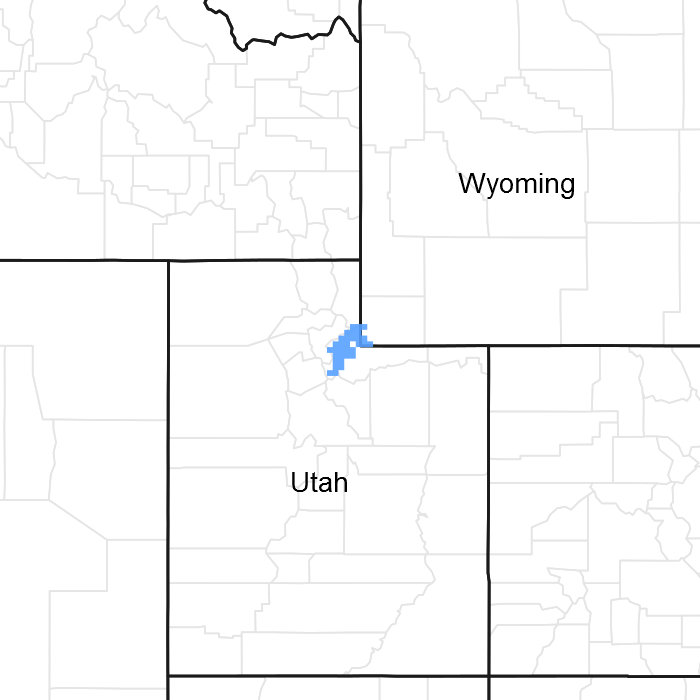
Figure 1. Mapped extent
Areas shown in blue indicate the maximum mapped extent of this ecological site. Other ecological sites likely occur within the highlighted areas. It is also possible for this ecological site to occur outside of highlighted areas if detailed soil survey has not been completed or recently updated.
MLRA notes
Major Land Resource Area (MLRA): 047X–Wasatch and Uinta Mountains
MLRA 47 occurs in Utah (86 percent), Wyoming (8 percent), Colorado (4 percent), and Idaho (2 percent). It encompasses approximately 23,825 square miles (61,740 square kilometers). The northern half of this area is in the Middle Rocky Mountains Province of the Rocky Mountain System. Parts of the western edge of this MLRA are in the Great Basin Section of the Basin and Range Province of the Intermontane Plateaus. The MLRA includes the Wasatch Mountains, which trend north and south. The steeply sloping, precipitous Wasatch Mountains have narrow crests and deep valleys. Active faulting and erosion are a dominant force in controlling the geomorphology of the area.
The mountains in this area are primarily fault blocks that have been tilted up. Alluvial fans at the base of the mountains are recharge zones for the basin fill aquifers. An ancient shoreline of historic Bonneville Lake is evident on the footslopes along the western edge of the area. Rocks exposed in the mountains are mostly Mesozoic and Paleozoic sediments.
The average precipitation is from 12 to 16 inches in the valleys and can range up to 73 inches in the mountains. Peak precipitation occurs in the winter months. The average annual temperature is 30 to 50 degrees Fahrenheit (-1 to 15 C). The freeze-free period averages 140 days and ranges from 60 to 220 days, generally decreasing in length with elevation.
The dominant soil orders in this MLRA are Entisols, Inceptisols, and Mollisols. The lower elevations are dominated by a frigid temperature regime, while the higher elevations experience cryic temperature regimes. The soil moisture regime is typically xeric. The minerology is generally mixed and the soils are very shallow to very deep, generally well drained, and loamy or loamy-skeletal.
LRU notes
This LRU includes the Wasatch Mountains which tend to run north and south. These steeply sloping, precipitous mountains have narrow crests and deep valleys. They are primarily fault blocks that have been tilted up. The alluvial fans located at the base of these mountains are important recharge zones for valley aquifers.
Classification relationships
Modal Soil: Bequinn Family GVR-L, 25-70% — loamy-skeletal, mixed (calcareous) frigid Xeric Torriorthents
Ecological site concept
The soils for this site formed in colluvium and slope alluvium or colluvium over residuum derived from sandstone and other sedimentary rock. They are shallow to moderately deep having bedrock within 20 to 40 inches of the soil surface. They are well-drained and moderately slow to moderate in terms of permeability. Surface textures are loamy and usually contain gravels or channers. However, rock fragments may or may not be present on the soil surface and throughout the profile. These soils are calcareous and have a pH range of 7.4 to 8.4. The water holding capacity ranges from 0.8 inches on shallower soils to 4.3 inches on deeper soils. The soil moisture regime is aridic xeric and the soil temperature regime is frigid bordering on mesic.
Associated sites
| R047XA301UT |
Upland Clay Loam (early sagebrush) |
|---|---|
| R047XA308UT |
Upland Loam (basin big sagebrush) |
| R047XA338UT |
Upland Stony Loam (Wyoming big sagebrush) |
Similar sites
| R047XA336UT |
Upland Stony Loam (pinyon/Utah juniper) This site has Pinyon pine as well as Utah juniper. |
|---|
Table 1. Dominant plant species
| Tree |
(1) Juniperus osteosperma |
|---|---|
| Shrub |
Not specified |
| Herbaceous |
(1) Pseudoroegneria spicata |

Click on box and path labels to scroll to the respective text.
Ecosystem states
| T1a | - | introduction of exotic species |
|---|---|---|
| T2a | - | harvesting for fence posts and firewood and heavy continuous season-long grazing by cattle |
| T3a | - | Wildfire |