Ecological dynamics
The following are the narratives for each of the described plant communities. These plant communities may not represent every possibility, but they probably are the most prevalent and repeatable plant communities. As more data is collected, some of these plant communities way be revised or removed, and new ones may be added. None of these plant communities should necessarily be thought of as the “desired plant community”. According to the USDA NRCS National Range and Pasture Handbook, the desired plant community will be determined be the decision makers and will meet minimum quality criteria established by the NRCS. The main purpose for including any description of a plant community here is to capture the current knowledge and experience at the time of this revision.
All of these scenarios are very interrelated and dependent on weather patterns and events as well as fire frequency and intensity. The fire frequency should be around 30 to 55 years. Any set of events that are strong enough to force the plant community out of this pattern can push it over a threshold and into another state.
State 1
Reference State
This state includes the plant communities that were best adapted to the unique combination of factors associated with this ecological site prior to European settlement. It was in a natural dynamic equilibrium with the historic biotic, abiotic, climatic factors on its ecological site in North America at the time of European immigration and settlement. This dominant aspect of the plant community is Bonneville big sagebrush and bluebunch wheatgrass. The community is made up of 55 percent grasses, 25 percent forbs, and 20 percent shrubs on a dry weight base.
All of these scenarios are very interrelated and dependent on weather patterns and events as well as fire frequency and intensity. The fire frequency should be around 30 to 55 years. Any set of events that are strong enough to force the plant community out of this pattern can push it over a threshold and into another state.
Community 1.1
Bonneville big sagebrush . Perennial Cool-season Grasses Forbs Other Native Shrubs
Bonneville big sagebrush, perennial cool-season grasses, forbs and other shrubs: This is the community that is described in the initial plant list. This community is represented with 55 percent grasses, 25 percent forbs, and 20 percent shrubs. The dominant shrub visually and in production is Bonneville big sagebrush. The dominant grass is bluebunch wheatgrass and the dominant forb, visually, is arrowleaf balsamroot. This community is strong and maintains 10 to 15 percent bare ground and surface rock fragments.
Table 5. Annual production by plant type
| Plant type |
Low
(lb/acre) |
Representative value
(lb/acre) |
High
(lb/acre) |
| Grass/Grasslike |
500 |
1000 |
1485 |
| Forb |
225 |
450 |
675 |
| Shrub/Vine |
180 |
500 |
550 |
| Total |
905 |
1950 |
2710 |
Table 6. Canopy structure (% cover)
| Height Above Ground (ft) |
Tree |
Shrub/Vine |
Grass/
Grasslike |
Forb |
| <0.5 |
– |
0% |
5-10% |
10-15% |
| >0.5 <= 1 |
– |
3-5% |
10-15% |
10-20% |
| >1 <= 2 |
– |
10-35% |
10-15% |
5-15% |
| >2 <= 4.5 |
– |
5-10% |
5-10% |
5-15% |
| >4.5 <= 13 |
– |
– |
0-5% |
– |
| >13 <= 40 |
– |
– |
– |
– |
| >40 <= 80 |
– |
– |
– |
– |
| >80 <= 120 |
– |
– |
– |
– |
| >120 |
– |
– |
– |
– |
Community 1.2
Bonneville big sagebrush Other Native Shrubs Perennial Cool-season Grasses = Forbs
Bonneville big sagebrush, other native shrubs, perennial cool-season grasses, and forbs: This community shows up when there is a period of time when the Bonneville big sagebrush increases to where it is suppressing the understory and other shrubs, (notably mountain snowberry, antelope bitterbrush and Utah serviceberry) increase which also helps to suppress the herbaceous understory. This community is strong enough to maintain 10 to 20 percent bare ground and surface rock fragments.
Community 1.3
Antelope bitterbrush Perennial Cool-season Grasses Forbs Fire Tolerant Shrubs
Antelope bitterbrush, perennial cool-season grasses, forbs, and fire tolerant shrubs: With this community the initial plant list fits except that due to fire (usually mid-temperature fast moving fire, associated with summer convection thunderstorms) removes the Bonneville big sagebrush and is replaced with antelope bitterbrush. It takes about five to ten years and a proper episodic weather event year to get the sagebrush to move back into the site. This community maintains 10 to 15 percent bare ground and surface rock fragments.
Community 1.4
Perennial Cool-season Grasses Forbs Fire Tolerant Shrubs
Perennial cool-season grasses, forbs and fire tolerant shrubs: This community usually occurs when there is a hot erratically moving fire that heats the ground to the point where it damages the antelope bitterbrush so that it cannot take the dominant community position. The plant community is represented with 65 percent grasses, 25 percent forbs, and 10 percent shrubs. The initial plant list of grasses and forbs will be quite accurate in this community. This community will likely have around 15 to 20 percent bare ground and surface rock fragments.
Pathway 1.1a
Community 1.1 to 1.2
Time without catastrophic event. This was probably dependent on a specific chain of climatic events.
Pathway 1.1b
Community 1.1 to 1.3
Fire: Normally mid-Summer. A fire that is hot enough and fast enough moving to kill the sagebrush and stimulate the antelope bitterbrush.
Pathway 1.1c
Community 1.1 to 1.4
Fire; insects; prolonged drought; pathogens that kills or reduces the dominant shrub overstory. Fire is the most effective of these disturbances
Pathway 1.2a
Community 1.2 to 1.3
Fire: Normally mid-summer. A fire that is hot enough and fast enough moving to kill the sagebrush and stimulate the antelope bitterbrush.
Pathway 1.2b
Community 1.2 to 1.4
Fire; insects; prolonged drought; pathogens that kills or reduces the dominant shrub overstory. Fire is the most effective of these disturbances
Pathway 1.3b
Community 1.3 to 1.1
Time without catastrophic event. This was probably dependent on a specific chain of climatic events.
Pathway 1.3a
Community 1.3 to 1.4
Fire; insects; prolonged drought; pathogens that kills or reduces the dominant shrub overstory. Fire is the most effective of these disturbances
Pathway 1.4a
Community 1.4 to 1.1
Time without catastrophic event. This was probably dependent on a specific chain of climatic events.
State 2
Current Potential State
This state includes the biotic communities that would become established on the ecological site if all successional sequences were completed without interferences by man under the present environmental conditions. Natural disturbances are inherent in its development. The Current Potential State (CPS) will include acclimatized, naturalized or invasive nonnative species. There is no known way to effectively remove these plants from the site once they have become established. The level of occurrence of these plants in the CPS is such that careful management can prevent their domination of the site. This site is irreversibly changed. Plant communities within the CPS state may be managed and used for various purposes by man without significant alteration in plant community composition or production. It includes all of the plant communities that exist in the RPC state with the inclusion of species that are non-native to this ESD. These non-native plants are not to be considered when considering plants for the rangeland health site evaluation.
The initial Plant List of Grasses and Forbs will be quite accurate in this community also. This community will likely have around 15 to 20 percent bare ground and surface rock fragments.
All of these scenarios are very interrelated and dependent on weather patterns and events as well as fire frequency and intensity. The fire frequency should be around 30 to 55 years. Any set of events that are strong enough to force the plant community out of this pattern can push it over a threshold and push it into another state.
Community 2.1
Bonneville big sage > Perennial Cool Season Grass > Forbs > Other Native Shrubs > Non-Native Species
Bonneville big sagebrush, Perennial cool season grasses, Forbs and other shrubs: This is the Community that is described in the initial Plant List. This community is represented with 55% grasses, 25% Forbs and 20% Shrubs. The dominant shrub visually and in production is Bonneville big sagebrush. The dominant grass is Bluebunch wheatgrass and the dominant Forb visually is Arrowleaf balsamroot. This community is strong enough to only have around 10 – 15% bare ground and surface rock fragments. This community will have notable amounts of non-native species shown above as well as others not mentioned.
Community 2.2
Bonneville big sage > Other Native Shrubs > Perennial Cool Season grass >= Forb > Non-Native Species
Bonneville big sagebrush, other native shrubs, Perennial cool season grasses, and Forbs: This Community is shows up when there is a period of time when the Bonneville big sagebrush increases to where it is suppressing the understory and other shrubs (notably) Mountain snowberry, Antelope bitterbrush and Utah serviceberry increase which also helps to suppress the herbaceous understory. This community is strong enough to only have around 10 – 20% bare ground and surface rock fragments. This community will have notable amounts of non-native species shown above as well as others not mentioned.
Community 2.3
Antelope bitterbrush > Perennial Cool Season Grass > Forb > Fire Tolerant Shrub > N0n-Native Species
Antelope bitterbrush, Perennial cool season grasses, Forbs and Fire tolerant shrubs: With this community the initial plant list fits except that due to fire (usually mid temperature fast moving fire, of the kind that would be associated with Summer convection thunder storms) the Bonneville big sagebrush has been removed and replaced with Antelope bitterbrush. It takes about five to ten years and a proper episodic weather event year to get the sagebrush to move back into the site. This community will have notable amounts of non-native species shown above as well as others not mentioned.
Community 2.4
Perennial Cool Season Grass > Forbs > Fire Tolerant Shrubs > Non-Native Species
Perennial cool season grasses, Forbs and Fire tolerant shrubs: This community usually occurs when there is a hot erratically moving fire that heats the ground to the point where it damages the antelope bitterbrush so that it cannot take the dominant community position. The plant community is represented with 65% grasses, 25% forbs and 10% shrubs. This community will have notable amounts of non-native species shown above as well as others not mentioned.
Pathway 2.1a
Community 2.1 to 2.2
Time without catastrophic event. This was probably dependent on a specific chain of climatic events
Pathway 2.1b
Community 2.1 to 2.3
Fire: Normally mid-Summer. A fire that is hot enough and fast enough moving to kill the
sagebrush and stimulate the antelope bitterbrush.
Pathway 2.1c
Community 2.1 to 2.4
Fire; insects; prolonged drought; pathogens that kills and/or reduces the
dominant shrub overstory. Also overgrazing with or without drought over a prolonged period of time Fire and/or overgrazing are the most common of these disturbances
Pathway 2.2a
Community 2.2 to 2.3
Fire: Normally mid-Summer. A fire that is hot enough and fast enough moving to kill the sagebrush and stimulate the antelope bitterbrush.
Pathway 2.2b
Community 2.2 to 2.4
Fire; insects; prolonged drought; pathogens that kills and/or reduces the dominant shrub
overstory. Also overgrazing with or without drought over a prolonged period of time Fire and/or overgrazing are the most common of these disturbances
Pathway 2.3b
Community 2.3 to 2.1
Time without catastrophic event. This was probably dependent on a specific chain of climatic events
Pathway 2.3a
Community 2.3 to 2.4
Fire; insects; prolonged drought; pathogens that kills and/or reduces the dominant shrub
overstory. Also overgrazing with or without drought over a prolonged period of time Fire and/or overgrazing are the most common of these disturbances
Pathway 2.4a
Community 2.4 to 2.1
Time without catastrophic event. This was probably dependent on a specific chain of climatic events
State 3
Utah Juniper / Invasive Annuals State
This state has only two described plant communities but many variations of the represented ones are present. The lack of fire with a source of Utah Juniper and maybe a source of pinyon seed insight the move to this state. Movement from community phase to community phase can and often is accelerated by overgrazing. The dominant drivers of the plant community is Utah Juniper and cheatgrass. This state can persist for a long time until extreme conditions needed for a wildfire occur or some other management treatment is implemented.
Community 3.1
Utah Juniper Bonneville big sagebrush Native Perennials Invasive Annuals
This community has a strong overstory of Utah Juniper and Singleleaf pinyon but still has an understory similar to Community 2.1. This community will have around 20 to 35 percent bare ground and surface rock fragments. Fire is the surest means to bring this community back toward the Current Potential State.
Community 3.2
Utah Juniper Invasive Annuals
This community is present when 99 to 100 percent of the native plants have been removed from the plant community and only pinyon pine and Utah juniper with a sparse understory of invasive annuals are left on the site. This community will have around 35 to 85 percent bare ground and surface rock fragments.
Pathway 3.1a
Community 3.1 to 3.2
Overgrazing with or without drought over a prolonged period of time
Pathway 3.2a
Community 3.2 to 3.1
Fire; insects; prolonged drought; pathogens that kills or reduces the dominant shrub
overstory. Fire is the most effective of these disturbances
State 4
Yellow rabbitbrush / Invasive Annuals State
This is the state that this plant community will move to when it is in an over-grazed or drought condition and then burned (wild or controlled) and not seeded. The dominant aspect of the plant community is cheatgrass, yellow rabbitbrush with a very small amount of Bonneville big sagebrush. The community will usually be made up of 70 percent cheatgrass, 10 percent forbs, and 20 percent yellow rabbitbrush with minor components of other shrubs.
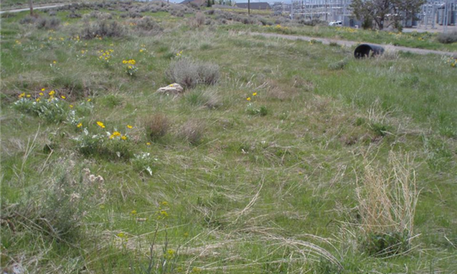
Community 4.1
Yellow rabbitbrush Invasive Annuals Native Perennials

Figure 6. R047XA306 State 4 phase 4.1
Yellow rabbitbrush, invasive annuals, native perennials: This plant community consists of approximately 40 percent yellow rabbitbrush, 45 percent invasive annuals, and 10 percent native perennials with a small component of other species. This community will have around 20 to 35 percent bare ground and surface rock fragments.
Community 4.2
Invasive Annuals
Invasive annuals: This plant community consists of approximately 85 percent invasive annuals (mostly cheatgrass and Japanese brome (field brome)), and 10 percent native perennials with a small component of other species. This community will have around 20 to 40 percent bare ground and surface rock fragments.
Pathway 4.1a
Community 4.1 to 4.2
Increased fire frequency (from a 10 to 15 year interval to a 3 to 5 year fire return interval) and intensity without follow-up management. Overgrazing can move this change along faster. The Yellow rabbitbrush / Invasive annuals Community (5.1), the fire frequency will remain at a 3 to 5 year interval. This condition is self-sustaining and the site will keep deteriorating until the site potential is lost. This will continue unless a large amount of energy is injected into the system to cause a change to take place.
Pathway 4.2a
Community 4.2 to 4.1
Time and management of grazing alone or along with other disturbances where human or naturalized introduction of native and introduced perennial plant species takes place.
State 5
Seeded Range State
This state exists when the site is cultivated or burned, and planted to introduced and, in some situations, native grasses and forbs.
Community 5.1
Introduced Perennial Plants
The plant community here consists of introduced or native grasses and forbs. It is normally as productive as the site is in the Current Potential State.
Community 5.2
Native Shrubs = Introduced Perennial Plants
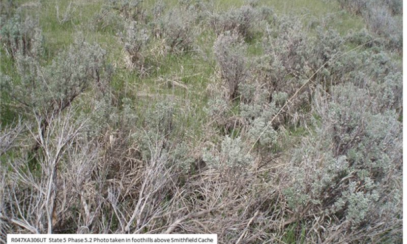
Figure 7. R047XA306 State 5 Phase 5.2
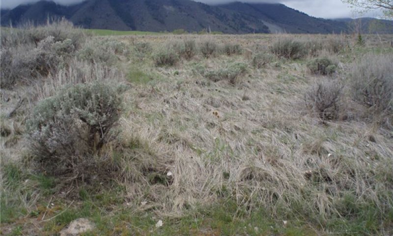
Figure 8. R047XA306 State 5 Phase 5.2
This site comes into existence when weather conditions create the kind of episodic situation that allows Bonneville big sagebrush to move back into the site.
Pathway 5.1a
Community 5.1 to 5.2
Time without catastrophic event. This was probably dependent on a specific chain of climatic events
Pathway 5.2a
Community 5.2 to 5.1
Time and management of grazing alone or along with other disturbances where human intervention takes place to move the community back.
Transition T1a
State 1 to 2
Introduction of non-native species into the ecosystem.
Transition T2a
State 2 to 3
Prolonged Drought, Overgrazing, Extreme lengthening of the fire interval frequency. This takes place when the sagebrush canopy gets so heavy that it destroys the perennial grass and forb understory and the fire frequency is increased from a 20 to 40 year interval to a 60 to 90 year fire return interval, and the introduction of Utah juniper.
Transition T2b
State 2 to 4
Continued overgrazing and increase of fire frequency over a prolonged period of time. (8 to 12 year fire frequency interval)
Transition T2c
State 2 to 5
Human caused disturbance (mechanical treatment and seeding; chemical treatment and seeding. etc.)
Transition T3a
State 3 to 4
Continued overgrazing and increase of fire frequency over a prolonged period of time. (8 to 12 year fire frequency interval)
Transition T3b
State 3 to 5
Human caused disturbance (mechanical treatment and seeding; chemical treatment and seeding. etc.)
Transition T4b
State 4 to 3
Prolonged Drought, Overgrazing, Extreme lengthening of the fire interval frequency. This takes place when the understory gets so depleted and the perennial grass and forb understory have been destroyed. At this time the fire frequency will increase from a 20 to 40 year interval to a 60 to 90 year fire return interval, because of the amount of bare ground and the introduction of Utah juniper.
Transition T4a
State 4 to 5
Human caused disturbance (mechanical treatment and seeding; chemical treatment and seeding. etc.)
Restoration pathway R5a
State 5 to 2
Time with proper management that favors the re-establishment of native plants in the site.
| Prescribed Grazing |
|
| Grazing Management Plan - Applied |
|
Transition T5a
State 5 to 3
Prolonged Drought, Overgrazing, Extreme lengthening of the fire interval frequency. This takes place when the sagebrush canopy gets so heavy that it destroys the perennial grass and forb under story and the fire frequency is increased from a 20 to 40 year interval to 60 to 90 year fire return interval, and the introduction of Utah juniper.