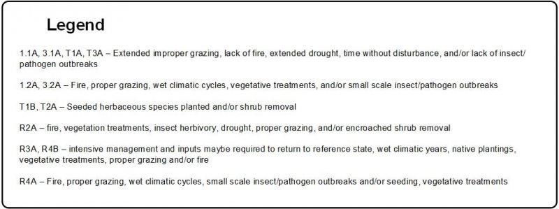
Provisional. A provisional ecological site description has undergone quality control and quality assurance review. It contains a working state and transition model and enough information to identify the ecological site.
MLRA notes
Major Land Resource Area (MLRA): 048A–Southern Rocky Mountains
MLRA 48A makes up about 45,920 square miles (119 000 square kilometers). It is in the Southern Rocky Mountains province, which is east of the Colorado Plateau, south of the Wyoming Basin, west of the Great Plains, and north of the Rio Grande rift. MLRA 48A is in western and central Colorado, southeastern Wyoming, eastern Utah, and northern New Mexico. The headwaters of major rivers, including the Colorado, Yampa, Arkansas, Rio Grande, North Platte, and South Platte Rivers are in this MLRA. It has numerous national forests, including the Medicine Bow National Forest in Wyoming; the Routt, Arapaho, Roosevelt, Pike, San Isabel, White River, Gunnison, Grand Mesa, Uncompahgre, Rio Grande, and San Juan National Forests in Colorado; and the Carson National Forest and part of the Santa Fe National Forest in New Mexico. Rocky Mountain National Park also is in this MLRA.
MLRA 48A is in the southern Rocky Mountains physiographic region. The Southern Rocky Mountains consist primarily of two belts of strongly sloping to precipitous mountain ranges trending north to south. Several basins, or parks, are between the belts. Some high mesas and plateaus are included. The mountains were uplifted during the Laramide orogeny and then were subject to periods of glaciation. The ranges include the Sangre de Cristo Mountains, Laramie Mountains, and Front Range in the east and the San Juan Mountains and Sawatch and Park Ranges in the west. The ranges are dissected by many narrow stream valleys that have steep gradients. In some areas, the upper mountain slopes and broad crests are covered by snowfields and glaciers. Elevation of the MLRA typically is 6,500 to 14,400 feet (1980 to 4390 meters). The part of the MLRA in central Colorado includes the highest point in the Rocky Mountains, Mount Elbert, which reaches an elevation of 14,433 feet (4400 meters). More than 50 peaks in this part of the MLRA are at an elevation of more than 14,000 feet (4270 meters). Many small glacial lakes are in the high mountains.
The mountains in this MLRA were formed mainly by crustal uplifts during the late Cretaceous and early Tertiary periods. This large MLRA can be subdivided into at least four general divisions. The first division includes the Rocky Mountains in the eastern part of this area, called the Front Range. This range is a fault block that has been tilted on edge and uplifted and is dominantly igneous and metamorphic rock. It was tilted on the east edge, so a steep front is on the east side and more gentle slopes are on the west side. In the southeast part, the exposed rock is mostly Precambrian igneous and metamorphic. The second division is the tertiary rock, primarily basalt and andesitic lava flows, tuff, breccia, and conglomerate, throughout the San Juan Mountains area. The third division is the northwest part of the MLRA, which is dominantly sedimentary rock from the Cretaceous and Tertiary periods and the Permian and Pennsylvanian periods. The fourth division is the long, narrow Sangre de Cristo Mountains uplifted during the Cenozoic era between the Rio Grande rift and the Great Plains. Many of the highest mountain ranges were reshaped by glaciation during the Pleistocene. Alluvial fans at the base of the mountains are recharge zones for local basin and valley-fill aquifers and are an important source of sand and gravel.
The average annual precipitation is dominantly 12 to 63 inches. Summer rainfall commonly occurs as high-intensity, convective thunderstorms. About one-half of the annual precipitation is received as snow in winter; the proportion increases as elevation increases. In the mountains, deep snowpack accumulates in winter and generally persists until spring or early in summer, depending on elevation. Some permanent snowfields and small glaciers are on the highest mountain peaks. In the valleys at the lower elevations, snowfall is lighter and snowpack may be intermittent. The average annual temperature is 26 to 54 degrees F (-3 to 12 degrees C). The freeze-free period averages 135 days, but it ranges from 45 to 230 days, decreasing in length as elevation increases. The climate of this MLRA varies according to the elevation. Precipitation is higher and temperatures are cooler at the higher elevations. The plant communities vary according to elevation, aspect, and latitude due to variations in the kind and timing of the precipitation and the temperature.
The dominant soil orders in this MLRA are Mollisols, Alfisols, Inceptisols, and Entisols. The soils in the area dominantly have a frigid or cryic soil temperature regime and an ustic or udic soil moisture regime. Mineralogy typically is mixed, smectitic, or paramicaceous. In areas of granite, gneiss, and schist bedrock, Glossocryalfs (Seitz, Granile, and Leadville series) and Haplocryolls (Rogert series) formed in colluvium on the mountain slopes and Dystrocryepts (Leighcan and Mummy series) formed on mountain slopes and summits at the higher elevations. In areas of andesite and rhyolite bedrock, Dystrocryepts (Endlich and Whitecross series) formed in colluvium on the mountain slopes. In areas of sedimentary bedrock, Haplustolls (Towave series) formed on the mountain slopes at low elevations that receive a low amount of precipitation. Haplocryolls (Lamphier and Razorba series), Argicryolls (Cochetopa series), and Haplocryalfs (Needleton series) formed in colluvium on the mountain slopes at high elevations.
LRU notes
This site occurs only in the Gunnison Basin Land Resource Unit. The Gunnison Basin is a valley with hills that occurs along the frigid/cryic temperature break and the aridic bordering on ustic/typic ustic climate break. Gunnison Basin has 5 dominant ecological sites.
The lower elevations are in the dry mountain ecological site climate zone and the upper elevations are in the mountain ecological site climate zone. Aspect and wind directions further complicates where plant communities occur in the basin. Southern aspects tend to be dry and warmer and Dry Mountain Loam (R048AA231CO) usually can be found on these aspects at middle elevations in the basin. Mountain Loam (R048AA228CO) occurs on the Northern and eastern aspects and depression areas were the wind blows the snow too. Thus, creating a higher effective precipitation at lower and middle elevations in the Basin. Dry exposure (R048AA235CO) is found on the southern most aspects and landscape positions where it is windswept from moisture that is received. Mountain Swale and Mountain Meadows occur in the draws where the snow is deposited during the winter. Mountain Swale (R048AY245CO) received extra water only during snow melt and large precipitation events. Mountain Meadows (R048AA241CO) has a water table year-round.
Classification relationships
NRCS:
Major Land Resource Area 48A, Southern Rocky Mountains (USDA-NRCS, 2006).
M331I – Northern Parks and Ranges Section Southern Rocky Mountain Steppe - Open Woodland - Coniferous Forest - Alpine Meadow
EPA:
21b–Crystalline Subalpine Forests, 21c–Crystalline Mid-Elevations Forests, 21d–Foothill Shrublands, 21f–Sedimentary Mid-Elevation Forests, and 21h–Volcanic Mid-Elevation Forests < 21 Southern Rockies < 6.2 Western Cordillera < 6 Northwestern Forested Mountains North American Deserts (Griffith, 2006).
USGS:
Southern Rocky Mountain Province
Ecological site concept
Mountain Loam occurs mainly hills, hillsides, mountainside, or mountain slopes. Slopes average between 3 and 25% but can range up to 45% in some areas. Soils are moderately deep to deep (20-60+ inches); fine-loamy soils derived from colluvium derived from rhyolite; slopes alluvium derived from rhyolite; colluvium derived from volcanic and sedimentary rock or igneous and metamorphic rock; residuum weathered from schist; or old alluvium derived from basalt and/or glacial till from basalt. Surface textures are loam, sandy loam, gravelly sandy loam, or sandy clay loam with subsurface clay content ranging from 25 to 45% clay. It is a Mountain Big Sagebrush -Arizona Fescue-needlegrass community. It has a typic ustic moisture regime. The effective precipitation ranges from 16 to 20 inches.
Mountain Swale occurs mainly swales, flood plains or drainageways. Slopes average between 1 and 15%. This is a run-in site which after large precipitation events or during spring snowmelt, water may flow in channels for short periods. Normally, water spreads out across the site rather than flowing in channels. If a water table is present is it greater than 60 inches during the growing season. Soils are deep to very deep (40-60+ inches); fine-loamy soils derived from alluvium derived from igneous, metamorphic, and sedimentary rock. Surface textures are loam, sandy loam, or silt loam with a loamy subsurface. It is a basin wildrye-slender wheatgrass-Wood’s Rose community. It has an aridic ustic or typic ustic moisture regime. The effective precipitation ranges from 12 to 20 inches.
Dry Mountain Loam occurs mainly hillsides. Slopes average between 5 and 25% but can range up to 45% in some areas. Soils are moderately deep (20-40 inches); fine-loamy soils derived from slope alluvium derived from rhyolite and/or sedimentary rock or residuum from granite and rhyolite. Surface textures are fine sandy loam or gravelly sandy loam with loamy subsurface with an average of 20-30% clay. It is a Wyoming Big Sagebrush - Indian Ricegrass community. It has an aridic ustic moisture regime. The effective precipitation ranges from 12 to 16 inches.
Dry Exposure occurs mainly ridgetops, hills, and hillsides. Slopes average between 5 and 45%. Soils are shallow (10-20 inches); loamy soils derived from slope alluvium derived from rhyolite and/or or residuum from granite, gneiss, or rhyolite. Surface textures are gravelly loam with loamy subsurface with an average of 20-30% clay. It is a Black Sagebrush – Muttongrass - Squirreltail community. It has an aridic ustic moisture regime. The effective precipitation ranges from 12 to 16 inches.
The description of site R048AA228CO originally was written to include the entire western slope of Colorado. This is the archived range site description for use until other ecological site descriptions in the Land Resource Unit A are written. This entire site has similar effective precipitation, but it does not recognize the difference in understory that can occur north to south in MLRA 48A. In the northern area, bluebunch wheatgrass and Rocky Mountain fescue are the dominant grasses and most of the precipitation is received in winter. In the south-central area, Arizona fescue and pine needlegrass are the dominant grasses and precipitation is received in winter and as monsoonal rain in summer.
The Mountain Loam site is on hills in concave positions where snow is blown by the prevailing winds and accumulates. Slopes average 0 to 25 percent, but they range to as much as 45 percent in some areas. Elevation predominantly is 8,000 to 9,200 feet with no aspect influence, but it is as low as 7,700 feet in wetter areas (north and northeast aspects, depressional areas) and as high as 9,500 feet in drier areas (south and east aspects). The site is concave positions on the hillsides, side hills and mountainsides in the lower elevations where snow accumulates.
Table 2. Representative physiographic features
Landforms
(1) Hill (2) Hillside or mountainside (3) Mountain slope
Runoff class
Medium to high
Flooding frequency
None
Ponding frequency
None
Elevation
8,000–9,200 ft
Slope
25%
Aspect
Aspect is not a significant factor
Table 3. Representative physiographic features (actual ranges)
Runoff class
Not specified
Flooding frequency
Not specified
Ponding frequency
Not specified
Elevation
7,500–9,500 ft
Slope
45%
Climatic features
The annual precipitation ranges from 16 to 20 inches. The average annual precipitation is 17 inches, of which about 60 percent falls as snow. The average annual total snowfall is 83.5 inches at Lake City. The highest annual snowfall on record was 141.5 inches, which occurred in 1957 at Lake City. This site normally has a deep cover of snow in winter, some of which is windblown. The site is in a transition zone between winter dominant and summer monsoonal dominant.
The optimum growing season for native plants is late in spring through summer. The frost-free period is 50 to 70 days. The last frost in spring occurs sometime in the middle of June to the first week in July, and the first frost in fall occurs sometime in the middle of August to the first week in September. The annual air temperature ranges from 77 to -1 degree F. The lowest recorded temperature in winter was -38 degrees F on January 4, 1974, and the lowest recorded temperature in summer was 16 degrees F on June 15, 1976. The highest temperature on record was 98 degrees F on July 11, 1979.
Better climate data is needed for this ecological site. The Lake City climate station is the closest, but it is in an area at the low end of the precipitation range (16 inches). The data do not represent the average conditions for this site. Although the Ridgeway climate station is just outside the land resource unit, data from this station better represent the site. The site is dominantly on north- and east-facing slopes at the lower elevations, which impacts the effective precipitation. This site has a cryic temperature regime. Climate data are from the Western Regional Climate Center, Lake City climate station (2012).
Table 4. Representative climatic features
Frost-free period (characteristic range)
48-68 days
Freeze-free period (characteristic range)
93-94 days
Precipitation total (characteristic range)
16-20 in
Frost-free period (actual range)
44-72 days
Freeze-free period (actual range)
92-95 days
Precipitation total (actual range)
16-20 in
Frost-free period (average)
58 days
Freeze-free period (average)
94 days
Precipitation total (average)
18 in
Characteristic range
Actual range
Bar
Line
Figure 1. Monthly precipitation range
Characteristic range
Actual range
Bar
Line
Figure 2. Monthly minimum temperature range
Characteristic range
Actual range
Bar
Line
Figure 3. Monthly maximum temperature range
Bar
Line
Figure 4. Monthly average minimum and maximum temperature
Figure 5. Annual precipitation pattern
Figure 6. Annual average temperature pattern
Climate stations used
(1) RIDGWAY [USC00057020], Ridgway, CO
(2) LAKE CITY [USC00054734], Lake City, CO
Influencing water features
None
Soil features
The soils associated with this site are moderately deep to deep in depth. The texture of the surface layer dominantly is loam or gravelly sandy loam. The surface layer commonly is 12 to 18 percent clay, and the subsurface layer is about 25 to 35 percent. The soil profile may have a restrictive layer at 30 to 40 inches deep, which consists of an increase in the content of rock fragments (as much as 35 percent or more) or bedrock. The soils have a mollic epipedon and an argillic horizon. The argillic typically starts around 11-13 inches in depth. Secondary carbonates may be at a depth of 30 to 40 inches. The pH commonly ranges from 6.6 to 7.3, but it may be 8.0 to 8.6 in the subsurface layer if carbonates are present.
This site has a soil moisture regime of Typic Ustic and a soil temperature regime of cryic.
The soils correlated to the site are typically Kezar and Lucky. This section reflects information from an update of the soil map units and ecological sites conducted in 2011-2019 rather than just the 1975 soil survey of Gunnison County Area.
Figure 7. Soil Pit - Mountain Loam
Table 5. Representative soil features
Parent material
(1) Slope alluvium–rhyolite (2) Residuum–schist (3) Colluvium–rhyolite (4) Colluvium–igneous and metamorphic rock (5) Colluvium–volcanic and sedimentary rock
Surface texture
(1) Loam
(2) Gravelly sandy loam
(3) Sandy loam
Family particle size
(1) Fine-loamy
Drainage class
Well drained
Permeability class
Moderately slow to moderately rapid
Soil depth
20–60 in
Surface fragment cover <=3"
15%
Surface fragment cover >3"
5%
Available water capacity (Depth not specified)
3.5–7.5 in
Calcium carbonate equivalent (Depth not specified)
Not specified
Electrical conductivity (Depth not specified)
Not specified
Sodium adsorption ratio (Depth not specified)
Not specified
Soil reaction (1:1 water) (Depth not specified)
6.6–7.3
Subsurface fragment volume <=3" (Depth not specified)
15%
Subsurface fragment volume >3" (Depth not specified)
5%
Ecological dynamics
The description of this Mountain Loam site was drafted from the existing description of the Mountain Loam range site (R048XY228CO) (USDA-SCS, 1975). The original site concept covered the entire MLRA 48A, which consists of the mountainous areas in Colorado. The concept for this ecological site covers primarily the high mountain valleys and hills in the Gunnison Basin and Montrose-Ridgeway area. The site has a typic ustic moisture regime and a warm cryic to cool frigid temperature regime. This site is treeless; however, trees commonly are in the general vicinity. The site is below the spruce-fir treeline. The reference state is a cool-season bunchgrass/shrub community. The appearance of the site is grassland with woody shrubs such as mountain big sagebrush and several forbs. The dominant grass species are Arizona fescue, pine needlegrass, prairie Junegrass, bottlebrush squirreltail, Sandberg bluegrass, muttongrass, and upland sedges. The dominant shrub species is mountain big sagebrush. Yellow rabbitbrush may be present in small amounts, but the abundance will increase under some disturbances. Hood's phlox, sulphur-flower buckwheat, pussytoes, and redroot buckwheat are common.The species composition and relative productivity may fluctuate from year to year depending on precipitation and other climatic factors.
The Gunnison Basin is in a climatic zone where pinyon (Pinus edulis) and juniper (Juniperus osteosperma) normally occur; however, the basin generally does not support these species because of its unique ecological characteristics. The basin does support intergradations of Wyoming big sagebrush and mountain big sagebrush. The Gunnison Basin is recognized for its unusual ecological characteristics, including absence of certain plants and vertebrates. Pinyon pine is rare in the basin, and western rattlesnake is absent. Winters are extremely cold, and the cold air settles into the basin. Also, this area is drier than other regions at similar elevations. It is thought that the temperature, moisture, and topography are responsible for the sagebrush-dominant plant communities in the Upper Gunnison Basin (Emslie et al., 2005).
The Gunnison Basin is in the transition zone from Wyoming big sagebrush to mountain big sagebrush. Wyoming big sagebrush generally is in areas that receive 7 to 11 inches of precipitation and are at an elevation of 4,500 to 6,000 feet, but in Colorado it may be in areas of well drained soils at an elevation of as high as 8,000 feet. Mountain big sagebrush is at an elevation of 6,800 to 8,500 feet. Bonneville big sagebrush, a hybrid of Wyoming big sagebrush and mountain big sagebrush, has been observed at the head of Long Gulch near Gunnison, Colorado, at an elevation of about 8,000 feet (between the boundaries of Wyoming big sagebrush and mountain big sagebrush (Winward, 2004). Ultraviolet fluorescent tests showed intergradations between the two subspecies in areas that receive 8 to 15 inches of precipitation, but dominantly in areas that receive an average of 12 inches of precipitation (Goodrich et al., 1999). This ecological site is in areas that receive 14 to 19 inches of precipitation; thus, both the subspecies and the hybrid may be in this site, depending on elevation and aspect. Mountain big sagebrush may grow in areas with Wyoming big sagebrush (Johnson, 2000); however, Wyoming big sagebrush tends to be associated with the Dry Mountain Loam ecological site (R048AA231CO) and mountain big sagebrush with the Mountain Loam site. At the lower elevations, the Mountain Loam site is on the cooler, wetter north and northeast aspects adjacent to areas of the Dry Mountain Loam site. The Dry Mountain Loam site is on the warmer, drier south and west aspects at the higher elevations.
Soils, topographic location, climate, periodic droughts and fire influenced the stabilization of the Reference State on this site as was the case on most high mountain valley ecological sites. The Reference State is presumed to be as found by European settlers in the early 1800's developed under the prevailing climate over time along with the soils in their topographic location. Grazing and/or browsing by wildlife influenced the plant community as well. The resulting plant community was a cool season bunchgrass/shrub community. Sagebrush taxa in Colorado above 8500 feet in elevation are in relatively good condition and appear to be recovering slowly from the impacts during the settlement period of the west (Winward, 2004). Sagebrush below 8500 feet has been slower to recover from settlement of the west (Winward, 2004). The high elevation valley of the Gunnison Basin sits in a transitional area where the climate and topographic location helped recovery of the sagebrush communities after European settlement of the west.
Natural fire played an important role in the function of most high mountain valley sites, especially the sagebrush communities. Grasses such as needlegrasses and bluegrasses were dependent upon fire to stimulate them. Fire also kept sagebrush stands from getting too dense, while invigorating other sprouting shrubs such as serviceberry and snowberry. Fire helped to keep a balance between the grasses, forbs and shrubs. Plant community dynamics was improved by opening up canopies and stimulating forb growth creating a mosaic of different age classes and species composition. Other than sagebrush, the deep rooted shrub species that grow on the site are not easily damaged by fire. Shrubs which re-sprout (yellow rabbitbrush, and snowberry), are suppressed for a time allowing grasses to dominate. If periodic fire does not occur, then sagebrush will slowly increase and can begin to dominate the site. Mountain big Sagebrush communities are more prone to fire than Wyoming big sagebrush with fire return intervals ranging from 10-115 years for Wyoming big sagebrush year (West and Hassan 1985, Evers, et al, 2011, Johnson, 2000). Mountain big sagebrush becomes dominant on this site if periodic burning or some other method of brush control is not used (10 to 50 year intervals) (Goodrich et al., 1999, Arno and Gruell, 1983, Evers, et al, 2011, Johnson, 2000). Fire size prior to 1850 were most likely a large number of small to medium size mosaic burns and since 1980 can be typified by a few very large fires due to human caused changes (Evers, et al, 2011). This change in fire return intervals and intensities was cause by fire suppression and reduced fine-fuels from livestock grazing practices around the late 1800’s and early 1900’s. Treatment response will vary among sites due to differences in vegetation composition and abundance, soils, elevation, aspect, slope and climate (McIver, et al, 2010). Since fire is not always available to be applied, then other practices may necessary from time to time to help keep the community in balance.
There has been shrub die-off in several sagebrush taxa in the past 10-15 years due to several factors. The two dominant factors are disease/pathogens and drought. Disease/pathogens to cause die-off are believed to be tied to disease or stem/root pathogens occurring in dense over-mature sagebrush stands throughout the west. It appears to be in older age sagebrush stands that most cases of disease/pathogen die-off are thinning sage densities. While in other cases, the factors of drought and heavy browsing occurring in conjunction with disease/pathogens complete areas are dying.
The major forces that influence the transition from the reference plant community are continuous season long grazing by ungulates and/or the decrease in the fire frequency. As ungulate numbers increase and grazing use exceeds a plant's ability to sustain defoliation, the more palatable and more productive species, and decline in stature, productivity and density.
Currently, cheatgrass (Bromus tectorum) is present in the Gunnison Basin, but has not developed into a problem yet. Cheatgrass is limited in area in the Basin; it is found primarily along roadsides, and campgrounds (Gasch and Bingham, 2006). A germination study of cheatgrass seeds collected in the Gunnison Basin showed significant differences in germination characteristics with regards to storage duration and germination temperature (Gasch and Bingham, 2006). This may indicate that cheatgrass is adapting to colder temperatures in the Gunnison Basin, but further study is needed (Gasch and Bingham, 2006).
Variability in climate, soils, aspect and complex biological processes will cause the plant communities to differ. The species lists are representative and not complete list of all occurring or potentially occurring species on this site. The species lists are not intended to cover the full range of conditions, species and responses of the site. The State & Transition model depicted for this site is based on available research, field observations and interpretations by experts and could change as knowledge increases. This is the interpretive plant community and is considered to be the Reference Plant Community (RPC). This plant community evolved with grazing, fire, and other disturbances such as drought. This site is well suited for grazing by domestic livestock and wildlife and can be found on areas that are properly managed prescribed grazing.
Grass and minor amounts of woody plants such as sagebrush and several forbs make up most of the vegetative cover of this state. The site is treeless; however, trees commonly are in the general vicinity. The dominant grass is Arizona fescue, but subdominant grasses include muttongrass, Letterman’s needlegrass, and pine needlegrass. Sandberg bluegrass, elk sedge, Geyer’s sedge, and bottlebrush squirreltail also are present. The principal forbs are germander beardtongue, flowery phlox, sulphur-flower buckwheat, and hollyleaf clover. Flowery phlox is replaced by Hood’s phlox (spiny phlox) at the lowest elevations. The major shrubs are mountain big sagebrush and yellow rabbitbrush. This state is in areas where proper grazing management has been used over a long period. Proper grazing management allows for the establishment of understory species and increased vigor of stressed plants. Sagebrush may become dominant if the understory species are over-defoliated.
This state represents the community and function of the site prior to European settlement. Two dominant plant community phases are in the reference state. Fire and drought are natural disturbances that drive the pathways between the community phases. The site is subject to frequent periods of drought and fires of mixed intensity and frequency. The fire return interval (FRI) is 10 to 70 years in the more arid sagebrush areas (Wyoming big sagebrush) (Howard, 1999), and it is 15 to 40 years in the wetter mountain big sagebrush areas (Johnson, 2000). Sagebrush species less than 50 years old are easily killed by fire. Most forb species that re-sprout from a caudex, corm, bulb, rhizome, or rootstock recover rapidly following fire, and suffrutescent, low-growing or mat-forming forbs such as pussytoes or buckwheat may be severely damaged by fire (Miller and Eddleman, 2001).
Recurring fires less than 10 years apart maintain the grassland and prevent mountain big sagebrush from becoming established. Five to ten years are needed for mountain big sagebrush to establish and 15 to 20 years for it to return to pre-burn density and canopy cover (Nelle, 2000). Severe fires can slow re-establishment of mountain big sagebrush and extend the period needed for it to become dominant (Nelle et al., 2000). Total production of grass herbage reaches its maximum 2 to 5 years after burning, but the period of increased grass cover is short lived. It begins to decline as the abundance of sagebrush and other shrub species increases. The forb cover has greater biomass 5 to 15 years after burning (Nelle et al., 2000).
When the density and canopy cover of sagebrush are near maximum for several decades, sagebrush can become competitive with the understory forbs and grasses. Grazing can accentuate the competitiveness of sagebrush. Sagebrush has tap, lateral, and tertiary roots that give it a competitive advantage. Thinning of sagebrush crowns may be necessary for establishment of the understory. Treatment methods should be adapted to the specific needs of the site. Sagebrush recruitment is episodic in 7- to 9-year cycles, and sagebrush seeds have limited viability after the second year (Winward, 2004). Resting or deferring grazing after shrub management promotes the establishment of grasses and slows the establishment of sagebrush. Grazing by species that prefer grasses and forbs will speed up the establishment of sagebrush. Needle and thread (Bunting, 1985), Indian ricegrass, and muttongrass are very palatable and can be over-defoliated. Mountain big sagebrush, western wheatgrass, yellow rabbitbrush, Sandberg bluegrass (Bunting, 1985), prairie Junegrass (Bunting, 1985), blue grama, and pine needlegrass are less palatable and can increase in abundance unless burned or defoliated by browsing or grazing. The species most likely to increase in abundance are rabbitbrush and snakeweed.
Community 1.1 Mixed Grass/Shrub
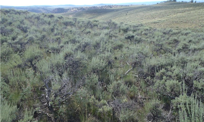
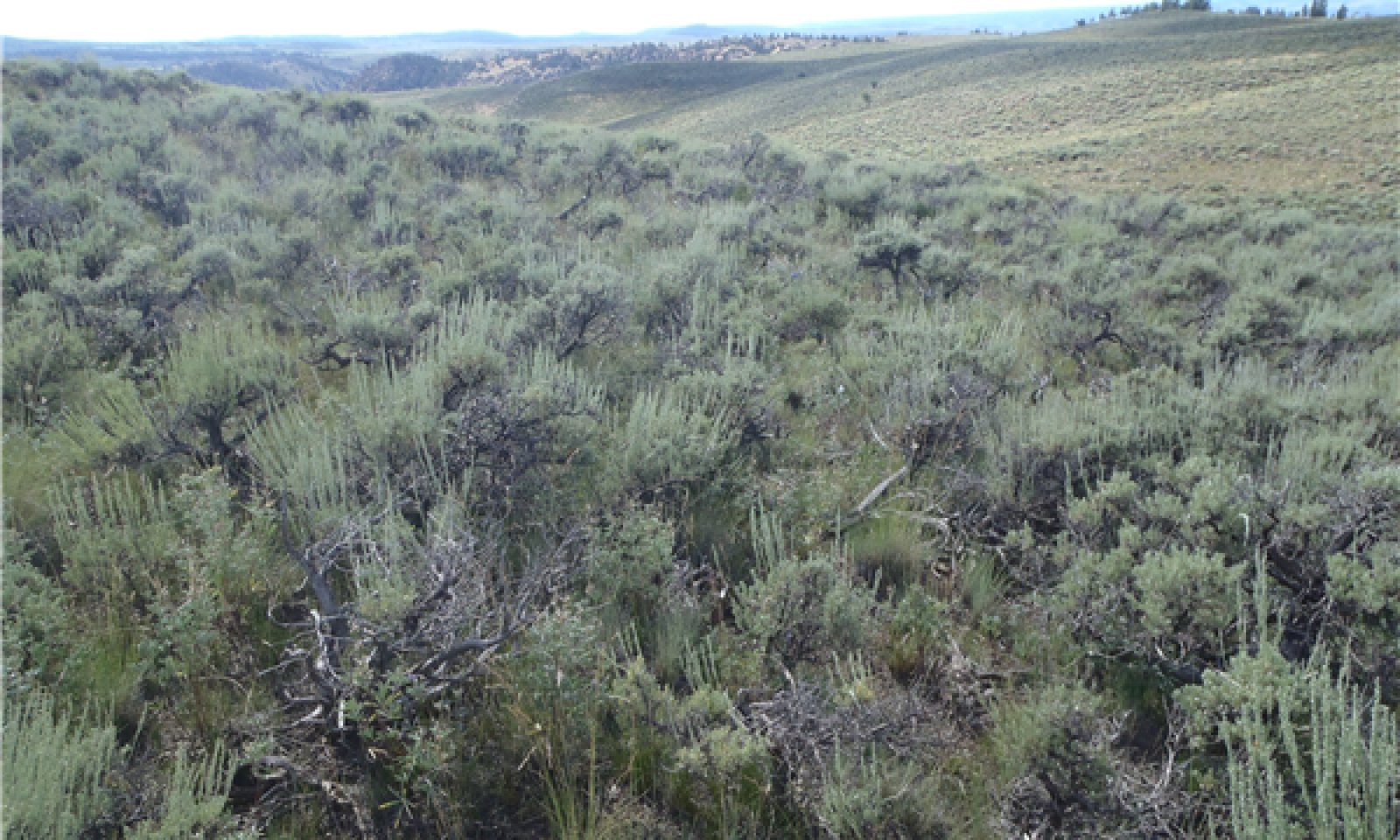
Figure 8. Mountain Loam site in an area of adequate moisture in spring.
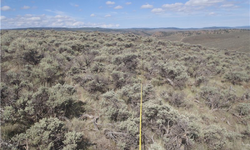
Figure 9. Mountain Loam site in a drought year.
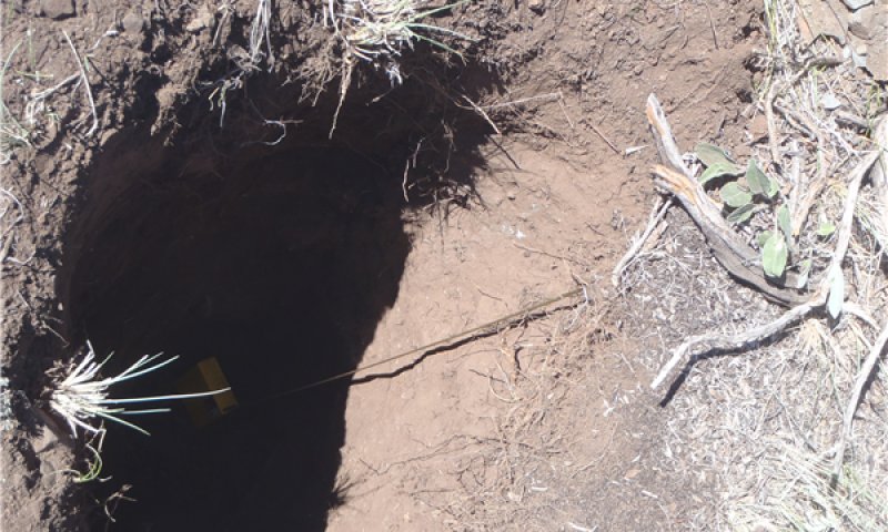
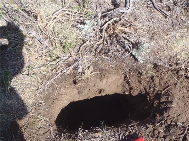
Figure 10. Soil pit in a Mountain Loam site.
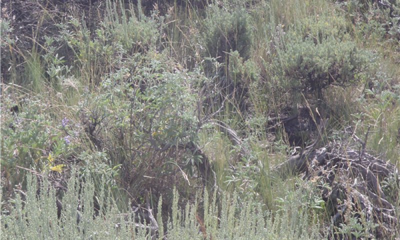
Figure 11. Closeup view of a Mountain Loam site.
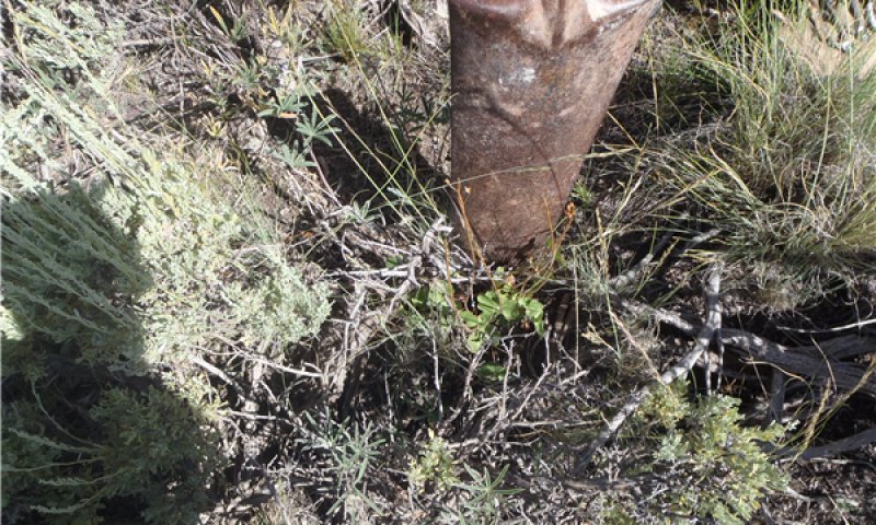
Figure 12. Ground view of a Mountain Loam site.
This community is characterized by mountain big sagebrush and an understory of Arizona fescue, pine needlegrass, prairie Junegrass, muttongrass, flowery phlox, sulphur-buckwheat, and pussytoes. Generally, this site is resistant to defoliation under proper grazing management and normal precipitation. Prolonged grazing during a period of drought may result in an increase in the abundance of grass species and shift the plant community to a mixed grass community rather than one that is dominantly Arizona fescue. The canopy cover of mountain big sagebrush can be 15 to 40 percent within 20 years after a low-intensity fire or other disturbance, and it can be as high as 40 to 50 percent in undisturbed areas (Winward, 2004; Miller and Eddleman, 2001; Nelle et al., 2000). After a severe fire, it may be 30 years or more before mountain big sagebrush becomes dominant again (Nelle et al., 2000).
This plant community is diverse, stable, and productive under normal precipitation. Litter is properly distributed, and a minimal amount is moved offsite. The natural plant mortality rate is low. Forbs are a dynamic component on this site; production varies greatly and is dependent on the annual precipitation. If the plant community is healthy, it has a diverse, productive herbaceous component capable of producing a seed source and a multi-aged overstory of sagebrush (Winward, 2004). Community dynamics, nutrient cycles, water cycles, and energy flow are functioning properly. The community can be maintained by properly managing grazing. This includes adequate deferment during the growing season to allow establishment of grass and recover the vigor of stressed plants. This community is resistant to many natural disturbances.
The species most likely to increase under continuous overgrazing are pine needlegrass, Letterman's needlegrass, Sandberg bluegrass, yellow rabbitbrush, pussytoes, and phlox.
Figure 13. Annual production by plant type (representative values) or group (midpoint values)
Table 6. Annual production by plant type
Plant type
Low (lb/acre)
Representative value (lb/acre)
High (lb/acre)
Grass/Grasslike
500
700
900
Shrub/Vine
300
400
500
Forb
100
200
300
Total
900
1300
1700
Table 7. Ground cover
Tree foliar cover
0%
Shrub/vine/liana foliar cover
20-35%
Grass/grasslike foliar cover
25-45%
Forb foliar cover
3-15%
Non-vascular plants
0-2%
Biological crusts
0-2%
Litter
15-35%
Surface fragments >0.25" and <=3"
5-15%
Surface fragments >3"
0-5%
Bedrock
0-2%
Water
0%
Bare ground
10-20%
Table 8. Canopy structure (% cover)
Height Above Ground (ft)
Tree
Shrub/Vine
Grass/ Grasslike
Forb
<0.5
–
20-35%
25-45%
3-15%
>0.5 <= 1
–
20-35%
15-25%
1-8%
>1 <= 2
–
10-30%
10-20%
1-5%
>2 <= 4.5
–
0-15%
0-10%
0-2%
>4.5 <= 13
–
–
–
–
>13 <= 40
–
–
–
–
>40 <= 80
–
–
–
–
>80 <= 120
–
–
–
–
>120
–
–
–
–
Figure 14. Plant community growth curve (percent production by month). CO0105, MLRA 48A - Mountain Sites. MLRA 48A.
Jan
Feb
Mar
Apr
May
Jun
Jul
Aug
Sep
Oct
Nov
Dec
J
F
M
A
M
J
J
A
S
O
N
D
0
0
0
5
30
38
17
0
5
5
0
0
Community 1.2 Sagebrush Dominated
This community consists dominantly of mountain big sagebrush. It has more shrub cover and less understory than does the reference community. A few remnant herbaceous plants are in the understory, but they may not be able to re-seed the site if disturbed. The sagebrush is a single age stand. The abundance of Sandberg bluegrass and western wheatgrass is increased and that of prairie Junegrass is decreased. The abundance of low shrubs such as yellow rabbitbrush, spineless horsebrush, and broom snakeweed is increased, replacing some of the herbaceous component in the understory. Minimal understory helps to suppress low-intensity fires because of the limited fuel. The increased sagebrush canopy may be due to lack of disturbance such as wildfire. Cumulating effects of degrading sagebrush habitats include higher susceptibility to erosion and sedimentation, decreased water quality, decreased forage for domestic livestock, and decreased habitat for wildlife species (McIver et al., 2010). This phase has less diversity of species as compared to community phase 1.1.
Figure 15. Plant community growth curve (percent production by month). CO0105, MLRA 48A - Mountain Sites. MLRA 48A.
Jan
Feb
Mar
Apr
May
Jun
Jul
Aug
Sep
Oct
Nov
Dec
J
F
M
A
M
J
J
A
S
O
N
D
0
0
0
5
30
38
17
0
5
5
0
0
Pathway 1.1A Community 1.1 to 1.2
Improper grazing for extended periods during the growing season can reduce the fine fuel in the understory, which favors sagebrush encroachment and shortens the period to transition to community phase 1.2. Lack of fire over time can cause this transition (McIver et al., 2010). Extended periods of drought and lack of insects and pathogens can influence this pathway and create a single-aged stand of sagebrush. This transition is characterized by a loss of understory and an increase in bare ground between the shrubs and other evidence of soil erosion. Depletion of fine fuel due to inappropriate grazing has shifted the fire regime from relatively frequent, low or mixed severity fires (10 to 50 years mean fire return interval) to less frequent, high severity fires (more than 50 years mean fire return interval) (McIver et al., 2010). This pathway results in short-term loss of topsoil and reduction in water-holding capacity in the upper part of the soil because the limited understory does not prevent runoff.
Pathway 1.2A Community 1.2 to 1.1
Periodic, naturally occurring fires increase the resilience of the community. This transitions it from phase 1.2 (shrub dominant) to phase 1.1 (Arizona fescue dominant) by reducing competition and the canopy cover of less fire-tolerant species (McIver et al., 2010). Proper grazing, wet periods, fire after seed set of the understory, and small-scale mortality of shrubs from insects and pathogens can move this community toward a diverse understory and away from a dense, single-aged stand of sagebrush (Evers et al., 2011). Drought and prescribed grazing or improper grazing can influence the time frame of this pathway. Improper browsing and proper grazing of the understory, frequent fires prior to seed set of sagebrush but after seed set of understory species, and large-scale die-off of sagebrush from insects or pathogens can cause this pathway (Evers et al, 2011). Short-term drought in winter and early in spring can facilitate an increase in the understory. Grasses respond quicker to moisture received in midsummer to late in summer than do shrubs. Management practices that could be used to mimic this pathway include applying herbicides, prescribed burning, seeding to native plants, and mowing.
State 2 Mature Sagebrush
State 2 is a sagebrush-dominant community. It has more shrub cover and less understory cover as compared to state 1. State 2 is an even-structured, single-aged stand. It has more Sandberg bluegrass and western wheatgrass and less prairie Junegrass as compared to State 1.
The abundance of low shrubs such as yellow rabbitbrush and spineless horsebrush is higher and that of herbaceous plants in the understory is lower as compared to state 1. State 2 also has a lower diversity of species. Improper grazing management that decreases the abundance of deep-rooted understory species can lead to compaction of the soil, erosion, decreased organic matter in the soil, and increased exposure due to a reduction in the amount of litter.
Community 2.1 Mature Sagebrush
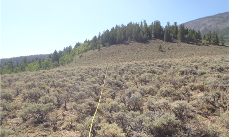
Figure 16. Area of Mountain Loam site.
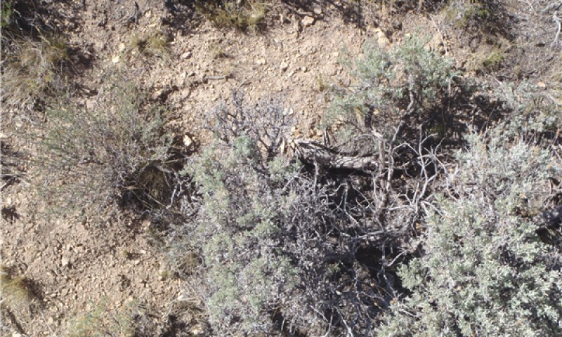
Figure 17. Ground view of Mountain Loam site.
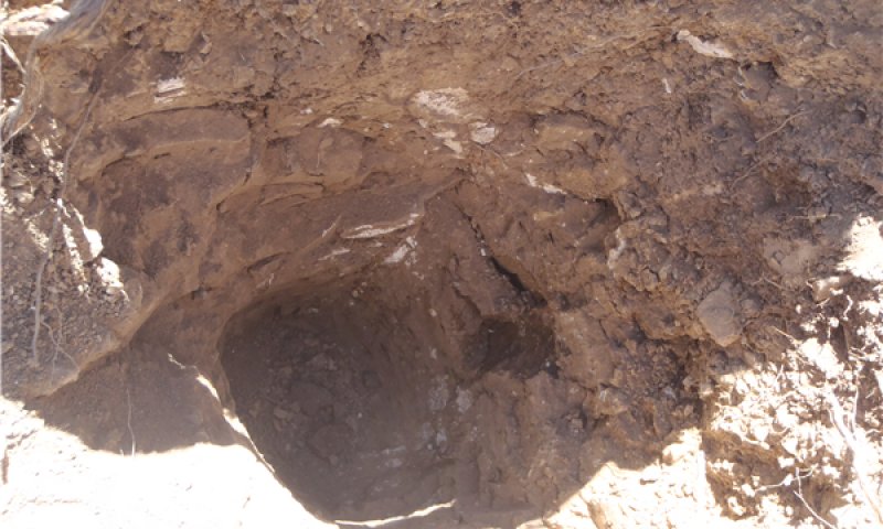
Figure 18. Soil pit in area of Mountain Loam site.
This community consists of a very dense stand of big sagebrush and little, if any, understory. A few remnant herbaceous plants may be present, but the amount may not be sufficient to reseed the site if it is disturbed. The dominant shrubs are mountain big sagebrush and yellow rabbitbrush, and the dominant forbs are Hood's phlox and some prickly pear cactus. Minimal understory helps to suppress low-intensity fires because of the limited fuel. The increased sagebrush canopy may be due to lack of disturbance such as wildfire. Cumulating effects of degrading sagebrush habitats include increased threat to property and life, higher susceptibility to erosion and sedimentation, decreased water quality, decreased forage for domestic livestock, and decreased habitat for big game and threatened wildlife species (McIver et al., 2010).
Figure 19. Plant community growth curve (percent production by month). CO0105, MLRA 48A - Mountain Sites. MLRA 48A.
Jan
Feb
Mar
Apr
May
Jun
Jul
Aug
Sep
Oct
Nov
Dec
J
F
M
A
M
J
J
A
S
O
N
D
0
0
0
5
30
38
17
0
5
5
0
0
State 3 Seeded
This state is characterized by sagebrush removal due to fire or shrub management treatments, which may include chaining, disking, and mowing. The community dynamics are similar those of the reference state. This state could persist for long periods. Sagebrush will start to re-establish when the conditions are favorable. This site historically has been seeded to perennial species such as crested wheatgrass and Russian wildrye.
Due to changes in soil properties and the presence of seeded plants, this state is not likely to return to the reference state unless restoration practices are applied.
Community 3.1 Seeded Grassland
This community is characterized by introduced perennial grasses. Perennial species such as crested wheatgrass and Russian wildrye have been seeded. Sagebrush will re-establish from seed in adjacent areas or seedbanks. Small amounts of Sandberg bluegrass and western wheatgrass will slowly establish. Fire or other shrub management is needed to maintain this community. Short-term loss of topsoil and a reduction in the water-holding capacity of the upper part of the soil occur because the understory is not sufficient to prevent runoff.
Figure 20. Plant community growth curve (percent production by month). CO0105, MLRA 48A - Mountain Sites. MLRA 48A.
Jan
Feb
Mar
Apr
May
Jun
Jul
Aug
Sep
Oct
Nov
Dec
J
F
M
A
M
J
J
A
S
O
N
D
0
0
0
5
30
38
17
0
5
5
0
0
Community 3.2 Seeded Grassland/Shrub
This community consists of seeded perennial grasses such as Russian wildrye and crested wheatgrass with mountain big sagebrush established in the overstory. The sagebrush is seeded from adjacent areas or the seedbanks, or it may be in the seed mix with the grasses.
Figure 21. Plant community growth curve (percent production by month). CO0105, MLRA 48A - Mountain Sites. MLRA 48A.
Jan
Feb
Mar
Apr
May
Jun
Jul
Aug
Sep
Oct
Nov
Dec
J
F
M
A
M
J
J
A
S
O
N
D
0
0
0
5
30
38
17
0
5
5
0
0
Pathway 3.1A Community 3.1 to 3.2
The natural pathway over time without fire. Improper grazing of the understory species and little, if any, seedling establishment or regeneration results in an increased canopy cover of sagebrush. Continuous season-long grazing favors establishment of sagebrush.
Pathway 3.2A Community 3.2 to 3.1
Proper grazing and wet periods can move the state toward community phase 3.1. Shrub management, including use of herbicides, can be used to mimic the pathway. Mortality of establishing sagebrush from pathogens and insects can influence this pathway. Short-term drought in winter and early in spring will facilitate an increase in the understory. Grasses respond quicker to moisture received in midsummer and late in summer than do shrubs.
State 4 Seeded Mature Sagebrush
State 4 consists dominantly of sagebrush. This state has more shrub cover and less understory cover. The community is an even-structured, single-aged stand. Less introduced species are in this state. The abundance of low shrubs such as yellow rabbitbrush and spineless horsebrush is increased, replacing some of the herbaceous component in the understory. This state has minimal diversity of species. Improper grazing management leads to a decrease in the abundance of deep-rooted plants in the understory.
Community 4.1 Mature Sagebrush with Seeded Species
The live canopy cover of mountain big sagebrush in this community is more than 45 percent. The understory is minimal; little, if any, grasses and forbs are in the interspaces. The grasses and forbs present are directly under the canopy of mountain big sagebrush. Soil erosion is active.
Transition T1A State 1 to 2
Improper grazing for extended periods during the growing season can reduce the amount of fine fuel in the understory, which favors sagebrush encroachment. Lack of fire over time can cause this transition (McIver et al., 2010). Extended periods of drought and lack of insect and pathogen activity can result in a single-aged stand of sagebrush. This transition is characterized by a decrease in the understory and an increase in the amount of bare ground between the shrubs and other evidence of soil erosion. The depletion of fine fuel due to improper grazing shifts the fire regime from relatively frequent fires of low to mixed severity (10- to 50-year mean fire return interval) to less frequent fires of high severity (more than 50-year mean fire return interval) (McIver et al., 2010). Short-term drought in winter and early in spring facilitates and increase in the understory. Grasses respond quicker to moisture received in midsummer and late in summer than do shrubs. Loss of topsoil and a reduction in the water-holding capacity in the upper part of the soil occur when the understory is not sufficient to prevent runoff.
Transition T1B State 1 to 3
Historically, this transition has resulted from a catastrophic wildlife but it can be induced by human activity (shrub management or prescribed burning). Introduced species are seeded. Short-term loss of topsoil and a reduction in the water-holding capacity in the upper part of the soil occurs, and the diversity of species is decreased.
Restoration pathway R2A State 2 to 1
This transition is caused by catastrophic fire or other natural disturbances or by human activity (shrub management or prescribed burning). Native species are seeded.
Transition T2A State 2 to 3
This transition is caused by human activity (shrub management or prescribed burning) or a catastrophic wildfire. Introduced species are seeded.
Restoration pathway R3A State 3 to 1
This site may be restored to resemble the Arizona fescue and mountain big sagebrush community of the reference state by seeding commercial mixtures of native grasses, forbs, and shrubs. Selective removal of introduced species also may be needed. If properly managed, a semblance of the diversity and complexity of the reference state can be restored.
Transition T3A State 3 to 4
Improper grazing for extended periods during the growing season can reduce the amount of fine fuel in the understory, which favors sagebrush encroachment. Lack of fire over time can cause this transition (McIver et al., 2010). Extended periods of drought and lack of insect and pathogen activity can result in a single-aged stand of sagebrush. This transition is characterized by a decrease in the understory and an increase in the amount of bare ground between the shrubs and other evidence of soil erosion. The depletion of fine fuel due to improper grazing shifts the fire regime from relatively frequent fires of low to mixed severity (10- to 50-year mean fire return interval) to less frequent fires of high severity (more than 50-year mean fire return interval) (McIver et al., 2010). Short-term drought in winter and early in spring facilitates an increase in the understory. Grasses respond quicker to moisture received in midsummer and late in summer than do shrubs. Loss of topsoil and a reduction in the water-holding capacity in the upper part of the soil occur when the understory is not sufficient to prevent runoff.
Restoration pathway R4B State 4 to 1
The site may be restored to resemble the western wheatgrass and mountain big sagebrush community in the reference state by seeding commercial mixtures of native grasses, forbs, and shrubs. Selective removal of introduced species also may be needed. If properly managed, a semblance of the diversity and complexity of the reference state can be restored. This restoration pathway is intensive if attempted on a large scale.
Restoration pathway R4A State 4 to 3
Fire and wet periods can cause the mature, single-aged shrub communities to transition to grassland if proper grazing is implemented and sufficient seed is in the seedbank to regenerate the understory species. If sufficient seed or mature plants are not available, reseeding may be needed. Shrub management practices such as prescribed burning and prescribed grazing can be used to assist in restoring state 4 to state 3.
Additional community tables
Table 9. Community 1.1 plant community composition
By Christina Santana, NRCS Partner Wildlife Biologist.
The shrubs, grasses, and forbs associated with this ecological site provide habitat for a variety of sagebrush steppe wildlife species. Large grazers in these communities include elk, mule deer, pronghorn, and bighorn sheep. Small mammals that occur in this ecological site include least chipmunk, Wyoming ground squirrels, golden-mantled ground squirrels, western garter snake, jackrabbit, cottontail rabbit, coyote, and fox. Both migratory and resident sagebrush obligate bird species such as the Sage Thrasher, Sage Sparrow, Vesper Sparrow, Brewer’s Sparrow, vesper sparrows, green-tailed towhees, mourning dove, common nighthawk, and Gunnison Sage-grouse may inhabit this ecological site. (Magee et al. 2011) Domestic grazers now share these habitats with wildlife. Changes to plant community composition when moving from the Reference State to other States on this ecological site may result in changes to carrying capacity for the wildlife species found here.
Mountain Loam (Reference State):
The Mountain Loam Reference State provides both food and cover for a variety of wildlife species. This State may see significant winter use by elk and year round use by mule deer, pronghorn, and bighorn sheep. The big sagebrush component of Plant Community 1.1 meets many of the habitat requirements for sagebrush obligate birds, Gunnison Sage-grouse, and small mammals. Plant Community 1.1 provides an increase in potential brood rearing habitat for Gunnison Sage-grouse because the percent shrub and herbaceous cover meets the ideal vegetation cover for nesting hens and young broods. In Plant Community 1.3 there may be an increase in available forage and browse for mule deer, elk, pronghorn, and bighorn sheep. Some sagebrush obligate avian species may be less abundant in Plant Community 1.3 due to lack of sagebrush available to provide nesting cover.
Mature Sagebrush (State 2):
The lack of grass and forb understory may encourage many wildlife species to travel through State 2 to areas with more abundant forage and increased plant diversity. Sagebrush obligate bird species may remain though habitat is compromised because of insufficient understory that serves as both food and cover. Some small mammal species will likely remain.
Seeded State (State 3):
The Mountain Loam Seeded State (State 3) is similar to the Reference State and provides habitat for a variety of wildlife species. State 3 may see significant winter use by elk and year round use by mule deer, pronghorn, and bighorn sheep. The big sagebrush component of Plant Community 3.1 meets many of the habitat requirements for sagebrush obligate birds, Gunnison Sage-grouse, and small mammals. Plant Community 3.1 provides an increase in potential brood rearing habitat for Gunnison Sage-grouse because the percent shrub and herbaceous cover meets the ideal vegetation cover for nesting hens and young broods. In Plant Community 3.2 there may be an increase in available forage and browse for mule deer, elk, pronghorn, and bighorn sheep. Some sagebrush obligate avian species may be less abundant in Plant Community 3.2 due to lack of sagebrush available to provide nesting cover. The reduced understory and dense sagebrush component of Plant Community 3.3 may encourage large wild ungulates to pass through Plant Community 3.3 to areas with a more abundant and diverse herbaceous understory. The sagebrush canopy may provide hiding and nesting cover for sagebrush obligate avian species and small mammals. Though some ungulates, mammals, and birds may utilize Plant Community 3.3, the lack of understory and active erosion reduces the quality of habitat available to these species.
Hydrological functions
Soils originally were assigned to hydrologic soil groups based on measured rainfall, runoff, and infiltrometer data (Musgrave, 1955). Since the initial work was done to establish these groupings, assignment of soils to hydrologic soil groups has been based on the judgment of soil scientists. Assignments are made based on comparison of the characteristics of unclassified soil profiles with profiles of soils already placed into hydrologic soil groups. Most of the groupings are based on the premise that soils in a specific climatic region will have a similar runoff response if the depth to a restrictive layer or water table, the transmission rate of water, texture, structure, and the degree of swelling when saturated are similar. Four hydrologic soil groups are recognized (A, B, C, and D). For specific definitions of each group, see the National Engineering Handbook, Chapter 7, Part 630, Hydrology (http://policy.nrcs.usda.gov/OpenNonWebContent.aspx? content=22526.wba).
The hydrologic soil groups are based on the following factors:
—intake and transmission of water under maximum yearly wetness (thoroughly wet),
—unfrozen soil,
—bare soil surface, and
—maximum swelling of expansive clays.
The slope of the soil surface is not considered when assigning hydrologic soil groups. In its simplest form, the hydrologic soil group is determined by the water-transmitting soil layer that has the lowest saturated hydraulic conductivity and depth to any layer that is more or less water impermeable (such as a fragipan or duripan) or depth to a water table (if present) (Caudle et al., 2013). The runoff curve numbers are determined by field investigations using the hydrologic cover conditions and hydrologic soil groups.
Hydrologic Soil Groups:
Duffson series—Group B
Kezar series—Group C
Lucky series—Group C
Recreational uses
The climate of this site is cool in summer; thus, it is very desirable for a wide range of outdoor activities such as picnicking, sightseeing, photography, wildlife watching, hiking, and camping.
Wood products
No trees are native to this ecological site.
Other products
None.
Other information
The Gunnison and Montrose field offices are responsible for this site.
Supporting information
Other references
Arno, Stephen F., and George E. Gruell. 1983. Fire history at the forest-grassland ecotone in southwestern Montana. Journal of Range Management 36(3): 332-336.
Bunting, S.C. 1985. Fire in sagebrush-grass ecosystems: Successional changes. K. Sanders and J. Durham, editors. In Rangeland Fire Effects: A Symposium. U.S. Department of the Interior, Bureau of Land Management, Idaho State Office, Boise, Idaho. Pages 7-11.
Caudle, D., H. Sanchez, J. DiBenedetto, C. Talbot, and M. Karl. 2013. Interagency ecological site handbook for rangelands. U.S. Department of Agriculture, Natural Resources Conservation Service. Washington, D.C.
Emslie, S.D., M. Stiger, and E. Wambach. 2005. Packrat middens and late Holocene environmental change in southwestern Colorado. The Southwestern Naturalist 50(2): 209-215.
Evers, L., R.F. Miller, M. Hemstrom, J. Merzenich, and R. Neilson. 2011. Estimating historical sage-grouse habitat abundance using state-and-transition model. Natural Resources and Environmental Issues. Volume 17, Article 16. Pages 1-13.
Gasch, C., and R. Bingham. 2006. A study of Bromus tectorum L. seed germination in the Gunnison Basin, Colorado. BIOS 77(1): 7-12.
Goodrich, S., E.D. McArthur, and A.H. Winward. 1999. Sagebrush ecotones and average Annual Precipitation. U.S. Department of Agriculture, Forest Service Proceedings RMRS-P-11.
Howard, Janet L. 1999. Artemisia tridentata subsp. wyomingensis. In Fire Effects Information System. U.S. Department of Agriculture, Forest Service, Rocky Mountain Research Station, Fire Sciences Laboratory. Available at https://www.feis-crs.org/feis/. Accessed July 18, 2012.
Johnson, Kathleen A. 2000. Artemisia tridentata subsp. vaseyana. In Fire Effects Information System. U.S. Department of Agriculture, Forest Service, Rocky Mountain Research Station, Fire Sciences Laboratory. Available at https://www.feis-crs.org/feis/. Accessed February 28, 2012.
Magee, P.A., J. Brooks, N. Hirsch, and T.L. Hicks. 2011. Response of obligate birds to mechanical manipulations in a sagebrush ecosystem near Gunnison, Colorado. Natural Resources and Environmental Issues. Volume 16, Article 6. Pages 1-11.
McIver, J. D., Brunson, M., Bunting, S. C., and others. 2010. The sagebrush steppe treatment evaluation project (SageSTEP): a test of state-and-transition theory. Gen. Tech. Rep. RMRS-GTR-237. Fort Collins, CO. USDA, Forest Service, Rocky Mountain Research Station. 16 p.
Miller, R.F., and L.L. Eddleman. 2001. Spatial and temporal changes of sage grouse habitat in the sagebrush biome. Oregon State University, Agricultural Experiment Station Technical Bulletin 151.
Musgrave, G.W. 1955. How much of the rain enters the soil? In Water: U.S. Department of Agriculture Yearbook. Washington, D.C. Pages 151-159.
Nelle, P.J., K.P. Reese, and J.W. Connelly. 2000. Long-term effects of fire on sage grouse habitat. Journal of Range Management 53: 586-591.
United States Department of Agriculture, Soil Conservation Service. 1975. Range site description for Mountain Loam (228). Denver, Colorado.
United States Department of Agriculture, Soil Conservation Service. 1975. Soil survey of Gunnison Area, Colorado, parts of Gunnison, Hinsdale, and Saguache Counties.
West, N.E. and M.A. Hassan. 1985. Recovery of sagebrush-grass vegetation following wildfire. Journal of Range Management 38(2): 131-134.
Winward, A.H. 2004. Sagebrush of Colorado: Taxonomy, distribution, ecology, and management. Colorado Division of Wildlife. Denver, Colorado.
Contributors
Suzanne Mayne-Kinney
Approval
Kirt Walstad, 3/11/2025
Acknowledgments
Project Staff:
Suzanne Mayne-Kinney, Ecological Site Specialist, NRCS-MLRA, Grand Junction Soil Survey Office
Chuck Peacock, MLRA Soil Survey Leader, NRCS-MLRA, Grand Junction Soil Survey Office
Program Support:
Rachel Murph, State Rangeland Management Specialist, NRCS, Denver, CO
Scott Woodhall, MLRA Ecological Site Specialist (quality assurance), NRCS, Phoenix, AZ
Eva Muller, Regional Director, Rocky Mountain Region, Bozeman, MT
B.J. Shoup, State Soil Scientist, NRCS, Denver, CO
Eugene Backhaus, State Resource Conservationist, NRCS, Denver, CO
Partners/Contributors:
Those involved in developing earlier versions of this site description include Bob Rayer, retired NRCS soil scientist, and Herman Garcia, retired State rangeland management specialist and MLRA ecological site specialist (quality assurance).
Site Development and Testing:
Future work is needed to validate and further refine the information in this provisional ecological site description (pESD). This will include field activities to collect low-, medium-, and high-intensity samples, soil correlation, and analysis of data.
Additional information and data are required to refine the plant production and annual production data in the tables for this ecological site. The extent of MLRA 48A requires further investigated.
Field testing of the information in this pESD is required. As this pESD progresses to the approved level, reviews will be conducted by the technical team, quality control and quality assurance staff, and peers.
Rangeland health reference sheet
Interpreting Indicators of Rangeland Health is a qualitative assessment protocol used to
determine ecosystem condition based on benchmark characteristics described in the Reference Sheet. A suite of 17 (or
more) indicators are typically considered in an assessment. The ecological site(s) representative of an assessment
location must be known prior to applying the protocol and must be verified based on soils and climate. Current plant
community cannot be used to identify the ecological site.
Author(s)/participant(s)
Original authors and participants—J. Murray, C. Holcomb, L. Santana, F. Cummings, A. Jones, P. Billig, and S, Jaouen; 12/08/2004
Update by Suzanne Mayne-Kinney; 7/27/2015
Contact for lead author
Date
07/27/2015
Approved by
Kirt Walstad
Approval date
Composition (Indicators 10 and 12) based on
Annual Production
Indicators
Number and extent of rills:
None to slight on slopes of less than 15 percent. Rills may be more defined on slopes of more than than 15 percent. After intense storms, wildfires, and extended periods of drought the number of rills will increase.
Presence of water flow patterns:
Slight. Few water patterns, and short, unconnected flow patterns. Flow patterns present only after an intense weather event. The length and abundance of flows increases after wildfires and extended periods of drought. Flow paths are more apparent on slopes of more than 15 percent.
Number and height of erosional pedestals or terracettes:
None to slight. No pedestals or terracettes caused by water should occur in the reference community phase of this site. Wind-caused patterns are rare; they commonly only occur after wildfires and extended periods of drought. Water from intense storms may cause slightly more pedestals on the steeper slopes.
Bare ground from Ecological Site Description or other studies (rock, litter, lichen, moss, plant canopy are
not bare ground):
Commonly, 10 to 20 percent of the ground is bare. Extended drought and other disturbances may result in more bare ground.
Number of gullies and erosion associated with gullies:
Rare. In areas of drainageways, the gullies are stabilized by native vegetation and thus are not subject to erosion.
Extent of wind scoured, blowouts and/or depositional areas:
Little, if any, wind erosion occurs in this site; however, significant wind erosion may occur after wildfires and extended periods of drought. Areas of wind scouring, blowouts, and depositional areas are rare; they are associated with disturbances only (e.g., bedding areas and small mammal burrows).
Amount of litter movement (describe size and distance expected to travel):
Litter commonly is evenly distributed across the site, but it is slightly thicker under the shrub canopy. Litter movement consists primarily of redistribution of fine litter (herbaceous plant material) associated with flow paths. Movement is expected to be short-lived and minimal. Most occurs after wildfires, extended periods of drought, and other disturbances. High-intensity thunderstorms may increase the amount of movement and the size of material moved.
Soil surface (top few mm) resistance to erosion (stability values are averages - most sites will show a range
of values):
The stability class is 1 to 3 in unprotected areas in interspaces. Under a canopy of shrubs or grasses, it is 4 to 6. The class should be at the higher range in soils that have a higher content of clay.
Soil surface structure and SOM content (include type of structure and A-horizon color and thickness):
The average content of soil organic matter is 2 to 5 percent. The surface layer typically is granular. This layer is stable; evidence of movement is very slight. The soils typically are moderately deep or deep and well drained.
Effect of community phase composition (relative proportion of different functional groups) and spatial
distribution on infiltration and runoff:
The diverse canopy of grasses, forbs, and shrubs and their root structure reduce the impact of raindrops and slow overland flow, providing time for infiltration to occur. Extended periods of drought in spring reduce the abundance of cool-season bunchgrasses, which results in decreased infiltration and increased runoff following intense storms.
Presence and thickness of compaction layer (usually none; describe soil profile features which may be
mistaken for compaction on this site):
None.
Functional/Structural Groups (list in order of descending dominance by above-ground annual-production or live foliar
cover using symbols: >>, >, = to indicate much greater than, greater than, and equal to):
Amount of plant mortality and decadence (include which functional groups are expected to show mortality or
decadence):
Typically minimal. Slight mortality or decadence of shrubs and grasses may occur during and following drought. Extended periods of drought typically results in a relatively high mortality rate in short-lived species. Mortality of shrubs is limited to periods of severe drought. Sagebrush species are affected by a lack of snow in winter. A combination of wildfire and extended periods of drought would cause more mortality for several years than would either disturbance by itself.
Average percent litter cover (%) and depth ( in):
The reference community averages 40 to 60 percent litter under the shrub canopy and 15 to 35 percent in the interspaces. The content of litter in the interspaces declines during and following droughts. No litter remains after wildfires and extended periods of drought. Depending on climate and plant production, post-disturbance levels of litter will be in the site within 1 to 5 growing seasons.
Expected annual annual-production (this is TOTAL above-ground annual-production, not just forage annual-production):
900 pounds per acre in low precipitation years, 1,300 pounds in average precipitation years, and 1,700 pounds in above-average years. After extended periods of drought or during the first growing season following a wildfire, production may be significantly reduced by 600 to 800 pounds per acre or more.
Potential invasive (including noxious) species (native and non-native). List species which BOTH characterize
degraded states and have the potential to become a dominant or co-dominant species on the ecological site if
their future establishment and growth is not actively controlled by management interventions. Species that become
dominant for only one to several years (e.g., short-term response to drought or wildfire) are not invasive
plants. Note that unlike other indicators, we are describing what is NOT expected in the reference state for the
ecological site:
None.
Perennial plant reproductive capability:
All plant species should be able to reproduce if water is available. All plants should be vigorous and healthy. Plant should produce seed heads and vegetative tillers, etc. Weather, wildfire, natural disease, interspecies competition, wildlife, and insects may temporarily reduce reproduction.
The Ecosystem Dynamics Interpretive Tool is an information system framework developed by the USDA-ARS Jornada Experimental Range, USDA Natural Resources Conservation Service, and New Mexico State University.
Click on box and path labels to scroll to the respective text.