Major Land Resource Area 049X
Southern Rocky Mountain Foothills
Accessed: 04/09/2026
Description
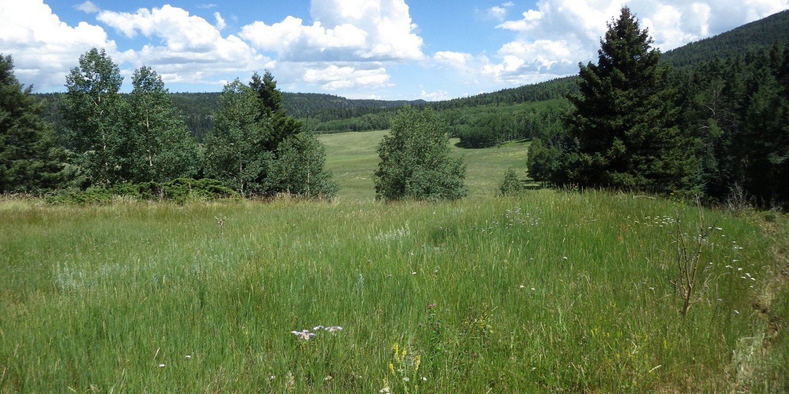
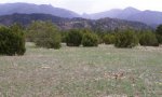
MLRA 49 represents the eastern foothills of the Rocky Mountains. Traditionally it has covered portions of the lower elevation Rocky Mountains consisting of the hog back and strike valley and the highest elevations of the Great Plains such as the Palmer divide.
Key publications
Next steps
-
1
Select an ecological site
Select an ecological site using the list, keys, photos, briefcase, or quick search option located on this page. -
2
Explore the ecological site description
Next, learn more about the selected ecological site and its characteristic dynamics by browsing the ecological site description and exploring alternative state and transition model formats.
Ecological site list
-
i
Key Characteristics
- LRU C - Frigid (MAAT 45-47 degrees F), Typic Ustic, (MAP 16-20 inches), Freeze Free days 90-150, elevation 5,400-7,500 feet); Black Forest Area (Douglas County) Dawson and White River formation; West of Colorado Spring including Monument Hill and Palmer Divide (El Paso County) Pierre Shale, Laramie and Fox Hill Sandstone, and Denver Formation.
- Site receives no extra water beyond normal precipitation
- Site not as above
- Site not as above
- Site not as above
- Site not as above
- Site has surface texture of loam
-
i
Key Characteristics
- LRU C - Frigid (MAAT 45-47 degrees F), Typic Ustic, (MAP 16-20 inches), Freeze Free days 90-150, elevation 5,400-7,500 feet); Black Forest Area (Douglas County) Dawson and White River formation; West of Colorado Spring including Monument Hill and Palmer Divide (El Paso County) Pierre Shale, Laramie and Fox Hill Sandstone, and Denver Formation.
- Site receives no extra water beyond normal precipitation
- Site has bedrock within 20 inches of the soil surface
- Site not as above
- Bedrock limestone or sandstone
-
i
Key Characteristics
- LRU C - Frigid (MAAT 45-47 degrees F), Typic Ustic, (MAP 16-20 inches), Freeze Free days 90-150, elevation 5,400-7,500 feet); Black Forest Area (Douglas County) Dawson and White River formation; West of Colorado Spring including Monument Hill and Palmer Divide (El Paso County) Pierre Shale, Laramie and Fox Hill Sandstone, and Denver Formation.
- Site receives no extra water beyond normal precipitation
- Site not as above
- Site not as above
- Site not as above
- Site has surface textures of clay loam, clay, silty clay, or silty clay loam and residuum, alluvium from shale or slope alluvium from shale
-
i
Key Characteristics
- LRU C - Frigid (MAAT 45-47 degrees F), Typic Ustic, (MAP 16-20 inches), Freeze Free days 90-150, elevation 5,400-7,500 feet); Black Forest Area (Douglas County) Dawson and White River formation; West of Colorado Spring including Monument Hill and Palmer Divide (El Paso County) Pierre Shale, Laramie and Fox Hill Sandstone, and Denver Formation.
- Site receives no extra water beyond normal precipitation
- Site not as above
- Site not as above
- Site has surface textures of sandy loam, loamy sand, or sand. There are 2 choices for this node - Sandy Foothill or Sandy Divide.
- Effective precipitation ranges from 12-16 inches
-
i
Key Characteristics
- LRU B – Mesic and Frigid (MAAT42-50 degrees F), Aridic Ustic and Typic Ustic (MAP 13-19 inches); Freeze Free days 75-155; Elevation 5, 200-7,00 feet; Narrow hogback bands from WY/CO state line to Fort Collins (Larimer, Boulder and Jefferson counties) on Pierre Shale, Dakota, Morrison, Lykins and Fountain Formations; and western Elbert and northeastern El Paso on Dawson and White River Formation.
- Site receives no extra water beyond normal precipitation
- Site not as above
- Site not as above
- Site not as above
- Site not as above
- Site not as above
- Family particle size varies. Surface textures are sandy loam and loam and soil depth is greater than 60 inches
- LRU C - Frigid (MAAT 45-47 degrees F), Typic Ustic, (MAP 16-20 inches), Freeze Free days 90-150, elevation 5,400-7,500 feet); Black Forest Area (Douglas County) Dawson and White River formation; West of Colorado Spring including Monument Hill and Palmer Divide (El Paso County) Pierre Shale, Laramie and Fox Hill Sandstone, and Denver Formation.
- Site receives no extra water beyond normal precipitation
- Site not as above
- Site not as above
- Site not as above
- Site not as above
- Site not as above
- Family particle size varies. Surface textures are sandy loam and loam and soil depth is greater than 60 inches
-
i
Key Characteristics
- Soil depth moderately deep to deep (>20”) without root restricting layer that inhibits the productivity potential
- Sites with a high volume of coarse fragments in top 20” (>35% by volume) Site occurs in a variety of upland positions, boulders found in abundance on surface, Columbia needlegrass, Idaho fescue, spike fescue, bitterbrush, and big sage, productivity less than others in group
-
i
Key Characteristics
- Soil depth very shallow (<10”), shallow (10-20”) OR moderately deep to deep (>20”) reacting like shallow soils due to root restrictive layer or on south and west facing slopes (LOW productivity potential)
- Soils very shallow (<10”), but may include areas of exposed bedrock and pockets of deep soil, often on steep (up to 55%) south and west facing slopes with VERY LOW productivity potential
- Bedrock igneous or volcanic, three-tip sagebrush, antelope bitterbrush, and black sage common shrubs
-
i
Key Characteristics
- Soil depth moderately deep to deep (>20”) without root restricting layer that inhibits the productivity potential
- Sites without high volume of coarse fragments
- Soils very fine sandy loams to clay loams, a good variety and even mix of grass species, mountain big sagebrush dominant shrub
-
i
Key Characteristics
- Site in a lowland position that receives significant additional moisture from runoff of adjacent slopes or from intermittent/perennial streams or a water table (HIGH Productivity Potential)
- Site not as above
- Site receives periodic overflow from adjacent slopes, but without a water table within rooting depth of woody plants, and soil textures are loamy, serviceberry, silver sagebrush, slender wheatgrass, and basin wildrye common
-
i
Key Characteristics
- Soil depth very shallow (<10”), shallow (10-20”) OR moderately deep to deep (>20”) reacting like shallow soils due to root restrictive layer or on south and west facing slopes (LOW productivity potential)
- Soils shallow (10-20” (25-50cm)), but may include moderately deep to deep (>20” (>50cm)) skeletal soils on south and west aspects, >15% slopes, productivity potential is LOW
- Site with a highly calcareous subsoil (<10” (25cm)), often gravelly or skeletal subsoil OR underlain by soft calcareous materials and slopes >15%
- Shallow sandy and loamy soils (10-20” (25-50cm)), often cobbly or channery with slopes >35%, underlain by soft calcareous materials with many outcrops of sedimentary rock (often associated with Lime Stone parent material) , mountain mahogany, bluebunch wheatgrass, Indian ricegrass common
-
i
Key Characteristics
- Soil depth very shallow (<10”), shallow (10-20”) OR moderately deep to deep (>20”) reacting like shallow soils due to root restrictive layer or on south and west facing slopes (LOW productivity potential)
- Soils shallow (10-20” (25-50cm)), but may include moderately deep to deep (>20” (>50cm)) skeletal soils on south and west aspects, >15% slopes, productivity potential is LOW
- Soils not as above
- Medium to moderately coarse textured soils over igneous or volcanic bedrock, bitterbrush, black sage and three-tip sagebrush common
-
i
Key Characteristics
- Soil depth very shallow (<10”), shallow (10-20”) OR moderately deep to deep (>20”) reacting like shallow soils due to root restrictive layer or on south and west facing slopes (LOW productivity potential)
- Soils shallow (10-20” (25-50cm)), but may include moderately deep to deep (>20” (>50cm)) skeletal soils on south and west aspects, >15% slopes, productivity potential is LOW
- Soils not as above
- Very fine sandy loam to clay loam textured soils over various bedrock types (commonly limestone, siltstone, or shale), black sagebrush or mountain mahogany intermixed with big sage
-
i
Key Characteristics
- Site in a lowland position that receives significant additional moisture from runoff of adjacent slopes or from intermittent/perennial streams or a water table (HIGH Productivity Potential)
- Site not as above
- Water table within rooting depth of herbaceous species (typically above 20”) during part of the growing season, tufted hairgrass, Nebraska sedge, shrubby cinquefoil, sedges, rushes, and willow common
-
i
Key Characteristics
- Soil depth very shallow (<10”), shallow (10-20”) OR moderately deep to deep (>20”) reacting like shallow soils due to root restrictive layer or on south and west facing slopes (LOW productivity potential)
- Soils very shallow (<10”), but may include areas of exposed bedrock and pockets of deep soil, often on steep (up to 55%) south and west facing slopes with VERY LOW productivity potential
- Fractured bedrock of various types except igneous or volcanic, commonly on windswept ridges, bluebunch wheatgrass, Columbia needlegrass and a variety of shrub species dominate
-
i
Key Characteristics
- Site in a lowland position that receives significant additional moisture from runoff of adjacent slopes or from intermittent/perennial streams or a water table (HIGH Productivity Potential)
- Site poorly drained with water table above surface part of growing season, Nebraska sedge, northern reedgrass, tufted hairgrass, and willows common species
-
i
Key Characteristics
- LRU B – Mesic and Frigid (MAAT42-50 degrees F), Aridic Ustic and Typic Ustic (MAP 13-19 inches); Freeze Free days 75-155; Elevation 5, 200-7,00 feet; Narrow hogback bands from WY/CO state line to Fort Collins (Larimer, Boulder and Jefferson counties) on Pierre Shale, Dakota, Morrison, Lykins and Fountain Formations; and western Elbert and northeastern El Paso on Dawson and White River Formation.
- Site receives no extra water beyond normal precipitation
- Site not as above
- Site not as above
- Site not as above
- Site not as above
- Fine-loamy family particle size and has surface texture of loam, silt loam or fine sandy loam and 20-60 inches in depth
-
i
Key Characteristics
- LRU B – Mesic and Frigid (MAAT42-50 degrees F), Aridic Ustic and Typic Ustic (MAP 13-19 inches); Freeze Free days 75-155; Elevation 5, 200-7,00 feet; Narrow hogback bands from WY/CO state line to Fort Collins (Larimer, Boulder and Jefferson counties) on Pierre Shale, Dakota, Morrison, Lykins and Fountain Formations; and western Elbert and northeastern El Paso on Dawson and White River Formation.
- Site receives no extra water beyond normal precipitation
- Site has bedrock within 20 inches of the soil surface
- Site not as above
- Bedrock basalt, limestone or sandstone
- LRU D - Frigid (MAAT 40-46 degrees F), Ustic Aridic (MAP 11-14 inches), Freeze Free days 90-150, elevation 5,500-7,200 FT; Gardner Area (northern Huerfano County) & Huerfano & Farisita Formations; West of Canon City & Howard (Southwestern Pueblo county) & metamorphic quartz, monzonite, gneiss & schist with lesser amounts of igneous granite & diorite; Southwestern El Paso (Fountain, Morrison & Dakota Formations); & Arkansas River Canyon-West of Pueblo to near Salida
- Site not as above
- Site have bedrock within 20 inches of the soil surface
- Site not as above
- Bedrock limestone or sandstone
-
i
Key Characteristics
- LRU B – Mesic and Frigid (MAAT42-50 degrees F), Aridic Ustic and Typic Ustic (MAP 13-19 inches); Freeze Free days 75-155; Elevation 5, 200-7,00 feet; Narrow hogback bands from WY/CO state line to Fort Collins (Larimer, Boulder and Jefferson counties) on Pierre Shale, Dakota, Morrison, Lykins and Fountain Formations; and western Elbert and northeastern El Paso on Dawson and White River Formation.
- Site receives no extra water beyond normal precipitation
- Site not as above
- Site not as above
- Site not as above
- Fine family particle size and has surface textures of clay loam, clay, silty clay, or silty clay loam
- LRU D - Frigid (MAAT 40-46 degrees F), Ustic Aridic (MAP 11-14 inches), Freeze Free days 90-150, elevation 5,500-7,200 FT; Gardner Area (northern Huerfano County) & Huerfano & Farisita Formations; West of Canon City & Howard (Southwestern Pueblo county) & metamorphic quartz, monzonite, gneiss & schist with lesser amounts of igneous granite & diorite; Southwestern El Paso (Fountain, Morrison & Dakota Formations); & Arkansas River Canyon-West of Pueblo to near Salida
- Site not as above
- Site not as above
- Site not as above
- Site not as above
- Site has surface textures of clay loam derived from calcareous clayey alluvium and deep (60-80 inches) in depth; fine family particle size
-
i
Key Characteristics
- LRU B – Mesic and Frigid (MAAT42-50 degrees F), Aridic Ustic and Typic Ustic (MAP 13-19 inches); Freeze Free days 75-155; Elevation 5, 200-7,00 feet; Narrow hogback bands from WY/CO state line to Fort Collins (Larimer, Boulder and Jefferson counties) on Pierre Shale, Dakota, Morrison, Lykins and Fountain Formations; and western Elbert and northeastern El Paso on Dawson and White River Formation.
- Site receives no extra water beyond normal precipitation
- Site not as above
- Site not as above
- Coarse-loamy or sandy family particle size and has surface textures of fine sandy loam, loamy sand, or sand
- LRU D - Frigid (MAAT 40-46 degrees F), Ustic Aridic (MAP 11-14 inches), Freeze Free days 90-150, elevation 5,500-7,200 FT; Gardner Area (northern Huerfano County) & Huerfano & Farisita Formations; West of Canon City & Howard (Southwestern Pueblo county) & metamorphic quartz, monzonite, gneiss & schist with lesser amounts of igneous granite & diorite; Southwestern El Paso (Fountain, Morrison & Dakota Formations); & Arkansas River Canyon-West of Pueblo to near Salida
- Site not as above
- Site not as above
- Site not as above
- Site have surface textures of sandy loam, loamy sand, or sand
-
i
Key Characteristics
- LRU B – Mesic and Frigid (MAAT42-50 degrees F), Aridic Ustic and Typic Ustic (MAP 13-19 inches); Freeze Free days 75-155; Elevation 5, 200-7,00 feet; Narrow hogback bands from WY/CO state line to Fort Collins (Larimer, Boulder and Jefferson counties) on Pierre Shale, Dakota, Morrison, Lykins and Fountain Formations; and western Elbert and northeastern El Paso on Dawson and White River Formation.
- Site receives no extra water beyond normal precipitation
- Site has bedrock within 20 inches of the soil surface
- Bedrock shale
- LRU C - Frigid (MAAT 45-47 degrees F), Typic Ustic, (MAP 16-20 inches), Freeze Free days 90-150, elevation 5,400-7,500 feet); Black Forest Area (Douglas County) Dawson and White River formation; West of Colorado Spring including Monument Hill and Palmer Divide (El Paso County) Pierre Shale, Laramie and Fox Hill Sandstone, and Denver Formation.
- Site receives no extra water beyond normal precipitation
- Site has bedrock within 20 inches of the soil surface
- Bedrock shale
- LRU D - Frigid (MAAT 40-46 degrees F), Ustic Aridic (MAP 11-14 inches), Freeze Free days 90-150, elevation 5,500-7,200 FT; Gardner Area (northern Huerfano County) & Huerfano & Farisita Formations; West of Canon City & Howard (Southwestern Pueblo county) & metamorphic quartz, monzonite, gneiss & schist with lesser amounts of igneous granite & diorite; Southwestern El Paso (Fountain, Morrison & Dakota Formations); & Arkansas River Canyon-West of Pueblo to near Salida
- Site not as above
- Site have bedrock within 20 inches of the soil surface
- Bedrock shale
-
i
Key Characteristics
- LRU D - Frigid (MAAT 40-46 degrees F), Ustic Aridic (MAP 11-14 inches), Freeze Free days 90-150, elevation 5,500-7,200 FT; Gardner Area (northern Huerfano County) & Huerfano & Farisita Formations; West of Canon City & Howard (Southwestern Pueblo county) & metamorphic quartz, monzonite, gneiss & schist with lesser amounts of igneous granite & diorite; Southwestern El Paso (Fountain, Morrison & Dakota Formations); & Arkansas River Canyon-West of Pueblo to near Salida
- Site not as above
- Site not as above
- Site not as above
- Site not as above
- Site not as above
- Site not as above
- Site have surface texture of loam
-
i
Key Characteristics
- LRU E – Mesic and Frigid (MAAT 42-50 degrees F), Ustic Aridic and Typic Ustic (MAP 15-18inches), Freeze Free days 70-120, elevation 6,500-8,500 feet; West of Trinidad and Southern Huerfano County (Ration Formation); North part (Purgatoire River Watershed Area) Las Animas and southwestern Huerfano Counties (Poison Canyon Sandstone).
- Site has surface textures of clay loam, or silty clay loam; shallow to moderately deep (8-40 inches) in depth; clayey and fine family particle size
-
i
Key Characteristics
- LRU D - Frigid (MAAT 40-46 degrees F), Ustic Aridic (MAP 11-14 inches), Freeze Free days 90-150, elevation 5,500-7,200 FT; Gardner Area (northern Huerfano County) & Huerfano & Farisita Formations; West of Canon City & Howard (Southwestern Pueblo county) & metamorphic quartz, monzonite, gneiss & schist with lesser amounts of igneous granite & diorite; Southwestern El Paso (Fountain, Morrison & Dakota Formations); & Arkansas River Canyon-West of Pueblo to near Salida
- Site not as above
- Site not as above
- Site not as above
- Site not as above
- Site not as above
- Site have surface textures of clay loam, clay, silty clay, or silty clay loam; moderately deep to deep (20-100 inches in depth)
- LRU E – Mesic and Frigid (MAAT 42-50 degrees F), Ustic Aridic and Typic Ustic (MAP 15-18inches), Freeze Free days 70-120, elevation 6,500-8,500 feet; West of Trinidad and Southern Huerfano County (Ration Formation); North part (Purgatoire River Watershed Area) Las Animas and southwestern Huerfano Counties (Poison Canyon Sandstone).
- Site not as above
- Site has surface textures of clay loam derived from calcareous clayey alluvium and deep (60-80 inches) in depth; fine family particle size
-
i
Key Characteristics
- LRU B – Mesic and Frigid (MAAT42-50 degrees F), Aridic Ustic and Typic Ustic (MAP 13-19 inches); Freeze Free days 75-155; Elevation 5, 200-7,00 feet; Narrow hogback bands from WY/CO state line to Fort Collins (Larimer, Boulder and Jefferson counties) on Pierre Shale, Dakota, Morrison, Lykins and Fountain Formations; and western Elbert and northeastern El Paso on Dawson and White River Formation.
- Site receives extra water beyond normal precipitation through high water table, riparian area, or run-in water
- Site not as above
- Site is sandy or coarse-loamy family particle size
- LRU C - Frigid (MAAT 45-47 degrees F), Typic Ustic, (MAP 16-20 inches), Freeze Free days 90-150, elevation 5,400-7,500 feet); Black Forest Area (Douglas County) Dawson and White River formation; West of Colorado Spring including Monument Hill and Palmer Divide (El Paso County) Pierre Shale, Laramie and Fox Hill Sandstone, and Denver Formation.
- Site receives extra water beyond normal precipitation through high water table, riparian area, or run-in water
- Site not as above
- Site is sandy or coarse-loamy in the family particle size control section
-
i
Key Characteristics
- LRU B – Mesic and Frigid (MAAT42-50 degrees F), Aridic Ustic and Typic Ustic (MAP 13-19 inches); Freeze Free days 75-155; Elevation 5, 200-7,00 feet; Narrow hogback bands from WY/CO state line to Fort Collins (Larimer, Boulder and Jefferson counties) on Pierre Shale, Dakota, Morrison, Lykins and Fountain Formations; and western Elbert and northeastern El Paso on Dawson and White River Formation.
- Site receives extra water beyond normal precipitation through high water table, riparian area, or run-in water
- Site is in the fine-loamy/loamy family particle size
- LRU C - Frigid (MAAT 45-47 degrees F), Typic Ustic, (MAP 16-20 inches), Freeze Free days 90-150, elevation 5,400-7,500 feet); Black Forest Area (Douglas County) Dawson and White River formation; West of Colorado Spring including Monument Hill and Palmer Divide (El Paso County) Pierre Shale, Laramie and Fox Hill Sandstone, and Denver Formation.
- Site receives extra water beyond normal precipitation through high water table, riparian area, or run-in water
- Site is in the fine-loamy/loamy in family particle size control section
- LRU D - Frigid (MAAT 40-46 degrees F), Ustic Aridic (MAP 11-14 inches), Freeze Free days 90-150, elevation 5,500-7,200 FT; Gardner Area (northern Huerfano County) & Huerfano & Farisita Formations; West of Canon City & Howard (Southwestern Pueblo county) & metamorphic quartz, monzonite, gneiss & schist with lesser amounts of igneous granite & diorite; Southwestern El Paso (Fountain, Morrison & Dakota Formations); & Arkansas River Canyon-West of Pueblo to near Salida
- Site receive additional run-on moisture. Site is subject to flooding (rare, occasional, frequent, or very frequent)
-
i
Key Characteristics
- LRU B – Mesic and Frigid (MAAT42-50 degrees F), Aridic Ustic and Typic Ustic (MAP 13-19 inches); Freeze Free days 75-155; Elevation 5, 200-7,00 feet; Narrow hogback bands from WY/CO state line to Fort Collins (Larimer, Boulder and Jefferson counties) on Pierre Shale, Dakota, Morrison, Lykins and Fountain Formations; and western Elbert and northeastern El Paso on Dawson and White River Formation.
- Site receives no extra water beyond normal precipitation
- Site not as above
- Site influenced by rock fragments (fragments on surface or in the surface horizon, >15% rock fragments in surface horizon)
- Site is predominantly stones and/or boulders (>10 inches in diameter) Stony Foothill (formerly Rocky Foothill)
- LRU C - Frigid (MAAT 45-47 degrees F), Typic Ustic, (MAP 16-20 inches), Freeze Free days 90-150, elevation 5,400-7,500 feet); Black Forest Area (Douglas County) Dawson and White River formation; West of Colorado Spring including Monument Hill and Palmer Divide (El Paso County) Pierre Shale, Laramie and Fox Hill Sandstone, and Denver Formation.
- Site receives no extra water beyond normal precipitation
- Site not as above
- Site influenced by rock fragments (fragments on surface or in the surface horizon, >15% rock fragments in surface horizon)
- Site is predominantly stones and/or boulders (≥10 inches) Stony Foothill (formerly Rocky Foothill)
-
i
Key Characteristics
- LRU B – Mesic and Frigid (MAAT42-50 degrees F), Aridic Ustic and Typic Ustic (MAP 13-19 inches); Freeze Free days 75-155; Elevation 5, 200-7,00 feet; Narrow hogback bands from WY/CO state line to Fort Collins (Larimer, Boulder and Jefferson counties) on Pierre Shale, Dakota, Morrison, Lykins and Fountain Formations; and western Elbert and northeastern El Paso on Dawson and White River Formation.
- Site receives no extra water beyond normal precipitation
- Site not as above
- Site influenced by rock fragments (fragments on surface or in the surface horizon, >15% rock fragments in surface horizon)
- Site not as above
- Site has predominantly cobbles (3-10 inches in diameter)
- LRU C - Frigid (MAAT 45-47 degrees F), Typic Ustic, (MAP 16-20 inches), Freeze Free days 90-150, elevation 5,400-7,500 feet); Black Forest Area (Douglas County) Dawson and White River formation; West of Colorado Spring including Monument Hill and Palmer Divide (El Paso County) Pierre Shale, Laramie and Fox Hill Sandstone, and Denver Formation.
- Site receives no extra water beyond normal precipitation
- Site not as above
- Site influenced by rock fragments (fragments on surface or in the surface horizon, >15% rock fragments in surface horizon)
- Site not as above
- Site have predominantly cobbles (3-10 inches)
- LRU D - Frigid (MAAT 40-46 degrees F), Ustic Aridic (MAP 11-14 inches), Freeze Free days 90-150, elevation 5,500-7,200 FT; Gardner Area (northern Huerfano County) & Huerfano & Farisita Formations; West of Canon City & Howard (Southwestern Pueblo county) & metamorphic quartz, monzonite, gneiss & schist with lesser amounts of igneous granite & diorite; Southwestern El Paso (Fountain, Morrison & Dakota Formations); & Arkansas River Canyon-West of Pueblo to near Salida
- Site not as above
- Site not as above
- Site influenced by rock fragments (fragments on surface or in the surface horizon; >15% rock fragments in surface horizon). Note Cobbly Foothills and Gravelly Foothills have been correlated to soil map unit very inconsistently in the past)
- Site have predominantly cobbles (3-10 inches)
-
i
Key Characteristics
- LRU B – Mesic and Frigid (MAAT42-50 degrees F), Aridic Ustic and Typic Ustic (MAP 13-19 inches); Freeze Free days 75-155; Elevation 5, 200-7,00 feet; Narrow hogback bands from WY/CO state line to Fort Collins (Larimer, Boulder and Jefferson counties) on Pierre Shale, Dakota, Morrison, Lykins and Fountain Formations; and western Elbert and northeastern El Paso on Dawson and White River Formation.
- Site receives no extra water beyond normal precipitation
- Site not as above
- Site influenced by rock fragments (fragments on surface or in the surface horizon, >15% rock fragments in surface horizon)
- Site not as above
- Site not as above
- Site is predominantly gravel (≤ 3 inches in diameter)
- LRU C - Frigid (MAAT 45-47 degrees F), Typic Ustic, (MAP 16-20 inches), Freeze Free days 90-150, elevation 5,400-7,500 feet); Black Forest Area (Douglas County) Dawson and White River formation; West of Colorado Spring including Monument Hill and Palmer Divide (El Paso County) Pierre Shale, Laramie and Fox Hill Sandstone, and Denver Formation.
- Site receives no extra water beyond normal precipitation
- Site not as above
- Site influenced by rock fragments (fragments on surface or in the surface horizon, >15% rock fragments in surface horizon)
- Site not as above
- Site not as above
- Site is predominantly gravel (< 3 inches in size)
- LRU D - Frigid (MAAT 40-46 degrees F), Ustic Aridic (MAP 11-14 inches), Freeze Free days 90-150, elevation 5,500-7,200 FT; Gardner Area (northern Huerfano County) & Huerfano & Farisita Formations; West of Canon City & Howard (Southwestern Pueblo county) & metamorphic quartz, monzonite, gneiss & schist with lesser amounts of igneous granite & diorite; Southwestern El Paso (Fountain, Morrison & Dakota Formations); & Arkansas River Canyon-West of Pueblo to near Salida
- Site not as above
- Site not as above
- Site influenced by rock fragments (fragments on surface or in the surface horizon; >15% rock fragments in surface horizon). Note Cobbly Foothills and Gravelly Foothills have been correlated to soil map unit very inconsistently in the past)
- Site not as above
- Site have predominantly gravel ≤ 3 inches in size
-
i
Key Characteristics
- LRU C - Frigid (MAAT 45-47 degrees F), Typic Ustic, (MAP 16-20 inches), Freeze Free days 90-150, elevation 5,400-7,500 feet); Black Forest Area (Douglas County) Dawson and White River formation; West of Colorado Spring including Monument Hill and Palmer Divide (El Paso County) Pierre Shale, Laramie and Fox Hill Sandstone, and Denver Formation.
- Site receives no extra water beyond normal precipitation
- Site not as above
- Site not as above
- Site has surface textures of sandy loam, loamy sand, or sand. There are 2 choices for this node - Sandy Foothill or Sandy Divide.
- Effective precipitation ranges from 16-19 inches
Ecological site map
Basemap
Find me
Find point
Full screen
Zoom in to display soil survey map units for an area of interest, and zoom out to display MLRAs. Select a map unit polygon to view ecological sites correlated to that map unit. View a brief description of an ecological site by clicking on its name in the map popup. Soil survey correlations may not be accurate, and ecological site classification of a location should always be verified in the field. Each selection may require the transfer of several hundred KB of data.
Ecological site keys
Ecological site photos
Print Options
Sections
Font
Other
Briefcase
Add ecological sites and Major Land Resource Areas to your briefcase by clicking on the briefcase (![]() ) icon wherever it occurs. Drag and drop items to reorder. Cookies are used to store briefcase items between browsing sessions. Because of this, the number of items that can be added to your briefcase is limited, and briefcase items added on one device and browser cannot be accessed from another device or browser. Users who do not wish to place cookies on their devices should not use the briefcase tool. Briefcase cookies serve no other purpose than described here and are deleted whenever browsing history is cleared.
) icon wherever it occurs. Drag and drop items to reorder. Cookies are used to store briefcase items between browsing sessions. Because of this, the number of items that can be added to your briefcase is limited, and briefcase items added on one device and browser cannot be accessed from another device or browser. Users who do not wish to place cookies on their devices should not use the briefcase tool. Briefcase cookies serve no other purpose than described here and are deleted whenever browsing history is cleared.
Ecological sites
Major Land Resource Areas
The Ecosystem Dynamics Interpretive Tool is an information system framework developed by the USDA-ARS Jornada Experimental Range, USDA Natural Resources Conservation Service, and New Mexico State University.