Major Land Resource Area 004B
Coastal Redwood Belt
Accessed: 04/11/2026
Description
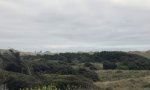
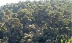
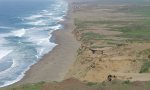
MLRA 4B is primarily in California (98 percent). A small part of the area is in Oregon (2 percent). The MLRA makes up about 4,844 square miles (12,545 square kilometers). It is characterized by low-elevation beaches, elevated coastal plains and plateaus, marine terraces, and isomesic mountains; by a primarily udic soil moisture regime; and by exposure to heavy fog from the California Current, which favors the dominance of coast redwoods. The cool temperatures, higher precipitation, and winds created from the California Current interact with the low-elevation land surfaces to provide a significant portion of the yearly moisture by creating a daily heavy fog throughout the warmer summer months. A key distinguishing characteristic between MLRA 4B and MLRA 4A (to the north) is the colder winter temperatures and the decreased frequency and intensity of summer fog in MLRA 4A. The colder temperatures and occasional snow favor Sitka spruce, which dominates most of the landscape within MLRA 4A, and the soils have a udic or perudic moisture regime. To the east of MLRA 4B, as the maritime influence decreases, precipitation increases, the freeze-free period decreases, and the area gradually transitions into MLRA 5 (Siskiyou-Trinity Area). To the south and southeast, as the maritime influence decreases, temperatures increase and precipitation decreases and the area gradually transitions into MLRA 15 (Central California Coast Range). The soils in MLRA 15 dominantly have a thermic temperature regime and a xeric moisture regime and support oak woodlands, oak savannas, chaparral, and grasslands.
Key publications
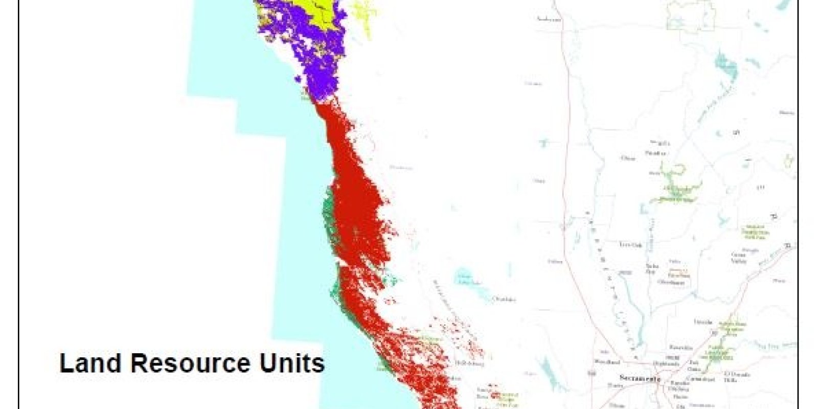
Geographic subunits
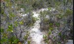
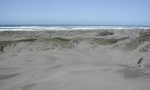
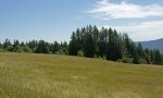
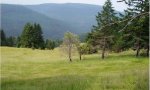
Land Resource Unit 1. This LRU (formerly LRU A) is primarily influenced by hydrological processes and contains beaches, dunes, rivers, and marine terraces below 400 feet elevation. Wet forests, lakes, estuarine marshes, and tea-colored (tannic) streams are characteristic features of this LRU. Marshes and wetlands have been widely altered and/or drained with many converted to agriculture and urban developments. Soil moisture regimes are udic and aquic and soil temperatures are isomesic. Dune communities, grassland, coastal scrub, beach pine, bishop pine, and Sitka spruce on floodplain soils are more typical than the redwoods found in adjacent LRU I. Riparian areas contain red alder and salmonberry, and, in a few areas, some scattered redwoods. In California, the region includes the Crescent City Plain, and Humboldt Bay Flats and Terraces.
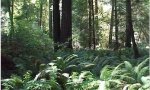
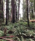
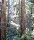
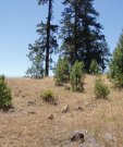
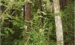
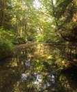
Land Resource Unit 2. The low mountains of the Northern Franciscan Redwood Forest LRU (formerly LRU I) lie entirely within the coastal fog zone and are characteristically covered by fog-dependent coast redwoods and Douglas-fir. Historically, unbroken redwood forests occurred and moderated local climate by trapping coastal fog and producing shade. The combination of shade, root competition, young soils with a deep organic debris layer on the soil surface, occasional fire, and silting by floods limits the number of plant species that occur here. The region extends north only about 10 miles into Oregon near Brookings. Dominated by conifers, the region also includes Sitka spruce, western hemlock, western redcedar, Port Orford cedar, and grand fir. Hardwoods such as red alder, Pacific rhododendron, and tanoak commonly occur. This LRU also includes the areas known as the Bald Hills that have been maintained for over 100 years as prairies and oak woodlands through prescribed fire. These hills are dominated by Oregon white oak and perennial and annual native and non-native grasses and forbs but are actively encroached by Douglas-fir and redwood. Fine and fine-loamy, udic, isomesic, Ultisols and Alfisols are typical. In some factors, this region has more similarities to the temperate rain forests of the Oregon and Washington Coast Ranges, however since it does not receive winter snow and colder temperatures and still maintains the distinct presence and dominance of coast redwood make this LRU unique to MLRA 4B.
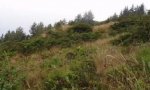
Land Resource Unit 3. In contrast to the redwood forests to the north and south, the vegetation of the King Range/Mattole Basin LRU (formerly LRU J) includes a mixed evergreen forest of predominantly Douglas-fir, tanoak, and madrone, as well as low elevation footslopes and stream terraces dominated by coast redwood and small areas of grassland. Prairies and coastal scrub cover many of the headlands. Although this is one of the wettest spots in California, precipitation-wise--the hot, dry, offshore summer winds keep out the fog and make the King Range too dry to support a dominant overstory of redwoods, like that of the surrounding LRUs. The key difference between the redwood dominated slopes of this LRU and those of LRU I, is that when redwoods are harvested from LRU J, they will not re-establish on their own, they must be planted. Soils in this LRU are typically fine or fine-loamy, ustic, isomesic and mesic Inceptisols and Alfisols. The King Range thrusts 4,000 feet above the Pacific, making this area one of the more spectacular and remote stretches of coastline in the continental U.S. In the northern part of the region the Bear and Mattole rivers drain a hilly to steep landscape of mixed evergreen forest, with a landcover that includes a relatively greater amount of annual grasslands than in LRU I to the north or 1k to the south. Timber production, livestock grazing, and recreation are principal land uses.
Land Resource Unit 4. The main part of the Coastal Franciscan Redwood Forest LRU (formerly LRU K) extends through Mendocino County from just south of the King Range to just south of the Russian River in Sonoma County. Unlike the conifer-dominated forests of LRU I to the north, these central redwood forests are typically more a mixture of conifers and hardwoods. Vegetation includes a multi-story canopy of redwood, Douglas-fir, tanoak, bigleaf maple, evergreen shrubs, and various grasses. The near-coastal part of the region that is influenced more by fog has more redwoods and similarities to LRU I to the north, however the drier summers and more limited duration of coastal fog limits the competitive advantage of the coastal redwoods in this LRU. This creates limited areas that remain dominated by coast redwood and a larger portion of the LRU dominated by Douglas-fir and other hardwoods, with some redwoods near the lower parts of the mountain slopes where fog still has some influence or the drainages are narrower and remain cooler in the summers, limiting evapotranspiration losses. The soil temperature regimes are predominantly isomesic and mesic. Soil moisture regimes are predominantly udic, ustic, and xeric. Runoff is rapid and many of the smaller streams are dry by the end of the summer. Natural lakes are absent. This LRU differs from LRU L due to the ustic-isomesic soil temperatures in LRU K and a decrease in fog days in the summer due to the inland locations and direction of the mountain slopes.
Land Resource Unit 5. The Fort Bragg/Fort Ross Terraces LRU (formerly LRU L) form an elevated coastal plain that has less relief (200-800 feet) than the adjacent low elevation mountains of LRU K. This LRU also contains the dissected coastal plateau feature that is very acidic and is home to the ecologically unique and rare pygmy forest and bog lands. Quaternary and Tertiary sandstones and mudstones form the terraces, and some areas are deeply dissected, forming ravines that expose Cretaceous sedimentary rocks. Soil moisture regimes are udic and some aquic, and soil temperatures are isomesic. Monthly and annual temperature variations are minimal and summer fog is common. Vegetation includes coastal grasslands and shrubs, stunted beach pine, bishop pine, or pygmy cypress, along with areas of some grand fir and western hemlock. Terrace soils are typically unsuitable for redwoods, although they do occur in ravines and some bluffs.
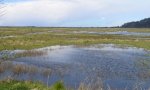
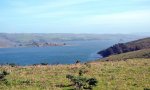
Land Resource Unit 6. The Point Reyes/Farallon Islands LRU (formerly LRU M) includes the Point Reyes Peninsula, Bodega Head and the sand spit at the north end of Bodega Bay, and the offshore Farallon Islands. The maritime climate is temperate and humid, and fog often occurs. Heavy coastal winds are an influential factor in vegetation expression in this LRU that occur primarily in the summer months, explaining the large extent of coastal prairies and coastal scrub species along much of the coastline. Where trees are present along or near the coastline and within the reach of these heavy winds, the tree canopies form unidirectional windswept crowns. There are granitic rocks along with Pliocene and Miocene sandstone and mudstone, and Quaternary sands. Soil temperature regimes are mostly isomesic, with some mesic. Soil moisture regimes are mostly ustic. Common vegetation includes Douglas-fir, tanoak, Bishop pine, coast live oak, Pacific reedgrass, and coyote brush. A few redwoods occur. Most of the streams are small, and dry by the end of the summer. Much of this area is within the Point Reyes National Seashore and remains unmapped as of 2018. The Farallon Islands, about 20 miles southwest of Point Reyes, are a group of small granitic rock islands providing important unvegetated habitat for seabirds, seals, and sea lions.
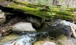
Land Resource Unit 7. The Santa Cruz Mountains LRU (formerly LRU N) covers the western and southwestern parts of the range where vegetation includes redwood, Douglas-fir, tanoak, coast live oak, and California bay, along with some chaparral and coastal scrub species. The shrub layer under forest canopy is generally sparse. Species of limited range in this area include the Santa Cruz cypress and Shreve oak. Forests of this region are ecologically and genetically distinct from those of the redwood regions (LRUs I and K) further north. Climate varies from the west to the east, as the high mountain ridges reduce the penetration of maritime air. Winters are cool and wet with the occasional snow storms at the highest elevations and in narrow, north-facing drainages, leading to some white and red fir in limited locations. Heavy rains are also known to cause mudslides throughout this LRU, and on the west side, summers are cooler, and fog or low overcast skies are only around for the mornings and carry through the low slopes and stream terraces. Soil temperature regimes are mostly mesic and isomesic, with some thermic. Soil moisture regimes are mostly ustic and xeric. Streams on the northeast side of the mountains are generally dry during the summer, but streams on the seaward side are generally perennial.
Land Resource Unit 8. The San Mateo Coastal Hills LRU (formerly LRU O) have lower relief and elevations than LRU N, with more coastal oak and scrub vegetation and coastal grasslands and areas of cultivation rather than the denser forest and woodland of the Santa Cruz Mountains. Pliocene sandstone and siltsone are the main rock types compared to the mix of geology in LRU N that includes older sedimentary and some igneous rocks. Marine terraces, coastal benches, and small valleys are the primary landforms. Mollisols are typical, with mostly thermic to isomesic temperature regimes. Soil moisture regimes are mostly xeric and ustic. Summer fog is common and winters are cool and moist.
Next steps
-
1
Select an ecological site group
Select an ecological site group using the list, keys, photos, briefcase, or quick search option located on this page. -
2
Explore the ecological site group description
Next, learn more about the selected ecological site group and its characteristic dynamics by browsing the ecological site group description and exploring alternative state and transition model formats.