

Natural Resources
Conservation Service
Ecological site R024XY022NV
SODIC TERRACE 8-10 P.Z.
Last updated: 3/07/2025
Accessed: 03/14/2025
General information
Provisional. A provisional ecological site description has undergone quality control and quality assurance review. It contains a working state and transition model and enough information to identify the ecological site.
MLRA notes
Major Land Resource Area (MLRA): 024X–Humboldt Basin and Range Area
Major land resource area (MLRA) 24, the Humboldt Area, covers an area of approximately 8,115,200 acres (12,680 sq. mi.). It is found in the Great Basin Section of the Basin and Range Province of the Intermontane Plateaus. Elevations range from 3,950 to 5,900 feet (1,205 to 1,800 meters) in most of the area, some mountain peaks are more than 8,850 feet (2,700 meters).
A series of widely spaced north-south trending mountain ranges are separated by broad valleys filled with alluvium washed in from adjacent mountain ranges. Most valleys are drained by tributaries to the Humboldt River. However, playas occur in lower elevation valleys with closed drainage systems. Isolated ranges are dissected, uplifted fault-block mountains. Geology is comprised of Mesozoic and Paleozoic volcanic rock and marine and continental sediments. Occasional young andesite and basalt flows (6 to 17 million years old) occur at the margins of the mountains. Dominant soil orders include Aridisols, Entisols, Inceptisols and Mollisols. Soils of the area are generally characterized by a mesic soil temperature regime, an aridic soil moisture regime and mixed geology. They are generally well drained, loamy and very deep.
Approximately 75 percent of MLRA 24 is federally owned, the remainder is primarily used for farming, ranching and mining. Irrigated land makes up about 3 percent of the area; the majority of irrigation water is from surface water sources, such as the Humboldt River and Rye Patch Reservoir. Annual precipitation ranges from 6 to 12 inches (15 to 30 cm) for most of the area, but can be as much as 40 inches (101 cm) in the mountain ranges. The majority of annual precipitation occurs as snow in the winter. Rainfall occurs as high-intensity, convective thunderstorms in the spring and fall.
Ecological site concept
This ecological site is on lake plains and basin floor remnants. Soils are very deep, well drained and formed in a thin layer of loess and alluvium derived from mixed parent material influenced by volcanic ash over lacustrine sediments. Soils are characterized by a very low infiltration, an ochric epipedon, moderate to very strong alkalinity, and SAR greater than 45 in (114cm) the upper profile. The soil temperature regime is mesic, and the soil moisture regime is typic aridic.
The plant community is characterized by the mixing of shadscale, and black greasewood and approximate canopy cover is less than 15 percent. Approximate vegetative composition is 85 percent shrubs, 10 percent grasses, and 5 percent forbs.
This ESC will be field checked for correlation to similar concepts. This site has similar species composition and does not compete based on soil characteristic or abiotic factors with Sodic Terrace 6-8"PZ R024XY003NV, Sodic Terrace 6-10"PZ R024XY014OR, or Sodic Fan 6-10"PZ R024XY113OR.
Associated sites
R024XY003NV |
SODIC TERRACE 6-8 P.Z. Soils are very deep, well drained and formed in a thin layer of loess and alluvium derived from mixed parent material influenced by volcanic ash over lacustrine sediments and characterized by a very low infiltration. |
---|---|
R024XY006NV |
DRY FLOODPLAIN This ecological site is on stream terraces and on fan skirts along intermittent drainageways. Soils are very deep, moderately well drained and formed in alluvium derived from mixed rocks with components of loess and volcanic ash. |
R024XY007NV |
SALINE BOTTOM The soil profile is characterized by an ochric epipedon, strong to moderate salinity throughout and a high-water table between 70-100cm at some time during the year. Sodicity (SAR) is 13-99 in the upper 50cm and decreases with depth. Dominant plant species are Black greasewood (SAVE4) and Basin wildrye (LECI4) |
R024XY011NV |
SODIC FLAT 6-8 P.Z. This ecological site is on stream terraces and on fan skirts along intermittent drainageways. Soils are very deep, moderately well drained and formed in alluvium derived from mixed rocks with components of loess and volcanic ash. |
R024XY015NV |
DEEP SODIC FAN This ecological site is on alluvial flat and stream terraces. Soils are very deep, well drained, and formed in alluvium derived from mixed parent material. The soil profile is characterized by an ochric epipedon, a pH greater than 8.5 throughout and silt clay loam or loam texture. |
Similar sites
R024XY007NV |
SALINE BOTTOM Black greasewood (SAVE4) dominant shrub; Big sagebrush (ARTR2) absent; more productive site. |
---|---|
R024XY008NV |
SODIC FLAT 8-10 P.Z. Black greasewood (SAVE4) dominant shrub; Big sagebrush (ARTR2) absent. |
R024XY003NV |
SODIC TERRACE 6-8 P.Z. Black greasewood (SAVE4)- Shadscale saltbrush (ATCO) codominant shrubs. |
R024XY006NV |
DRY FLOODPLAIN Big sagebrush (ARTR2) dominant shrub; Black greasewood (SAVE4) minor shrub, if present; Basin Wildrye (LECI4) dominant plant |
Table 1. Dominant plant species
Tree |
Not specified |
---|---|
Shrub |
(1) Sarcobatus vermiculatus |
Herbaceous |
(1) Leymus cinereus |
Physiographic features
This site occurs on fan aprons, fan skirts, alluvial flats and stream terraces. Slopes range from 0 to 8 percent, but slope gradient of 0 to 4 percent are typical. Elevations are to 3900 to 6000 feet (1189 to 1829m).
Table 2. Representative physiographic features
Landforms |
(1)
Basin floor
> Fan apron
(2) Fan skirt (3) Alluvial flat |
---|---|
Runoff class | Very low to high |
Flooding frequency | None |
Ponding frequency | None |
Elevation | 3,900 – 6,000 ft |
Slope | 8% |
Water table depth | 51 – 84 in |
Aspect | Aspect is not a significant factor |
Climatic features
The climate is semiarid, characterized by cold, moist winters, and warm, somewhat dry summers. Average annual precipitation is 8 to 10 inches (20 to 25cm). Mean annual air temperature is 45 to 53 degrees F. The average growing season is about 90 to 130 days.
Table 3. Representative climatic features
Frost-free period (average) | 130 days |
---|---|
Freeze-free period (average) | |
Precipitation total (average) | 10 in |
Figure 1. Monthly precipitation range
Figure 2. Monthly average minimum and maximum temperature
Influencing water features
This site is not adjacent to perennial streams.
Soil features
The soils associated with this site are very deep, well drained and formed in a thin layer of loess and alluvium derived from mixed rocks influenced by volcanic ash over lacustrine sediments. The soil profile is characterized by a surface horizon with a platy soil structure, moderate to strong alkalinity and a SAR greater than 45.
Soil texture is a silt loam throughout. Many of these soils were formed under more poorly drained conditions than exist curently and relict redox concentrations can be found below 30cm. The surface horizon is violently effervescent and will normally crust and bake upon drying inhibiting water infiltration and seedling emergence.
The representative soil series associated with this site is Boton. Other series include: Batan, Benin, Beoska, Blacka, Broyles, Bubus, Caphor, Chuckles, Creemon, Cren, Cresal, Essal, Geysen, Iron Blossom, Jerval, Kawich, Mazuma, Misad, Nomazu, Raglan, Ragtown, Relley, Rosney, Soolake, Swingler, Tresed, Wardenot, Weso, Whirlo, and Yipor.
Where this ecological site is correlated to Ocala components will be field checked for re-correlation to 024XY008NV/024XY011NV.
Table 4. Representative soil features
Parent material |
(1)
Loess
(2) Alluvium (3) Volcanic ash (4) Lacustrine deposits |
---|---|
Surface texture |
(1) Fine sandy loam (2) Loamy fine sand (3) Very fine sandy loam |
Family particle size |
(1) Loamy |
Drainage class | Moderately well drained to well drained |
Permeability class | Slow to moderately rapid |
Soil depth | 60 – 84 in |
Surface fragment cover <=3" | 15% |
Surface fragment cover >3" | 2% |
Available water capacity (0-40in) |
5 – 8.2 in |
Calcium carbonate equivalent (0-40in) |
5% |
Electrical conductivity (0-40in) |
32 mmhos/cm |
Sodium adsorption ratio (0-40in) |
10 – 40 |
Soil reaction (1:1 water) (0-40in) |
8.2 – 9.6 |
Subsurface fragment volume <=3" (Depth not specified) |
15% |
Subsurface fragment volume >3" (Depth not specified) |
5% |
Ecological dynamics
An ecological site is the product of all the environmental factors responsible for its development and it has a set of key characteristics that influence a site’s resilience to disturbance and resistance to invasives. Key characteristics include 1) climate (precipitation, temperature), 2) topography (aspect, slope, elevation, and landform), 3) hydrology (infiltration, runoff), 4) soils (depth, texture, structure, organic matter), 5) plant communities (functional groups, productivity), and 6) natural disturbance regime (fire, herbivory, etc.) (Caudle 2013). Biotic factors that influence resilience include site productivity, species composition and structure, and population regulation and regeneration (Chambers et al. 2013).
This ecological site is dominated by black greasewood with an understory of basin wildrye. Inland saltgrass and alkali sacaton are also common on these sites.
Black greasewood is classified as a phreatophyte (Eddleman 2002), and its distribution is well correlated with the distribution of groundwater (Mozingo 1987). Meinzer (1927) discovered that the taproots of black greasewood could penetrate from 20 to 57 feet below the surface. Romo (1984) found water tables ranging from 3.5-15 m under black greasewood dominated communities in Oregon. Black greasewood stands develop best where moisture is readily available, either from surface or subsurface runoff (Brown 1965). It is commonly found on floodplains that are either subject to periodic flooding, have a high water table at least part of the year, or have a water table less than 34 feet deep (Harr and Price 1972, Blauer et al. 1976, Branson et al. 1976, Blaisdell and Holmgren 1984, Eddleman 2002). Black greasewood is usually a deep rooted shrub but has some shallow roots near the soil surface; the maximum rooting depth can be determined by the depth to a saturated zone (Harr and Price 1972). (Ganskopp (1986) reported that water tables within 9.8 to 11.8 inches of the surface had no effect on black greasewood in Oregon. However, a study, conducted in California, found that black greasewood did not survive six months of continuous flooding (Groeneveld and Crowley 1988, Groeneveld 1990). Additionally, seasonally high water tables have been found necessary for maintenance of productivity and reestablishment of basin wildrye following disturbances such as fire, drought or excessive herbivory (Eckert et al. 1973). The sensitivity of basin wildrye seedling establishment to reduced soil water availability is increased as soil pH increases (Stuart et al.1971). Lowering of the water table through extended drought or water pumping will decrease basin wildrye production and establishment while black greasewood, rabbitbrush, inland saltgrass and invasive weeds will increase.
Drought will initially cause a decline in bunchgrasses, but prolonged drought will eventually cause a decline in shrubs, including black greasewood. As site conditions deteriorate, the Sodic Flat 6-8” P.Z. may become a pure stand of black greasewood or a pure stand with an annual understory. Marcum and Kopec (1997) found inland saltgrass more tolerant of increased levels of salinity than alkali sacaton therefore dewatering and/or long term drought causing increased levels of salinity would create environmental conditions more favorable to inland saltgrass over alkali sacaton. Alkali sacaton is considered a facultative wet species in this region; therefore it is not drought tolerant. A lowering of the water table can occur with groundwater pumping and this may contribute to the loss of deep-rooted species such as greasewood and basin wildrye and an increase in rabbitbrush (Ericameria nauseosa), shadscale (Atriplex confertifolia) and other species that are not groundwater dependent.
Annual non-native species such as halogeton (Halogeton glomeratus) and cheatgrass (Bromus tectorum) invade these sites where competition from perennial species is decreased. Three possible alternative stable states have been identified for this site.
Fire Ecology:
Fire is a rare disturbance in these plant communities likely occurring in years with above average production. Natural fire return intervals are estimated to vary between less than 35 years up to 100 years in salt desert ecosystems with basin wildrye (Paysen et al. 2000). Historically, black greasewood-saltbush communities had sparse understories and bare soil in intershrub spaces, making these communities somewhat resistant to fire (Young 1983, Paysen et al. 2000). They may burn only during high fire hazard conditions; for example, years with high precipitation can result in almost continuous fine fuels, increasing fire hazard (West 1994, Paysen et al. 2000).
Black greasewood may be killed by severe fires, but can resprout after low to moderate severity fires (Robertson 1983, West 1994). Sheeter (1969) reported that following a Nevada wildfire, black greasewood sprouts reached approximately 2.5 feet within 3 years. Grazing and other disturbance may result in increased biomass production due to sprouting and increased seed production, also leading to greater fuel loads (Sanderson and Stutz 1994). Higher production sites would have experienced fire more frequently than lower production sites.
Basin wildrye is relatively resistant to fire, particularly dormant season fire, as plants sprout from surviving root crowns and rhizomes (Zschaechner 1985). Miller et al. (2013) reports fall and spring burning increased total shoot and reproductive shoot densities in the first year, although live basal areas were similar between burn and unburned plants. By year two, there was little difference between burned and control treatments.
As ecological condition declines and where management results in abusive grazing use by livestock or feral horses, basin wildrye decreases as black greasewood, rabbitbrush, and big sagebrush increase and become the dominant vegetation. Cheatgrass, annual mustards, and Russian thistle readily invade this site.
Fire Ecology:
Black greasewood communities have been historically subject to stand-replacing fire regimes with intervals of <100 years. Black greasewood may be killed by severe fires, but it commonly sprouts soon after low to moderate-severity fires. Wyoming big sagebrush and basin big sagebrush are killed by fire and establish after fire from a seedbank; from seed produced by remnant plants that escaped fire; and from plants adjacent to the burn that seed in. Spiny hopsage is considered to be somewhat fire tolerant and often survives fires that kill sagebrush. Mature spiny hopsage generally sprout after being burned. Spiny hopsage is reported to be least susceptible to fire during summer dormancy. Basin wildrye is top-killed by fire. Older basin wildrye plants with large proportions of dead material within the perennial crown can be expected to show higher mortality due to fire than younger plants having little debris. Basin wildrye is generally tolerant of fire but may be damaged by early season fire combined with dry soil conditions. Bottlebrush squirreltail's small size, coarse stems, and sparse leafy material aid in its tolerance of fire. Postfire regeneration occurs from surviving root crowns and from on- and off-site seed sources. Frequency of disturbance greatly influences postfire response of bottlebrush squirreltail. Undisturbed plants within a 6 to 9 year age class generally contain large amounts of dead material, increasing bottlebrush squirreltail's susceptibility to fire. Indian ricegrass can be killed by fire, depending on severity and season of burn. Indian ricegrass reestablishes on burned sites through seed dispersed from adjacent unburned areas.
State and transition model

Figure 3. T Stringham 4/2017

Figure 4. Legend 2017
More interactive model formats are also available.
View Interactive Models
More interactive model formats are also available.
View Interactive Models
Click on state and transition labels to scroll to the respective text
State 1 submodel, plant communities
State 2 submodel, plant communities
State 3 submodel, plant communities
State 4 submodel, plant communities
State 1
Reference State
The Reference State 1.0 is a representative of the natural range of variability under pristine conditions. The reference state has three general community phases; a shrub-grass dominant phase, a perennial grass dominant phase and a shrub dominant phase. State dynamics are maintained by interactions between climatic patterns and disturbance regimes. Negative feedbacks enhance ecosystem resilience and contribute to the stability of the state. These include the presence of all structural and functional groups, low fine fuel loads, and retention of organic matter and nutrients. Plant community phase changes are primarily driven by fire, periodic drought and/or insect or disease attack.
Community 1.1
Reference Plant Community
This community is dominated by black greasewood. Basin wildrye and inland saltgrass are present in the understory. Drought will favor shrubs over perennial bunchgrasses. However, long-term drought will result in an overall decline in the plant community, regardless of functional group.
Figure 5. Annual production by plant type (representative values) or group (midpoint values)
Table 5. Annual production by plant type
Plant type | Low (lb/acre) |
Representative value (lb/acre) |
High (lb/acre) |
---|---|---|---|
Shrub/Vine | 245 | 420 | 560 |
Grass/Grasslike | 87 | 150 | 200 |
Forb | 18 | 30 | 40 |
Total | 350 | 600 | 800 |
Community 1.2
Community Phase
This community phase is characteristic of a post-disturbance, early-seral community phase. Basin wildrye and alkali sacaton dominate the community. Black greasewood will decrease but will likely sprout and return to pre-burn levels within a few years. Early colonizers such as rabbitbrush and shadscale may increase.
Community 1.3
Community Phase
Black greasewood and shadscale increase in the absence of disturbance. Decadent shrubs dominate the overstory and deep-rooted perennial bunchgrasses in the understory are reduced either from competition with shrubs, herbivory, drought or combinations of these. Inland saltgrass is more drought tolerant and may increase in the community.
Pathway 1.1a
Community 1.1 to 1.2
A low severity fire would decrease the overstory of black greasewood and allow for the understory perennial grasses to increase. Fires are typically low severity resulting in a mosaic pattern due to low fuel loads. A fire following an unusually wet spring facilitating an increase in fine fuels may be more severe and reduce black greasewood cover to trace amounts.
Pathway 1.1b
Community 1.1 to 1.3
Absence of disturbance over time, significant herbivory, long term drought or combinations of these would allow the black greasewood overstory to increase and dominate the site. This will generally cause a reduction in perennial bunch grasses; however inland saltgrass may increase in the understory depending on the timing and intensity of herbivory. Heavy spring utilization will favor an increase in black greasewood.
Pathway 1.2a
Community 1.2 to 1.1
Time and lack of disturbance will allow black greasewood to increase.
Pathway 1.3a
Community 1.3 to 1.2
Fire will decrease the overstory of black greasewood and allow for the perennial bunchgrasses to dominate the site. Fires are typically high severity in this phase due to the dominance of black greasewood resulting in removal of the overstory shrub community.
State 2
Current Potential State
This state is similar to the Reference State 1.0 with three similar community phases. Ecological function has not changed, however the resiliency of the state has been reduced by the presence of invasive weeds. Non-natives may increase in abundance but will not become dominant within this State. These non-natives can be highly flammable and can promote fire where historically fire had been infrequent. Negative feedbacks enhance ecosystem resilience and contribute to the stability of the state. These feedbacks include the presence of all structural and functional groups, low fine fuel loads, and retention of organic matter and nutrients. Positive feedbacks decrease ecosystem resilience and stability of the state. These include the non-natives’ high seed output, persistent seed bank, rapid growth rate, ability to cross pollinate, and adaptations for seed dispersal.
Community 2.1
Community Phase
This community phase is compositionally similar to the Reference State Community Phase 1.1 with the presence of non-native species in trace amounts. This community is dominated by black greasewood. Basin wildrye, inland saltgrass, Alkali sacaton, shadscale, rubber rabbitbrush and other shrubs comprise the minor components. Non-native annual species such as halogeton and cheatgrass are present.
Community 2.2
Community Phase
This community phase is characteristic of a post-disturbance, early-seral community where annual non-native species are present. Perennial bunchgrasses such as alkali sacaton, inland saltgrass and basin wildrye dominate the site. Depending on fire severity patches of intact shrubs may remain. Black greasewood and rabbitbrush may be sprouting. Annual non-native species are stable to increasing in the community.
Community 2.3
Community Phase (At Risk)
Black greasewood dominates the overstory and perennial bunchgrasses in the understory are reduced, either from competition with shrubs or from inappropriate grazing, or from both. Rabbitbrush may be a significant component. Inland saltgrass is more grazing tolerant and may increase within the community. Annual non-native species are stable or increasing. This community is at risk of crossing a threshold to State 3.0 (grazing or fire).
Pathway 2.1a
Community 2.1 to 2.2
A low severity fire would decrease the overstory of black greasewood and allow for the understory perennial grasses to increase. Fires are typically low severity resulting in a mosaic pattern due to low fuel loads. A fire following an unusually wet spring or a change in management favoring an increase in fine fuels may be more severe and reduce black sagebrush cover to trace amounts. Brush treatments with minimal soil disturbance may also reduce black greasewood and allow for perennial bunchgrasses to increase. Annual non-native species are likely to increase after fire.
Pathway 2.1b
Community 2.1 to 2.3
Absence of disturbance over time, long term drought, inappropriate grazing management or combinations of these would allow the black greasewood overstory to increase and dominate the site. Inappropriate grazing management reduces the perennial bunchgrass understory; conversely inland saltgrass may increase in the understory.
Pathway 2.2a
Community 2.2 to 2.1
Absence of disturbance over time, long term drought and/or grazing management that favors the establishment and growth of black greasewood allows the shrub component to recover.
Pathway 2.3a
Community 2.3 to 2.2
Grazing management that reduces shrubs will allow for the perennial bunchgrasses in the understory to increase. Heavy late-fall/winter grazing may cause mechanical damage to black greasewood promoting the perennial bunchgrass understory. Brush treatments with minimal soil disturbance will also decrease greasewood and release the perennial understory. Fires may be high severity due to the dominance of black greasewood in this community phase; a fire would decrease the shrub overstory and may allow for an increase in perennial bunchgrasses. Annual non-native species are present and may increase in the community.
State 3
Shrub State
This state has two community phases, one that is characterized by a dominance of black greasewood overstory and the other with a rabbitbrush overstory. This site has crossed a biotic and abiotic threshold and site processes are being controlled by shrubs. Bare ground has increased and pedestalling of grasses may be excessive.
Community 3.1
Community Phase

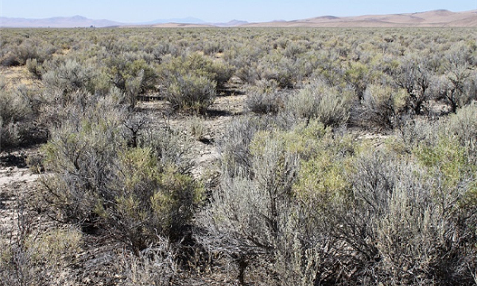
Figure 6. T Stringham 8/2010 NV775, MU3740, Kelk series

Figure 7. TStringham, 4/2010, NV777 MU603, Valmy Series
Black greasewood dominates the overstory. Rabbitbrush may be a significant component. Deep-rooted perennial bunchgrasses such as basin wildrye have significantly declined. Annual non-native species increase. Bare ground is significant.
Community 3.2
Community Phase
Rabbitbrush dominates the site. Perennial bunchgrasses are present but a minor component. Annual non-native species are present and may be increasing in the understory.
Pathway 3.1a
Community 3.1 to 3.2
Long term drought and/or lowering of water table by groundwater pumping would reduce black greasewood and allow for rabbitbrush and other shrubs on the site to dominate. Severe fire would also reduce black greasewood overstory and allow for an increase rabbitbrush.
Pathway 3.2a
Community 3.2 to 3.1
Release from long term drought and/or grazing pressure may allow for black greasewood, basin wildrye and other perennial bunchgrasses to increase.
State 4
Annual State
This state has two community phases. In this state, a biotic threshold has been crossed and state dynamics are driven by the dominance and persistence of the annual plant community which is perpetuated by a shortened fire return interval. The herbaceous understory is dominated by annual non-native species such as cheatgrass and halogeton. Bare ground may be abundant. Resiliency has declined and further degradation from fire facilitates a cheatgrass and sprouting shrub plant community. The fire return interval has shortened due to the dominance of cheatgrass in the understory and is a driver in site dynamics.
Community 4.1
Community Phase
This community is dominated by annual non-native species. Halogeton most commonly invades these sites. Trace amounts of shadscale and other shrubs may be present, but are not contributing to site function. Bare ground may be abundant, especially during low precipitation years. Soil erosion from wind and soil temperature are driving factors in site function.
Community 4.2
Community Phase
This community is dominated by black greasewood which can sprout after fire. Shadscale is increasing within the community. Annual non-native species dominate the understory.
Pathway 4.1a
Community 4.1 to 4.2
Time and lack of disturbance allows for reestablishment of black greasewood.
Pathway 4.2a
Community 4.2 to 4.1
Fire
Transition T1A
State 1 to 2
Trigger: Introduction of non-native annual plants. Slow variables: Over time the annual non-native plants will increase within the community. Threshold: Any amount of introduced non-native species causes an immediate decrease in the resilience of the site. Annual non-native species cannot be easily removed from the system and have the potential to significantly alter disturbance regimes from their historic range of variation.
Transition T2A
State 2 to 3
Trigger: To Community Phase 3.1: Inappropriate cattle/horse grazing will decrease or eliminate deep rooted perennial bunchgrasses and favor shrub growth and establishment. To Community Phase 3.2: Severe fire will reduce and/or eliminate black greasewood overstory and decrease perennial bunchgrasses. Soil disturbing brush treatments will reduce black greasewood and possibly increase non-native annual species. Lowering of the water table due to groundwater pumping will also decrease black greasewood and allow for rabbitbrush and other shrubs to increase. Slow variables: Long term decrease in deep-rooted perennial grass density and/or black greasewood. Threshold: Loss of deep-rooted perennial bunchgrasses changes nutrient cycling, nutrient redistribution, and reduces soil organic matter. Loss of long-lived, black greasewood changes the temporal and depending on the replacement shrub, the spatial distribution of nutrient cycling.
Transition T2B
State 2 to 4
Trigger: Fire and/or soil disturbing treatments such as drill seeding and plowing. An unusually wet spring may facilitate the increased germination and production of cheatgrass leading to its dominance within the community. Slow variables: Increased production and cover of non-native annual species. Threshold: Increased, continuous fine fuels modify the fire regime by changing intensity, size and spatial variability of fires. Changes in plant community composition and spatial variability of vegetation due to the loss of perennial bunchgrasses and shadscale truncate energy capture spatially and temporally thus impacting nutrient cycling and distribution.
Transition T3A
State 3 to 4
Trigger: Fire and/or soil disturbing treatments such as drill seeding and plowing. An unusually wet spring may facilitate the increased germination and production of cheatgrass leading to its dominance within the community. Slow variables: Increased production and cover of non-native annual species. Threshold: Increased, continuous fine fuels modify the fire regime by changing intensity, size and spatial variability of fires. Changes in plant community composition and spatial variability of vegetation due to the loss of perennial bunchgrasses and shadscale truncate energy capture spatially and temporally thus impacting nutrient cycling and distribution.
Additional community tables
Table 6. Community 1.1 plant community composition
Group | Common name | Symbol | Scientific name | Annual production (lb/acre) | Foliar cover (%) | |
---|---|---|---|---|---|---|
Grass/Grasslike
|
||||||
1 | Primary Perennial Grasses | 84–180 | ||||
basin wildrye | LECI4 | Leymus cinereus | 60–120 | – | ||
Indian ricegrass | ACHY | Achnatherum hymenoides | 12–30 | – | ||
squirreltail | ELEL5 | Elymus elymoides | 12–30 | – | ||
2 | Secondary Perennial Grasses | 12–30 | ||||
saltgrass | DISP | Distichlis spicata | 3–12 | – | ||
western wheatgrass | PASM | Pascopyrum smithii | 3–12 | – | ||
alkali sacaton | SPAI | Sporobolus airoides | 3–12 | – | ||
Forb
|
||||||
3 | Perennial Forbs | 12–48 | ||||
basin wildrye | LECI4 | Leymus cinereus | 60–120 | – | ||
milkvetch | ASTRA | Astragalus | 3–18 | – | ||
globemallow | SPHAE | Sphaeralcea | 3–18 | – | ||
thelypody | THELY | Thelypodium | 3–18 | – | ||
Shrub/Vine
|
||||||
4 | Primary Shrubs | 210–420 | ||||
greasewood | SAVE4 | Sarcobatus vermiculatus | 120–180 | – | ||
spiny hopsage | GRSP | Grayia spinosa | 30–90 | – | ||
basin big sagebrush | ARTRT | Artemisia tridentata ssp. tridentata | 30–75 | – | ||
Wyoming big sagebrush | ARTRW8 | Artemisia tridentata ssp. wyomingensis | 30–75 | – | ||
saltgrass | DISP | Distichlis spicata | 4–10 | – | ||
5 | Secondary Shrubs | 12–60 | ||||
shadscale saltbush | ATCO | Atriplex confertifolia | 6–12 | – | ||
Torrey's saltbush | ATTO | Atriplex torreyi | 6–12 | – | ||
yellow rabbitbrush | CHVI8 | Chrysothamnus viscidiflorus | 6–12 | – | ||
rubber rabbitbrush | ERNAN5 | Ericameria nauseosa ssp. nauseosa var. nauseosa | 6–12 | – | ||
horsebrush | TETRA3 | Tetradymia | 6–12 | – | ||
alkali sacaton | SPAI | Sporobolus airoides | 4–10 | – |
Interpretations
Animal community
Livestock Interpretations:
This site has value for livestock grazing. Grazing management should be keyed to dominant grasses and palatable shrubs production. Black greasewood is an important winter browse plant for domestic sheep and cattle. It also receives light to moderate use by domestic sheep and cattle during spring and summer months. Black greasewood contains soluble sodium and potassium oxalates that may cause poisoning and death in domestic sheep and cattle if large amounts are consumed in a short time. Basin big sagebrush may serve as emergency food during severe winter weather, but it is not usually sought out by livestock. Livestock browse Wyoming big sagebrush, but may use it only lightly when palatable herbaceous species are available. Spiny hopsage provides a palatable and nutritious food source for livestock, particularly during late winter through spring. Domestic sheep browse the succulent new growth of spiny hopsage in late winter and early spring. The early growth and abundant production of basin wildrye make it a valuable source of forage for livestock. It is important forage for cattle and is readily grazed by cattle and horses in early spring and fall. Though coarse-textured during the winter, basin wildrye may be utilized more frequently by livestock and wildlife when snow has covered low shrubs and other grasses. Bottlebrush squirreltail is very palatable winter forage for domestic sheep of Intermountain ranges. Domestic sheep relish the green foliage. Overall, bottlebrush squirreltail is considered moderately palatable to livestock. Indian ricegrass is highly palatable to all classes of livestock in both green and cured condition. It supplies a source of green feed before most other native grasses have produced much new growth.
Stocking rates vary over time depending upon season of use, climate variations, site, and previous and current management goals. A safe starting stocking rate is an estimated stocking rate that is fine tuned by the client by adaptive management through the year and from year to year.
Wildlife Interpretations:
Black greasewood is an important winter browse plant for big game animals and a food source for many other wildlife species. It also receives light to moderate use by mule deer and pronghorn during spring and summer months. Basin big sagebrush is the least palatable of all the subspecies of big sagebrush. Basin big sagebrush is browsed by mule deer from fall to early spring, but is not preferred. Wyoming big sagebrush is preferred browse for wild ungulates. Pronghorn usually browse Wyoming big sagebrush heavily. Spiny hopsage provides a palatable and nutritious food source for big game animals. Spiny hopsage is used as forage to at least some extent by domestic goats, deer, pronghorn, and rabbits. Basin wildrye provides winter forage for mule deer, though use is often low compared to other native grasses. Basin wildrye provides summer forage for black-tailed jackrabbits. Because basin wildrye remains green throughout early summer, it remains available for small mammal forage for longer time than other grasses. Bottlebrush squirreltail is a dietary component of several wildlife species. Bottlebrush squirreltail may provide forage for mule deer and pronghorn. Indian ricegrass is eaten by pronghorn in moderate amounts whenever available. In Nevada it is consumed by desert bighorns. A number of heteromyid rodents inhabiting desert rangelands show preference for seed of Indian ricegrass. Indian ricegrass is an important component of jackrabbit diets in spring and summer. In Nevada, Indian ricegrass may even dominate jackrabbit diets during the spring through early summer months. Indian ricegrass seed provides food for many species of birds. Doves, for example, eat large amounts of shattered Indian ricegrass seed lying on the ground. Sagebrush-grassland communities provide critical sage-grouse breeding and nesting habitats. Sagebrush is a crucial component of their diet year-round, and sage-grouse select sagebrush almost exclusively for cover. Sage-grouse prefer mountain big sagebrush and Wyoming big sagebrush communities to basin big sagebrush communities.
Hydrological functions
Runoff is very low to high and the potential for sheet and rill erosion is slight. Permeability is slow to moderately rapid. Hydrologic soil groups are A, B, C, and D. Rills are none to rare. Water flow patterns are often numerous in areas subjected to summer convection storms. Flow patterns short and stable. Pedestals are none to rare with occurrence typically limited to areas within water flow patterns. Frost heaving of shallow rooted plants is not considered a "normal" condition. Gullies are none to rare in areas of this site that occur on stable landforms. Where this site occurs on inset fans or fan skirts, gullies and head-cuts associated with ephemeral channel entrenchment may be common. Gullies and head-cuts should be healing or stable. This site may be ponded for very short periods in the late winter. In areas with herbaceous cover (although sparse) of deep-rooted perennial bunchgrasses and/or rhizomatous grasses, these plants can increase infiltration.
Recreational uses
Aesthetic value is derived from the diverse floral and faunal composition and the colorful flowering of wild flowers and shrubs during the spring and early summer. This site offers rewarding opportunities to photographers and for nature study. This site is used for camping and hiking and has potential for upland and big game hunting.
Other products
The leaves, seeds and stems of black greasewood are edible. Some Native American peoples used the bark of big sagebrush to make rope and baskets. Native Americans made tea from big sagebrush leaves. They used the tea as a tonic, an antiseptic, for treating colds, diarrhea, and sore eyes and as a rinse to ward off ticks. Big sagebrush seeds were eaten raw or made into meal. Some Native American peoples traditionally ground parched seeds of spiny hopsage to make pinole flour. Basin wildrye was used as bedding for various Native American ceremonies, providing a cool place for dancers to stand. Indian ricegrass was traditionally eaten by some Native Americans. The Paiutes used seed as a reserve food source.
Other information
Black greasewood is useful for stabilizing soil on wind-blown areas. It successfully revegetates eroded areas and sites too saline for most plant species. Basin big sagebrush shows high potential for range restoration and soil stabilization. Basin big sagebrush grows rapidly and spreads readily from seed. Wyoming big sagebrush is used for stabilizing slopes and gullies and for restoring degraded wildlife habitat, rangelands, mine spoils and other disturbed sites. It is particularly recommended on dry upland sites where other shrubs are difficult to establish. Spiny hopsage has moderate potential for erosion control and low to high potential for long-term revegetation projects. It can improve forage, control wind erosion, and increase soil stability on gentle to moderate slopes. Spiny hopsage is suitable for highway plantings on dry sites in Nevada. Basin wildrye is useful in mine reclamation, fire rehabilitation and stabilizing disturbed areas. Its usefulness in range seeding, however, may be limited by initially weak stand establishment. Bottlebrush squirreltail is tolerant of disturbance and is a suitable species for revegetation.
Supporting information
Inventory data references
NASIS soil component data.
Type locality
Location 1: Humboldt County, NV | |
---|---|
Township/Range/Section | T36 N R38 E S10 |
UTM zone | N |
UTM northing | 4540126 |
UTM easting | 442193 |
Latitude | 41° 0′ 37″ |
Longitude | 117° 41′ 14″ |
General legal description | NW¼ Approximately 3 miles northeast of Winnemuca, Humboldt County, Nevada. Also occurs in Elko, Eureka, Lander, Pershing and Washoe counties, Nevada. |
Other references
Fire Effects Information System (Online; http://www.fs.fed.us/database/feis/plants/).
USDA-NRCS Plants Database (Online; http://www.plants.usda.gov).
Contributors
CP/GKB
Approval
Kendra Moseley, 3/07/2025
Rangeland health reference sheet
Interpreting Indicators of Rangeland Health is a qualitative assessment protocol used to determine ecosystem condition based on benchmark characteristics described in the Reference Sheet. A suite of 17 (or more) indicators are typically considered in an assessment. The ecological site(s) representative of an assessment location must be known prior to applying the protocol and must be verified based on soils and climate. Current plant community cannot be used to identify the ecological site.
Author(s)/participant(s) | Patti Novak-Echenique |
---|---|
Contact for lead author | State Rangeland Management Specialist |
Date | 02/05/2010 |
Approved by | Kendra Moseley |
Approval date | |
Composition (Indicators 10 and 12) based on | Annual Production |
Indicators
-
Number and extent of rills:
Rills are typically none due to the nearly level site conditions. -
Presence of water flow patterns:
Water flow patterns are often numerous near inflow areas from adjacent landscapes. Flow patterns can be fairly long (up to 2 meters) and stable. -
Number and height of erosional pedestals or terracettes:
Pedestals are none to rare with occurrence typically limited to areas within water flow patterns. -
Bare ground from Ecological Site Description or other studies (rock, litter, lichen, moss, plant canopy are not bare ground):
Bare Ground 30-50% -
Number of gullies and erosion associated with gullies:
None -
Extent of wind scoured, blowouts and/or depositional areas:
None -
Amount of litter movement (describe size and distance expected to travel):
Fine litter (foliage of grasses and annual & perennial forbs) expected to move distance of slope length during periods of intense summer convection storms. Persistent litter (large woody material) will remain in place except during unusually severe flooding events. -
Soil surface (top few mm) resistance to erosion (stability values are averages - most sites will show a range of values):
Soil stability values will range from 3 to 6. (To be field tested.) -
Soil surface structure and SOM content (include type of structure and A-horizon color and thickness):
Structure of soil surface is medium to thick platy. Soil surface colors are light and soils are typified by an ochric epipedon. Organic matter is typically less than 1 percent. -
Effect of community phase composition (relative proportion of different functional groups) and spatial distribution on infiltration and runoff:
This site may be ponded for very short periods in the late winter. In areas with herbaceous cover (although sparse) of deep-rooted perennial bunchgrasses and/or rhizomatous grasses, these plants can increase infiltration. -
Presence and thickness of compaction layer (usually none; describe soil profile features which may be mistaken for compaction on this site):
Compacted layers are none. Platy, subangular blocky, prismatic, or massive subsurface layers are normal for this site and are not to be interpreted as compaction. -
Functional/Structural Groups (list in order of descending dominance by above-ground annual-production or live foliar cover using symbols: >>, >, = to indicate much greater than, greater than, and equal to):
Dominant:
Reference Plant Community: Tall shrubs (big sagebrush, black greasewood)Sub-dominant:
Deep-rooted, cool season, perennial bunchgrasses > shallow-rooted, cool season, perennial grasses > cool season, perennial rhizomatous grasses > deep-rooted, cool season, perennial forbs = fibrous, shallow-rooted, cool season, perennial and annual forbsOther:
Microbiotic crustsAdditional:
-
Amount of plant mortality and decadence (include which functional groups are expected to show mortality or decadence):
Dead branches within individual shrubs common and standing dead shrub canopy material may be as much as 35% of total woody canopy. -
Average percent litter cover (%) and depth ( in):
Between plant interspaces (< 5%) and depth of litter is ± ¼ inch. -
Expected annual annual-production (this is TOTAL above-ground annual-production, not just forage annual-production):
For normal or average growing season (through end of May) ± 600 lbs/ac; Winter and spring moisture significantly affect total production. Favorable years ± 800 lbs/ac and unfavorable years ± 350 lbs/ac. -
Potential invasive (including noxious) species (native and non-native). List species which BOTH characterize degraded states and have the potential to become a dominant or co-dominant species on the ecological site if their future establishment and growth is not actively controlled by management interventions. Species that become dominant for only one to several years (e.g., short-term response to drought or wildfire) are not invasive plants. Note that unlike other indicators, we are describing what is NOT expected in the reference state for the ecological site:
Potential invaders include halogeton, Russian thistle, knapweeds, and cheatgrass. -
Perennial plant reproductive capability:
All functional groups should reproduce in average (or normal) and above average growing season years. Reduced reproduction and growth occurs during extended or extreme drought conditions.
Print Options
Sections
Font
Other
The Ecosystem Dynamics Interpretive Tool is an information system framework developed by the USDA-ARS Jornada Experimental Range, USDA Natural Resources Conservation Service, and New Mexico State University.
Click on box and path labels to scroll to the respective text.