
Natural Resources
Conservation Service
Ecological site R024XY030NV
SHALLOW CALCAREOUS LOAM 8-10 P.Z.
Last updated: 3/06/2025
Accessed: 04/10/2026
General information
Provisional. A provisional ecological site description has undergone quality control and quality assurance review. It contains a working state and transition model and enough information to identify the ecological site.
MLRA notes
Major Land Resource Area (MLRA): 024X–Humboldt Basin and Range Area
Major land resource area (MLRA) 24, the Humboldt Area, covers an area of approximately 8,115,200 acres (12,680 sq. mi.). It is found in the Great Basin Section of the Basin and Range Province of the Intermontane Plateaus. Elevations range from 3,950 to 5,900 feet (1,205 to 1,800 meters) in most of the area, some mountain peaks are more than 8,850 feet (2,700 meters).
A series of widely spaced north-south trending mountain ranges are separated by broad valleys filled with alluvium washed in from adjacent mountain ranges. Most valleys are drained by tributaries to the Humboldt River. However, playas occur in lower elevation valleys with closed drainage systems. Isolated ranges are dissected, uplifted fault-block mountains. Geology is comprised of Mesozoic and Paleozoic volcanic rock and marine and continental sediments. Occasional young andesite and basalt flows (6 to 17 million years old) occur at the margins of the mountains. Dominant soil orders include Aridisols, Entisols, Inceptisols and Mollisols. Soils of the area are generally characterized by a mesic soil temperature regime, an aridic soil moisture regime and mixed geology. They are generally well drained, loamy and very deep.
Approximately 75 percent of MLRA 24 is federally owned, the remainder is primarily used for farming, ranching and mining. Irrigated land makes up about 3 percent of the area; the majority of irrigation water is from surface water sources, such as the Humboldt River and Rye Patch Reservoir. Annual precipitation ranges from 6 to 12 inches (15 to 30 cm) for most of the area, but can be as much as 40 inches (101 cm) in the mountain ranges. The majority of annual precipitation occurs as snow in the winter. Rainfall occurs as high-intensity, convective thunderstorms in the spring and fall.
Ecological site concept
This ecological site is on fan remnants. The soils are shallow to a duripan, well drained and formed in loess with a component of volcanic ash and alluvium derived from mixed parent material. The soil profile is characterized by an ochric epipedon, effervescence throughout the profile and less than 35 percent rock fragments by volume.
Important abiotic factors contributing to the presence of this site include shallow depth, low available water holding capacity and less than 10 percent CaCO3 in the surface and subsurface.
Associated sites
| R024XY005NV |
LOAMY 8-10 P.Z. Vegetative cover is less than 35 percent and is dominated by cool season, deep-rooted, perennial bunchgrasses and evergreen shrubs. Dominant species include Thurber’s needlegrass (ACTH7) and Wyoming big sagebrush (ARTRW8). The soil temperature regime is mesic, and the soil moisture regime is aridic bordering on xeric. The presence of this ecological site includes limited precipitation and the presence of the argillic horizon that helps retain soil moisture. |
|---|---|
| R024XY031NV |
SHALLOW CALCAREOUS LOAM 10-14 P.Z. Soils are shallow to moderately deep, well drained and formed in residuum derived from chert, argillite and other mixed parent material. The soil profile is characterized by an ochric epipedon and greater than 35 percent rock fragments by volume. Important abiotic factors contributing to the presence of this site include low available water holding capacity and the presence of secondary carbonates in the soil profile. |
| R024XY045NV |
ERODED SLOPE 6-10 P.Z. This ecological site occurs on hills and rock pediments. Soils are shallow to a restrictive layer, well drained and formed in residuum/colluvium derived from mixed parent material. The soil profile is characterized by an ochric epipedon and strong effervescence, increasing with depth. |
Similar sites
| R024XY031NV |
SHALLOW CALCAREOUS LOAM 10-14 P.Z. Bluebunch wheat grass (PSSPS)- Thurber's needlegrass (ACTH7) codominant grasses; more productive site. |
|---|---|
| R024XY042NV |
STEEP GRAVELLY LOAM 14+ P.Z. Black sagebrush (ARNO4) dominant shrub- Idaho fescue (FEID) dominant grass; more productive site. |
| R024XY016NV |
Mountain Ridge Low sagebrush (ARAR8) and Black sagebrush (ARNO4) common shrub- Idaho fescue (FEID) dominant grass; less productive site. |
Table 1. Dominant plant species
| Tree |
Not specified |
|---|---|
| Shrub |
(1) Artemisia nova |
| Herbaceous |
(1) Achnatherum thurberianum |
Physiographic features
This site is on summits and side slopes of fan remnants, hills and lower mountains on all aspects. Slopes range from 2 to 75 percent, but slope gradients of 30 to 50 percent are typical. Elevations are 4200 to about 7400 feet (1280 to about 2255 m).
Table 2. Representative physiographic features
| Landforms |
(1)
Fan remnant
(2) Hill (3) Mountain |
|---|---|
| Runoff class | Very high |
| Elevation | 4,200 – 7,400 ft |
| Slope | 2 – 75% |
| Water table depth | 72 in |
| Aspect | Aspect is not a significant factor |
Climatic features
The climate associated with this site is semiarid and characterized by cool, moist winters and warm, dry summers. Average annual precipitation is 8 to 10 inches (20 to 25cm). Mean annual air temperature is 45 to 53 degrees F. The average growing season is about 90 to 120 days.
Table 3. Representative climatic features
| Frost-free period (average) | 120 days |
|---|---|
| Freeze-free period (average) | |
| Precipitation total (average) | 10 in |
Figure 1. Monthly precipitation range
Figure 2. Monthly average minimum and maximum temperature
Influencing water features
There are no influencing water features associated with this site.
Soil features
The soils associated with this site are shallow to a duripan, well drained and formed in loess with a component of volcanic ash and alluvium derived from mixed parent material.
Soil profile is characterized by an ochric epipedon, low water holding capacity, less than 35 percent rock fragments (mainly gravel, most of which are duripan fragments), and increasing pH with soil depth. These soils typically have less than 10 percent calcium carbonate and are strongly effervescent throughout. Runoff is high to very high and the potential for sheet and rill erosion is moderate to high depending on the slope.
Soil series associated with this site include: Ackett, Akerue, Atlow, Barrier, Desatoya, Eastwell, Grassval, Hooplite, Hundraw, Izar, Izod, Jung, Loomis, Norfork, Peeko, Pibler, Puett, Puffer, Punchbowl, Tessfive, and Zapa.
Table 4. Representative soil features
| Parent material |
(1)
Colluvium
–
volcanic breccia
(2) Residuum – tuff (3) Alluvium |
|---|---|
| Surface texture |
(1) Very gravelly loam (2) Very cobbly loam (3) Very cobbly silt loam |
| Family particle size |
(1) Clayey |
| Drainage class | Well drained to somewhat excessively drained |
| Permeability class | Slow to moderate |
| Soil depth | 8 – 40 in |
| Surface fragment cover <=3" | 8 – 44% |
| Surface fragment cover >3" | 2 – 30% |
| Available water capacity (0-40in) |
0.5 – 3.6 in |
| Calcium carbonate equivalent (0-40in) |
50% |
| Electrical conductivity (0-40in) |
8 mmhos/cm |
| Sodium adsorption ratio (0-40in) |
30 |
| Soil reaction (1:1 water) (0-40in) |
6.6 – 9.6 |
| Subsurface fragment volume <=3" (Depth not specified) |
8 – 68% |
| Subsurface fragment volume >3" (Depth not specified) |
30% |
Ecological dynamics
The potential native plant community is an overstory dominated by black or Lahontan sagebrush, with an herbaceous understory of Idaho fescue at higher precipitation zones and Thurber’s needlegrass, Indian ricegrass or bluebunch wheatgrass at the lower precipitation zones. Bottlebrush squirreltail and Sandberg’s bluegrass are also common.
As ecological condition declines and where management results in abusive grazing use by cattle or feral horses, Indian ricegrass and bottlebrush squirreltail increase in the understory as black sagebrush and rabbitbrush increase and become the dominant overstory vegetation. Abusive grazing by sheep will reduce black sagebrush, Thurber's needlegrass and Sandberg's bluegrass in the plant community. Cheatgrass, Russian thistle, and halogeton are species most likely to invade this site. Following wildfire, shadscale and spiny hopsage (with rabbitbush, horsebrush, and snakeweed) often replace black sagebrush.
Fire Ecology:
Fire is not a major ecological component of these community types (Winward 2001), and would be infrequent. Fire return intervals have been estimated at 100-200 years (Kitchen and McArthur 2007); however, fires were probably patchy due to the low productivity of these sites. Black sagebrush plants have no morphological adaptations for surviving fire and must reestablish from seed following fire (Wright et al. 1979). Since black sagebrush has a transient soil seed bank, the ability of black sagebrush to establish after fire is mostly dependent on the amount of seed deposited in the seed bank the year before the fire. Seeds typically do not persist in the soil for more than 1 growing season (Beetle 1960). A few seeds may remain viable in soil for 2 years (Meyer 2008); however, even in dry storage, black sagebrush seed viability has been found to drop rapidly over time, from 81% to 1% viability after 2 and 10 years of storage, respectively (Stevens et al. 1981). Thus, repeated frequent fires can eliminate black sagebrush from a site, however black sagebrush in zones receiving 12 to 16 inches of annual precipitation have been found to have greater fire survival (Boltz 1994). In lower precipitation zones shadscale, spiny hopsage and rabbitbrush may become the dominant shrub species following fire, often with an understory of Sandberg’s bluegrass and/or cheatgrass and other weedy species. Sandberg’s bluegrass has been found to increase following fire likely due to its low stature and productivity (Daubenmire 1975).
Thurber’s needlegrass, the primary bunchgrass within this site, reproduces from seed and tillers; however, following fire the reestablishment of the needlegrass component is largely seed dependent (Hironaka et al. 1983). Reestablishment on burned sites has been found to be relatively slow due to low germination and seedling vigor. In a controlled environment study, Thurber’s needlegrass was found to have a maximum germination rate of 25% under ideal conditions (Martens et al. 1994). Fire-caused mortality of Thurber’s needlegrass varies by both plant size and season (Young et al. 1976). Wright and others (1979) concluded that Thurber’s needlegrass is probably the least fire-resistant needlegrass, largely due to its densely tufted stems. Aboveground vegetation is often consumed by fire and burning has been found to decrease Thurber’s needlegrass' vegetative and reproductive vigor (Uresk et al. 1976). The seasonal response to burning is also important in determining the extent of damage by fire with growing season burning causing greater mortality (50 to 70%) than dormant season burning (Young et al. 1976). Regeneration of Thurber’s needlegrass is often dependent on competition from other species. Cheatgrass has been found to a highly successful competitor with seedlings of this needlegrass and may preclude reestablishment (Evans and Young 1978). Repeated frequent fire in the black sagebrush – Thurber’s needlegrass community will eliminate both species from the site and facilitate the establishment of an annual grass and weed community with varying amounts of Sandberg’s bluegrass, shadscale, spiny hopsage and rabbitbrush.
Black sagebrush communities generally lack enough fine fuels to carry a fire. In addition to low fine fuel loading, wide shrub spacing makes fire infrequent or difficult to prescribe in black sagebrush types. Black sagebrush is highly susceptible to fire-caused mortality; plants are readily killed by all fire intensities. Following burning, reestablishment occurs through off-site sources. Thurber’s needlegrass is classified as moderately resistant, but depending on season of burn, phenology, and fire severity, this perennial bunchgrass is moderately to severely damaged by fire. Burning has been found to decrease the vegetation and reproductive vigor. Early season burning is more damaging to this needlegrass than late season burning. Indian ricegrass can be killed by fire, depending on severity and season of burn. Indian ricegrass reestablishes on burned sites through seed dispersed from adjacent unburned areas.
State and transition model
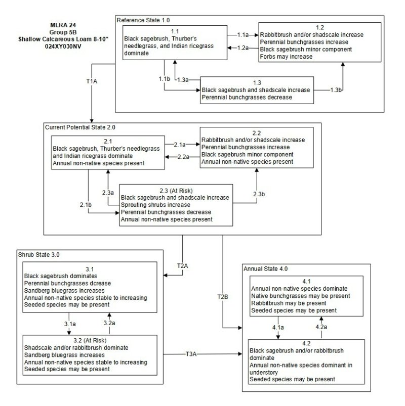
Figure 3. State and Transition Model
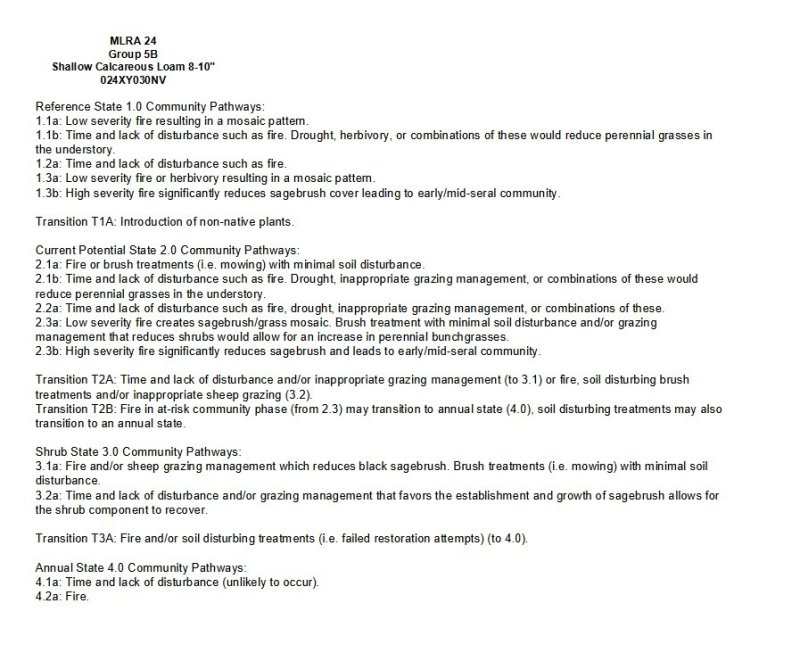
Figure 4. STM Legend
More interactive model formats are also available.
View Interactive Models
More interactive model formats are also available.
View Interactive Models
Click on state and transition labels to scroll to the respective text
Ecosystem states
State 1 submodel, plant communities
State 2 submodel, plant communities
State 3 submodel, plant communities
State 4 submodel, plant communities
State 1
Reference State
The Reference State is a representative of the natural range of variability under pristine conditions. The Reference State has three general community phases; a shrub-grass dominant phase, a shrub dominant phase and a grass dominate phase. State dynamics are maintained by interactions between climatic patterns and disturbance regimes. Negative feedbacks enhance ecosystem resilience and contribute to the stability of the state. These include the presence of all structural and functional groups, low fine fuel loads, and retention of organic matter and nutrients. Plant community phase changes are primarily driven by fire, periodic drought and/or insect or disease attack. Due to the nature and extent of disturbance in this site, all three plant community phases would likely occur in a mosaic across the landscape. This is a stable plant community that is highly drought tolerant and does not experience frequent fire (100 to 200 year intervals). Prolonged drought may reduce perennial bunchgrasses.
Community 1.1
Reference Plant Community 1.1
The reference plant community is dominated by black sagebrush, Thurber's needlegrass, and Indian ricegrass. Potential vegetative composition is about 50% grasses, 5% forbs and 45% shrubs. Approximate ground cover (basal and crown) is 15 to 30 percent.
Figure 5. Annual production by plant type (representative values) or group (midpoint values)
Table 5. Annual production by plant type
| Plant type | Low (lb/acre) |
Representative value (lb/acre) |
High (lb/acre) |
|---|---|---|---|
| Grass/Grasslike | 125 | 175 | 250 |
| Shrub/Vine | 113 | 158 | 225 |
| Forb | 12 | 17 | 25 |
| Total | 250 | 350 | 500 |
Community 1.2
Reference Plant Community 1.2
This community phase is characteristic of a post-disturbance, early seral community phase. Thurber’s needlegrass, Indian ricegrass and other perennial bunchgrasses dominate. Sprouting shrubs such as Douglas’ rabbitbrush, spiny hopsage, and shadscale may increase. Black sagebrush could still be present in unburned patches. Forbs may increase post-fire but will likely return to pre-burn levels within a few years. Sandberg bluegrass will generally increase following fire, but may decrease in below-average years of precipitation. Sandberg bluegrass may also increase.
Community 1.3
Reference Plant Community 1.3
Black sagebrush increases in the absence of disturbance. Decadent sagebrush dominates the overstory and the deep-rooted perennial bunchgrasses in the understory are reduced either from competition with shrubs and/or herbivory. Sandberg bluegrass may increase in the understory and become the dominant grass on the site.
Pathway P1.1a
Community 1.1 to 1.2
Low severity fire resulting in a mosaic pattern
Pathway P1.1b
Community 1.1 to 1.3
Time and lack of disturbance such as fire. Drought, herbivory, or combinations of these would reduce perennial grasses in the understory.
Pathway P1.2a
Community 1.2 to 1.1
Time and lack of disturbance such as fire.
Pathway P1.3a
Community 1.3 to 1.1
Low severity fire or herbivory resulting in a mosaic pattern.
Pathway P1.3b
Community 1.3 to 1.2
High severity fire significantly reduces sagebrush cover leading to early/mid-seral community.
State 2
State 2
This state is similar to the Reference State (1). Ecological function has not changed, however the resiliency of the state has been reduced by the presence of invasive weeds.
Community 2.1
Plant community 2.1
This community is compositionally similar to the reference state 1.1 Plant Community with a trace of annual weeds, primarily cheatgrass, Russian thistle and halogeton.
Community 2.2
Plant community 2.2
This community is characterized by an increase in black sagebrush and rabbitbrush. Annual non-native species may be stable or increasing. With the exception of bluegrass, perennial bunchgrasses decline. If the transition from the 2.1 Plant Community is drought induced, black sagebrush will not increase, but will stay stable while perennial bunchgrasses decline.
Community 2.3
Plant community (at risk) 2.3
This community is characterized by a decrease in black sagebrush and perennial bunchgrasses. Sandberg’s bluegrass may be increasing. Black sagebrush is highly drought tolerant; therefore drought alone will not create this community. Drought will have a greater impact on the perennial bunchgrasses. Annual non-native species are stable or increasing. Scattered piñon and juniper trees (1-2%) may be present 75 throughout the site. However, due to inherent site characteristics (e.g., low precipitation) piñon and/or juniper trees will not become dominate.
Pathway 2.1A
Community 2.1 to 2.2
Abusive growing season grazing by cattle or feral horses or prolonged drought.
Pathway 2.1B
Community 2.1 to 2.3
Abusive growing season grazing by sheep.
Pathway 2.2A
Community 2.2 to 2.1
Prescribed grazing and/or release from drought.
Pathway 2.2B
Community 2.2 to 2.3
Abusive grazing by sheep, may be coupled with drought.
Pathway 2.3A
Community 2.3 to 2.2
Prescribed grazing and/or release from drought. Long recovery period.
State 3
State 3
A biotic threshold has been crossed. Shrub species are dominant and bunchgrasses are in trace amounts or non-existent. Nutrient cycling, energy capture and surface hydrology have been altered due to the lack of bunchgrasses. Annual weedy species and/or Sandberg’s bluegrass dominate the understory.
Community 3.1
Plant community 3.1
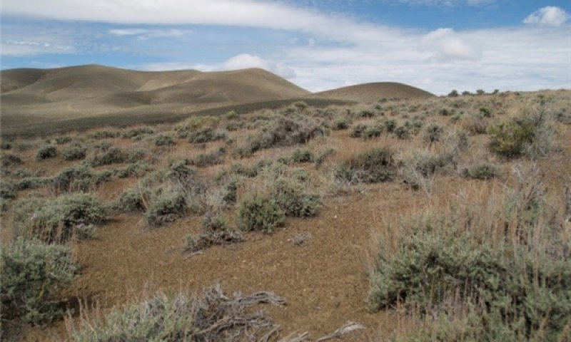
Figure 6. Shallow Calcareous Loam 8-10 Phase 3.1 T. Stringham
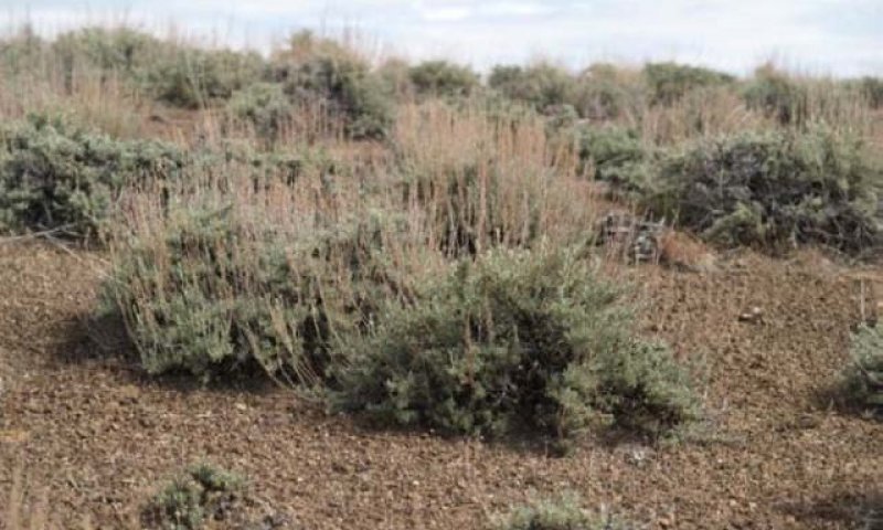
Figure 7. Plant community 3.1
This community is dominated by black sagebrush. Annual species dominate the understory, though may be sparse. Trace amounts of perennial bunchgrasses may be present, but are not contributing to site repair. Bareground is significant, due to the decline in bunchgrasses and precipitation capture is reduced. Site is at-risk of soil erosion.
Community 3.2
Plant community 3.2
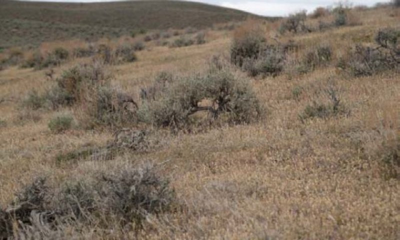
Figure 8. Plant community 3.2a
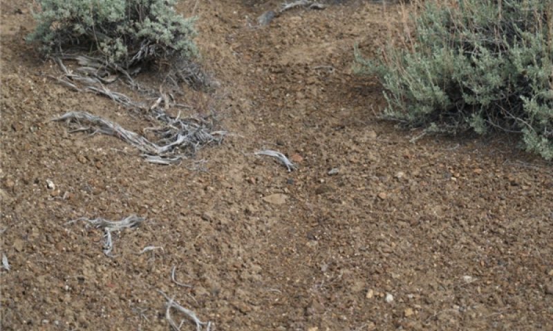
Figure 9. Shallow Calcareous Loam 8-10 Phase 3.2 June 2010 T. Stringham
Native perennial bunchgrasses are essentially absent and unable to compete with annual species. Shrub recruitment is limited or non-existent, therefore annual weed control and seeding of both shrub and grass species will be required. Likelihood of success is very low. *** This community is characterized by an overall decline in black sagebrush density and vigor. Black sagebrush recruitment is non-existent. Annual non-native species dominate the understory, which may be carpet-like or quite sparse. Cessation of abusive grazing favors annual understory and sagebrush becomes decadent. Rill erosion is possible.
Pathway 3.1A
Community 3.1 to 3.2
Continued abusive grazing, like sheep, possibly combined with long-term drought.
State 4
State 4
Site is dominated by cheatgrass, mustards and other invasive weeds. Black sagebrush is in trace amounts if present. Ecological processes of energy and nutrient cycling have been truncated by the lack of deep rooted, perennial plants. Soil redistribution may be occurring. Increased ponding and decreased infiltration of water may occur as soil redistribution changes surface properties. Increased fire frequency, due to annual weed dominance, maintains this state.
Community 4.1
Plant community 4.1
This community is dominated by annual non-native species, such as cheatgrass, Russian thistle, halogeton, mustards.
Community 4.2
Plant community 4.2
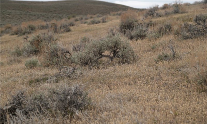
Figure 10. Shallow Calcareous Loam 8-10 Phase 4.2 June 2010 T.Stringham
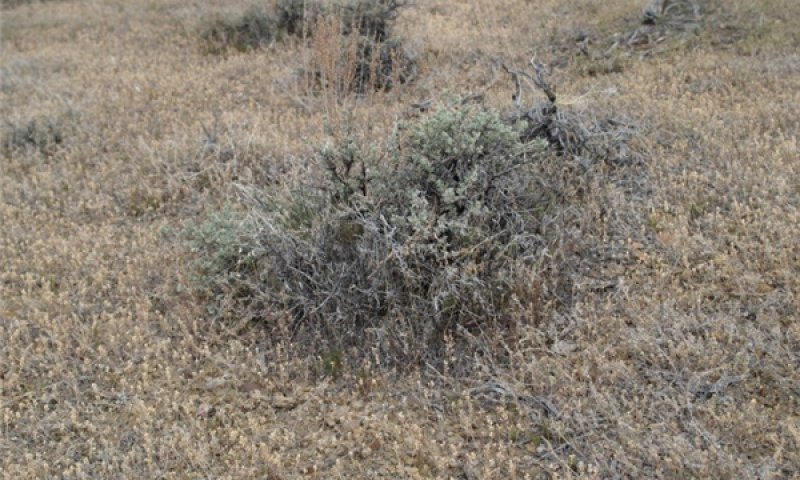
Figure 11. Shallow Calcareous Loam 8-10 Phase 4.2 June 2010 T. Stringham
This community is characterized by an increase or establishment of shadscale or spiny hopsage. Other shrubs that may be increasing or sprouting after fire include rabbitbrush, snakeweed, and horsebrush. Black sagebrush is only present in trace amounts or in islands that have not burned. Annual non-native species still dominate the understory.
Pathway 4.1A
Community 4.1 to 4.2
Time may allow for establishment of shadscale and other shrubs.
Pathway 4.2A
Community 4.2 to 4.1
Fire will reduce the shrub component of the community and return this site to an annual dominated community.
Transition T1A
State 1 to 2
This transition is caused by the introduction of non-native annual weeds.
Transition T2A
State 2 to 3
Abusive grazing by domestic livestock, likely cattle or horses, and/or long-term drought.
Transition T2B
State 2 to 4
Fire.
Restoration pathway R3A
State 3 to 2
Native perennial bunchgrasses are essentially absent and unable to compete with annual species. Shrub recruitment is limited or non-existent, therefore annual weed control and seeding of both shrub and grass species will be required. Likelihood of success is very low.
Transition T3A
State 3 to 4
Fire.
Additional community tables
Table 6. Community 1.1 plant community composition
| Group | Common name | Symbol | Scientific name | Annual production (lb/acre) | Foliar cover (%) | |
|---|---|---|---|---|---|---|
|
Grass/Grasslike
|
||||||
| 1 | Primary Perennial Grasses | 88–158 | ||||
| Thurber's needlegrass | ACTH7 | Achnatherum thurberianum | 70–105 | – | ||
| Indian ricegrass | ACHY | Achnatherum hymenoides | 18–53 | – | ||
| 2 | Secondary Perennial Grasses | 7–53 | ||||
| Webber needlegrass | ACWE3 | Achnatherum webberi | 2–11 | – | ||
| squirreltail | ELEL5 | Elymus elymoides | 2–11 | – | ||
| needle and thread | HECO26 | Hesperostipa comata | 2–11 | – | ||
| Sandberg bluegrass | POSE | Poa secunda | 2–11 | – | ||
| bluebunch wheatgrass | PSSPS | Pseudoroegneria spicata ssp. spicata | 2–11 | – | ||
|
Forb
|
||||||
| 3 | Perennial Forbs | 18–53 | ||||
| milkvetch | ASTRA | Astragalus | 2–18 | – | ||
| buckwheat | ERIOG | Eriogonum | 2–18 | – | ||
| phlox | PHLOX | Phlox | 2–18 | – | ||
| globemallow | SPHAE | Sphaeralcea | 2–18 | – | ||
|
Shrub/Vine
|
||||||
| 4 | Primary Shrubs | 105–140 | ||||
| black sagebrush | ARNO4 | Artemisia nova | 105–140 | – | ||
| 5 | Secondary Shrubs | 5–20 | ||||
| shadscale saltbush | ATCO | Atriplex confertifolia | 4–11 | – | ||
| yellow rabbitbrush | CHVIP4 | Chrysothamnus viscidiflorus ssp. puberulus | 4–11 | – | ||
| Nevada jointfir | EPNE | Ephedra nevadensis | 4–11 | – | ||
| spiny hopsage | GRSP | Grayia spinosa | 4–11 | – | ||
| winterfat | KRLA2 | Krascheninnikovia lanata | 4–11 | – | ||
| littleleaf horsebrush | TEGL | Tetradymia glabrata | 4–11 | – | ||
Interpretations
Animal community
Livestock Interpretations:
Black sagebrush palatability has been rated as moderate to high depending on the ungulate and the season of use (Horton 1989, Wambolt 1996). The palatability of black sagebrush increases the potential negative impacts on remaining black sagebrush plants from grazing or browsing pressure following fire (Wambolt 1996). Pronghorn utilize black sagebrush heavily (Beale and Smith 1970). On the Desert Experiment Range, black sagebrush was found to comprise 68% of pronghorn diet even though it was only the 3rd most common plant. Fawns were found to prefer black sagebrush utilizing it more than all other forage species combined (Beale and Smith 1970). Domestic livestock will also utilize black sagebrush. The domestic sheep industry that emerged in the Great Basin in the early 1900s was largely based on wintering domestic sheep in black sagebrush communities (Mozingo 1987). Domestic sheep will browse black sagebrush during all seasons of the year depending on the availability of other forage species with greater amounts being consumed in fall and winter. Black sagebrush is generally less palatable to cattle than to domestic sheep and wild ungulates (McArthur et al. 1979); however, cattle use of black sagebrush has also been shown to be greatest in fall and winter (Schultz and McAdoo 2002), with only trace amounts being consumed in summer (Van Vuren 1984).
The Thurber’s needlegrass component of this plant community is an important forage source for livestock and wildlife in the arid regions of the West (Ganskopp 1988). Although the seeds are apparently not injurious, grazing animals avoid them when they begin to mature yet sheep have been observed to graze the leaves closely, leaving stems untouched (Eckert and Spencer 1987). Heavy grazing during the growing season has been shown to reduce the basal area of Thurber’s needlegrass (Eckert and Spencer 1987) suggesting that both seasonality and utilization are important factors in management of this plant. A single defoliation, particularly during the boot stage, was found to reduce herbage production and root mass thus potentially lowering the competitive ability of this needlegrass (Ganskopp 1988). Repeated growing season grazing, particularly by sheep, can reduce or eliminate Thurber needlegrass along with black sagebrush. However, growing season grazing by cattle may initially cause a decrease in the bunchgrass component and give a competitive advantage to shrub species including black sagebrush (Eckert et al. 1972).
Reduced bunchgrass vigor or density provides an opportunity for Sandberg’s bluegrass expansion and/or cheatgrass and other invasive species to occupy interspaces, leading to increased fire frequency and potentially an annual plant community. Sandberg’s bluegrass increases under grazing pressure (Tisdale and Hironaka 1981) and is capable of co-existing with cheatgrass. Excessive sheep grazing favors Sandberg’s bluegrass; however, where cattle are the dominant grazers, cheatgrass often dominates (Daubenmire 1970). Thus, depending on the season of use, the grazer and site conditions, either Sandberg’s bluegrass or cheatgrass may become the dominant understory with inappropriate grazing management.
This site has limited value for livestock grazing, due to the low forage production. Grazing management should be keyed to dominant grasses or palatable shrubs production. Thurber’s needlegrass species begin growth early in the year and remain green throughout a relatively long growing season. This pattern of development enables animals to use Thurber’s needlegrass when many other grasses are unavailable. Cattle prefer Thurber’s needlegrass in early spring before fruits have developed as it becomes less palatable when mature. Thurber’s needlegrasses are grazed in the fall only if the fruits are softened by rain. Indian ricegrass is highly palatable to all classes of livestock in both green and cured condition. It supplies a source of green feed before most other native grasses have produced much new growth. In winter, at lower elevations, black sagebrush is heavily utilized by domestic sheep.
Stocking rates vary over time depending upon season of use, climate variations, site, and previous and current management goals. A safe starting stocking rate is an estimated stocking rate that is fine tuned by the client by adaptive management through the year and from year to year.
Wildlife Interpretations:
Thurber needlegrass is valuable forage for wildlife. Indian ricegrass is eaten by pronghorn in moderate amounts whenever available. In Nevada it is consumed by desert bighorns. A number of heteromyid rodents inhabiting desert rangelands show preference for seed of Indian ricegrass. Indian ricegrass is an important component of jackrabbit diets in spring and summer. In Nevada, Indian ricegrass may even dominate jackrabbit diets during the spring through early summer months. Indian ricegrass seed provides food for many species of birds. Doves, for example, eat large amounts of shattered Indian ricegrass seed lying on the ground. Black sagebrush is a significant browse species within the Intermountain region. It is especially important on low elevation winter ranges in the southern Great Basin, where extended snow free periods allow animal’s access to plants throughout most of the winter. In these areas it is heavily utilized by pronghorn and mule deer. Sagebrush-grassland communities provide critical sage-grouse breeding and nesting habitats. Sagebrush is a crucial component of their diet year-round, and sage-grouse select sagebrush almost exclusively for cover.
Hydrological functions
Runoff is high to very high. Permeability is slow to moderate. Hydrologic soil groups are B, C, and D.
Recreational uses
Aesthetic value is derived from the diverse floral and faunal composition and the colorful flowering of wild flowers and shrubs during the spring and early summer. This site offers rewarding opportunities to photographers and for nature study. This site is used for hiking and has potential for upland and big game hunting.
Other products
Indian ricegrass was traditionally eaten by some Native Americans. The Paiutes used seed as a reserve food source.
Other information
Black sagebrush is an excellent species to establish on sites where management objectives include restoration or improvement of domestic sheep, pronghorn, or mule deer winter range.
Supporting information
Inventory data references
NASIS soil component data.
Type locality
| Location 1: Lander County, NV | |
|---|---|
| Township/Range/Section | T32N R43E S36 |
| UTM zone | N |
| UTM northing | 4494842 |
| UTM easting | 493137 |
| Latitude | 40° 36′ 15″ |
| Longitude | 117° 4′ 52″ |
| General legal description | NE¼ About 6 miles southwest of Battle Mountain, Little Cottonwood Canyon area, Battle Mountain, Lander County, Nevada. This site also occurs in Eureka, Humboldt and Pershing Counties, Nevada. |
Other references
Fire Effects Information System (Online; http://www.fs.fed.us/database/feis/plants/).
USDA-NRCS Plants Database (Online; http://www.plants.usda.gov).
Beale, D.M. and A.D. Smith. 1970. Forage use, water consumption, and productivity of pronghorn antelope in western Utah. Journal of Wildlife Management 34(3):570-582
Beetle, A.A. 1960. A study of sagebrush: The section Tridentatae of Artemisia. Bulletin 368. Laramie, WY: University of Wyoming, Agricultural Experiment Station. 83 p.
Boltz, M. 1994. Factors influencing postfire sagebrush regeneration in south-central Idaho. In: Monsen, S.B. and S.G. Kitchen (compilers). Proceedings--ecology and management of annual rangelands; 1992 May 18-22; Boise, ID. Gen. Tech. Rep. INT-GTR-313. Ogden, UT: U.S. Department of Agriculture, Forest Service, Intermountain Research Station: Pgs 281-290.
Daubenmire, R.F. 1970. Steppe vegetation of Washington. Technical Bulletin 62. Pullman, WA: Washington State University, College of Agriculture, Washington Agricultural Experiment Station. 131 p.
Daubenmire, R.F. 1975. Plant succession on abandoned fields, and fire influences, in a steppe area in southeastern Washington. Northwest Science 49(1):36-48.
Eckert, R.E., Jr. and J.S. Spencer. 1987. Growth and reproduction of grasses heavily grazed under rest-rotation management. Journal of Range Management 40(2):156-159.
Evans, R.A. and J.A. Young. 1978. Effectiveness of rehabilitation practices following wildfire in a degraded big sagebrush-downy brome community. Journal of Range Management 31(3):185-188.
Ganskopp, D. 1988. Defoliation of Thurber needlegrass: herbage and root responses. Journal of Range Management 41(6):472-476.
Hironaka, M., M.A. Fosberg, and A.H. Winward. 1983. Sagebrush-grass habitat types of southern Idaho. Bulletin Number 35. Moscow, ID: University of Idaho, Forest, Wildlife and Range Experiment Station. 44 p.
Horton, H. 1989. Interagency forage and conservation planting guide for Utah. Extension Circular 433. Logan, UT: Utah State University, Cooperative Extension Service. 67 p.
Kitchen, S.G. and E.D. McArthur. 2007. Big and black sagebrush landscapes. In: Hood, S.M. and M. Miller (eds.). Fire ecology and management of the major ecosystems of southern Utah. Gen. Tech. Rep. RMRS-GTR-202. Fort Collins, CO: U.S. Department of Agriculture, Forest Service, Rocky Mountain Research Station. Pgs 73-95.
Martens, E., D. Palmquist, and J.A. Young. 1994. Temperature profiles for germination of cheatgrass versus native perennial bunchgrasses. In: Monsen, S.B. and S.G.
Kitchen (compilers). Proceedings--ecology and management of annual rangelands; 1992 May 18-22; Boise, ID. Gen. Tech. Rep. INT-GTR-313. Ogden, UT: U.S. Department of Agriculture, Forest Service, Intermountain Research Station: Pgs 238-243.
McArthur, E.D., A.C. Blauer, A.P. Plummer, and R. Stevens. 1979. Characteristics and hybridization of important Intermountain shrubs. III. Sunflower family. Res. Pap. INT-220. Ogden, UT. U.S. Department of Agriculture, Forest Service, Intermountain Forest and Range Experiment Station. 82 p.
Meyer, S.E. 2008. Artemisia L.--sagebrush. In:
Bonner, F.T. and R.P. Karrfalt (eds.). The woody plant seed manual. Agriculture Handbook 727. Washington, DC: U.S. Department of Agriculture, Forest Service: Pgs 274-280.
Mozingo, H.N. 1987. Shrubs of the Great Basin: A natural history. Reno, NV: University of Nevada Press. 342 p.
Schultz, B. and K. McAdoo. 2002. Common sagebrush in Nevada. Special Publication SP-02-02. Reno, NV. University of Nevada, Cooperative Extension. 9 p.
Stevens, R., K.R. Jorgensen, and J.N. Davis. 1981. Viability of seed from thirty-two shrub and forb species through fifteen years of warehouse storage. The Great Basin Naturalist 41(3):274-277.
Tisdale, E.W. and M. Hironaka. 1981. The sagebrush-grass region: a review of the ecological literature. Bull. 33. Moscow, ID: University of Idaho, Forest, Wildlife and Range Experiment Station. 31 p.
Uresk, D.W., J.F. Cline, and W.H. Rickard. 1976. Impact of wildfire on three perennial grasses in south-central Washington. Journal of Range Management 29(4):309-310.
Van Vuren, D. 1984. Summer diets of bison and cattle in southern Utah. Journal of Range Management 37(3): 260-261.
Winward, A.H. 2001. Sagebrush taxonomy and ecology workshop--October 5-6, 1999. In: Vegetation, wildlife and fish ecology and rare species management--Wasatch-Cache National Forest. Logan, UT: U.S. Department of Agriculture, Forest Service, Intermountain Region, Uinta-Wasatch-Cache National Forest.
Wright, H.A., L.F. Neuenschwander, and C.M. Britton. 1979. The role and use of fire in sagebrush-grass and pinyon-juniper plant communities: A state-of-the-art review. Gen. Tech. Rep. INT-58. Ogden, UT. U.S. Department of Agriculture, Forest Service, Intermountain Forest and Range Experiment Station. 48 p.
Wambolt, C.L. 1996. Mule deer and elk foraging preference for 4 sagebrush taxa. Journal of Range Management 49(6):499-503.
Young, J. A., R. A. Evans, and P. T. Tueller. 1976. Great Basin plant communities--pristine and grazed. In: Elston, Robert, ed. Holocene environmental change in the Great Basin. Res. Pap. No. 6. Reno, NV: University of Nevada, Nevada Archeological Society: 187-216.
Contributors
CP/GKB
Approval
Kendra Moseley, 3/06/2025
Rangeland health reference sheet
Interpreting Indicators of Rangeland Health is a qualitative assessment protocol used to determine ecosystem condition based on benchmark characteristics described in the Reference Sheet. A suite of 17 (or more) indicators are typically considered in an assessment. The ecological site(s) representative of an assessment location must be known prior to applying the protocol and must be verified based on soils and climate. Current plant community cannot be used to identify the ecological site.
| Author(s)/participant(s) | Patti Novak-Echenique |
|---|---|
| Contact for lead author | State Rangeland Management Specialist |
| Date | 09/24/2009 |
| Approved by | Kendra Moseley |
| Approval date | |
| Composition (Indicators 10 and 12) based on | Annual Production |
Indicators
-
Number and extent of rills:
Rills are none to rare. A few can be expected on steeper slopes in areas subjected to summer convection storms or rapid spring snowmelt. -
Presence of water flow patterns:
Water flow patterns are few and can be expected in areas subjected to summer convection storms or rapid snowmelt. -
Number and height of erosional pedestals or terracettes:
Pedestals are none to rare. Occurrence is usually limited to areas of water flow patterns. Frost heaving of shallow rooted plants should not be considered a "normal" condition. -
Bare ground from Ecological Site Description or other studies (rock, litter, lichen, moss, plant canopy are not bare ground):
Bare Ground ± 50%. -
Number of gullies and erosion associated with gullies:
None -
Extent of wind scoured, blowouts and/or depositional areas:
None -
Amount of litter movement (describe size and distance expected to travel):
Fine litter (foliage from grasses and annual & perennial forbs) expected to move distance of slope length during intense summer convection storms or rapid snowmelt events. Persistent litter (large woody material) will remain in place except during large rainfall events. -
Soil surface (top few mm) resistance to erosion (stability values are averages - most sites will show a range of values):
Soil stability values should be 3 to 6 on most soil textures found on this site. (To be field tested.) -
Soil surface structure and SOM content (include type of structure and A-horizon color and thickness):
Surface structure is typically thin to thick platy or massive. Soil surface colors are light and soils are typified by an ochric epipedon. Organic matter of the surface 2 to 3 inches is typically 1 to 1.5 percent dropping off quickly below. Organic matter content can be more or less depending on micro-topography -
Effect of community phase composition (relative proportion of different functional groups) and spatial distribution on infiltration and runoff:
Perennial herbaceous plants (especially deep-rooted bunchgrasses [i.e., Thurber's needlegrass] slow runoff and increase infiltration. Shrub canopy and associated litter break raindrop impact. -
Presence and thickness of compaction layer (usually none; describe soil profile features which may be mistaken for compaction on this site):
Compacted layers are not typical. Platy or massive sub-surface horizons, subsoil calcic, argillic horizons or hardpans shallow to the surface are not to be interpreted as compacted layers. -
Functional/Structural Groups (list in order of descending dominance by above-ground annual-production or live foliar cover using symbols: >>, >, = to indicate much greater than, greater than, and equal to):
Dominant:
Deep-rooted, cool season, perennial bunchgrasses=low shrubs (black sagebrush)Sub-dominant:
associated shrubs>shallow-rooted, cool season, grasses>deep-rooted, cool season, perennial forbs=fibrous, shallow-rooted, cool season, perennial and annual forbsOther:
Additional:
-
Amount of plant mortality and decadence (include which functional groups are expected to show mortality or decadence):
Dead branches within individual shrubs common and standing dead shrub canopy material may be as much as 25% of total woody canopy; some of the mature bunchgrasses (<20%) have dead centers. -
Average percent litter cover (%) and depth ( in):
Under canopy and within plant interspaces (15-30%) and depth of litter is <½ inch. -
Expected annual annual-production (this is TOTAL above-ground annual-production, not just forage annual-production):
For normal or average growing season (end of May) ± 350 lbs/ac; Spring moisture significantly affects total production. -
Potential invasive (including noxious) species (native and non-native). List species which BOTH characterize degraded states and have the potential to become a dominant or co-dominant species on the ecological site if their future establishment and growth is not actively controlled by management interventions. Species that become dominant for only one to several years (e.g., short-term response to drought or wildfire) are not invasive plants. Note that unlike other indicators, we are describing what is NOT expected in the reference state for the ecological site:
Potential invaders include halogeton, Russian thistle, annual mustards, and cheatgrass. -
Perennial plant reproductive capability:
All functional groups should reproduce in average (or normal) and above average growing season years.
Print Options
Sections
Font
Other
The Ecosystem Dynamics Interpretive Tool is an information system framework developed by the USDA-ARS Jornada Experimental Range, USDA Natural Resources Conservation Service, and New Mexico State University.
Click on box and path labels to scroll to the respective text.