Major Land Resource Area 044A
Northern Rocky Mountain Valleys
Accessed: 04/08/2026
Description
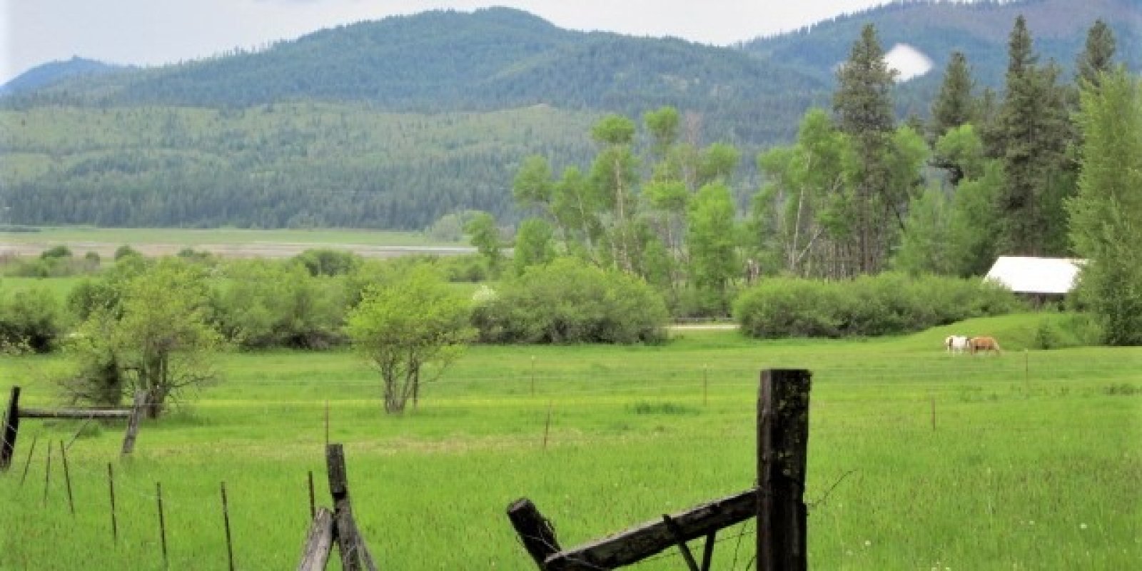
This MLRA is in Idaho , Washington and Montana. In Idaho and Washington, It makes up about 5,660 square miles (14,670 square kilometers). The cities of Spokane, Washington, and Coeur d’Alene, Idaho, are in this MLRA. Although most of the valley floors are privately owned, the valley borders commonly are part of numerous national forests, including the Kaniksu and Colville National Forests in Washington and Idaho This area is in the Northern Rocky Mountains Province of the Rocky Mountain System. It is an area of deeply dissected mountain valleys. The deep valleys are typically bordered by mountains trending north to south. In the valleys, nearly level, broad flood plains are bordered by gently sloping to strongly sloping terraces and alluvial fans. In many areas, the valleys have been modified by glaciation. In the northern part of the area, glacial debris dams created lakes in the valleys for a period of time in the past. In these areas, lacustrine sediments cover much of the valley floors. Elevation ranges from 1,540 feet (470 meters) to 5,085 feet (1,550 meters). This MLRA is entirely within the Kootenai-Pend Oreille-Spokane (1701) Hydrologic Unit. The mountains bordering the valleys in this MLRA are uplifted fault blocks that have been recently glaciated. Streams eroding the mountains have created alluvial fans at the edges of the valleys and have deposited silt, sand, and gravel as alluvial valley fill throughout the area. Modern streams have reworked the valley fill deposits, creating terraces and flood plains at the lower elevations in the valleys. Glacial lake deposits occur in some of the valleys in the northern part of the MLRA. Glacial outburst flooding has deposited large amounts of outwash in the southwestern portion of the MLRA. The average annual precipitation is 15 to 53 inches (375 to 1340 millimeters) with the highest amounts in northern Idaho. Precipitation is fairly evenly distributed throughout fall, winter, and spring but is low in summer. Rainfall occurs as high-intensity, convective thunderstorms during spring and fall. Most of the precipitation in winter is snow. The average annual temperature is 39 to 50 degrees F (4 to 10 degrees C). The freeze-free period averages 115 days and ranges from 85 to 140 days. The dominant soil orders in this MLRA are Inceptisols, Mollisols, and Andisols. The soils in the area have a mesic or frigid soil temperature regime and, a xeric or udic soil moisture regime, and mixed mineralogy. They generally are very deep, well drained, and loamy or loamy skeletal. Vitrixerands formed in glacial outwash or ablation till on stream terraces, terrace escarpments, and till plains. Haploxerepts formed in glacial outwash on outwash plains and outwash terraces. Dystroxerepts and Udivitrands formed on slopes of foothills and mountains. This area supports conifer forests and grassland vegetation. Bluebunch wheatgrass, rough fescue, Idaho fescue, and bearded wheatgrass are the major species on the grassland in the valleys and foothills. Douglas-fir, ponderosa pine, grand fir, western red cedar, western hemlock, pinegrass, common snowberry, mallow ninebark, and white spirea are the major forest species. Some of the major wildlife species in this area are elk, mule deer, white-tailed deer, antelope, coyote, bobcat, badger, beaver, mink, otter, muskrat, cottontail, ground squirrel, pheasant, gray partridge, sharp-tailed grouse, sage grouse, blue grouse, spruce grouse, and ruffed grouse. The species of fish in the area include rainbow, brown, and brook trout. More than one-half of this area is in farms and ranches. A large acreage is used for hay, grain, or pasture for livestock feed. In areas where precipitation is adequate, dry-farmed wheat is grown Beef cattle and sheep are the principal kinds of livestock, but dairying is an important enterprise near the larger towns. Much of the part of this MLRA in northern Idaho is forested. In Montana, this MLRA includes the Flathead Valleys, with the predominant landscape as valleys with landforms including floodplains, stream terraces, outwash, lacustrine terraces, foothills, glacial moraines. The estimated acres are 1,412,271 and it is primarily private lands. Land use is development and agriculture. Climatically, this LRU has a frigid soil temperature regime and a xeric soil moisture regime. It has a mean annual air temperature of 43 degrees Fahrenheit (ranging 33-58 degrees Fahrenheit), mean frost free days of 94 (ranging 60-110 days) and mean annual precipitation ranging 14-19 (but can go up to 23 inches in higher areas). Majority of the elevations range is 1000-4000 feet, with some areas up to 5000 feet. Vegetation is predominantly Douglas Fir-Ponderosa Pine-Lodgepole Pine Forest / Woodland and montane grassland, minor amount of Engelmann Spruce-Subalpine Fir, and open water, developed areas and agriculture. Trace Western Redcedar and Western Hemlock and Grand Fir. The geology is predominantly fluvial and bedform topography related to Cordilleran glaciation. Rock types are dominantly metasedimentary of the Belt Supergroup (Ravalli group) with some Tertiary sediments, eolian deposits, open water, Glacial lake deposits. The soils are dominantly very deep, well-developed soils formed in alluvium, lacustrine deposits, glacial outwash and till from metasedimentary parent materials. These tend to be well drained, neutral to moderately alkaline soils with both skeletal and non-skeletal sandy loam, loam and clay loam textures. Poorly drained soils are present as well but are generally confined to areas along riparian corridors. Volcanic ash influenced soils occur here as well but tend to be limited to stable footslope positions marginal to the valley floor. This is related to the EPA land classification framework of: Level 3 the Northern Rockies and includes numerous Level 4 including: Stillwater-Swan Wooded Valley, Tobacco Plains, Flathead Valley, a small part of the Western Canadian Rockies (Level 3 is Canadian Rockies) and a small part of the rattlesnake-Blackfoot-south Swan-Northern Garnet-Sapphire Mountains and the Foothill Potholes (both in the Middle Rockies Level 3 subdivision). This area is related predominantly to the USFS Provinces: Predominantly resides in the northern portion in M333Bc (Flathead River Valley), the middle portion of 430Hi in M333Cb (Canadian Rockies-Whitefish-Swan Mountains) and the southern portion in M332Bp (Avon-Nevada Valleys).
Key publications
Next steps
-
1
Select an ecological site
Select an ecological site using the list, keys, photos, briefcase, or quick search option located on this page. -
2
Explore the ecological site description
Next, learn more about the selected ecological site and its characteristic dynamics by browsing the ecological site description and exploring alternative state and transition model formats.
Ecological site list
-
i
Key Characteristics
- Site resides along the Clark Fork River, east of Lake Pend Oreille, in areas with narrow valley width along river corridors to Bull Lake and south to the substantially wider Missoula valley.
- Site resides in moraines, foothills and mountain slopes with soils that are very deep, well drained from parent material of glacial till.
-
i
Key Characteristics
- Site resides along the Clark Fork River, east of Lake Pend Oreille, in areas with narrow valley width along river corridors to Bull Lake and south to the substantially wider Missoula valley.
- Site resides in foothills and mountain slopes with soils that are deep, somewhat excessively drained with parent materials of outwash or colluvium from argillite or quartzite.
-
i
Key Characteristics
- Site resides along the Clark Fork River, east of Lake Pend Oreille, in areas with narrow valley width along river corridors to Bull Lake and south to the substantially wider Missoula valley.
- Site resides on outwash terraces and alluvial fans, soils are very deep, well drained and have parent material of volcanic ash over alluvium.
-
 ProvisionalF044AH001MT/F044AH001MTMontane Warm Dry Coniferous Seeley, Swan, Flathead and Tobacco Valleysi
Key Characteristics
- Site resides in the Tobacco Valley, the northern-most extent of this MLRA, on glaciofluvial landforms with generally eolian or alluvial parent material.
- Site forested.
- Sites reside on dune, outwash terraces with low slopes with soils that are very deep, well drained with parent material of eolian sand and textures are sandy.
-
ProvisionalF044AH002MT/F044AH002MTMontane Wet Cool Coniferous Seeley, Swan, Flathead and Tobacco Valleysi
Key Characteristics
- Site resides in the Tobacco Valley, the northern-most extent of this MLRA, on glaciofluvial landforms with generally eolian or alluvial parent material.
- Site forested.
- Site resides on drainageways and swales with soils that are very deep, and somewhat poorly to very poorly drained.
-
ProvisionalF044AH003MT/F044AH003MTMontane Moderately Warm Dry Coniferous Seeley, Swan, Flathead and Tobacco Valleysi
Key Characteristics
- Site resides in the Tobacco Valley, the northern-most extent of this MLRA, on glaciofluvial landforms with generally eolian or alluvial parent material.
- Site forested.
- Site resides on drumlins, ground moraines and mountain slopes with soils that are very deep, well drained with parent materials of glacial till.
-
i
Key Characteristics
- Site is not captured in the above subsections of this key.
- Site forested.
- Site in moist conditions (24-34" mean annual precipitation, 43-45 degrees F mean annual temperature, 70-105 days frost free, 2200-3000 feet elevation).
- Soils ashy.
-
i
Key Characteristics
- Site is not captured in the above subsections of this key.
- Site forested.
- Site in low elevations; warm conditions (13-22" mean annual precipitation, 39-45 degrees F mean annual temperature, 60-100 days frost free, 1300-5500 feet elevation).
- Site with shallow soils (16-22" mean annual precipitation, 39-46 degrees F mean annual temperature, 60-100 days frost free, 2200-5500 feet elevation).
-
i
Key Characteristics
- Site is not captured in the above subsections of this key.
- Site forested.
- Site is not in moist conditions and resides in moderate elevations.
- Site in moderate to high elevations; cool conditions (18-25" mean annual precipitation, 43-45 degrees F mean annual temperature, 90-105 days frost free, 2300-3400 feet elevation).
-
i
Key Characteristics
- Site is not captured in the above subsections of this key.
- Site forested.
- Site in moist conditions (24-34" mean annual precipitation, 43-45 degrees F mean annual temperature, 70-105 days frost free, 2200-3000 feet elevation).
- Soils not ashy.
-
i
Key Characteristics
- Site is not captured in the above subsections of this key.
- Site forested.
- Site in low elevations; warm conditions (13-22" mean annual precipitation, 39-45 degrees F mean annual temperature, 60-100 days frost free, 1300-5500 feet elevation).
- Site does not have shallow soils (13-19" mean annual precipitation, 39-45 degrees mean annual temperature, 80-100 days frost free, 1300-4600 feet elevation).
-
i
Key Characteristics
- West of Cabinet Gorge and Cabinet Mountains
- Outwash terraces, outwash plains and footslopes below 2625 feet elevation, south and west of Lake Pend Oreille and Spirit Valley; LRU01 Spokane Rathdrum Outwash Plains
- Mesic climate zone
- Xeric moisture regime (EX044AESG01)
- Loamy with low AWC
- West of Cabinet Gorge and Cabinet Mountains
- Outwash terraces, outwash plains and footslopes below 3500 feet, north and east of Lake Pend Oreille and Spirit Valley; LRU02 Pend Oreille-Kootenai Valleys
- Mesic climate zone
- Xeric moisture regime (EX044AESG01)
- Loamy with low AWC
-
i
Key Characteristics
- West of Cabinet Gorge and Cabinet Mountains
- Outwash terraces, outwash plains and footslopes below 2625 feet elevation, south and west of Lake Pend Oreille and Spirit Valley; LRU01 Spokane Rathdrum Outwash Plains
- Mesic climate zone
- Xeric moisture regime (EX044AESG01)
- Sandy
-
i
Key Characteristics
- West of Cabinet Gorge and Cabinet Mountains
- Outwash terraces, outwash plains and footslopes below 2625 feet elevation, south and west of Lake Pend Oreille and Spirit Valley; LRU01 Spokane Rathdrum Outwash Plains
- Frigid climate zone
- Warm-frigid
- Xeric or Moist xeric moisture regime
- Moist-xeric with high water table (EX044AESG02)
- West of Cabinet Gorge and Cabinet Mountains
- Outwash terraces, outwash plains and footslopes below 3500 feet, north and east of Lake Pend Oreille and Spirit Valley; LRU02 Pend Oreille-Kootenai Valleys
- Frigid climate zone
- Warm-frigid
- Xeric or moist xeric moisture regime
- Moist-xeric with high water table (EX044AESG02)
-
i
Key Characteristics
- West of Cabinet Gorge and Cabinet Mountains
- Outwash terraces, outwash plains and footslopes below 2625 feet elevation, south and west of Lake Pend Oreille and Spirit Valley; LRU01 Spokane Rathdrum Outwash Plains
- Frigid climate zone
- Warm-frigid
- Xeric or Moist xeric moisture regime
- Xeric with high water table
- West of Cabinet Gorge and Cabinet Mountains
- Outwash terraces, outwash plains and footslopes below 2625 feet elevation, south and west of Lake Pend Oreille and Spirit Valley; LRU01 Spokane Rathdrum Outwash Plains
- Frigid climate zone
- Cool-frigid climate zone (EX044AESG03)
- High water table
- West of Cabinet Gorge and Cabinet Mountains
- Outwash terraces, outwash plains and footslopes below 3500 feet, north and east of Lake Pend Oreille and Spirit Valley; LRU02 Pend Oreille-Kootenai Valleys
- Frigid climate zone
- Cool-frigid climate zone (EX044AESG03)
- High water table
-
i
Key Characteristics
- West of Cabinet Gorge and Cabinet Mountains
- Outwash terraces, outwash plains and footslopes below 2625 feet elevation, south and west of Lake Pend Oreille and Spirit Valley; LRU01 Spokane Rathdrum Outwash Plains
- Frigid climate zone
- Cool-frigid climate zone (EX044AESG03)
- Sandy, no high water table
- West of Cabinet Gorge and Cabinet Mountains
- Outwash terraces, outwash plains and footslopes below 3500 feet, north and east of Lake Pend Oreille and Spirit Valley; LRU02 Pend Oreille-Kootenai Valleys
- Frigid climate zone
- Cool-frigid climate zone (EX044AESG03)
- Sandy, no high water table
-
i
Key Characteristics
- West of Cabinet Gorge and Cabinet Mountains
- Outwash terraces, outwash plains and footslopes below 3500 feet, north and east of Lake Pend Oreille and Spirit Valley; LRU02 Pend Oreille-Kootenai Valleys
- Frigid climate zone
- Warm-frigid
- Xeric or moist xeric moisture regime
- Xeric with high water table
-
i
Key Characteristics
- Site is non-forested and resides in the 10-14" or 14-19" precipitation zone.
- Site is non-forested and resides in the 10-14" precipitation range.
- Soils moderately deep to very deep.
- Soils not skeletal.
- Not strongly or violently effervescent in surface mineral 4”; Slope < 15%.
- Clay content is > 32% in surface mineral 4” of mineral soil (ribbon > 2” long and Soil 32% to 45% clay within surface mineral 4”.
-
i
Key Characteristics
- Site is non-forested and resides in the 10-14" or 14-19" precipitation zone.
- Site is non-forested and resides in the 10-14" precipitation range.
- Soils moderately deep to very deep.
- Soils skeletal.
- Soil sandy-skeletal, sandy-skeletal within 10” of soil surface.
-
i
Key Characteristics
- Site is non-forested and resides in the 10-14" or 14-19" precipitation zone.
- Site is non-forested and resides in the 10-14" precipitation range.
- Soils moderately deep to very deep.
- Soils not skeletal.
- Not strongly or violently effervescent in surface mineral 4”; Slope < 15%.
- Clay content is < 32% in surface mineral 4” and Slope < 15% and argillic horizon, if present, has < 35% clay of mineral soil (ribbon < 2” long).
-
i
Key Characteristics
- Site is non-forested and resides in the 10-14" or 14-19" precipitation zone.
- Site is non-forested and resides in the 10-14" precipitation range.
- Soils moderately deep to very deep.
- Soils skeletal.
- Soil loamy-skeletal or clayey-skeletal.
- Not strongly or violently effervescent within surface mineral 4”; Slope < 15%.
-
i
Key Characteristics
- Site is non-forested and resides in the 10-14" or 14-19" precipitation zone.
- Site is non-forested and resides in the 10-14" precipitation range.
- Soils moderately deep to very deep.
- Soils skeletal.
- Soil loamy-skeletal or clayey-skeletal.
- Not strongly or violently effervescent within surface mineral 4”; Slope ≥ 15%.
-
i
Key Characteristics
- Site is non-forested and resides in the 10-14" or 14-19" precipitation zone.
- Site is non-forested and resides in the 10-14" precipitation range.
- Soils shallow.
- Soil not skeletal and clay content < 32% in surface mineral 4” (able to make a ribbon < 2” long) and soil texture within surface mineral 4” is typified by loam, clay loam, or silt loam.
-
i
Key Characteristics
- Site is non-forested and resides in the 10-14" or 14-19" precipitation zone.
- Site is non-forested and resides in the 10-14" precipitation range.
- Soils moderately deep to very deep.
- Soils not skeletal.
- Slope ≥15% and mollic epipedon not present, clay content > 32% (ribbon > 2”) in surface mineral 4”.
-
i
Key Characteristics
- Site is non-forested and resides in the 10-14" or 14-19" precipitation zone.
- Site is non-forested and resides in the 10-14" precipitation range.
- Soils moderately deep to very deep.
- Soils not skeletal.
- Mollic epipedon not present, clay content < 32% (ribbon < 2”) in surface mineral 4”.
-
i
Key Characteristics
- Site is non-forested and resides in the 10-14" or 14-19" precipitation zone.
- Site is non-forested and resides in the 14-19" precipitation range.
- Soils moderately deep, deep, or very deep (≥ 20” deep to bedrock, lithic, or paralithic root restrictive layer).
- Soil skeletal to within 20” of soil surface (averages > 35% rock fragments in the 10”-20” layer).
- Sandy-skeletal within 10” of soil surface.
-
i
Key Characteristics
- Site is non-forested and resides in the 10-14" or 14-19" precipitation zone.
- Site is non-forested and resides in the 14-19" precipitation range.
- Soils moderately deep, deep, or very deep (≥ 20” deep to bedrock, lithic, or paralithic root restrictive layer).
- Soils not skeletal.
- Not strongly or violently effervescent in surface mineral 4” and not sandy textures.
- Slope <15%.
- Clay content is < 32% in surface mineral 4” and argillic horizon, if present, has < 35% clay of mineral soil (ribbon < 2” long).
-
i
Key Characteristics
- Site is non-forested and resides in the 10-14" or 14-19" precipitation zone.
- Site is non-forested and resides in the 14-19" precipitation range.
- Soils moderately deep, deep, or very deep (≥ 20” deep to bedrock, lithic, or paralithic root restrictive layer).
- Soils not skeletal.
- Not strongly or violently effervescent in surface mineral 4” and not sandy textures.
- Slope <15%.
- Not sandy soil textures, slope <15%, clay content is < 32% in surface mineral 4” and any argillic horizon in surface 20” with >35% clay (ribbon > 2” long).
-
i
Key Characteristics
- Site is non-forested and resides in the 10-14" or 14-19" precipitation zone.
- Site is non-forested and resides in the 14-19" precipitation range.
- Soils moderately deep, deep, or very deep (≥ 20” deep to bedrock, lithic, or paralithic root restrictive layer).
- Soil skeletal to within 20” of soil surface (averages > 35% rock fragments in the 10”-20” layer).
- Soil loamy-skeletal or clayey-skeletal.
- Slope < 15%.
-
i
Key Characteristics
- Site is non-forested and resides in the 10-14" or 14-19" precipitation zone.
- Site is non-forested and resides in the 14-19" precipitation range.
- Soils moderately deep, deep, or very deep (≥ 20” deep to bedrock, lithic, or paralithic root restrictive layer).
- Soil skeletal to within 20” of soil surface (averages > 35% rock fragments in the 10”-20” layer).
- Soil loamy-skeletal or clayey-skeletal.
- Slope >15%.
-
i
Key Characteristics
- Site is non-forested and resides in the 10-14" or 14-19" precipitation zone.
- Site is non-forested and resides in the 14-19" precipitation range.
- Soils moderately deep, deep, or very deep (≥ 20” deep to bedrock, lithic, or paralithic root restrictive layer).
- Soils not skeletal.
- Not strongly or violently effervescent in surface mineral 4” and not sandy textures.
- Slope >15%.
- Mollic epipedon present; Slope ≥15% and mollic epipedon present, clay content is < 32% (ribbon < 2” long) in surface mineral 4”.
-
i
Key Characteristics
- Site is non-forested and resides in the 10-14" or 14-19" precipitation zone.
- Site is non-forested and resides in the 14-19" precipitation range.
- Soils moderately deep, deep, or very deep (≥ 20” deep to bedrock, lithic, or paralithic root restrictive layer).
- Soils not skeletal.
- Sandy soil texture, coarse sandy loam to fine sandy loam texture within surface mineral 4” and argillic horizon, if present, has < 20% clay.
-
i
Key Characteristics
- Site is non-forested and resides in the 10-14" or 14-19" precipitation zone.
- Site is non-forested and resides in the 14-19" precipitation range.
- Soils moderately deep, deep, or very deep (≥ 20” deep to bedrock, lithic, or paralithic root restrictive layer).
- Soil skeletal to within 20” of soil surface (averages > 35% rock fragments in the 10”-20” layer).
- Soil sandy-skeletal and not strongly or violently effervescent within surface mineral 4”.
-
i
Key Characteristics
- Site is non-forested and resides in the 10-14" or 14-19" precipitation zone.
- Site is non-forested and resides in the 14-19" precipitation range.
- Soils moderately deep, deep, or very deep (≥ 20” deep to bedrock, lithic, or paralithic root restrictive layer).
- Soils not skeletal.
- Not strongly or violently effervescent in surface mineral 4” and not sandy textures.
- Slope >15%.
- Mollic epipedon not present.
- Mollic epipedon not present and clay content < 32% (ribbon < 2”) in surface mineral 4”.
-
i
Key Characteristics
- Site resides in the Tobacco Valley, the northern-most extent of this MLRA, on glaciofluvial landforms with generally eolian or alluvial parent material.
- Site non-forested.
- Seasonal water table < 12” and Soil not organic.
-
i
Key Characteristics
- Site resides in the Tobacco Valley, the northern-most extent of this MLRA, on glaciofluvial landforms with generally eolian or alluvial parent material.
- Site non-forested.
- Seasonal high water table < 40” from ground surface; Soil organic (organic surface > 8” thick).
- Site resides in a basin.
-
i
Key Characteristics
- Site resides in the Tobacco Valley, the northern-most extent of this MLRA, on glaciofluvial landforms with generally eolian or alluvial parent material.
- Site non-forested.
- Seasonal high water table < 40” from ground surface; Soil organic (organic surface > 8” thick).
- Site resides on a slope (even very low slopes).
-
i
Key Characteristics
- Site resides in the Tobacco Valley, the northern-most extent of this MLRA, on glaciofluvial landforms with generally eolian or alluvial parent material.
- Site non-forested.
- Site is a closed depression with run-in.
-
i
Key Characteristics
- Site resides in the Tobacco Valley, the northern-most extent of this MLRA, on glaciofluvial landforms with generally eolian or alluvial parent material.
- Site non-forested.
- Site does not have seasonal water table.
- Soils not skeletal.
- Clay content is < 32% in surface mineral 4” and argillic horizon, if present, has < 35% clay of mineral soil (ribbon < 2” long), Loamy and slopes less than 15%.
-
i
Key Characteristics
- Site resides in the Tobacco Valley, the northern-most extent of this MLRA, on glaciofluvial landforms with generally eolian or alluvial parent material.
- Site non-forested.
- Site does not have seasonal water table.
- Soils skeletal.
- Soil loamy-skeletal or clayey-skeletal and not strongly or violently effervescent within surface mineral 4”
- Slope < 15%.
-
i
Key Characteristics
- Site resides in the Tobacco Valley, the northern-most extent of this MLRA, on glaciofluvial landforms with generally eolian or alluvial parent material.
- Site non-forested.
- Site does not have seasonal water table.
- Soils skeletal.
- Soil loamy-skeletal or clayey-skeletal and not strongly or violently effervescent within surface mineral 4”
- Slopes >15%.
-
i
Key Characteristics
- Site resides in the Tobacco Valley, the northern-most extent of this MLRA, on glaciofluvial landforms with generally eolian or alluvial parent material.
- Site non-forested.
- Site does not have seasonal water table.
- Soils not skeletal.
- Slope ≥15% and mollic epipedon present, clay content is < 32% (ribbon < 2” long) in surface mineral 4”.
-
i
Key Characteristics
- Site resides in the Tobacco Valley, the northern-most extent of this MLRA, on glaciofluvial landforms with generally eolian or alluvial parent material.
- Site non-forested.
- Site does not have seasonal water table.
- Soils skeletal.
- Sandy-skeletal within 10-20” of soil surface & typically consists of gravels and/or cobbles and . Not strongly or violently effervescent within surface mineral 4”.
-
i
Key Characteristics
- Site is not captured in the above subsections of this key.
- Site not forested.
- Site located in a floodplain (12-14" mean annual precipitation, 41-45 degrees F mean annual temperature, 90-115 days frost free, 0-2 percent slopes, 3100-3800 feet elevation).
-
i
Key Characteristics
- Site is not captured in the above subsections of this key.
- Site not forested.
- Site not located in a floodplain; Site does not receive additional effective moisture.
- Soils saline-sodic within 20" of surface.
- Vegetation dominated by grasses - Saline-Sodic Grassland 12-16" mean annual precipitation, 39-45 degrees F mean annual temperature, 105-120 days frost free, 2-5 percent slopes, 2600-3300 feet elevation).
-
i
Key Characteristics
- Site is not captured in the above subsections of this key.
- Site not forested.
- Site not located in a floodplain; Site does not receive additional effective moisture.
- Soils saline-sodic within 20" of surface.
- Vegetation dominated by shrubs, (10-14" mean annual precipitation, 39-45 degree mean annual temperature, 105-120 days frost free, 2-15 percent slopes, 2500-3000 feet elevation).
-
i
Key Characteristics
- Site is not captured in the above subsections of this key.
- Site not forested.
- Site not located in a floodplain; Site does not receive additional effective moisture.
- Soils not saline-sodic within 20" of surface.
- Soils Shallow (16-22" mean annual precipitation, 39-45 degrees F mean annual temperature, 70-100 days frost free, 15-35 percent slopes, 3500-5500 feet elevation).
-
i
Key Characteristics
- Site is not captured in the above subsections of this key.
- Site not forested.
- Site not located in a floodplain; Site receives additional effective moisture.
- Soils not saline-sodic (high water table within 100 cm of surface, 13-17" mean annual precipitation, 39-45 degree mean annual temperature, 85-105 days frost free, 0-4 percent slopes, 3300-4300 feet elevation).
-
i
Key Characteristics
- Site is not captured in the above subsections of this key.
- Site not forested.
- Site not located in a floodplain; Site receives additional effective moisture.
- Soils saline-sodic within 20" of surface (12-14" mean annual precipitation, 39-45 degrees F mean annual temperature, 90-115 days frost free, 0-2 percent slopes, 3400-4100 feet elevation).
-
i
Key Characteristics
- Site is not captured in the above subsections of this key.
- Site not forested.
- Site not located in a floodplain; Site does not receive additional effective moisture.
- Soils not saline-sodic within 20" of surface.
- Soils not shallow.
- Vegetation dominated by grasses (14-22" mean annual precipitation, 39-45 degrees F mean annual temperature, 95-120 days frost free, 12-35 percent slopes, 3000-4000 feet elevation).
-
i
Key Characteristics
- Site is not captured in the above subsections of this key.
- Site not forested.
- Site not located in a floodplain; Site does not receive additional effective moisture.
- Soils not saline-sodic within 20" of surface.
- Soils not shallow.
- Vegetation dominated by sagebrush (12-16" mean annual precipitation, 39-45 degrees mean annual temperature, 100-120 days frost free, 7-15 percent slopes, 2500-3200 feet elevation).
-
i
Key Characteristics
- West of Cabinet Gorge and Cabinet Mountains
- Outwash terraces, outwash plains and footslopes below 2625 feet elevation, south and west of Lake Pend Oreille and Spirit Valley; LRU01 Spokane Rathdrum Outwash Plains
- Mesic climate zone
- Aquic with organic soil materials
- West of Cabinet Gorge and Cabinet Mountains
- Outwash terraces, outwash plains and footslopes below 3500 feet, north and east of Lake Pend Oreille and Spirit Valley; LRU02 Pend Oreille-Kootenai Valleys
- Mesic climate zone
- Aquic with organic soil materials
-
ProvisionalR044AY502WA/R044AY502WAWarm-frigid, Aquic-Xeric, Loamy, Flood Plains (Grass/Sedge) Semi-wet Meadowi
Key Characteristics
- West of Cabinet Gorge and Cabinet Mountains
- Outwash terraces, outwash plains and footslopes below 2625 feet elevation, south and west of Lake Pend Oreille and Spirit Valley; LRU01 Spokane Rathdrum Outwash Plains
- Frigid climate zone
- Warm-frigid
- Aquic-xeric moisture regime
- West of Cabinet Gorge and Cabinet Mountains
- Outwash terraces, outwash plains and footslopes below 3500 feet, north and east of Lake Pend Oreille and Spirit Valley; LRU02 Pend Oreille-Kootenai Valleys
- Frigid climate zone
- Warm-frigid
- Aquic-xeric moisture regime
Ecological site map
Basemap
Find me
Find point
Full screen
Zoom in to display soil survey map units for an area of interest, and zoom out to display MLRAs. Select a map unit polygon to view ecological sites correlated to that map unit. View a brief description of an ecological site by clicking on its name in the map popup. Soil survey correlations may not be accurate, and ecological site classification of a location should always be verified in the field. Each selection may require the transfer of several hundred KB of data.
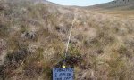
Ecological site keys
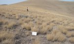
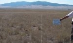
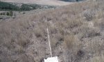
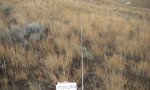
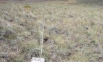
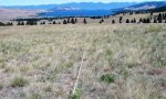
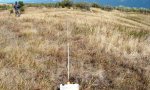
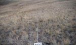
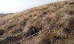
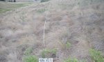
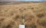
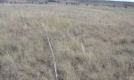
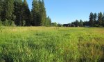
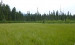
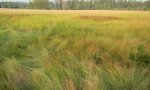
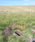
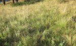
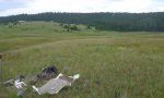
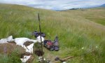
Ecological site photos
Print Options
Sections
Font
Other
Briefcase
Add ecological sites and Major Land Resource Areas to your briefcase by clicking on the briefcase (![]() ) icon wherever it occurs. Drag and drop items to reorder. Cookies are used to store briefcase items between browsing sessions. Because of this, the number of items that can be added to your briefcase is limited, and briefcase items added on one device and browser cannot be accessed from another device or browser. Users who do not wish to place cookies on their devices should not use the briefcase tool. Briefcase cookies serve no other purpose than described here and are deleted whenever browsing history is cleared.
) icon wherever it occurs. Drag and drop items to reorder. Cookies are used to store briefcase items between browsing sessions. Because of this, the number of items that can be added to your briefcase is limited, and briefcase items added on one device and browser cannot be accessed from another device or browser. Users who do not wish to place cookies on their devices should not use the briefcase tool. Briefcase cookies serve no other purpose than described here and are deleted whenever browsing history is cleared.
Ecological sites
Major Land Resource Areas
The Ecosystem Dynamics Interpretive Tool is an information system framework developed by the USDA-ARS Jornada Experimental Range, USDA Natural Resources Conservation Service, and New Mexico State University.