Major Land Resource Area 156A
Florida Everglades and Associated Areas
Accessed: 04/10/2026
Description
This area makes up about 7,749 square miles (20,071 square kilometers) and is entirely in Florida. It is located at the southern tip of the State and has shoreline on both the Atlantic Ocean and the Gulf of Mexico. Lake Okeechobee borders the MLRA to the north. Aside from sugar cane plantations in the north, the Everglades National Park, Big Cypress National Preserve, and the Big Cypress Seminole Indian Reservation comprise this area. Historical ditching, berming, and canals prevent natural water flow through this delicate ecosystem. To mitigate this, extensive restoration efforts have been implemented. Urban sprawl from Miami and cities to its north on the Atlantic Ridge has encroached along the eastern boundary of this area. Most of the MLRA has resisted urbanization because of a water table that is at or near the surface, a considerable acreage of unstable organic soils, and its identity as a national treasure. The MLRA area is in the Floridian Section of the Lower Coastal Plain Province of the Atlantic Plain. It is on a level, low coastal plain that has large areas of swamps and marshes. Poorly defined and broad streams, canals, and ditches drain the area to the ocean. Most of the area is flat, but in the interior, hummocks rise 3 to 6 feet (1 to 2 meters) above the general level of the landscape and low beach ridges and dunes, mainly in the eastern part of the area, rise 10 to 15 feet (3 to 5 meters) above the adjoining swamps and marshes. Elevation ranges from sea level to less than 80 feet (25 meters). The average annual precipitation is 37 to 62 inches (950 to 1,565 millimeters). About 60 percent of the precipitation occurs from June through September. The center of the area is the driest. Most of the rainfall occurs during moderate intensity, tropical storms that produce large amounts of rain from late spring through early autumn. Late autumn and winter are relatively dry. The average annual temperature is 74 to 78 degrees F (23 to 26 degrees C). The freeze-free period averages 355 days and ranges from 345 to 365 days. Five major physiographic ecological regions has been described inside of this area and act as MLRA subunits; Big Cypress Ecoregion, Everglades Ecoregion, Southern Coast and Islands Ecoregion, Miami Ridge / Atlantic Coastal Strip Ecoregion, and Coastal Marine and Estuarine Ecoregions.
Key publications
Geographic subunits
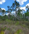
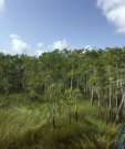
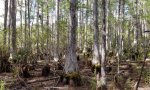
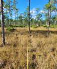
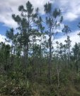
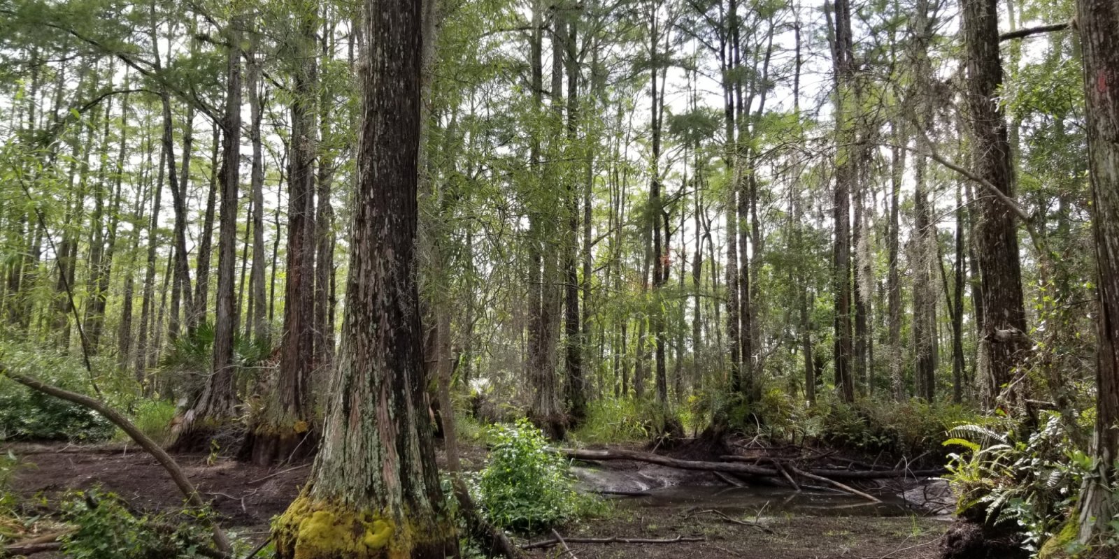
Land Resource Unit 1. The Big Cypress Ecoregion, 3 to 7 m (10 to 25 ft) in elevation and include the Big Cypress National Preserve, Big Cypress and Miccosukee Reservations, and Fakahatachee Strand State Preserve. It is an area slightly higher in elevation than the Everglades, covered by pine flatwoods, open scrub cypress, prairie type grasslands, and extensive marsh and wetlands. Poorly drained soils overlie limestone, calcareous sandstones, marls, swamp deposit mucks, and algal muds. Lakes are generally absent from the region.
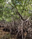
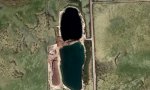
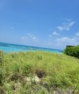
Land Resource Unit 2. The Southern Coast and Islands Ecoregion, 5 m and below (17 ft and below) in elevation and includes the Ten Thousand Islands and Cape Sable, the islands of Florida Bay, and the Florida Keys. It is an area of mangrove swamps and coastal marshes, coral reefs, various coastal strand type vegetation on beach ridge deposits and limestone rock islands. Although freshwater habitats are limited or non-existent in this region, any freshwater that does occur for periods of time may have great ecological significance. Coastal rockland lakes are small and number, occurring primarily in the Florida Keys. These waters are alkaline, with high mineral content and highly variable salinity levels. The rockland lakes provide important habitat for several kinds of fish, mammals, and birds of the Keys. Reductions in the fresh groundwater lens that floats on the denser saline groundwater can severely affect these lakes.
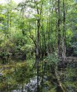
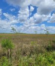
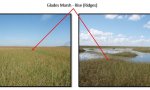
Land Resource Unit 3. The Everglades region, 1 to 7 m (3 to 23 ft) in elevation and begins south of Lake Okeechobee to include the Everglades Agricultural Area, the water conservation areas, and the sawgrass and sloughs of the national park. The flat plain of saw-grass marshes, tree-islands, and marsh prairies, with cropland in the north, ranges in elevation from sea level to twenty feet. Peat, muck, and some clay are the main surficial materials over the limestone. Wide sloughs, marshes, and some small ponds contain most of the surface waters in this "River of Grass" region. Canals drain much of the water in some areas.
Land Resource Unit 4. The Miami Ridge/Atlantic Coastal Strip Ecoregion, sea level to 20 m (0 to 66 ft) in elevation, is a heavily urbanized region, with coastal ridges on the east and flatter terrain to the west that grades into the Everglades. The western side originally had wet and dry prairie marshes on marl and rockland and sawgrass marshes, but much of it is now covered by cropland, pasture, and suburbs. To the south, the Miami Ridge extends from near Hollywood south to Homestead and west into Long Pine Key of Everglades National Park. It is a gently rolling rock ridge of oolitic limestone that once supported more extensive southern slash pine forests and islands of tropical hardwood hammocks. The northern part of the region is a plain of pine flatwoods and wet prairie, and coastal sand ridges with scrub vegetation and sand pine. There are very few natural lakes in the region, but three types of ponded surface waters occur: 1) Pits dug deep into underlying "rock" containing water that is clear, high pH and alkaline, with moderate nutrients; 2) Shallow, surficial dug drains that are darker water; and 3) flow-through lakes (e.g., Lake Osborne) that are colored and nutrient rich.
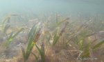
Land Resource Unit 5. The Coastal Marine and Estuarine Ecoregion is an unofficial ecoregion, which encompasses subaqueous habitats within this MLRA. It consists of subaqueous estuarine and marine habitats which are dominated by seagrass and algal beds, coral reefs, oyster beds, and unconsolidated substrates. These areas provide important habitat for marine life which is a major economic driver in the Florida Keys and along the Florida coast.
Next steps
-
1
Select an ecological site
Select an ecological site using the list, keys, photos, briefcase, or quick search option located on this page. -
2
Explore the ecological site description
Next, learn more about the selected ecological site and its characteristic dynamics by browsing the ecological site description and exploring alternative state and transition model formats.