Major Land Resource Area 115X
Central Mississippi Valley Wooded Slopes
Accessed: 04/03/2026
Next steps
-
1
Select an ecological site
Select an ecological site using the list, keys, photos, briefcase, or quick search option located on this page. -
2
Explore the ecological site description
Next, learn more about the selected ecological site and its characteristic dynamics by browsing the ecological site description and exploring alternative state and transition model formats.
Ecological site list
-
i
Key Characteristics
- Uplands
- Slopes <18%
- No depth restrictions
- Moderately well drained and well drained
-
i
Key Characteristics
- Uplands
- Slopes >18%
- No depth restrictions (very deep)
-
i
Key Characteristics
- Uplands
- Slopes <18%
- No depth restrictions
- Somewhat Poorly drained to Poorly drained
-
i
Key Characteristics
- Uplands
- Slopes <18%
- Depth restrictions
- Fragipan
-
i
Key Characteristics
- Uplands
- Slopes >18%
- Depth restrictions (deep to moderately deep)
-
i
Key Characteristics
- Terraces/Lakeplains
- Mineral
- Moderately well drained to well drained
- No fragipan
- Clayey
-
i
Key Characteristics
- Terraces/Lakeplains
- Mineral
- Somewhat poorly drained to very poorly drained
- Clayey
-
i
Key Characteristics
- Terraces/Lakeplains
- Mineral
- Moderately well drained to well drained
- No fragipan
- Loamy
- Slope <10%
-
i
Key Characteristics
- Terraces/Lakeplains
- Mineral
- Moderately well drained to well drained
- No fragipan
- Loamy
- Slope >10%
-
i
Key Characteristics
- Terraces/Lakeplains
- Mineral
- Somewhat poorly drained to very poorly drained
- Loamy
-
i
Key Characteristics
- Floodplains
- Textural family - fine
- Moderately well drained
-
i
Key Characteristics
- Floodplains
- Textural family - course silty to fine silty
- Moderately well drained to well drained
-
i
Key Characteristics
- Floodplains
- Textural family - course silty to fine silty
- Somewhat poorly drained
-
i
Key Characteristics
- Floodplains
- Textural family -course Loamy
-
i
Key Characteristics
- Floodplains
- Textural family - course silty to fine silty
- Very poorly drained
-
i
Key Characteristics
- Floodplains
- Textural family - sandy
-
i
Key Characteristics
- Floodplains
- Textural family - fine
- Poorly drained to very poorly drained
-
i
Key Characteristics
- Upland Summits, Shoulders or Backslopes
- Bedrock > 20”
- <15% slope
- Loess >40”
- No HAHT (Human altered/human transported) )material
-
i
Key Characteristics
- Upland Summits, Shoulders or Backslopes
- Bedrock > 20”
- >15% slope
- Loess >40”
- North, East aspects
-
i
Key Characteristics
- Upland Summits, Shoulders or Backslopes
- Bedrock > 20”
- <15% slope
- Loess >12” and <40”
- Pedisediment/till substratum
-
i
Key Characteristics
- Upland Summits, Shoulders or Backslopes
- Bedrock > 20”
- <15% slope
- Loess >12” and <40”
- Residuum substratum
-
i
Key Characteristics
- Upland Summits, Shoulders or Backslopes
- Bedrock > 20”
- >15% slope
- Loess >12” and <40”
- North, East aspects
-
i
Key Characteristics
- Upland Summits, Shoulders or Backslopes
- Bedrock > 20”
- <15% slope
- Little or no loess (<12”)
- Dolomite/Limestone residuum
- Silt loam surface; not skeletal
-
i
Key Characteristics
- Upland Summits, Shoulders or Backslopes
- Bedrock > 20”
- >15% slope
- Little or no loess (<12”)
- Dolomite/Limestone residuum
- Not Mollic
- Silt Loam surface; not skeletal
- North, East aspects
-
i
Key Characteristics
- Upland Summits, Shoulders or Backslopes
- Bedrock > 20”
- >15% slope
- Little or no loess (<12”)
- Dolomite/Limestone residuum
- Not Mollic
- Skeletal surface
- Bedrock >40”
- North, East aspects
-
i
Key Characteristics
- Upland Summits, Shoulders or Backslopes
- Bedrock > 20”
- <15% slope
- Little or no loess (<12”)
- Dolomite/Limestone residuum
- Skeletal to surface
-
i
Key Characteristics
- Upland Summits, Shoulders or Backslopes
- Bedrock > 20”
- >15% slope
- Little or no loess (<12”)
- Dolomite/Limestone residuum
- Not Mollic
- Skeletal surface
- Bedrock 20-40”
- North, East aspects
-
i
Key Characteristics
- VI. Floodplains (occasional to frequent flooding)
- Not ponded
- Mississippi/Missouri River floodplain
- Sandy, loamy
-
i
Key Characteristics
- Upland Summits, Shoulders or Backslopes
- Bedrock > 20”
- <15% slope
- Little or no loess (<12”)
- Sandstone residuum
-
i
Key Characteristics
- Upland Summits, Shoulders or Backslopes
- Bedrock > 20”
- >15% slope
- Little or no loess (<12”)
- Sandstone residuum
- North, East aspects
-
i
Key Characteristics
- VI. Floodplains (occasional to frequent flooding)
- Not ponded
- Secondary stream floodplain
- Skeletal
-
i
Key Characteristics
- High Terrace
-
i
Key Characteristics
- Footslope
-
i
Key Characteristics
- Low Terraces and Floodplain Steps
- Not Mollic (Historic Forest)
- Moderately Well to Well Drained
-
i
Key Characteristics
- Low Terraces and Floodplain Steps
- Not Mollic (Historic Forest)
- Poorly to Somewhat Poorly Drained
-
i
Key Characteristics
- Upland Drainageways
- Poorly to Somewhat Poorly Drained
-
i
Key Characteristics
- Upland Drainageways
- Moderately Well to Well Drained
-
i
Key Characteristics
- VI. Floodplains (occasional to frequent flooding)
- Not ponded
- Secondary stream floodplain
- Loamy
-
i
Key Characteristics
- Upland Summits, Shoulders or Backslopes
- Bedrock > 20”
- >15% slope
- Little or no loess (<12”)
- Dolomite/Limestone residuum
- Mollic (moist Munsell color value and chroma ≤3; minimum thickness of mollic colors is > 10 inches)
- North, East aspects
-
i
Key Characteristics
- VI. Floodplains (occasional to frequent flooding)
- Not ponded
- Mississippi/Missouri River floodplain
- Clayey
-
i
Key Characteristics
- Upland Summits, Shoulders or Backslopes
- Bedrock > 20”
- >15% slope
- Loess >40”
- South, West aspects
-
i
Key Characteristics
- Upland Summits, Shoulders or Backslopes
- Bedrock > 20”
- >15% slope
- Loess >12” and <40”
- South, West aspects
-
i
Key Characteristics
- Upland Summits, Shoulders or Backslopes
- Bedrock > 20”
- >15% slope
- Little or no loess (<12”)
- Dolomite/Limestone residuum
- Not Mollic
- Silt Loam surface; not skeletal
- South, West aspects
-
i
Key Characteristics
- Upland Summits, Shoulders or Backslopes
- Bedrock > 20”
- >15% slope
- Little or no loess (<12”)
- Dolomite/Limestone residuum
- Not Mollic
- Skeletal surface
- Bedrock 20-40”
- South, West aspects
-
i
Key Characteristics
- Upland Summits, Shoulders or Backslopes
- Bedrock > 20”
- >15% slope
- Little or no loess (<12”)
- Dolomite/Limestone residuum
- Not Mollic
- Skeletal surface
- Bedrock >40”
- South, West aspects
-
i
Key Characteristics
- Upland Summits, Shoulders or Backslopes
- Bedrock > 20”
- >15% slope
- Little or no loess (<12”)
- Dolomite/Limestone residuum
- Mollic (moist Munsell color value and chroma ≤3; minimum thickness of mollic colors is > 10 inches)
- South, West aspects
-
i
Key Characteristics
- Upland Summits, Shoulders or Backslopes
- Bedrock > 20”
- >15% slope
- Little or no loess (<12”)
- Sandstone residuum
- South, West aspects
-
i
Key Characteristics
- Low Terraces and Floodplain Steps
- HAHT (Human altered/human transported - Anthropic) material
-
i
Key Characteristics
- Upland Summits, Shoulders or Backslopes
- Bedrock > 20”
- <15% slope
- Loess >40”
- HAHT (Human altered/human transported) material
-
i
Key Characteristics
- Uplands and high stream terraces
- Bedrock limestone <50cm (20")
-
i
Key Characteristics
- Uplands and high stream terraces
- Bedrock >50cm (20")
- Loess, loess over glacial till/paleosol, glacial till
- Light surface (ochric epipedon) or dark surface <15cm (6")
- Slopes <18 percent
- Depth to water table >30cm (12")
-
i
Key Characteristics
- Uplands and high stream terraces
- Bedrock >50cm (20")
- Loess, loess over glacial till/paleosol, glacial till
- Light surface (ochric epipedon) or dark surface <15cm (6")
- Slopes <18 percent
- Depth to water table <30cm (12")
-
i
Key Characteristics
- Uplands and high stream terraces
- Bedrock >50cm (20")
- Loess, loess over glacial till/paleosol, glacial till
- Light surface (ochric epipedon) or dark surface <15cm (6")
- Slopes >18 percent
- North-East aspects
-
i
Key Characteristics
- Uplands and high stream terraces
- Bedrock >50cm (20")
- Loess, loess over glacial till/paleosol, glacial till
- Light surface (ochric epipedon) or dark surface <15cm (6")
- Slopes >18 percent
- South-West aspects
-
i
Key Characteristics
- Uplands and high stream terraces
- Bedrock >50cm (20")
- Residuum weathered from cherty limestone
- Slopes >18 percent, North-East aspects
-
i
Key Characteristics
- Uplands and high stream terraces
- Bedrock >50cm (20")
- Residuum weathered from cherty limestone
- Slopes >18 percent, South-West aspects
-
i
Key Characteristics
- Uplands and high stream terraces
- Bedrock >50cm (20")
- Sandy eolian deposits, outwash
- Light colored surface (ochric epipedon) or dark surface <15cm (6")
-
i
Key Characteristics
- Floodplains and low stream terraces subject to flooding
- Floodplains, occasionally to frequently flooded
- Site experiences flooding only
- Directly adjacent to stream channel
- Clayey alluvium, Poorly drained
-
i
Key Characteristics
- Floodplains and low stream terraces subject to flooding
- Floodplains, occasionally to frequently flooded
- Site experiences flooding only
- Directly adjacent to stream channel
- Silty or loamy alluvium, Somewhat Poorly to Well drained
-
i
Key Characteristics
- Floodplains and low stream terraces subject to flooding
- Floodplains, occasionally to frequently flooded
- Site experiences flooding only
- Directly adjacent to stream channel
- Sandy or gravelly alluvium, Well to Excessively drained
-
i
Key Characteristics
- Dunes
- Somewhat poorly drained to poorly drained
-
i
Key Characteristics
- Dunes
- Somewhat excessively drained to excessively drained
-
i
Key Characteristics
- Dunes
- Well Drained
-
i
Key Characteristics
- Terraces/Lakeplains
- Mineral
- Moderately well drained to well drained
- No fragipan
- Sandy
-
i
Key Characteristics
- Terraces/Lakeplains
- Mineral
- Somewhat poorly drained to very poorly drained
- Sandy
-
i
Key Characteristics
- Terraces/Lakeplains
- Organic
- Very poorly drained
-
i
Key Characteristics
- Upland Summits, Shoulders or Backslopes
- Bedrock < 20”
- Steep slope minor
- Limestone/Dolomite residuum
-
i
Key Characteristics
- Upland Summits, Shoulders or Backslopes
- Bedrock < 20”
- Steep slope dominant (upper slope range to 70%)
- North, East aspects
-
i
Key Characteristics
- Upland Summits, Shoulders or Backslopes
- Bedrock < 20”
- Steep slope dominant (upper slope range to 70%)
- South, West aspects
-
i
Key Characteristics
- Low Terraces and Floodplain Steps
- Mollic (Historic Prairie)
- Moderately Well to Well Drained
-
i
Key Characteristics
- Low Terraces and Floodplain Steps
- Mollic (Historic Prairie)
- Poorly to Somewhat Poorly Drained
-
i
Key Characteristics
- VI. Floodplains (occasional to frequent flooding)
- Ponded
-
i
Key Characteristics
- Upland Summits, Shoulders or Backslopes
- Bedrock < 20”
- Steep slope minor
- Sandstone residuum
-
i
Key Characteristics
- Uplands and high stream terraces
- Bedrock >50cm (20")
- Loess, loess over glacial till/paleosol, glacial till
- Dark surface (mollic epipedon) >25cm (10")
- Slopes <18 percent
-
i
Key Characteristics
- Uplands and high stream terraces
- Bedrock >50cm (20")
- Loess, loess over glacial till/paleosol, glacial till
- Dark surface (mollic epipedon) >25cm (10")
- Slopes >18 percent
-
i
Key Characteristics
- Uplands and high stream terraces
- Bedrock >50cm (20")
- Loess, loess over glacial till/paleosol, glacial till
- Dark surface (mollic intergrade) 15-25cm (6-10")
-
i
Key Characteristics
- Uplands and high stream terraces
- Bedrock >50cm (20")
- Sandy eolian deposits, outwash
- Dark surface (mollic epipedon) >25cm (10")
- Depth to water table >30cm (12")
-
i
Key Characteristics
- Uplands and high stream terraces
- Bedrock >50cm (20")
- Sandy eolian deposits, outwash
- Dark surface (mollic epipedon) >25cm (10")
- Depth to water table <30cm (12")
-
i
Key Characteristics
- Floodplains and low stream terraces subject to flooding
- Low stream terrace, rare to occasionally flooded
- Depth to water table >30cm (12")
-
i
Key Characteristics
- Floodplains and low stream terraces subject to flooding
- Low stream terrace, rare to occasionally flooded
- Depth to water table <30cm (12")
-
i
Key Characteristics
- Floodplains and low stream terraces subject to flooding
- Floodplains, occasionally to frequently flooded
- Site experiences flooding and ponding for long duration
-
i
Key Characteristics
- Floodplains and low stream terraces subject to flooding
- Floodplains, occasionally to frequently flooded
- Site experiences flooding only
- Not directly adjacent to stream channel
- Depth to water table >30cm (12")
-
i
Key Characteristics
- Floodplains and low stream terraces subject to flooding
- Floodplains, occasionally to frequently flooded
- Site experiences flooding only
- Not directly adjacent to stream channel
- Depth to water table <30cm (12")


Ecological site map
Basemap
Find me
Find point
Full screen
Zoom in to display soil survey map units for an area of interest, and zoom out to display MLRAs. Select a map unit polygon to view ecological sites correlated to that map unit. View a brief description of an ecological site by clicking on its name in the map popup. Soil survey correlations may not be accurate, and ecological site classification of a location should always be verified in the field. Each selection may require the transfer of several hundred KB of data.
Ecological site keys
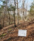
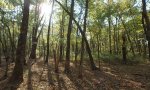
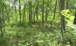
Ecological site photos
Print Options
Sections
Font
Other
Briefcase
Add ecological sites and Major Land Resource Areas to your briefcase by clicking on the briefcase (![]() ) icon wherever it occurs. Drag and drop items to reorder. Cookies are used to store briefcase items between browsing sessions. Because of this, the number of items that can be added to your briefcase is limited, and briefcase items added on one device and browser cannot be accessed from another device or browser. Users who do not wish to place cookies on their devices should not use the briefcase tool. Briefcase cookies serve no other purpose than described here and are deleted whenever browsing history is cleared.
) icon wherever it occurs. Drag and drop items to reorder. Cookies are used to store briefcase items between browsing sessions. Because of this, the number of items that can be added to your briefcase is limited, and briefcase items added on one device and browser cannot be accessed from another device or browser. Users who do not wish to place cookies on their devices should not use the briefcase tool. Briefcase cookies serve no other purpose than described here and are deleted whenever browsing history is cleared.
Ecological sites
Major Land Resource Areas
The Ecosystem Dynamics Interpretive Tool is an information system framework developed by the USDA-ARS Jornada Experimental Range, USDA Natural Resources Conservation Service, and New Mexico State University.