Major Land Resource Area 026X
Carson Basin and Mountains
Accessed: 04/09/2026
Description
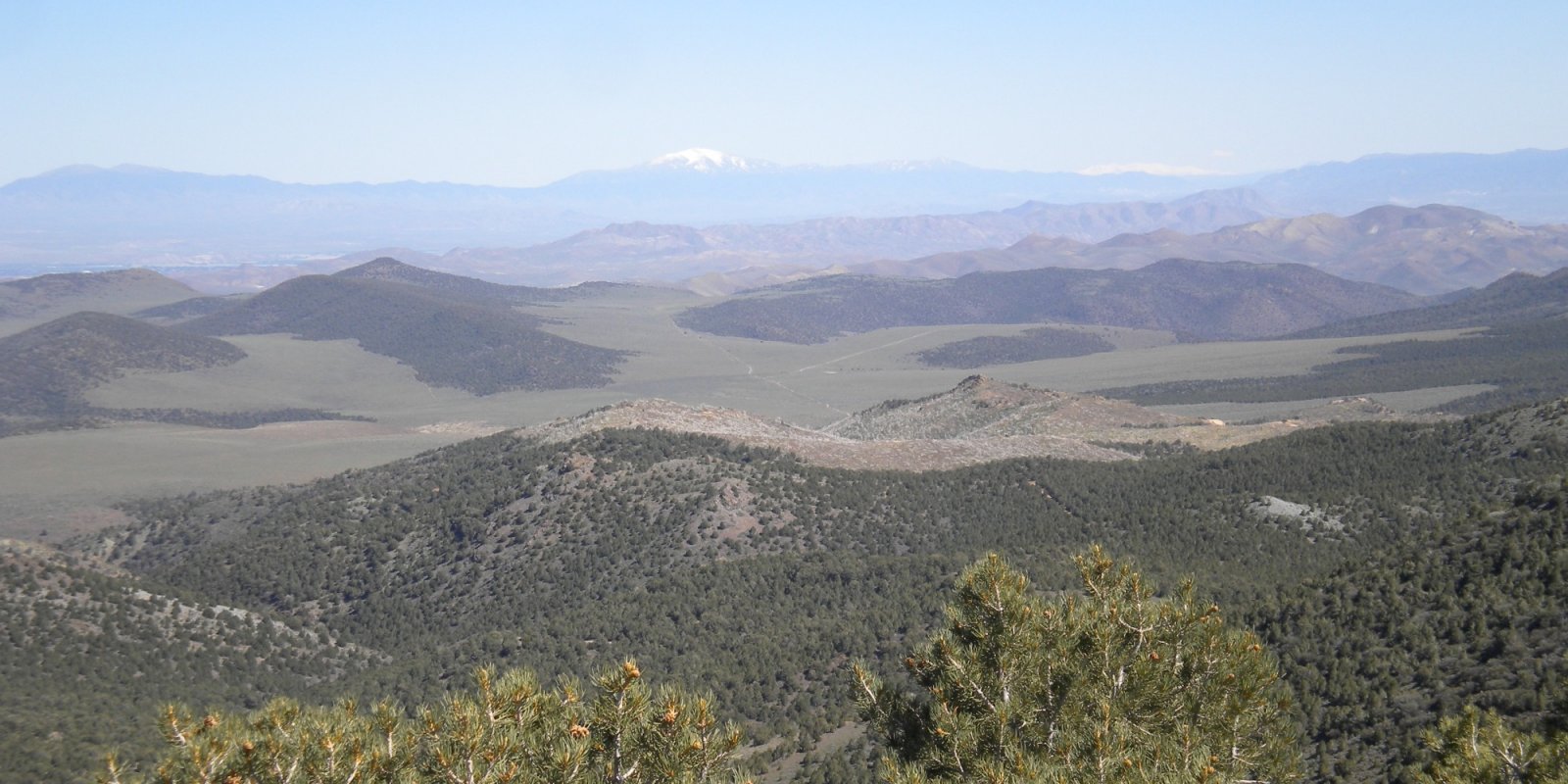
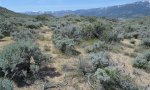
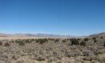
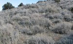
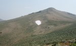
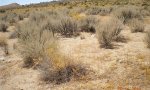
The area lies within western Nevada and eastern California, with about 69 percent being within Nevada, and 31 percent being within California. Almost all this area is in the Great Basin Section of the Basin and Range Province of the Intermontane Plateaus. Isolated north-south trending mountain ranges are separated by aggraded desert plains. The mountains are uplifted fault blocks with steep side slopes. Most of the valleys are drained by three major rivers flowing east across this MLRA. A narrow strip along the western border of the area is in the Sierra Nevada Section of the Cascade-Sierra Mountains Province of the Pacific Mountain System. The Sierra Nevada Mountains are primarily a large fault block that has been uplifted with a dominant tilt to the west. This structure leaves an impressive wall of mountains directly west of this area. This helps create a rain shadow affect to MLRA 26. Parts of this eastern face, but mostly just the foothills, mark the western boundary of this area. Elevations range from about 3,806 feet (1,160 meters) on the west shore of Pyramid Lake to 11,653 feet (3,552 meters) on the summit of Mount Patterson in the Sweetwater Mountains. Valley areas are dominantly composed of Quaternary alluvial deposits with Quaternary playa or alluvial flat deposits often occupying the lowest valley bottoms in the internally drained valleys, and river deposited alluvium being dominant in externally drained valleys. Hills and mountains are dominantly Tertiary andesitic flows, breccias, ash flow tuffs, rhyolite tuffs or granodioritic rocks. Quaternary basalt flows are present in lesser amounts, and Jurassic and Triassic limestone and shale, and Precambrian limestone and dolomite are also present in very limited amounts. Also of limited extent are glacial till deposits along the east flank of the Sierra Nevada Mountains, the result of alpine glaciation. The average annual precipitation in this area is 5 to 36 inches (125 to 915 millimeters), increasing with elevation. Most of the rainfall occurs as high-intensity, convective storms in spring and autumn. Precipitation is mostly snow in winter. Summers are dry. The average annual temperature is 37 to 54 degrees F (3 to 12 degrees C). The freeze-free period averages 115 days and ranges from 40 to 195 days, decreasing in length with elevation. The dominant soil orders in this MLRA are Aridisols and Mollisols. The soils in the area dominantly have a mesic soil temperature regime, an aridic or xeric soil moisture regime, and mixed or smectitic mineralogy. They generally are well drained, are clayey or loamy and commonly skeletal, and are very shallow to moderately deep. This area supports shrub-grass vegetation characterized by big sagebrush. Low sagebrush and Lahontan sagebrush occur on some soils. Antelope bitterbrush, squirreltail, desert needlegrass, Thurber needlegrass, and Indian ricegrass are important associated plants. Green ephedra, Sandberg bluegrass, Anderson peachbrush, and several forb species also are common. Juniper-pinyon woodland is typical on mountain slopes. Jeffrey pine, lodgepole pine, white fir, and manzanita grow on the highest mountain slopes. Shadscale is the typical plant in the drier parts of the area. Sedges, rushes, and moisture-loving grasses grow on the wettest parts of the wet flood plains and terraces. Basin wildrye, alkali sacaton, saltgrass, buffaloberry, black greasewood, and rubber rabbitbrush grow on the drier sites that have a high concentration of salts. Some of the major wildlife species in this area are mule deer, coyote, beaver, muskrat, jackrabbit, cottontail, raptors, pheasant, chukar, blue grouse, mountain quail, and mourning dove. The species of fish in the area include trout and catfish. The Lahontan cutthroat trout in the Truckee River is a threatened and endangered species.
Key publications
Next steps
-
1
Select an ecological site
Select an ecological site using the list, keys, photos, briefcase, or quick search option located on this page. -
2
Explore the ecological site description
Next, learn more about the selected ecological site and its characteristic dynamics by browsing the ecological site description and exploring alternative state and transition model formats.
Ecological site list
-
i
Key Characteristics
- Soil is very shallow (less than 10 inches) to shallow (10 to 20 inches) to a restrictive layer (duripan, paralithic, and/or lithic bedrock).
- Soil does not have an increase in clay below the soil surface that influences the site vegetation (sites are not dominated by Lahontan or low sagebrush).
- Site is typically found from 5000 to 9000 feet in elevation and average annual precipitation is typically greater than 10 inches.
- Soil has greater than 15 percent rock fragments on the soil surface and subsurface. Textures may be loam or coarser or always modified by rock fragments. Dominant vegetation may be trees or shrubs.
- Soils are typically mollisols or entisols. Site may be dominated by trees or shrubs.
- Soils are well developed with a dark top horizon (mollic epipedon). I would field check all the tree sites to make sure there has not been encroachment onto a sagebrush site.
- Site is dominated by juniper or pinyon, or a combination of both trees.
- Site is dominated by pinyon trees. See also F026XY069NV and F026XY104NV.
-
i
Key Characteristics
- Soil is moderately deep (20 to 40 inches) to very deep 40 to over 60 inches).
- Surface soil texture is sandy, sandy loam, much coarse than the sites above.
- Site has a water table within 60 inches of the soil surface.
- Site occurs along water ways, flood plains or stream terraces.
- Site typically occurs at elevations less than 5000 feet.
-
i
Key Characteristics
- Soil is shallow (less than 20 inches to a restrictive layer).
- Slopes are typically greater than 30 percent.
- Site typically occurs at elevations less than 8000 feet. Site is dominated by pinyon trees. See also F026XY044NV.
- Soil is moderately deep to deep (greater than 20 inches to a restrictive layer).
- Rocks on site are greater than 15 percent cover/volume.
- Rocks on site are stone or boulder sized (greater than 10 inches in diameter).
- Site occurs at elevations less than 9000 feet.
- Rocks on the site are between 10 and 24 inches in diameter (stone sized).
- Site is found at slopes typically between 30 and 50 percent.
- Soil is very shallow (less than 10 inches) to shallow (10 to 20 inches) to a restrictive layer (duripan, paralithic, and/or lithic bedrock).
- Soil does not have an increase in clay below the soil surface that influences the site vegetation (sites are not dominated by Lahontan or low sagebrush).
- Site is typically found from 5000 to 9000 feet in elevation and average annual precipitation is typically greater than 10 inches.
- Soil has greater than 15 percent rock fragments on the soil surface and subsurface. Textures may be loam or coarser or always modified by rock fragments. Dominant vegetation may be trees or shrubs.
- Soils are alfisols, which develop under long term tree cover. Site is dominated by pinyon trees.
-
i
Key Characteristics
- Soil is very shallow (less than 10 inches) to shallow (10 to 20 inches) to a restrictive layer (duripan, paralithic, and/or lithic bedrock).
- Soil does not have an increase in clay below the soil surface that influences the site vegetation (sites are not dominated by Lahontan or low sagebrush).
- Site is typically found from 5000 to 9000 feet in elevation and average annual precipitation is typically greater than 10 inches.
- Soil has greater than 15 percent rock fragments on the soil surface and subsurface. Textures may be loam or coarser or always modified by rock fragments. Dominant vegetation may be trees or shrubs.
- Soils are typically mollisols or entisols. Site may be dominated by trees or shrubs.
- Soils are less developed and do not have a dark upper horizon.
- Soil is very shallow (less than 10 inches to a restrictive layer).
- Site is typically found at elevations above 6000 feet.
-
i
Key Characteristics
- Soil is very shallow (less than 10 inches) to shallow (10 to 20 inches) to a restrictive layer (duripan, paralithic, and/or lithic bedrock).
- Soil does not have an increase in clay below the soil surface that influences the site vegetation (sites are not dominated by Lahontan or low sagebrush).
- Site is typically found from 5000 to 9000 feet in elevation and average annual precipitation is typically greater than 10 inches.
- Soil has greater than 15 percent rock fragments on the soil surface and subsurface. Textures may be loam or coarser or always modified by rock fragments. Dominant vegetation may be trees or shrubs.
- Soils are typically mollisols or entisols. Site may be dominated by trees or shrubs.
- Soils are well developed with a dark top horizon (mollic epipedon). I would field check all the tree sites to make sure there has not been encroachment onto a sagebrush site.
- Site is dominated by juniper or pinyon, or a combination of both trees.
- Site is dominated by both pinyon and juniper trees.
-
i
Key Characteristics
- Soil is shallow (less than 20 inches to a restrictive layer).
- Slopes are typically less than 30 percent.
- Site occurs at elevations less than 8500 feet.
- Surface soil texture is sand, with greater than 60 percent gravels.
-
i
Key Characteristics
- Soil is shallow (less than 20 inches to a restrictive layer).
- Slopes are typically less than 30 percent.
- Site occurs at elevations less than 8500 feet.
- Surface soil texture is sandy loam to fine sandy loam. See also R026XY078NV Claypan 12-14 P.Z. and R026XY009NV Mahogany Savanna.
- Soil is very shallow (less than 10 inches) to shallow (10 to 20 inches) to a restrictive layer (duripan, paralithic, and/or lithic bedrock).
- Soil has an increase in clay that restricts plant growth, site typically dominated by Lahontan or low sagebrush or pinyon and juniper.
- Site is located on a ridge or mountain summit. Slope is between 2 to 15 percent.
-
i
Key Characteristics
- Soil is very shallow (less than 10 inches) to shallow (10 to 20 inches) to a restrictive layer (duripan, paralithic, and/or lithic bedrock).
- Soil does not have an increase in clay below the soil surface that influences the site vegetation (sites are not dominated by Lahontan or low sagebrush).
- Site is typically found from 5000 to 9000 feet in elevation and average annual precipitation is typically greater than 10 inches.
- Soil has greater than 15 percent rock fragments on the soil surface and subsurface. Textures may be loam or coarser or always modified by rock fragments. Dominant vegetation may be trees or shrubs.
- Soils are typically mollisols or entisols. Site may be dominated by trees or shrubs.
- Soils are less developed and do not have a dark upper horizon.
- Soil is very shallow (less than 10 inches to a restrictive layer).
- Site is typically found at elevations below 7000 feet.
- Site is found on mountain slopes.
-
i
Key Characteristics
- Soil is moderately deep to deep (greater than 20 inches to a restrictive layer).
- Rocks on site are greater than 15 percent cover/volume.
- Rocks on site are cobble or gravel sized (less than 10 inches in diameter).
- Site is typically found at elevations less than 9500 feet.
- Site does not have an increase in clay that influences plant rooting depth. Dominant plants are either mahogany, big sagebrush, or aspen.
- Mean annual precipitation is greater than 16 inches.
- Site is in a concave position and is dominated by aspen.
-
i
Key Characteristics
- Soil is moderately deep to deep (greater than 20 inches to a restrictive layer).
- Rocks on site are greater than 15 percent cover/volume.
- Rocks on site are stone or boulder sized (greater than 10 inches in diameter).
- Site occurs at elevations greater than 9000 feet.
-
i
Key Characteristics
- Soil is moderately deep (20 to 40 inches) to very deep 40 to over 60 inches).
- Surface soil texture is sandy, sandy loam, much coarse than the sites above.
- Site has a water table within 60 inches of the soil surface.
- Site occurs in concave landscape positions, but is not associated with flood plains or stream terraces.
-
i
Key Characteristics
- Soil is moderately deep (20 to 40 inches) to very deep 40 to over 60 inches).
- Surface soil texture is sandy, sandy loam, much coarse than the sites above.
- Site does not have a water table within 60 inches.
- Site found at all slopes, but soil surface and subsurface have rocks over 10 percent.
- Site has a darker upper soil horizon (mollisol). All of these mollisols probably have overextended the site concepts. Certain soil series should be reevaluated for correlation to a different site.
- Site are typically higher on the landscape, between 6000 and 8000 feet, and have precipitation that averages between 12 and 14 inches.
- Site is dominated by pinyon trees. See also F026XY071NV.
-
-
i
Key Characteristics
- Soil is moderately deep (20 to 40 inches) to very deep 40 to over 60 inches).
- Surface soil texture is sandy, sandy loam, much coarse than the sites above.
- Site has a water table within 60 inches of the soil surface.
- Site occurs along water ways, flood plains or stream terraces.
- Site typically occurs at elevations greater than 6000 feet.
-
i
Key Characteristics
- Site has a watertable above 60 inches. Located in a concave position or along a waterway.
- Site typically occurs in a concave position, not next to a stream.
- Soil texture is loam to loamy sand.
- Site is not influenced by salts as the site above.
- Site has greater than 15 percent gravels on the soil surface.
-
i
Key Characteristics
- Soil is very shallow (less than 10 inches) to shallow (10 to 20 inches) to a restrictive layer (duripan, paralithic, and/or lithic bedrock).
- Soil does not have an increase in clay below the soil surface that influences the site vegetation (sites are not dominated by Lahontan or low sagebrush).
- Site is typically found from 5000 to 9000 feet in elevation and average annual precipitation is typically greater than 10 inches.
- Soil has less than 15 percent rock fragments on the soil surface and subsurface. Surface soil texture is loam. Dominant vegetation is pinyon pine and low sagebrush.
-
i
Key Characteristics
- Soil is very shallow (less than 10 inches) to shallow (10 to 20 inches) to a restrictive layer (duripan, paralithic, and/or lithic bedrock).
- Soil does not have an increase in clay below the soil surface that influences the site vegetation (sites are not dominated by Lahontan or low sagebrush).
- Site is typically found from 5000 to 9000 feet in elevation and average annual precipitation is typically greater than 10 inches.
- Soil has greater than 15 percent rock fragments on the soil surface and subsurface. Textures may be loam or coarser or always modified by rock fragments. Dominant vegetation may be trees or shrubs.
- Soils are typically mollisols or entisols. Site may be dominated by trees or shrubs.
- Soils are less developed and do not have a dark upper horizon.
- Soil is shallow with 10 to 20 inches to a restrictive layer.
- Site is typically found on south slopes and dominated by trees. Annual above ground production is less than 300 pounds.
-
i
Key Characteristics
- Site does not have a water table within 60 inches of the soil surface.
- Site is moderately deep to deep (20 inches or more to a restrictive layer).
- Site is not found on glacial moraines.
- Soil is deep (over 40 inches to a restrictive layer).
- Slope is less than 15 percent.
- Sites are located on lake terraces, alluvial fans, or valley floors.
- Soil is a entisol, does not have dark top horizon colors, and is not well developed.
- Soil surface texture is finer (loamy sand to sandy loam).
- Soil surface or subsurface has less than 10 percent rock fragments by cover or volume.
-
i
Key Characteristics
- Site does not have a water table within 60 inches of the soil surface.
- Site is moderately deep to deep (20 inches or more to a restrictive layer).
- Site is not found on glacial moraines.
- Soil is deep (over 40 inches to a restrictive layer).
- Slope is less than 15 percent.
- Site located on stabilized dunes.
-
i
Key Characteristics
- Site does not have a water table within 60 inches of the soil surface.
- Site is moderately deep to deep (20 inches or more to a restrictive layer).
- Site is not found on glacial moraines.
- Soil is deep (over 40 inches to a restrictive layer).
- Slope is less than 15 percent.
- Sites are located on lake terraces, alluvial fans, or valley floors.
- Soil is a entisol, does not have dark top horizon colors, and is not well developed.
- Soil surface texture is finer (loamy sand to sandy loam).
- Soil surface or subsurface has more than 10 percent rock fragments by cover or volume. All three sites should be field checked for site differences. See also R026XF004CA Gravelly Coarse Loamy 8-12", this site has antelope bitterbrush in the community.
-
-
i
Key Characteristics
- Site does not have a water table within 60 inches of the soil surface.
- Site is moderately deep to deep (20 inches or more to a restrictive layer).
- Site is not found on glacial moraines.
- Soil is deep (over 40 inches to a restrictive layer).
- Slope is less than 15 percent.
- Sites are located on lake terraces, alluvial fans, or valley floors.
- Soil is a entisol, does not have dark top horizon colors, and is not well developed.
- Soil surface texture is coarse sand to sand. See also R026XF046CA Gravelly Sand (BLM).
-
i
Key Characteristics
- Site has a water table within 60 inches of the soil surface, or the site in on a landform that experiences flooding.
- Site does not have a water table within 60 inches, but does experience flooding.
-
i
Key Characteristics
- Site has a water table within 60 inches of the soil surface, or the site in on a landform that experiences flooding.
- Site has a water table within 60 inches of the soil surface and experiences flooding.
- Site is influenced by salt.
- Water table is deeper (between 36 and 60 inches of the soil surface).
-
i
Key Characteristics
- Site has a water table within 60 inches of the soil surface, or the site in on a landform that experiences flooding.
- Site has a water table within 60 inches of the soil surface and experiences flooding.
- Site is not influenced by salt.
- Site is found in a bottom location, not associated with a stream, but may have a drainageway.
-
i
Key Characteristics
- Site does not have a water table within 60 inches of the soil surface.
- Site is moderately deep to deep (20 inches or more to a restrictive layer).
- Site is not found on glacial moraines.
- Soil is deep (over 40 inches to a restrictive layer).
- Slope is less than 15 percent.
- Sites are located on lake terraces, alluvial fans, or valley floors.
- Soil is a mollisol, with dark top horizon colors, and well developed.
-
i
Key Characteristics
- Site does not have a water table within 60 inches of the soil surface.
- Site is moderately deep to deep (20 inches or more to a restrictive layer).
- Site is found on glacial moraines.
-
i
Key Characteristics
- Site does not have a water table within 60 inches of the soil surface.
- Site is shallow to a restrictive layer (less than 20 inches to a restrictive layer).
- Site is located on volcanic flows.
-
i
Key Characteristics
- Site has a water table within 60 inches of the soil surface, or the site in on a landform that experiences flooding.
- Site has a water table within 60 inches of the soil surface and experiences flooding.
- Site is influenced by salt.
- Water table is shallow (24 inches or less).
-
i
Key Characteristics
- Site has a water table within 60 inches of the soil surface, or the site in on a landform that experiences flooding.
- Site has a water table within 60 inches of the soil surface and experiences flooding.
- Site is not influenced by salt.
- Site is associated with a stream.
-
i
Key Characteristics
- Site has a watertable above 60 inches. Located in a concave position or along a waterway.
- Site typically occurs next to a stream.
- Site occurs on stream terraces and typically has over 15 percent rock fragments on the soil surface.
- Water table 20 inches or less from the soil surface.
-
i
Key Characteristics
- Soil is moderately deep to deep (greater than 20 inches to a restrictive layer).
- Rocks on site are less than 15 percent cover/volume.
- Soil is moderately deep (20 to 40 inches) to very deep 40 to over 60 inches).
- Surface soil texture is sandy, sandy loam, much coarse than the sites above.
- Site does not have a water table within 60 inches.
- Site found at all slopes, but soil surface and subsurface have rocks over 10 percent.
- Site has a lighter soil upper horizon (not mollic, no mollic colors).
- Soil surface texture is loamy sand to coarse sand.
-
i
Key Characteristics
- Soil is moderately deep (20 to 40 inches) to very deep 40 to over 60 inches).
- Surface soil texture is sandy, sandy loam, much coarse than the sites above.
- Site does not have a water table within 60 inches.
- Site found at all slopes, but soil surface and subsurface have rocks over 10 percent.
- Site has a lighter soil upper horizon (not mollic, no mollic colors).
- Soil surface texture is loamy sand with cobble sized rocks on the soil surface.
-
i
Key Characteristics
- Site does not have a water table within 60 inches of the soil surface.
- Site is shallow to a restrictive layer (less than 20 inches to a restrictive layer).
- Site is located on mountains or hill, but not volcanic flows.
- Soil is shallow (10 to 20 inches to restrictive layer) and site occurs slightly lower on the landscape.
-
-
i
Key Characteristics
- Soil is moderately deep to deep (greater than 20 inches to a restrictive layer).
- Site does not have flooding, or if it does, it will not have a water table within 60 inches of the soil surface.
- Site does not occur on dunes, site may have a sandy surface texture, but do not occur on dunes.
- Site has greater than 5 percent rock cover on the soil surface.
- Site occurs on alluvial fans or fan remnants, but is not located in a drainageway.
- Site has a root restrictive layer, typically a increase in clay. This can be identified by a abrupt textural change.
- Rocks on the soil surface and in the soil profile are typically less than 20 percent cover/volume.
-
-
i
Key Characteristics
- Site has a watertable above 60 inches. Located in a concave position or along a waterway.
- Site typically occurs next to a stream.
- Site occurs on flood plains and has a mucky surface texture that has less than 15 percent rock fragments on the surface.
-
i
Key Characteristics
- Site has a watertable above 60 inches. Located in a concave position or along a waterway.
- Site typically occurs next to a stream.
- Site occurs on stream terraces and typically has over 15 percent rock fragments on the soil surface.
- Water table 40 inches or more from the soil surface.
-
i
Key Characteristics
- Site does not have a water table within 60 inches of the soil surface. Location on the landscape is various.
- Soil is shallow, less than 20 inches to a restrictive layer.
- Site occurs at elevations greater than 5,800 feet; soil may be very shallow to shallow.
- Restrictive layer is weathered bedrock.
- Restrictive layer is 14 inches or greater from the soil surface. See also R026XY105NV and R026XY111NV.
-
i
Key Characteristics
- Site does not have a water table within 60 inches of the soil surface. Location on the landscape is various.
- Soil is moderately deep (20 to 40 inches to restrictive layer) to deep (40 inches or more to a restrictive layer).
- Soil is deep, greater than 60 inches to a restrictive layer.
- Site is located on landforms other than stream terraces.
- Site is located on a mountain shoulder position.
-
i
Key Characteristics
- Site does not have a water table within 60 inches of the soil surface. Location on the landscape is various.
- Soil is shallow, less than 20 inches to a restrictive layer.
- Site occurs at elevations greater than 5,800 feet; soil may be very shallow to shallow.
- Restrictive layer is un-weathered bedrock.
-
i
Key Characteristics
- Site does not have a water table within 60 inches of the soil surface. Location on the landscape is various.
- Soil is moderately deep (20 to 40 inches to restrictive layer) to deep (40 inches or more to a restrictive layer).
- Soil is moderately deep, 20 to 40 inches to a restrictive layer.
- Slopes are less than 8 percent. Site is located on a summit with a high percentage of clay in the soil subsurface.
-
i
Key Characteristics
- Site does not have a water table within 60 inches of the soil surface. Location on the landscape is various.
- Soil is moderately deep (20 to 40 inches to restrictive layer) to deep (40 inches or more to a restrictive layer).
- Soil is moderately deep, 20 to 40 inches to a restrictive layer.
- Slopes are typically greater than 8 percent.
- Site is located primarily on south slopes.
- Site is found primarily below 8,000 feet and soil temperature regime is mesic.
-
i
Key Characteristics
- Site does not have a water table within 60 inches of the soil surface. Location on the landscape is various.
- Soil is shallow, less than 20 inches to a restrictive layer.
- Site occurs at elevations greater than 5,800 feet; soil may be very shallow to shallow.
- Restrictive layer is weathered bedrock.
- Restrictive layer is less than 14 inches from the soil surface.
-
i
Key Characteristics
- Site has a watertable above 60 inches. Located in a concave position or along a waterway.
- Site typically occurs in a concave position, not next to a stream.
- Soil texture is loam to loamy sand.
- Site is influenced by salts and the pH is over 9.
-
i
Key Characteristics
- Site has a watertable above 60 inches. Located in a concave position or along a waterway.
- Site typically occurs in a concave position, not next to a stream.
- Soil texture is silty clay.
-
i
Key Characteristics
- Site does not have a water table within 60 inches of the soil surface.
- Site is moderately deep to deep (20 inches or more to a restrictive layer).
- Site is not found on glacial moraines.
- Soil is moderately deep (20 to 40 inches to a restrictive layer).
-
i
Key Characteristics
- Site does not have a water table within 60 inches of the soil surface.
- Site is moderately deep to deep (20 inches or more to a restrictive layer).
- Site is not found on glacial moraines.
- Soil is deep (over 40 inches to a restrictive layer).
- Slope is greater than 15 percent.
-
i
Key Characteristics
- Site does not have a water table within 60 inches of the soil surface.
- Site is shallow to a restrictive layer (less than 20 inches to a restrictive layer).
- Site is located on mountains or hill, but not volcanic flows.
- Site is very shallow (less than 10 inches to a restrictive layer). Site also occurs slightly higher on the landscape.
-
i
Key Characteristics
- Soil is moderately deep to deep (greater than 20 inches to a restrictive layer).
- Site experiences flooding and has a water table within 60 inches of the soil surface.
- Water table is typically deeper than 20 inches from the soil surface and is not present near the soil surface during any time of year.
- Site occurs on a flood plain or stream terrace.
- Site is poorly drained.
- Site does not have salt influence.
-
i
Key Characteristics
- Soil is moderately deep to deep (greater than 20 inches to a restrictive layer).
- Site experiences flooding and has a water table within 60 inches of the soil surface.
- Water table is typically at the soil surface or ponded in winter and spring.
-
i
Key Characteristics
- Site experiences flooding, or ponding and the water table is within 60 inches of the soil surface.
- Site may occur in a valley bottom but does not occur directly adjacent to a stream.
- Water is typically subsurface and rises to the surface during spring runoff and may remain high in the soil surface but is not ponded on the soil surface (site is endosaturated).
- Water table is typically at the soil surface to 20 inches deep.
- Site is located on flood plains or stream terraces. Site concepts for each of these sites should be confirmed in the field since there is a bit of overlap between the sites. See also R026XY054NV Wet Meadow 14+ P.Z.
-
i
Key Characteristics
- Soil is moderately deep to deep (greater than 20 inches to a restrictive layer).
- Site experiences flooding and has a water table within 60 inches of the soil surface.
- Water table is typically deeper than 20 inches from the soil surface and is not present near the soil surface during any time of year.
- Site occurs on a flood plain or stream terrace.
- Site is somewhat poorly drained.
- Site has a duripan 20 to 40 inches below the soil surface.
-
i
Key Characteristics
- Soil is moderately deep to deep (greater than 20 inches to a restrictive layer).
- Rocks on site are greater than 15 percent cover/volume.
- Rocks on site are stone or boulder sized (greater than 10 inches in diameter).
- Site occurs at elevations less than 9000 feet.
- Rocks on the site are between 10 and 24 inches in diameter (stone sized).
- Site is found at slopes typically less than 30 percent. See also R026XY009NV Mahogany Savanna.
- Soil is moderately deep (20 to 40 inches) to very deep 40 to over 60 inches).
- Surface soil texture is sandy, sandy loam, much coarse than the sites above.
- Site does not have a water table within 60 inches.
- Site found at all slopes, but soil surface and subsurface have rocks over 10 percent.
- Site has a darker upper soil horizon (mollisol). All of these mollisols probably have overextended the site concepts. Certain soil series should be reevaluated for correlation to a different site.
- Site are typically higher on the landscape, between 6000 and 8000 feet, and have precipitation that averages between 12 and 14 inches.
- Site is dominated by big sagebrush. See also R026XY046NV Granitic Slope 12-14 P.Z.
-
i
Key Characteristics
- Soil is moderately deep to deep (greater than 20 inches to a restrictive layer).
- Rocks on site are greater than 15 percent cover/volume.
- Rocks on site are stone or boulder sized (greater than 10 inches in diameter).
- Site occurs at elevations less than 9000 feet.
- Rocks on the site are greater than 24 inches in diameter (boulder sized).
-
i
Key Characteristics
- Soil is moderately deep to deep (greater than 20 inches to a restrictive layer).
- Site does not have flooding, or if it does, it will not have a water table within 60 inches of the soil surface.
- Site does not occur on dunes, site may have a sandy surface texture, but do not occur on dunes.
- Site has greater than 5 percent rock cover on the soil surface.
- Site occurs on alluvial fans or fan remnants, but is not located in a drainageway.
- Site does not have a root restrictive layer or an abrupt soil texture change.
- Site typically has greater than 15 percent rock cover or volume on the soil surface and subsurface.
- Site is found higher on the landscape, where the precipitation is typically between 10 to 12 inches. Soil is classified as a mollisol. Plant production is between 600 to 1,000 lbs per acre.
-
-
i
Key Characteristics
- Soil is moderately deep (20 to 40 inches) to very deep 40 to over 60 inches).
- Surface soil texture is sandy, sandy loam, much coarse than the sites above.
- Site does not have a water table within 60 inches.
- Site found at all slopes, but soil surface and subsurface have rocks over 10 percent.
- Site has a darker upper soil horizon (mollisol). All of these mollisols probably have overextended the site concepts. Certain soil series should be reevaluated for correlation to a different site.
- Sites are typically lower on the landscape, between 4000 and 6000 feet, and have precipitation that averages between 10 and 12 inches.
- Site may have in increase in clay in the subsurface, but not enough to influence rooting depth of shrubs. Dominant shrub is big sagebrush. See also R026XY017NV and R026XY026NV.
-
-
i
Key Characteristics
- Soil is moderately deep to deep (greater than 20 inches to a restrictive layer).
- Site experiences flooding and has a water table within 60 inches of the soil surface.
- Water table is typically deeper than 20 inches from the soil surface and is not present near the soil surface during any time of year.
- Site occurs on a flood plain or stream terrace.
- Site is somewhat poorly drained.
- Site does not have a restrictive layer.
-
i
Key Characteristics
- Soil is moderately deep to deep (greater than 20 inches to a restrictive layer).
- Site experiences flooding and has a water table within 60 inches of the soil surface.
- Water table is typically deeper than 20 inches from the soil surface and is not present near the soil surface during any time of year.
- Site occurs on a flood plain or stream terrace.
- Site is poorly drained.
- Site is influenced by salts, high sodium adsorption ratio and electrical conductivity (up to 32 and 90).
-
i
Key Characteristics
- Soil is moderately deep to deep (greater than 20 inches to a restrictive layer).
- Site does not have flooding, or if it does, it will not have a water table within 60 inches of the soil surface.
- Site occurs on dunes and has a fine sand surface texture.
-
i
Key Characteristics
- Soil is very shallow (less than 10 inches) to shallow (10 to 20 inches) to a restrictive layer (duripan, paralithic, and/or lithic bedrock).
- Soil does not have an increase in clay below the soil surface that influences the site vegetation (sites are not dominated by Lahontan or low sagebrush).
- Site is typically found from 5000 to 9000 feet in elevation and average annual precipitation is typically greater than 10 inches.
- Soil has greater than 15 percent rock fragments on the soil surface and subsurface. Textures may be loam or coarser or always modified by rock fragments. Dominant vegetation may be trees or shrubs.
- Soils are typically mollisols or entisols. Site may be dominated by trees or shrubs.
- Soils are well developed with a dark top horizon (mollic epipedon). I would field check all the tree sites to make sure there has not been encroachment onto a sagebrush site.
- Dominant vegetation is big sagebrush.
- Soil is typically very shallow to shallow. Juniper is not a component in the plant community under reference conditions.
-
i
Key Characteristics
- Soil is moderately deep to deep (greater than 20 inches to a restrictive layer).
- Site does not have flooding, or if it does, it will not have a water table within 60 inches of the soil surface.
- Site does not occur on dunes, site may have a sandy surface texture, but do not occur on dunes.
- Site has greater than 5 percent rock cover on the soil surface.
- Site occurs on alluvial fans or fan remnants, but is not located in a drainageway.
- Site does not have a root restrictive layer or an abrupt soil texture change.
- Site typically has greater than 15 percent rock cover or volume on the soil surface and subsurface.
- Site is found lower on the landscape, where the precipitation is typically between 8 to 10 inches. Soil is classified as an aridisol. Plant production is between 400 to 800 lbs per acre.
-
i
Key Characteristics
- Soil is very shallow (less than 10 inches) to shallow (10 to 20 inches) to a restrictive layer (duripan, paralithic, and/or lithic bedrock).
- Soil does not have an increase in clay below the soil surface that influences the site vegetation (sites are not dominated by Lahontan or low sagebrush).
- Site is typically found from 5000 to 9000 feet in elevation and average annual precipitation is typically greater than 10 inches.
- Soil has greater than 15 percent rock fragments on the soil surface and subsurface. Textures may be loam or coarser or always modified by rock fragments. Dominant vegetation may be trees or shrubs.
- Soils are typically mollisols or entisols. Site may be dominated by trees or shrubs.
- Soils are well developed with a dark top horizon (mollic epipedon). I would field check all the tree sites to make sure there has not been encroachment onto a sagebrush site.
- Dominant vegetation is big sagebrush.
- Soils are typically shallow to moderately deep. Juniper is often a component in the plant community even under reference conditions.
-
i
Key Characteristics
- Soil is very shallow (less than 10 inches) to shallow (10 to 20 inches) to a restrictive layer (duripan, paralithic, and/or lithic bedrock).
- Soil does not have an increase in clay below the soil surface that influences the site vegetation (sites are not dominated by Lahontan or low sagebrush).
- Site is typically found from 5000 to 9000 feet in elevation and average annual precipitation is typically greater than 10 inches.
- Soil has greater than 15 percent rock fragments on the soil surface and subsurface. Textures may be loam or coarser or always modified by rock fragments. Dominant vegetation may be trees or shrubs.
- Soils are typically mollisols or entisols. Site may be dominated by trees or shrubs.
- Soils are less developed and do not have a dark upper horizon.
- Soil is shallow with 10 to 20 inches to a restrictive layer.
- Site is typically found on south slopes and dominated by shrubs. Annual above ground production is greater than 400 pounds.
-
-
i
Key Characteristics
- Soil is moderately deep to deep (greater than 20 inches to a restrictive layer).
- Site does not have flooding, or if it does, it will not have a water table within 60 inches of the soil surface.
- Site does not occur on dunes, site may have a sandy surface texture, but do not occur on dunes.
- Site has greater than 5 percent rock cover on the soil surface.
- Site occurs on alluvial fans or fan remnants, but is not located in a drainageway.
- Site does not have a root restrictive layer or an abrupt soil texture change.
- Site typically has less than 15 percent cover or volume of rocks on the soil surface and subsurface. Both sites should be evaluated in the field for potential combination. See also R026XF049CA Intermediate mountains 6-12".
-
i
Key Characteristics
- Soil is moderately deep to deep (greater than 20 inches to a restrictive layer).
- Site does not have flooding, or if it does, it will not have a water table within 60 inches of the soil surface.
- Site does not occur on dunes, site may have a sandy surface texture, but do not occur on dunes.
- Site has less than 5 percent rock cover on the soil surface.
- Site influenced by salt.
- Site experiences flooding but does not have a water table within 60 inches of the soil surface.
- Site occurs at elevations less than 6,400 feet.
- Site occurs on lake terraces and is influenced by salts and the soil surface texture is silt loam to silty clay.
-
i
Key Characteristics
- Soil is very shallow (less than 10 inches) to shallow (10 to 20 inches) to a restrictive layer (duripan, paralithic, and/or lithic bedrock).
- Soil does not have an increase in clay below the soil surface that influences the site vegetation (sites are not dominated by Lahontan or low sagebrush).
- Site is typically located lower on the landscape, between 4000 and 6000 feet. Average annual precipitation is typically less than 10 inches. See also R026XY011NV South Slope 8-12 P.Z.
-
i
Key Characteristics
- Soil is moderately deep (20 to 40 inches) to very deep 40 to over 60 inches).
- Surface soil texture is sandy, sandy loam, much coarse than the sites above.
- Site does not have a water table within 60 inches.
- Site found at all slopes, but soil surface and subsurface have rocks over 10 percent.
- Site has a darker upper soil horizon (mollisol). All of these mollisols probably have overextended the site concepts. Certain soil series should be reevaluated for correlation to a different site.
- Sites are typically lower on the landscape, between 4000 and 6000 feet, and have precipitation that averages between 10 and 12 inches.
- Site has an increase in clay in the soil subsurface that influences species composition. Site is dominated by low sagebrush.
-
i
Key Characteristics
- Soil is shallow (less than 20 inches to a restrictive layer).
-
-
i
Key Characteristics
- Soil is moderately deep (20 to 40 inches) to very deep 40 to over 60 inches).
- Surface soil texture is clay. The difference between 091NV and 027NV should be precipitation amount and probably elevation, however, the NASIS data suggest that these site concepts have not been used accurately and there is mixing of concepts between sites. See also R026XY091NV Churning Claypan 10-12 P.Z. and R026XY037NV Clay Basin.
-
i
Key Characteristics
- Soil is shallow (less than 20 inches to a restrictive layer).
- Slopes are typically less than 30 percent.
- Site occurs at elevations greater than 8500 feet.
-
i
Key Characteristics
- Soil is very shallow (less than 10 inches) to shallow (10 to 20 inches) to a restrictive layer (duripan, paralithic, and/or lithic bedrock).
- Soil does not have an increase in clay below the soil surface that influences the site vegetation (sites are not dominated by Lahontan or low sagebrush).
- Site is typically found from 5000 to 9000 feet in elevation and average annual precipitation is typically greater than 10 inches.
- Soil has greater than 15 percent rock fragments on the soil surface and subsurface. Textures may be loam or coarser or always modified by rock fragments. Dominant vegetation may be trees or shrubs.
- Soils are typically mollisols or entisols. Site may be dominated by trees or shrubs.
- Soils are less developed and do not have a dark upper horizon.
- Soil is very shallow (less than 10 inches to a restrictive layer).
- Site is typically found at elevations below 7000 feet.
- Site is found on hills and pediments (low relief, erosional footslope).
-
i
Key Characteristics
- Site experiences flooding, or ponding and the water table is within 60 inches of the soil surface.
- Site may occur in a valley bottom but does not occur directly adjacent to a stream.
- Water is typically subsurface and rises to the surface during spring runoff and may remain high in the soil surface but is not ponded on the soil surface (site is endosaturated).
- Water table is typically deeper than 20 inches below the soil surface.
- Site is in a low position in the valley bottom but has a water table that is deeper than 30 inches from the soil surface.
-
i
Key Characteristics
- Soil is moderately deep to deep (greater than 20 inches to a restrictive layer).
- Site does not have flooding, or if it does, it will not have a water table within 60 inches of the soil surface.
- Site does not occur on dunes, site may have a sandy surface texture, but do not occur on dunes.
- Site has less than 5 percent rock cover on the soil surface.
- Site is not influenced by salt.
- Soil surface texture is silty clay loam.
-
i
Key Characteristics
- Soil is moderately deep to deep (greater than 20 inches to a restrictive layer).
- Site experiences flooding and has a water table within 60 inches of the soil surface.
- Water table is typically deeper than 20 inches from the soil surface and is not present near the soil surface during any time of year.
- Site occurs on a alluvial fan.
-
i
Key Characteristics
- Soil is moderately deep to deep (greater than 20 inches to a restrictive layer).
- Site does not have flooding, or if it does, it will not have a water table within 60 inches of the soil surface.
- Site does not occur on dunes, site may have a sandy surface texture, but do not occur on dunes.
- Site has greater than 5 percent rock cover on the soil surface.
- Site occurs in drainageways, often associated with alluvial fans.
- Site experiences flooding but does not have a water table within 60 inches of the soil surface.
- Site occurs at elevations less than 6,400 feet.
- Site occurs on alluvial fans, stream terraces, and drainageways. The soil surface texture is very gravelly sandy loam.
-
i
Key Characteristics
- Site experiences flooding, or ponding and the water table is within 60 inches of the soil surface.
- Site may occur in a valley bottom but does not occur directly adjacent to a stream.
- Water is typically ponded on the surface because of clay soils (site is episaturated).
-
-
i
Key Characteristics
- Soil is moderately deep to deep (greater than 20 inches to a restrictive layer).
- Rocks on site are greater than 15 percent cover/volume.
- Rocks on site are cobble or gravel sized (less than 10 inches in diameter).
- Site is typically found at elevations less than 9500 feet.
- Site does not have an increase in clay that influences plant rooting depth. Dominant plants are either mahogany, big sagebrush, or aspen.
- Mean annual precipitation at the site is 16 inches or less. The difference between these sites appear to be slight differences in elevation and position on the landscape. 038NV tends toward cool frigid/cryic and 040NV is frigid. See also R026XY040NV Gravelly Loam 14+ P.Z.
-
i
Key Characteristics
- Soil is moderately deep to deep (greater than 20 inches to a restrictive layer).
- Rocks on site are greater than 15 percent cover/volume.
- Rocks on site are cobble or gravel sized (less than 10 inches in diameter).
- Site is typically found at elevations less than 9500 feet.
- Site has an increase in clay in the soil subsurface that influences rooting depth. Site is dominated by either Lahonton or low sagebrush. See also R026XY078NV Claypan 12-14 P.Z.
-
-
i
Key Characteristics
- Soil is very shallow (less than 10 inches) to shallow (10 to 20 inches) to a restrictive layer (duripan, paralithic, and/or lithic bedrock).
- Soil has an increase in clay that restricts plant growth, site typically dominated by Lahontan or low sagebrush or pinyon and juniper.
- Site is located on hills, mountains, fan remnants. Slopes range from 2 to 75 percent. Dominant vegetation is Lahonton or low sagebrush. Site R026XY033NV Sandy Claypan 8-10 P.Z. fit into this category, however, the site needs to be verified in the field.
- Restrictive layer is 14 to 20 inches deep.
- Average annual precipitation is typically between 8 to 10 inches.
-
-
i
Key Characteristics
- Soil is moderately deep to deep (greater than 20 inches to a restrictive layer).
- Site does not have flooding, or if it does, it will not have a water table within 60 inches of the soil surface.
- Site does not occur on dunes, site may have a sandy surface texture, but do not occur on dunes.
- Site has greater than 5 percent rock cover on the soil surface.
- Site occurs on alluvial fans or fan remnants, but is not located in a drainageway.
- Site has a root restrictive layer, typically a increase in clay. This can be identified by a abrupt textural change.
- Rocks on the soil surface and in the soil profile are typically greater than 20 percent cover/volume.
-
i
Key Characteristics
- Site has a watertable above 60 inches. Located in a concave position or along a waterway.
- Site typically occurs in a concave position, not next to a stream.
- Soil texture is loam to loamy sand.
- Site is not influenced by salts as the site above.
- Site has less than 15 percent gravels on the soil surface.
-
i
Key Characteristics
- Soil is very shallow (less than 10 inches) to shallow (10 to 20 inches) to a restrictive layer (duripan, paralithic, and/or lithic bedrock).
- Soil has an increase in clay that restricts plant growth, site typically dominated by Lahontan or low sagebrush or pinyon and juniper.
- Site is located on hills, mountains, fan remnants. Slopes range from 2 to 75 percent. Dominant vegetation is Lahonton or low sagebrush. Site R026XY033NV Sandy Claypan 8-10 P.Z. fit into this category, however, the site needs to be verified in the field.
- Restrictive layer is 14 to 20 inches deep.
- Average annual precipitation is typically between 10 to 12 inches. See also R026XY023NV Claypan 10-12 P.Z.
-
i
Key Characteristics
- Soil is moderately deep to deep (greater than 20 inches to a restrictive layer).
- Rocks on site are greater than 15 percent cover/volume.
- Rocks on site are cobble or gravel sized (less than 10 inches in diameter).
- Site is typically found at elevations greater than 9000 feet.
-
-
i
Key Characteristics
- Site experiences flooding, or ponding and the water table is within 60 inches of the soil surface.
- Site may occur in a valley bottom but does not occur directly adjacent to a stream.
- Water is typically subsurface and rises to the surface during spring runoff and may remain high in the soil surface but is not ponded on the soil surface (site is endosaturated).
- Water table is typically deeper than 20 inches below the soil surface.
- Site is typically located on a low stream terrace.
-
i
Key Characteristics
- Soil is shallow (less than 20 inches to a restrictive layer).
- Slopes are typically greater than 30 percent.
- Site typically occurs at elevations greater than 8000 feet. Site is dominated by big sagebrush.
-
i
Key Characteristics
- Site does not have a water table within 60 inches of the soil surface. Location on the landscape is various.
- Soil is moderately deep (20 to 40 inches to restrictive layer) to deep (40 inches or more to a restrictive layer).
- Soil is deep, greater than 60 inches to a restrictive layer.
- Site is located on stream terraces.
- Site experiences flooding but does not have a water table within 60 inches of the soil surface.
- Site occurs at elevation greater than 6,500 feet.
-
i
Key Characteristics
- Site experiences flooding, or ponding and the water table is within 60 inches of the soil surface.
- Site typically occurs adjacent to a stream and the rock cover and volume is over 15 percent on the surface and subsurface.
-
i
Key Characteristics
- Soil is moderately deep to deep (greater than 20 inches to a restrictive layer).
- Rocks on site are greater than 15 percent cover/volume.
- Rocks on site are cobble or gravel sized (less than 10 inches in diameter).
- Site is typically found at elevations less than 9500 feet.
- Site does not have an increase in clay that influences plant rooting depth. Dominant plants are either mahogany, big sagebrush, or aspen.
- Mean annual precipitation is greater than 16 inches.
- Site is in a convex position and is dominated by mahogany and/or big sagebrush. See also R026XY009NV Mahogany Savanna.
-
i
Key Characteristics
- Site does not have a water table within 60 inches of the soil surface. Location on the landscape is various.
- Soil is moderately deep (20 to 40 inches to restrictive layer) to deep (40 inches or more to a restrictive layer).
- Soil is moderately deep, 20 to 40 inches to a restrictive layer.
- Slopes are typically greater than 8 percent.
- Site is located on any aspect.
- Soil temperature regime is cryic and site is typically higher in elevation.
- Soil surface texture is loamy coarse sand and is located where snow accumulates.
-
-
i
Key Characteristics
- Soil is very shallow (less than 10 inches) to shallow (10 to 20 inches) to a restrictive layer (duripan, paralithic, and/or lithic bedrock).
- Soil has an increase in clay that restricts plant growth, site typically dominated by Lahontan or low sagebrush or pinyon and juniper.
- Site is located on hills, mountains, fan remnants. Slopes range from 2 to 75 percent. Dominant vegetation is Lahonton or low sagebrush. Site R026XY033NV Sandy Claypan 8-10 P.Z. fit into this category, however, the site needs to be verified in the field.
- Restrictive layer is 8 to 14 inches deep.
-
-
i
Key Characteristics
- Site does not have a water table within 60 inches of the soil surface. Location on the landscape is various.
- Soil is shallow, less than 20 inches to a restrictive layer.
- Site occurs as less than 5,800 feet and is very shallow, less than 10 inches to a bedrock restrictive layer.
-
i
Key Characteristics
- Soil is moderately deep (20 to 40 inches) to very deep 40 to over 60 inches).
- Surface soil texture is sandy, sandy loam, much coarse than the sites above.
- Site does not have a water table within 60 inches.
- Site is only found at slopes less than 10 percent and does not have surface or subsurface rocks over 10 percent.
-
i
Key Characteristics
- Soil is moderately deep to deep (greater than 20 inches to a restrictive layer).
- Site does not have flooding, or if it does, it will not have a water table within 60 inches of the soil surface.
- Site does not occur on dunes, site may have a sandy surface texture, but do not occur on dunes.
- Site has less than 5 percent rock cover on the soil surface.
- Site is not influenced by salt.
- Soil surface texture is sandy loam.
-
i
Key Characteristics
- Site does not have a water table within 60 inches of the soil surface. Location on the landscape is various.
- Soil is moderately deep (20 to 40 inches to restrictive layer) to deep (40 inches or more to a restrictive layer).
- Soil is moderately deep, 20 to 40 inches to a restrictive layer.
- Slopes are typically greater than 8 percent.
- Site is located on any aspect.
- Soil temperature regime is frigid and the site is typically lower in elevation.
- Site does not have a water table within 60 inches of the soil surface. Location on the landscape is various.
- Soil is moderately deep (20 to 40 inches to restrictive layer) to deep (40 inches or more to a restrictive layer).
- Soil is deep, greater than 60 inches to a restrictive layer.
- Site is located on landforms other than stream terraces.
- Site is located on a backslope, toeslope, or footslope position.
- Site is typically found at lower elevations with a frigid soil temperature regime.
-
i
Key Characteristics
- Site does not have a water table within 60 inches of the soil surface. Location on the landscape is various.
- Soil is moderately deep (20 to 40 inches to restrictive layer) to deep (40 inches or more to a restrictive layer).
- Soil is deep, greater than 60 inches to a restrictive layer.
- Site is located on landforms other than stream terraces.
- Site is located on a backslope, toeslope, or footslope position.
- Site is typically found at elevations greater than 7,000 feet and up to 10,000 feet with a cryic soil temperature regime.
-
i
Key Characteristics
- Site does not have a water table within 60 inches of the soil surface. Location on the landscape is various.
- Soil is moderately deep (20 to 40 inches to restrictive layer) to deep (40 inches or more to a restrictive layer).
- Soil is moderately deep, 20 to 40 inches to a restrictive layer.
- Slopes are typically greater than 8 percent.
- Site is located primarily on south slopes.
- Site is found primarily above 8,000 feet and soil temperature regime is frigid.
-
-
i
Key Characteristics
- Site does not have a water table within 60 inches of the soil surface. Location on the landscape is various.
- Soil is moderately deep (20 to 40 inches to restrictive layer) to deep (40 inches or more to a restrictive layer).
- Soil is moderately deep, 20 to 40 inches to a restrictive layer.
- Slopes are typically greater than 8 percent.
- Site is located on any aspect.
- Soil temperature regime is cryic and site is typically higher in elevation.
- Soil surface texture is ashy fine sandy loam.
Ecological site map
Basemap
Find me
Find point
Full screen
Zoom in to display soil survey map units for an area of interest, and zoom out to display MLRAs. Select a map unit polygon to view ecological sites correlated to that map unit. View a brief description of an ecological site by clicking on its name in the map popup. Soil survey correlations may not be accurate, and ecological site classification of a location should always be verified in the field. Each selection may require the transfer of several hundred KB of data.
Ecological site keys
Ecological site photos
Print Options
Sections
Font
Other
Briefcase
Add ecological sites and Major Land Resource Areas to your briefcase by clicking on the briefcase (![]() ) icon wherever it occurs. Drag and drop items to reorder. Cookies are used to store briefcase items between browsing sessions. Because of this, the number of items that can be added to your briefcase is limited, and briefcase items added on one device and browser cannot be accessed from another device or browser. Users who do not wish to place cookies on their devices should not use the briefcase tool. Briefcase cookies serve no other purpose than described here and are deleted whenever browsing history is cleared.
) icon wherever it occurs. Drag and drop items to reorder. Cookies are used to store briefcase items between browsing sessions. Because of this, the number of items that can be added to your briefcase is limited, and briefcase items added on one device and browser cannot be accessed from another device or browser. Users who do not wish to place cookies on their devices should not use the briefcase tool. Briefcase cookies serve no other purpose than described here and are deleted whenever browsing history is cleared.
Ecological sites
Major Land Resource Areas
The Ecosystem Dynamics Interpretive Tool is an information system framework developed by the USDA-ARS Jornada Experimental Range, USDA Natural Resources Conservation Service, and New Mexico State University.